Lewiston, Wisconsin

Last updated
Lewiston, Wisconsin
WIMap-doton-Lewiston.png
Location of Lewiston, Wisconsin
Coordinates: 43°35′20″N89°33′33″W / 43.58889°N 89.55917°W / 43.58889; -89.55917
Country Flag of the United States.svg  United States
State Flag of Wisconsin.svg  Wisconsin
County Columbia
Area
  Total54.9 sq mi (142.2 km2)
  Land54.0 sq mi (139.8 km2)
  Water1.0 sq mi (2.5 km2)
Elevation
[1]
804 ft (245 m)
Population
 (2000)
  Total1,187
  Density22.0/sq mi (8.5/km2)
Time zone UTC-6 (Central (CST))
  Summer (DST) UTC-5 (CDT)
FIPS code 55-43775 [2]
GNIS feature ID1583549 [1]

Lewiston is a town in Columbia County, Wisconsin, United States. The population was 1,187 at the 2000 census.

Contents

Geography

According to the United States Census Bureau, the town has a total area of 54.9 square miles (142.2 km2), of which, 54.0 square miles (139.8 km2) of it is land and 1.0 square miles (2.5 km2) of it (1.75%) is water.

Demographics

As of the census [2] of 2000, there were 1,187 people, 473 households, and 347 families residing in the town. The population density was 22.0 people per square mile (8.5/km2). There were 573 housing units at an average density of 10.6 per square mile (4.1/km2). The racial makeup of the town was 97.89% White, 0.51% Native American, 0.25% Asian, 0.17% from other races, and 1.18% from two or more races. Hispanic or Latino of any race were 1.01% of the population.

There were 473 households, out of which 30.4% had children under the age of 18 living with them, 63.6% were married couples living together, 4.2% had a female householder with no husband present, and 26.6% were non-families. 20.1% of all households were made up of individuals, and 7.4% had someone living alone who was 65 years of age or older. The average household size was 2.51 and the average family size was 2.88.

In the town, the population was spread out, with 23.3% under the age of 18, 5.8% from 18 to 24, 28.7% from 25 to 44, 29.5% from 45 to 64, and 12.7% who were 65 years of age or older. The median age was 41 years. For every 100 females, there were 109.7 males. For every 100 females age 18 and over, there were 111.9 males.

The median income for a household in the town was $45,962, and the median income for a family was $51,125. Males had a median income of $36,810 versus $23,214 for females. The per capita income for the town was $19,644. About 3.3% of families and 5.3% of the population were below the poverty line, including 6.6% of those under age 18 and 12.2% of those age 65 or over.

Historic sites

The Aldo Leopold Shack and Farm is located 6 miles south, in the town of Fairfield, in Sauk County, Wisconsin.

Related Research Articles

<span class="mw-page-title-main">Kennedy, Alabama</span> Town in Alabama, United States

Kennedy is a town in Lamar County, Alabama, United States. It was incorporated by an act of the legislature on February 18, 1895. At the 2010 census the population was 447, down from 541 in 2000.

<span class="mw-page-title-main">Blades, Delaware</span> Town in Delaware, United States

Blades is a town in Sussex County, Delaware, United States. As of the 2010 census, the town population was 1,241, a 29.8% increase over the previous decade. It is part of the Salisbury, Maryland-Delaware Metropolitan Statistical Area.

<span class="mw-page-title-main">Gillsville, Georgia</span> City in Georgia, United States

Gillsville is a city in Banks and Hall counties in the U.S. state of Georgia. The population was 235 at the 2010 census.

<span class="mw-page-title-main">Hollister, Idaho</span> City in Idaho, United States

Hollister is a city in Twin Falls County, Idaho, United States. The population was 272 at the 2010 census. It is part of the Twin Falls, Idaho Micropolitan Statistical Area.

<span class="mw-page-title-main">Windsor, Maine</span> Town in the state of Maine, United States

Windsor is a town in Kennebec County, Maine, United States. The population was 2,632 at the 2020 census. Windsor is included in the Augusta, Maine micropolitan New England City and Town Area.

<span class="mw-page-title-main">Andover, Maine</span> Town in the state of Maine, United States

Andover is a town in Oxford County, Maine, United States. The population was 752 at the 2020 census. Set among mountains and crossed by the Appalachian Trail, Andover is home to the Lovejoy Covered Bridge and was the site of the Andover Earth Station.

<span class="mw-page-title-main">Napoleon, Michigan</span> Census-designated place & unincorporated community in Michigan, United States

Napoleon is an unincorporated community and census-designated place (CDP) in Jackson County in the U.S. state of Michigan. The population of the CDP was 1,258 at the 2010 census. It is located within Napoleon Township.

<span class="mw-page-title-main">Loretto, Minnesota</span> City in Minnesota, United States

Loretto is a small rural city in Hennepin County, Minnesota, United States. The population was 650 at the 2010 census.

Green Lake Township is a township in Kandiyohi County, Minnesota, United States. The population was 1,473 at the 2000 census.

<span class="mw-page-title-main">Fairmont, Nebraska</span> Village in Nebraska, United States

Fairmont is a village in Fillmore County, Nebraska, United States. The population was 602 at the 2020 census.

<span class="mw-page-title-main">Tipton, Pennsylvania</span> Census-designated place in Pennsylvania, United States

Tipton is a census-designated place (CDP) in Blair County, Pennsylvania, United States. The population was 1,083 at the 2010 census. It was a stop on the former Pennsylvania Railroad Main Line between Tyrone and Altoona.

<span class="mw-page-title-main">Melvin, Texas</span> Town in Texas, United States

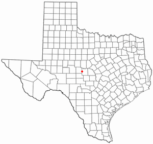
Melvin is a town in McCulloch County, Texas, United States. Its population was 179 at the 2010 census.

<span class="mw-page-title-main">Hewitt, Marathon County, Wisconsin</span>

Hewitt is a town in Marathon County, Wisconsin, United States. It is part of the Wausau, Wisconsin Metropolitan Statistical Area. The population was 606 at the 2010 census. The unincorporated community of Glandon is located in the town.

<span class="mw-page-title-main">Ringle, Wisconsin</span> Town in Wisconsin, United States

Ringle is a town in Marathon County, Wisconsin, United States. It is part of the Wausau (WI) Metropolitan Statistical Area. The population was 1,711 at the 2010 census. The unincorporated community of Ringle is located in the town.
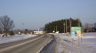
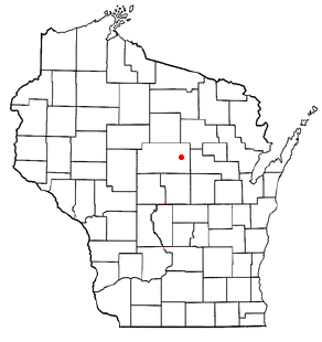
<span class="mw-page-title-main">Richfield, Wood County, Wisconsin</span> Town in Wisconsin, United States

Richfield is a town in Wood County, Wisconsin, United States. The population was 1,523 at the 2000 census. The unincorporated community of Bethel is located within the town.

<span class="mw-page-title-main">Albin, Wyoming</span> Town in Laramie County, Wyoming, United States

Albin is a town in Laramie County, Wyoming, United States. It is part of the Cheyenne Metropolitan Statistical Area. The population was 181 at the 2010 census.

<span class="mw-page-title-main">Prairie Farm, Wisconsin</span> Village in Wisconsin, United States

Prairie Farm is a village in Barron County in the U.S. state of Wisconsin. The population was 473 at the 2010 census. The village is located within the Town of Prairie Farm, on eastern shore of the Prairie Farm Flowage, a reservoir on the Hay River.

<span class="mw-page-title-main">Oregon (town), Wisconsin</span>

Oregon is a town in Dane County, Wisconsin, United States. The population was 3,148 at the 2000 census. The village of Oregon is located mostly within the town.

<span class="mw-page-title-main">Aniwa (town), Wisconsin</span>

Aniwa is a town in Shawano County, Wisconsin, United States. The population was 586 at the 2000 census. The Village of Aniwa is located within the town.

<span class="mw-page-title-main">Mills Township, Bond County, Illinois</span> Township in Illinois, United States

Mills Township is one of nine townships in Bond County, Illinois, US. As of the 2020 census, its population was 473 and it contained 219 housing units.

References

  1. 1 2 "US Board on Geographic Names". United States Geological Survey. 2007-10-25. Retrieved 2008-01-31.
  2. 1 2 "U.S. Census website". United States Census Bureau . Retrieved 2008-01-31.

Coordinates: 43°34′50″N89°38′08″W / 43.58056°N 89.63556°W / 43.58056; -89.63556