West Point, Wisconsin

Last updated

West Point, Wisconsin
WIMap-doton-West Point.png
Location of West Point, Wisconsin
Coordinates: 43°19′11″N89°38′15″W / 43.31972°N 89.63750°W / 43.31972; -89.63750
Country Flag of the United States.svg  United States
State Flag of Wisconsin.svg  Wisconsin
County Columbia
Area
  Total32.5 sq mi (84.1 km2)
  Land28.9 sq mi (74.9 km2)
  Water3.6 sq mi (9.2 km2)
Elevation
[1]
853 ft (260 m)
Population
 (2000)
  Total1,634
  Density56.5/sq mi (21.8/km2)
Time zone UTC-6 (Central (CST))
  Summer (DST) UTC-5 (CDT)
FIPS code 55-86100 [2]
GNIS feature ID1584414 [1]
Website http://townofwestpoint.us

West Point is a town in Columbia County, Wisconsin, United States. The population was 1,634 at the 2000 census.

Contents

Geography

According to the United States Census Bureau, the town has a total area of 32.5 square miles (84.1 km2), of which, 28.9 square miles (74.9 km2) is land and 3.5 square miles (9.2 km2) (10.94%) is water.

Demographics

As of the census [2] of 2000, there were 1,634 people, 660 households, and 485 families residing in the town. The population density was 56.5 people per square mile (21.8/km2). There were 907 housing units at an average density of 31.4 per square mile (12.1/km2). The racial makeup of the town was 98.35% White, 0.49% African American, 0.43% Asian, 0.24% from other races, and 0.49% from two or more races. Hispanic or Latino people of any race were 0.86% of the population.

There were 660 households, out of which 29.8% had children under the age of 18 living with them, 68.5% were married couples living together, 2.6% had a female householder with no husband present, and 26.4% were non-families. 22% of all households were made up of individuals, and 8.8% had someone living alone who was 65 years of age or older. The average household size was 2.48 and the average family size was 2.92.

In the town, the population was spread out, with 24% under the age of 18, 3.6% from 18 to 24, 26.4% from 25 to 44, 30.9% from 45 to 64, and 15.1% who were 65 years of age or older. The median age was 42 years. For every 100 females, there were 105 males. For every 100 females age 18 and over, there were 105.6 males.

The median income for a household in the town was $55,781, and the median income for a family was $62,132. Males had a median income of $39,063 versus $28,403 for females. The per capita income for the town was $30,750. About 2.5% of families and 3.8% of the population were below the poverty line, including 3.1% of those under age 18 and 5.9% of those age 65 or over.

Protected areas

Notable people

Related Research Articles

<span class="mw-page-title-main">Berkshire, Vermont</span> Town in Vermont, United States

Berkshire is a town in Franklin County, Vermont, United States. The population was 1,547 at the 2020 census. It contains the unincorporated village of East Berkshire.

<span class="mw-page-title-main">Medina, Wisconsin</span> Town in Wisconsin, United States

Medina is a town in Dane County, Wisconsin, United States. The population was 1,235 at the 2000 census. The unincorporated community of Deansville is located in the town.

<span class="mw-page-title-main">Montrose, Wisconsin</span> Town in Wisconsin, United States

The Town of Montrose is located in Dane County, Wisconsin, United States. The population was 1,134 at the 2000 census. The unincorporated communities of Basco and Paoli are located within the town.

<span class="mw-page-title-main">Herman, Dodge County, Wisconsin</span> Town in Wisconsin, United States

Herman is a town in Dodge County, Wisconsin, United States. The population was 1,207 at the 2000 census. The unincorporated communities of Herman Center and Huilsburg are located in the town. The unincorporated communities of Hochheim and Woodland are also located partially in the town.

<span class="mw-page-title-main">LeRoy, Wisconsin</span> Town in Wisconsin, United States

LeRoy is a town in Dodge County, Wisconsin, United States. The population was 1,116 at the 2000 census. The unincorporated communities of Farmersville and LeRoy are located in the town.

<span class="mw-page-title-main">Bridge Creek, Wisconsin</span> Town in Wisconsin, United States

Bridge Creek is a town in Eau Claire County, Wisconsin, United States. The population was 1,900 at the 2010 census. The city of Augusta is located entirely within the town of Bridge Creek. The unincorporated community of Hay Creek is located in the town.

<span class="mw-page-title-main">Mount Ida, Wisconsin</span> Town in Wisconsin, United States

Mount Ida is a town in Grant County, Wisconsin, United States. The population was 568 at the 2018 census. The unincorporated communities of Mount Ida and Werley are located in the town.

<span class="mw-page-title-main">Irving, Wisconsin</span> Town in Wisconsin, United States

Irving is a town in Jackson County, Wisconsin, United States. The population was 602 at the 2000 census.
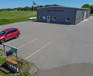
<span class="mw-page-title-main">Manchester, Jackson County, Wisconsin</span> Town in Wisconsin, United States

Manchester is a town in Jackson County, Wisconsin, United States. The population was 680 at the 2000 census. The unincorporated communities of Fall Hall Glen and Shamrock are located in the town.

<span class="mw-page-title-main">Centerville, Manitowoc County, Wisconsin</span> Town in Wisconsin, United States

Centerville is a town in Manitowoc County, Wisconsin, United States. The population was 713 at the 2000 census. The town is divided by I-43 and surrounds the Village of Cleveland.
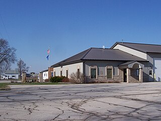
<span class="mw-page-title-main">Rockland, Manitowoc County, Wisconsin</span> Town in Wisconsin, United States

Rockland is a town in Manitowoc County, Wisconsin, United States. The population was 896 at the 2000 census. The unincorporated community of Collins is located in the town. The unincorporated community of Wells is also partially located in the town.

<span class="mw-page-title-main">Cleveland, Marathon County, Wisconsin</span> Town in Wisconsin, United States

Cleveland is a town in Marathon County, Wisconsin, United States. It is part of the Wausau, Wisconsin Metropolitan Statistical Area. The population was 1,488 at the 2010 census. The unincorporated community of Bradley is located in the town.

<span class="mw-page-title-main">McMillan, Wisconsin</span> Town in Wisconsin, United States

McMillan is a town in Marathon County, Wisconsin, United States. It is part of the Wausau, Wisconsin Metropolitan Statistical Area. The population was 1,968 at the 2010 census. The unincorporated community of McMillan is located in the town. A section of the Mead Wildlife Area is also located in the town.
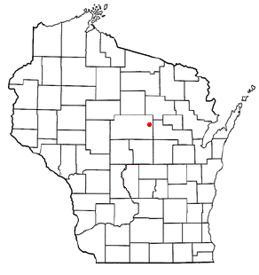
<span class="mw-page-title-main">Norrie, Wisconsin</span> Town in Wisconsin, United States

The Town of Norrie is located in Marathon County, Wisconsin, United States. It is part of the Wausau, Wisconsin Metropolitan Statistical Area. The population was 976 at the 2010 census.
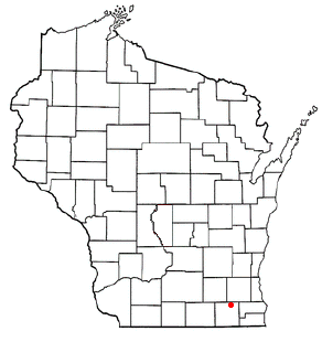
<span class="mw-page-title-main">Troy, Walworth County, Wisconsin</span> Town in Wisconsin, United States

Troy is a town in Walworth County, Wisconsin, United States. The population was 2,355 at the 2020 census. The unincorporated communities of Adams, Little Prairie, and Troy Center are located in the town. The ghost town of Mayhews was also located in the town.

<span class="mw-page-title-main">Rose, Wisconsin</span> Town in Wisconsin, United States

Rose is a town in Waushara County, Wisconsin, United States. The population was 595 at the 2000 census. The unincorporated community of Heffron is located partially in the town.

<span class="mw-page-title-main">Vinland, Wisconsin</span> Town in Wisconsin, United States

Vinland is a town in Winnebago County, Wisconsin, United States. The population was 1,765 at the 2010 census. The unincorporated community of Allenville is located in the town.

Andover is a town in Allegany County, New York, United States. The population was 1,634 at the 2020 census. The town is on the eastern edge of Allegany County and contains the village of Andover.

Colfax is a town in Dunn County, Wisconsin, United States. The population was 909 at the 2000 census.

Milltown is a town in Polk County, Wisconsin, United States. The population was 1,146 at the 2000 census. The village of Milltown is located within the town.

References

  1. 1 2 "US Board on Geographic Names". United States Geological Survey. October 25, 2007. Retrieved January 31, 2008.
  2. 1 2 "U.S. Census website". United States Census Bureau . Retrieved January 31, 2008.
  3. "Wisconsin Department of Transportation, Columbia County, Wisconsin map" (PDF). Archived from the original (PDF) on October 6, 2014. Retrieved October 29, 2012.
  4. Wisconsin Blue Book 1899, Biographical Sketch of Horace N. Polley, pg. 770