Courtland, Wisconsin

Last updated

Courtland, Wisconsin
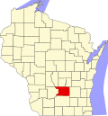
WIMap-doton-Courtland.png
Location of Courtland, Wisconsin
Coordinates: 43°29′54″N89°3′55″W / 43.49833°N 89.06528°W / 43.49833; -89.06528
Country Flag of the United States.svg  United States
State Flag of Wisconsin.svg  Wisconsin
County Columbia
Area
  Total35.3 sq mi (91.5 km2)
  Land35.2 sq mi (91.2 km2)
  Water0.1 sq mi (0.4 km2)
Elevation
[1]
912 ft (278 m)
Population
 (2000)
  Total463
  Density13.2/sq mi (5.1/km2)
Time zone UTC-6 (Central (CST))
  Summer (DST) UTC-5 (CDT)
FIPS code 55-17325 [2]
GNIS feature ID1583022 [1]

Courtland is a town in Columbia County, Wisconsin in the United States. The population was 463 at the 2000 census.

Contents

Geography

According to the United States Census Bureau, the town has a total area of 35.3 square miles (91.5 km2), of which, 35.2 square miles (91.2 km2) of it is land and 0.2 square miles (0.4 km2) of it (0.42%) is water.

Demographics

As of the census [2] of 2000, there were 463 people, 175 households, and 135 families residing in the town. The population density was 13.2 people per square mile (5.1/km2). There were 185 housing units at an average density of 5.3 per square mile (2.0/km2). The racial makeup of the town was 98.92% White, 0.22% Native American, 0.22% Asian, 0.65% from other races. Hispanic or Latino of any race were 0.65% of the population.

There were 175 households, out of which 30.9% had children under the age of 18 living with them, 69.7% were married couples living together, 5.1% had a female householder with no husband present, and 22.3% were non-families. 21.1% of all households were made up of individuals, and 10.9% had someone living alone who was 65 years of age or older. The average household size was 2.65 and the average family size was 3.04.

In the town, the population was spread out, with 24.6% under the age of 18, 7.3% from 18 to 24, 27.2% from 25 to 44, 27.2% from 45 to 64, and 13.6% who were 65 years of age or older. The median age was 39 years. For every 100 females, there were 125.9 males. For every 100 females age 18 and over, there were 125.2 males.

The median income for a household in the town was $42,396, and the median income for a family was $44,375. Males had a median income of $29,375 versus $19,375 for females. The per capita income for the town was $18,355. About 6.7% of families and 7.2% of the population were below the poverty line, including 12.3% of those under age 18 and 2.5% of those age 65 or over.

Related Research Articles

<span class="mw-page-title-main">Sylvan Springs, Alabama</span> Town in Alabama, United States

Sylvan Springs is a town in Jefferson County, Alabama, United States, located northwest of the Birmingham suburb of Pleasant Grove. It incorporated on May 22, 1957. At the 2010 census the population was 1,542, up from 1,465 in 2000. This area was damaged by an F5 tornado on April 8, 1998, including the First United Methodist Church of Sylvan Springs.

<span class="mw-page-title-main">Onslow, Iowa</span> City in Iowa, United States

Onslow is a city in Jones County, Iowa, United States. The population was 201 at the time of the 2020 census. It is part of the Cedar Rapids Metropolitan Statistical Area.

<span class="mw-page-title-main">Eagle Lake, Maine</span> Town in the state of Maine, United States

Eagle Lake is a town in Aroostook County, Maine, United States. The population was 772 at the 2020 census. The town was named by a body of troops heading from Bangor to the Aroostook War for the many eagles that they saw around the lake. A total of 49.0% of the population speaks French, reflecting a trend in Northeastern Maine.

Otis is a town in Hancock County, Maine, United States. The population was 673 at the 2020 census.

Winn is a town in Penobscot County, Maine, United States, on the east bank of the Penobscot River. The town was named for John M. Winn, an early landholder. The population was 399 at the 2020 census.

Beddington is a town in Washington County, Maine, United States. The population was 60 at the 2020 census. It is the third-smallest organized town in Maine after Frye Island and Frenchboro.

<span class="mw-page-title-main">Oslo, Minnesota</span> City in Minnesota, United States

Oslo is a city in Marshall County, Minnesota, United States. The population was 239 at the 2020 census.

<span class="mw-page-title-main">Walton Park, New York</span> CDP in New York, United States

Walton Park is a census-designated place (CDP) in Orange County, New York, United States. As of the 2020 census, the CDP had a total population of 3,907. Walton Park is on the town line separating the towns of Chester and Monroe. Street addresses within Walton Park are usually assigned to Monroe, not Chester.

<span class="mw-page-title-main">Barney, North Dakota</span> City in North Dakota, United States

Barney is a city in Richland County, North Dakota, United States. The population was 40 at the 2020 census. Barney was founded in 1899. It is part of the Wahpeton, ND–MN Micropolitan Statistical Area.

<span class="mw-page-title-main">Freehold Township, Warren County, Pennsylvania</span> Township in Pennsylvania, United States

Freehold Township is a township in Warren County, Pennsylvania, United States. The population was 1,217 at the 2020 census, down from 1,510 at the 2010 census.

<span class="mw-page-title-main">Auburn, West Virginia</span> Town in West Virginia, United States

Auburn is a town in Ritchie County, West Virginia, United States. The population was 80 at the 2020 census.

<span class="mw-page-title-main">Parkland, Wisconsin</span> Town in Wisconsin, United States

Parkland is a town in Douglas County, Wisconsin, United States. The population was 1,240 at the 2000 census. The unincorporated communities of Cutter, Parkland, Peyton, South Itasca, Sunnyside and South Range are in the town.

<span class="mw-page-title-main">Harrison, Grant County, Wisconsin</span> Town in Wisconsin, United States

The Town of Harrison is a town in Grant County, Wisconsin, United States. The population was 497 at the 2000 census. The unincorporated community of Cornelia is located in the town.

<span class="mw-page-title-main">Little Grant, Wisconsin</span> Town in Wisconsin, United States

Little Grant is a town in Grant County, Wisconsin, United States. The population was 257 at the 2000 census.

<span class="mw-page-title-main">Brigham, Wisconsin</span> Town in Wisconsin, United States

the Town of Brigham is a town located in Iowa County, Wisconsin, United States. The population was 908 at the 2000 census. The unincorporated community of Middlebury is located in the town.

<span class="mw-page-title-main">Elk Grove, Wisconsin</span> Town in Wisconsin, United States

Elk Grove is a town in Lafayette County, Wisconsin, United States. The population was 551 at the 2010 census, up from 463 at the 2000 census. The unincorporated communities of Elk Grove, Ipswich, and Meekers Grove are located in the town.

<span class="mw-page-title-main">Stella, Wisconsin</span> Town in Wisconsin, United States

Stella is a town in Oneida County, Wisconsin, United States. The population was 633 at the 2000 census. The unincorporated community of Starks is located within the town.

<span class="mw-page-title-main">Osborn, Wisconsin</span> Town in Wisconsin, United States

Osborn is a town in Outagamie County, Wisconsin, United States. The unincorporated community of Five Corners is partially located in the town. The ghost town of Lime Rock was also located partially in the town.

<span class="mw-page-title-main">Madge, Wisconsin</span> Town in Wisconsin, United States

Madge is a town in Washburn County, Wisconsin, United States. The population was 454 at the 2000 census.

<span class="mw-page-title-main">Matteson, Wisconsin</span> Town in Wisconsin, United States

Matteson is a town in Waupaca County, Wisconsin, United States. The population was 956 at the 2000 census. The former unincorporated community of Hunting was located partially in the town.

References

  1. 1 2 "US Board on Geographic Names". United States Geological Survey. October 25, 2007. Retrieved January 31, 2008.
  2. 1 2 "U.S. Census website". United States Census Bureau . Retrieved January 31, 2008.