Pardeeville, Wisconsin

Last updated

Pardeeville, Wisconsin
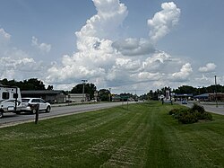
Pardeeville.jpg
Pardeeville pictured in July 2024
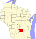
Columbia County Wisconsin Incorporated and Unincorporated areas Pardeeville Highlighted.svg
Location of Pardeeville in Columbia County, Wisconsin
Coordinates: 43°32′12″N89°17′53″W / 43.53667°N 89.29806°W / 43.53667; -89.29806
Country Flag of the United States.svg  United States
State Flag of Wisconsin.svg  Wisconsin
County Columbia
Area
[1]
  Total2.27 sq mi (5.87 km2)
  Land1.92 sq mi (4.98 km2)
  Water0.34 sq mi (0.89 km2)
Elevation
[2]
814 ft (248 m)
Population
 (2010) [3]
  Total2,115
  Estimate 
(1654) [4]
2,063
  Density1,073.36/sq mi (414.32/km2)
Time zone UTC-6 (Central (CST))
  Summer (DST) UTC-5 (CDT)
Area code 608
FIPS code 55-61100 [5]
GNIS feature ID1571029 [2]
Website www.villageofpardeeville.net

Pardeeville is a village in Columbia County, Wisconsin, United States. The population was 2,115 at the 2010 census. It is part of the Madison Metropolitan Statistical Area.

Contents

Geography

Pardeeville is located at 43°32′12″N89°17′53″W / 43.53667°N 89.29806°W / 43.53667; -89.29806 (43.536575, -89.298045). [6]

According to the United States Census Bureau, the village has a total area of 2.28 square miles (5.91 km2), of which, 1.93 square miles (5.00 km2) is land and 0.35 square miles (0.91 km2) is water. [7]

The Fox River begins as a small stream northeast of Pardeeville. It is dammed in Pardeeville to create Park Lake.

Highways

Pardeeville is served by Wis 22 along Main St and Wis 44 along Lake St. Wis 22 heads north to Montello and south to Wyocena. Wis 22 South also heads toward Madison via US Route 51. Wis 44 heads northeast to Kingston and eventually to Ripon and Oshkosh.

Demographics

Historical population
CensusPop.Note
1850 81
1870 205
1900 788
1910 98725.3%
1920 878−11.0%
1930 873−0.6%
1940 1,00114.7%
1950 1,11211.1%
1960 1,33119.7%
1970 1,50713.2%
1980 1,5945.8%
1990 1,6302.3%
2000 1,98221.6%
2010 2,1156.7%
2019 (est.)2,063 [4] −2.5%
U.S. Decennial Census [8]

2010 census

As of the census [3] of 2010, there were 2,115 people, 918 households, and 563 families living in the village. The population density was 1,095.9 inhabitants per square mile (423.1/km2). There were 1,003 housing units at an average density of 519.7 per square mile (200.7/km2). The racial makeup of the village was 97.2% White, 0.3% African American, 0.2% Native American, 0.9% Asian, 0.3% from other races, and 1% from two or more races. Hispanic or Latino people of any race were 1.6% of the population.

There were 918 households, of which 31.3% had children under the age of 18 living with them, 44.8% were married couples living together, 10.7% had a female householder with no husband present, 5.9% had a male householder with no wife present, and 38.7% were non-families. 32.2% of all households were made up of individuals, and 14.7% had someone living alone who was 65 years of age or older. The average household size was 2.30 and the average family size was 2.87.

The median age in the village was 38.9 years. 23.2% of residents were under the age of 18; 8.2% were between the ages of 18 and 24; 27.5% were from 25 to 44; 25.3% were from 45 to 64; and 15.9% were 65 years of age or older. The gender makeup of the village was 48.7% male and 51.3% female.

2000 census

As of the census [5] of 2000, there were 1,982 people, 825 households, and 515 families living in the village. The population density was 982.9 people per square mile (378.8/km2). There were 873 housing units at an average density of 432.9 per square mile (166.9/km2). The racial makeup of the village was 98.44% White, 0.15% African American, 0.25% Native American, 0.4% Asian, 0.15% from other races, and 0.61% from two or more races. Hispanic or Latino people of any race were 2.17% of the population.

There were 825 households, out of which 32.8% had children under the age of 18 living with them, 48.8% were married couples living together, 10.4% had a female householder with no husband present, and 37.5% were non-families. 30.4% of all households were made up of individuals, and 13.6% had someone living alone who was 65 years of age or older. The average household size was 2.38 and the average family size was 2.99.

In the village, the population was spread out, with 26.7% under the age of 18, 8.1% from 18 to 24, 30.7% from 25 to 44, 18.8% from 45 to 64, and 15.6% who were 65 years of age or older. The median age was 36 years. For every 100 females, there were 101.6 males. For every 100 females age 18 and over, there were 90.1 males.

The median income for a household in the village was $40,139, and the median income for a family was $45,700. Males had a median income of $32,250 versus $23,702 for females. The per capita income for the village was $21,365. About 2.5% of families and 3.9% of the population were below the poverty line, including 2.4% of those under age 18 and 3.9% of those age 65 or over.
Education

The Pardeeville Area School District administers the public elementary school, middle school, and high school of Pardeeville. [9]

St. John's Lutheran School is a 4K-8th grade school of the Wisconsin Evangelical Lutheran Synod in Pardeeville. [10]

Notable people

Related Research Articles

Larsen Bay is a city in Kodiak Island Borough, Alaska, United States. At the 2010 census the population was 87, down from 115 in 2000.

<span class="mw-page-title-main">Newcastle, Maine</span> Town in the state of Maine, United States

Newcastle is a town in Lincoln County, Maine, United States. The population was 1,848 at the 2020 census. The village of Newcastle is located in the eastern part of the town, on the Damariscotta River. Together with the village of Damariscotta linked by the Main Street bridge, they form the Twin Villages.

<span class="mw-page-title-main">Eagle, New York</span> Town in New York, United States

Eagle is an incorporated town in Wyoming County, New York. The population was 1,194 at the 2000 census. The town is on the south border of the county.

<span class="mw-page-title-main">Freedom Township, Adams County, Pennsylvania</span> Township in Pennsylvania, United States

Freedom Township is a township in Adams County, Pennsylvania, United States. The population was 825 at the 2020 census.

<span class="mw-page-title-main">Sherwood, Wisconsin</span> Village in Wisconsin, United States

Sherwood is a village in Calumet County, Wisconsin, United States. The population was 2,713 at the 2010 census. The former historical unincorporated community of High Cliff is located within present-day Sherwood.

<span class="mw-page-title-main">Cadott, Wisconsin</span> Village in Wisconsin, United States

Cadott is a village in Chippewa County in the U.S. state of Wisconsin. The population was 1,437 at the 2010 census.

<span class="mw-page-title-main">Lynxville, Wisconsin</span> Village in Wisconsin, United States

Lynxville is a village in Crawford County, Wisconsin, United States. The population was 132 at the 2010 census.

<span class="mw-page-title-main">Sister Bay, Wisconsin</span> Village in Wisconsin, United States

Sister Bay is a village in Door County, Wisconsin, United States. The population was 876 at the 2010 census.

<span class="mw-page-title-main">Alma Center, Wisconsin</span> Village in Wisconsin, United States

Alma Center is a village in Jackson County, Wisconsin, United States. The population was 503 at the 2010 census. The village is located within the Town of Alma.

<span class="mw-page-title-main">Maribel, Wisconsin</span> Village in Wisconsin, United States

Maribel is a village in Manitowoc County, Wisconsin, United States. The population was 336 at the 2020 census.

<span class="mw-page-title-main">Boaz, Wisconsin</span> Village in Wisconsin, United States

Boaz is a village in Richland County, Wisconsin, United States. According to the 2010 census, the population of the village was 156.

<span class="mw-page-title-main">Loganville, Wisconsin</span> Village in Wisconsin, United States

Loganville is a village in Sauk County, Wisconsin, United States. The population was 300 at the 2010 census. The village was named for Chauncey P. Logan who built the first house in 1853.

<span class="mw-page-title-main">Cecil, Wisconsin</span> Village in Wisconsin, United States

Cecil is a village in Shawano County, Wisconsin, United States. The population was 529 at the 2020 census.

<span class="mw-page-title-main">Wrightstown, Wisconsin</span> Village in Wisconsin, United States

Wrightstown is a village in Brown and Outagamie counties in the U.S. state of Wisconsin. The population was 3,179 at the 2020 census. The village is surrounded mostly by the westernmost part of the Town of Wrightstown in Brown County. On February 28, 2002, the village annexed a portion of land within the adjacent Town of Kaukauna in Outagamie County.

<span class="mw-page-title-main">Arlington, Wisconsin</span> Village in Wisconsin, United States

Arlington is a village in Columbia County, Wisconsin, United States. The population was 819 at the 2010 census. The village is located within the Town of Arlington. It is part of the Madison Metropolitan Statistical Area.

<span class="mw-page-title-main">Wyocena, Wisconsin</span> Village in Wisconsin, United States

Wyocena is a village in Columbia County, Wisconsin, United States. The population was 768 at the 2010 census. The village is located within the Town of Wyocena. It is part of the Madison Metropolitan Statistical Area.

<span class="mw-page-title-main">Arena, Wisconsin</span> Village in Wisconsin, United States

Arena is a village in Iowa County, Wisconsin, United States. The population was 834 at the 2010 census. The village is located within the Town of Arena. It is part of the Madison Metropolitan Statistical Area.

<span class="mw-page-title-main">Necedah, Wisconsin</span> Village in Wisconsin, United States

Necedah is a village in Juneau County, Wisconsin, United States. The population was 916 at the 2020 census. The village is located within the Town of Necedah.

<span class="mw-page-title-main">Spencer, Wisconsin</span> Village in Wisconsin, United States

Spencer is a village in Marathon County, Wisconsin. It is part of the Wausau, Wisconsin Metropolitan Statistical Area. The population was 1,925 at the 2010 census.

<span class="mw-page-title-main">Oxford, Wisconsin</span> Village in Wisconsin, United States

Oxford is a village in Marquette County, Wisconsin, United States. The population was 537 at the 2020 census. The village is located within the Town of Oxford. The Union Pacific Railroad runs through the town and over Neenah Lake to the northwest.

References

  1. "2019 U.S. Gazetteer Files". United States Census Bureau. Retrieved August 7, 2020.
  2. 1 2 "US Board on Geographic Names". United States Geological Survey. October 25, 2007. Retrieved January 31, 2008.
  3. 1 2 "U.S. Census website". United States Census Bureau . Retrieved November 18, 2012.
  4. 1 2 "Population and Housing Unit Estimates". United States Census Bureau. May 24, 2020. Retrieved May 27, 2020.
  5. 1 2 "U.S. Census website". United States Census Bureau . Retrieved January 31, 2008.
  6. "US Gazetteer files: 2010, 2000, and 1990". United States Census Bureau. February 12, 2011. Retrieved April 23, 2011.
  7. "US Gazetteer files 2010". United States Census Bureau. Archived from the original on January 25, 2012. Retrieved November 18, 2012.
  8. "Census of Population and Housing". Census.gov. Retrieved June 4, 2015.
  9. "Pardeeville Area School District".
  10. "Welcome to St. John's! - St. John's Lutheran School".