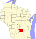
Fort Winnebago, Wisconsin

Last updated

Fort Winnebago, Wisconsin
WIMap-doton-Fort Winnebago.png
Location of Fort Winnebago, Wisconsin
Coordinates: 43°36′39″N89°25′1″W / 43.61083°N 89.41694°W / 43.61083; -89.41694
Country Flag of the United States.svg  United States
State Flag of Wisconsin.svg  Wisconsin
County Columbia
Area
  Total34.0 sq mi (88.0 km2)
  Land33.5 sq mi (86.7 km2)
  Water0.5 sq mi (1.2 km2)
Elevation
[1]
807 ft (246 m)
Population
 (2000)
  Total855
  Density25.5/sq mi (9.9/km2)
Time zone UTC-6 (Central (CST))
  Summer (DST) UTC-5 (CDT)
FIPS code 55-26725 [2]
GNIS feature ID1583220 [1]
Website http://www.fortwinn.com/

Fort Winnebago is a town in Columbia County, Wisconsin, United States. The population was 855 at the 2000 census. The unincorporated community of Anacker is located in the town.

Contents

Geography

According to the United States Census Bureau, the town has a total area of 34.0 square miles (88.0 km2), of which, 33.5 square miles (86.7 km2) of it is land and 0.5 square miles (1.2 km2) of it (1.41%) is water.

Demographics

As of the census [2] of 2000, there were 855 people, 325 households, and 259 families residing in the town. The population density was 25.5 people per square mile (9.9/km2). There were 343 housing units at an average density of 10.2 per square mile (4.0/km2). The racial makeup of the town was 98.83% White, 0.12% African American, 0.23% Native American, 0.23% from other races, and 0.58% from two or more races. Hispanic or Latino of any race were 0.47% of the population.

There were 325 households, out of which 32.3% had children under the age of 18 living with them, 69.8% were married couples living together, 5.5% had a female householder with no husband present, and 20.3% were non-families. 16.6% of all households were made up of individuals, and 6.8% had someone living alone who was 65 years of age or older. The average household size was 2.63 and the average family size was 2.92.

In the town, the population was spread out, with 24.7% under the age of 18, 4.3% from 18 to 24, 29.1% from 25 to 44, 31.1% from 45 to 64, and 10.8% who were 65 years of age or older. The median age was 41 years. For every 100 females, there were 101.2 males. For every 100 females age 18 and over, there were 103.2 males.

The median income for a household in the town was $55,673, and the median income for a family was $59,167. Males had a median income of $39,375 versus $24,931 for females. The per capita income for the town was $22,171. About 2.5% of families and 3.2% of the population were below the poverty line, including 1.9% of those under age 18 and 9.4% of those age 65 or over.

Notable people

Related Research Articles

New Vineyard is a town in Franklin County, Maine, United States. The population was 721 at the 2020 census.

<span class="mw-page-title-main">Glendale, Oregon</span> City in Oregon, United States

Glendale is a city in Douglas County, Oregon, United States. The population was 874 at the 2010 census.

<span class="mw-page-title-main">Easton, Adams County, Wisconsin</span> Town in Wisconsin, United States

Easton is a town in Adams County in the U.S. state of Wisconsin. The population was 1,130 at the 2010 census. The unincorporated communities of Brookside and White Creek are located in the town.

<span class="mw-page-title-main">Chippewa, Wisconsin</span> Town in Wisconsin, United States

Chippewa is a town in Ashland County in the U.S. state of Wisconsin. The population was 374 at the 2010 census.

<span class="mw-page-title-main">Maxville, Wisconsin</span> Town in Wisconsin, United States

Maxville is a town in Buffalo County in the U.S. state of Wisconsin. The population was 309 at the 2010 census. The ghost town of Savoy was located in the town.

<span class="mw-page-title-main">Medina, Wisconsin</span> Town in Wisconsin, United States

Medina is a town in Dane County, Wisconsin, United States. The population was 1,235 at the 2000 census. The unincorporated community of Deansville is located in the town.

<span class="mw-page-title-main">Montrose, Wisconsin</span> Town in Wisconsin, United States

The Town of Montrose is located in Dane County, Wisconsin, United States. The population was 1,134 at the 2000 census. The unincorporated communities of Basco and Paoli are located within the town.

<span class="mw-page-title-main">Franklin, Jackson County, Wisconsin</span> Town in Wisconsin, United States

Franklin is a town in Jackson County, Wisconsin, United States. The population was 325 at the 2000 census. The unincorporated community of Franklin is located in the town. The ghost town of Rogneys was also located in the town.

<span class="mw-page-title-main">King, Lincoln County, Wisconsin</span> Town in Wisconsin, United States

King is a town in Lincoln County, Wisconsin, United States. The population was 855 at the 2010 census.

<span class="mw-page-title-main">Bergen, Marathon County, Wisconsin</span> Town in Wisconsin, United States

Bergen is a town in Marathon County, Wisconsin, United States. It is part of the Wausau, Wisconsin Metropolitan Statistical Area. The population was 740 at the 2020 census. The unincorporated community of Moon is located partially in the town.

<span class="mw-page-title-main">Day, Wisconsin</span> Town in Wisconsin, United States

Day is a town in southwest Marathon County, Wisconsin, United States. It is part of the Wausau, Wisconsin Metropolitan Statistical Area. The population was 1,085 at the 2010 census. The unincorporated community of Rozellville is located in the town. The unincorporated community of Rangeline is also located partially in the town.

<span class="mw-page-title-main">Frankfort, Pepin County, Wisconsin</span> Town in Wisconsin, United States

Frankfort is a town in Pepin County, Wisconsin, United States. The population was 325 at the 2020 census. The unincorporated communities of Ella, and Porcupine are located in the town.

<span class="mw-page-title-main">Alban, Wisconsin</span> Town in Wisconsin, United States

Alban is a town in Portage County, Wisconsin, United States. The population was 897 at the 2000 census. The unincorporated community of Alban is located within the town. The town was named after Civil War Colonel James S. Alban, a state senator in the early 1850s lost in the Battle of Shiloh. The Township is Town 25 North, Range 10 East, 4th Principal Meridian.

<span class="mw-page-title-main">Emery, Wisconsin</span> Town in Wisconsin, United States

Emery is a town in Price County, Wisconsin, United States. The population was 325 at the 2000 census. The unincorporated community of Dover is located in the town.

<span class="mw-page-title-main">Hamburg, Vernon County, Wisconsin</span> Town in Wisconsin, United States

Hamburg is a town in Vernon County, Wisconsin, United States. The population was 848 at the 2000 census.

The Town of Potosi is located in Grant County, Wisconsin, United States. The population was 831 at the 2000 census. The Village of Potosi and the unincorporated communities of British Hollow, Buena Vista, Rockville, and Van Buren are located in the town.

<span class="mw-page-title-main">Highland (village), Iowa County, Wisconsin</span> Village in Wisconsin, United States

Highland is a village in Iowa County, Wisconsin, United States. The population was 842 at the 2010 census. It is part of the Madison Metropolitan Statistical Area. The village is located within the Town of Highland.

Elderon is a town in Marathon County, Wisconsin, United States. It is part of the Wausau, Wisconsin Metropolitan Statistical Area. The population was 606 at the 2010 census. The unincorporated community of Ingersoll is located in the town.

<span class="mw-page-title-main">Wausaukee, Wisconsin</span> Village in Wisconsin, United States

Wausaukee is a village in Marinette County, Wisconsin, in the United States. The population was 596 at the 2020 census. The village is part of the Marinette, WI–MI Micropolitan Statistical Area.

<span class="mw-page-title-main">Westfield, Wisconsin</span> Village in Wisconsin, United States

Westfield is a village in Marquette County, Wisconsin, United States. The population was 1,254 at the 2010 census. The village is located mostly within the Town of Westfield. A small portion extends east into the adjacent Town of Harris. The Marquette County fairgrounds is located within the village limits on the south side.

References

  1. 1 2 "US Board on Geographic Names". United States Geological Survey. October 25, 2007. Retrieved January 31, 2008.
  2. 1 2 "U.S. Census website". United States Census Bureau . Retrieved January 31, 2008.
  3. 'Wisconsin Blue Book 1899,' Biographical Sketch of Jabez H. Wells, pg. 765