Okee, Wisconsin | |
|---|---|
 | |
 Okee  Okee | |
| Coordinates: 43°21′28″N89°34′48″W / 43.35778°N 89.58000°W | |
| Country | |
| State | |
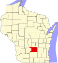
| County | Columbia |
| Town | Lodi |
| Elevation | 801 ft (244 m) |
| Time zone | UTC-6 (Central (CST)) |
| • Summer (DST) | UTC-5 (CDT) |
| Area code | 608 |
| GNIS feature ID | 1570763 [1] |
Okee is an unincorporated community located in the town of Lodi, in Columbia County, Wisconsin, United States. [1] [2]
Okee is the eastern terminus for the Merrimac Ferry, on the Wisconsin River. [3]