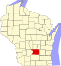
Fall River, Wisconsin

Last updated
Fall River, Wisconsin
Fall River, Wisconsin Entrance Sign.jpg
Fall River, Wisconsin Entrance Sign
Columbia County Wisconsin Incorporated and Unincorporated areas Fall River Highlighted.svg
Location of Fall River in Columbia County, Wisconsin.
Coordinates: 43°23′7″N89°2′45″W / 43.38528°N 89.04583°W / 43.38528; -89.04583 Coordinates: 43°23′7″N89°2′45″W / 43.38528°N 89.04583°W / 43.38528; -89.04583
Country Flag of the United States.svg  United States
State Flag of Wisconsin.svg  Wisconsin
County Columbia
Area
[1]
  Total1.89 sq mi (4.91 km2)
  Land1.83 sq mi (4.74 km2)
  Water0.07 sq mi (0.17 km2)
Elevation
[2]
856 ft (261 m)
Population
 (2010) [3]
  Total1,712
  Estimate 
(2019) [4]
1,741
  Density952.41/sq mi (367.68/km2)
Time zone UTC-6 (Central (CST))
  Summer (DST) UTC-5 (CDT)
Area code(s) 920
FIPS code 55-25150 [5]
GNIS feature ID1564844 [2]
Website http://fallriverwi.com/

Fall River is a village in Columbia County, Wisconsin, United States, along the North Fork of the Crawfish River. The population was 1,712 at the 2010 census. It is part of the Madison Metropolitan Statistical Area.

Contents

History

Alfred Brayton, an early settler, named the town after his father's family's home town of Fall River, Massachusetts. [6]

Geography

Fall River is located at 43°23′7″N89°2′45″W / 43.38528°N 89.04583°W / 43.38528; -89.04583 (43.385346, -89.045818). [7]

According to the United States Census Bureau, the village has a total area of 1.92 square miles (4.97 km2), of which, 1.86 square miles (4.82 km2) of it is land and 0.06 square miles (0.16 km2) is water. [8]

Demographics

Historical population
CensusPop.
1850 126
1870 259
1910 360
1920 40011.1%
1930 375−6.2%
1940 42513.3%
1950 47912.7%
1960 58421.9%
1970 6338.4%
1980 85034.3%
1990 842−0.9%
2000 1,09730.3%
2010 1,71256.1%
Est. 20191,741 [4] 1.7%
U.S. Decennial Census [9]

2010 census

As of the census [3] of 2010, there were 1,712 people, 617 households, and 461 families living in the village. The population density was 920.4 inhabitants per square mile (355.4/km2). There were 671 housing units at an average density of 360.8 per square mile (139.3/km2). The racial makeup of the village was 96.0% White, 0.7% African American, 0.1% Native American, 1.0% Asian, 0.4% from other races, and 1.9% from two or more races. Hispanic or Latino of any race were 2.0% of the population.

There were 617 households, of which 44.4% had children under the age of 18 living with them, 54.9% were married couples living together, 12.5% had a female householder with no husband present, 7.3% had a male householder with no wife present, and 25.3% were non-families. 18.2% of all households were made up of individuals, and 4.3% had someone living alone who was 65 years of age or older. The average household size was 2.77 and the average family size was 3.14.

The median age in the village was 32.5 years. 31.1% of residents were under the age of 18; 8.6% were between the ages of 18 and 24; 31.5% were from 25 to 44; 21.6% were from 45 to 64; and 7.1% were 65 years of age or older. The gender makeup of the village was 49.3% male and 50.7% female.

2000 census

As of the census [5] of 2000, there were 1,097 people, 418 households, and 290 families living in the village. The population density was 756.3 people per square mile (292.1/km2). There were 459 housing units at an average density of 316.5 per square mile (122.2/km2). The racial makeup of the village was 98.63% White, 0.55% African American, 0.09% Native American, 0.27% Asian, and 0.46% from two or more races. Hispanic or Latino of any race were 0.55% of the population.

There were 418 households, out of which 38.0% had children under the age of 18 living with them, 58.1% were married couples living together, 8.4% had a female householder with no husband present, and 30.4% were non-families. 23.2% of all households were made up of individuals, and 11.0% had someone living alone who was 65 years of age or older. The average household size was 2.62 and the average family size was 3.15.

In the village, the population was spread out, with 29.4% under the age of 18, 7.6% from 18 to 24, 34.4% from 25 to 44, 17.9% from 45 to 64, and 10.8% who were 65 years of age or older. The median age was 33 years. For every 100 females, there were 96.9 males. For every 100 females age 18 and over, there were 94.0 males.

The median income for a household in the village was $46,597, and the median income for a family was $54,271. Males had a median income of $35,739 versus $26,161 for females. The per capita income for the village was $19,257. About 4.1% of families and 5.2% of the population were below the poverty line, including 5.4% of those under age 18 and 17.4% of those age 65 or over.


Notable people

Related Research Articles

Holton, Indiana Town in Indiana, United States

Holton is a town in Otter Creek Township, Ripley County, in the U.S. state of Indiana. The population was 480 at the 2010 census.

River Bend, Missouri Village in Missouri, United States

River Bend is a village in Jackson County, Missouri, United States. The population was 10 at the 2010 census. It is the only part of Jackson County that lies north of the Missouri River. In 1951, the Missouri River was relocated to a new channel, creating River Bend,. The county line still follows the original riverbed. It is part of the Kansas City metropolitan area.

Wheeling, Missouri City in Missouri, United States

Wheeling is a city in Livingston County, Missouri, United States. The population was 271 at the 2010 census.

South Bend, Nebraska Village in Nebraska, United States

South Bend is a village in Cass County, Nebraska, United States. The population was 99 at the 2010 census. The main landmark is a pedestrian bridge across the Platte River which leads to Schramm Park State Recreation Area. It was built in 2004 on the pillars of the abandoned Rock Island Railroad bridge. 35 trains a day—most of them coal trains—still pass through the area on the BNSF Railway main.

Valley View, Ohio Village in Ohio, United States

Valley View is a village in Cuyahoga County, Ohio, United States. The population was 2,034 at the 2010 census. It is a suburb of Cleveland with a town council form of government. It is part of a school district that also includes nearby Cuyahoga Heights and Brooklyn Heights. Its name refers to the Cuyahoga River valley, and the town includes part of the Cuyahoga Valley National Park and the Ohio and Erie Canal. It is home to the Valley View Bridge that is on Interstate 480 and crosses the Cuyahoga River. The bridge is one of the major points that locals refer to as where the east side meets the west side of Cleveland.

Cleves, Ohio city in Ohio, United States

Cleves is a village in Miami Township, Hamilton County, Ohio, United States, located along the Ohio River. The population was 3,234 at the 2010 census. Founded in 1818, it is named for John Cleves Symmes who lived here, laid out the original town site, and sold lots.

Stratton, Ohio Village in Ohio, United States

Stratton is a village in Jefferson County, Ohio, United States, along the Ohio River. The population was 294 at the 2010 census.

St. Louisville, Ohio Village in Ohio, United States

St. Louisville is a village in Licking County, Ohio, United States, along the North Fork of the Licking River. The population was 373 at the 2010 census.

Lawson Heights, Pennsylvania CDP in Pennsylvania, United States

Lawson Heights is a census-designated place (CDP) in Unity Township, Westmoreland County, Pennsylvania, United States. The population was 2,339 at the 2000 census.

Beech Bottom, West Virginia Village in West Virginia, United States

Beech Bottom is a village in Brooke County, West Virginia, along the Ohio River. It is part of the Weirton–Steubenville, WV-OH Metropolitan Statistical Area. The population was 523 at the 2010 census.

Windsor Heights, West Virginia Village in West Virginia, United States

Windsor Heights is a village in Brooke County, West Virginia, United States. It is part of the Wheeling, West Virginia Metropolitan Statistical Area. The population was 423 at the 2010 census. Grace Davis was the mayor as of June, 2017.

Fall Creek, Wisconsin Village in Wisconsin, United States

Fall Creek is a village in Eau Claire County, Wisconsin, United States. The population was 1,315 at the 2010 census. The village is bordered by the Town of Lincoln.

Blue River, Wisconsin Village in Wisconsin, United States

Blue River is a village in Grant County, Wisconsin, United States. The population was 434 at the 2010 census.

River Hills, Wisconsin Village in Wisconsin, United States

River Hills is a village in Milwaukee County, Wisconsin, United States. The population was 1,597 at the 2010 census.

Bay City, Wisconsin Village in Wisconsin, United States

Bay City is a village on the Mississippi River in Pierce County, Wisconsin, United States. The population was 500 at the 2010 census.

La Farge, Wisconsin Village in Wisconsin, United States

La Farge is a village along the Kickapoo River in Vernon County, Wisconsin, United States. The population was 746 at the 2010 census.

Big Falls, Waupaca County, Wisconsin Village in Wisconsin, United States

Big Falls is a village in Waupaca County, Wisconsin, United States. The population was 61 at the 2010 census.

Nelson, Wisconsin Village in Wisconsin, United States

Nelson is a village in Buffalo County in the U.S. state of Wisconsin. The population was 374 at the 2010 census. The village is surrounded by the Town of Nelson.

Bloomington, Wisconsin Village in Wisconsin, United States

Bloomington is a village in Grant County, Wisconsin, United States. The population was 735 at the 2010 census. The village is located within the Town of Bloomington.

Cassville, Wisconsin Village in Wisconsin, United States

Cassville is a village in Grant County, Wisconsin, United States. The population was 947 at the 2010 census. The village is located along the Mississippi River within the Town of Cassville.

References

  1. "2019 U.S. Gazetteer Files". United States Census Bureau. Retrieved August 7, 2020.
  2. 1 2 "US Board on Geographic Names". United States Geological Survey. 2007-10-25. Retrieved 2008-01-31.
  3. 1 2 "U.S. Census website". United States Census Bureau . Retrieved 2012-11-18.
  4. 1 2 "Population and Housing Unit Estimates". United States Census Bureau. May 24, 2020. Retrieved May 27, 2020.
  5. 1 2 "U.S. Census website". United States Census Bureau . Retrieved 2008-01-31.
  6. Encyclopedia of Wisconsin. Somerset Publishers, 1990, p. 218.
  7. "US Gazetteer files: 2010, 2000, and 1990". United States Census Bureau. 2011-02-12. Retrieved 2011-04-23.
  8. "US Gazetteer files 2010". United States Census Bureau. Archived from the original on 2012-01-25. Retrieved 2012-11-18.
  9. "Census of Population and Housing". Census.gov. Retrieved June 4, 2015.
  10. 'Wisconsin Blue Book 1882,' Biographical Sketch of William Henry Proctor, pg. 542