Randolph, Wisconsin

Last updated

Randolph, Wisconsin
Randolph WI looking south WIS73.jpg
Looking south in Randolph on WIS 73
Dodge County Wisconsin Incorporated and Unincorporated areas Randolph Highlighted.svg
Location of Randolph in Dodge County, Wisconsin
Coordinates: 43°34′40″N89°3′15″W / 43.57778°N 89.05417°W / 43.57778; -89.05417
Country Flag of the United States.svg  United States
State Flag of Wisconsin.svg  Wisconsin
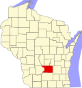
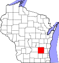
Counties Columbia, Dodge
Area
[1]
  Total1.24 sq mi (3.22 km2)
  Land1.24 sq mi (3.22 km2)
  Water0 sq mi (0 km2)
Elevation
[2]
961 ft (293 m)
Population
 (2010) [3]
  Total1,811
  Estimate 
(2019) [4]
1,747
  Density1,406.6/sq mi (543.01/km2)
Time zone UTC-6 (Central (CST))
  Summer (DST) UTC-5 (CDT)
Area code 920
FIPS code 55-66175 [5]
GNIS feature ID1572065 [2]
Website www.randolphwis.com

Randolph is a village in Columbia and Dodge Counties in the U.S. state of Wisconsin. The population was 1,811 at the 2010 census. Of this, 1,339 were in Dodge County, and 472 were in Columbia County. The village is located at the southeast corner of the Town of Randolph in Columbia County, although only a tiny portion of the village lies within the town. Most of the village lies within the Town of Westford in Dodge County. Small portions also lie within the Town of Fox Lake (also in Dodge County) to the north and the Town of Courtland in Columbia County.

Contents

The Dodge County portion of Randolph is part of the Beaver Dam Micropolitan Area, while the Columbia County portion is part of the Madison Metropolitan Statistical Area.

Geography

According to the United States Census Bureau, the village has a total area of 1.23 square miles (3.19 km2), all of it land. [6]

Demographics

Historical population
CensusPop.Note
1870 61
1880 421590.2%
1890 405−3.8%
1900 73882.2%
1910 93727.0%
1920 1,18326.3%
1930 1,161−1.9%
1940 1,146−1.3%
1950 1,35017.8%
1960 1,50711.6%
1970 1,5825.0%
1980 1,6916.9%
1990 1,7292.2%
2000 1,8698.1%
2010 1,811−3.1%
2019 (est.)1,747 [4] −3.5%
U.S. Decennial Census [7]
Water tower RandolphWisconsinWaterTowerWIS33.jpg
Water tower

2010 census

As of the census [3] of 2010, there were 1,811 people, 674 households, and 443 families living in the village. The population density was 1,472.4 inhabitants per square mile (568.5/km2). There were 728 housing units at an average density of 591.9 per square mile (228.5/km2). The racial makeup of the village was 96.7% White, 0.2% African American, 0.4% Native American, 0.2% Asian, 1.5% from other races, and 1.1% from two or more races. Hispanic or Latino people of any race were 4.7% of the population.

There were 674 households, of which 35.2% had children under the age of 18 living with them, 51.5% were married couples living together, 10.7% had a female householder with no husband present, 3.6% had a male householder with no wife present, and 34.3% were non-families. 29.7% of all households were made up of individuals, and 15.5% had someone living alone who was 65 years of age or older. The average household size was 2.51 and the average family size was 3.12.

The median age in the village was 39.3 years. 27.1% of residents were under the age of 18; 6.3% were between the ages of 18 and 24; 23.9% were from 25 to 44; 22.5% were from 45 to 64; and 20.3% were 65 years of age or older. The gender makeup of the village was 47.3% male and 52.7% female.

2000 census

As of the census [5] of 2000, there were 1,869 people, 698 households, and 483 families living in the village. The population density was 1,750.3 people per square mile (674.4/km2). There were 752 housing units at an average density of 704.2 per square mile (271.4/km2). The racial makeup of the village was 98.77% White, 0.11% Black or African American, 0.11% Native American, 0.16% Asian, 0.27% from other races, and 0.59% from two or more races. Hispanic or Latino people of any race were 1.44% of the population.

There were 698 households, out of which 35% had children under the age of 18 living with them, 57.7% were married couples living together, 8.7% had a female householder with no husband present, and 30.7% were non-families. 27.4% of all households were made up of individuals, and 16.2% had someone living alone who was 65 years of age or older. The average household size was 2.54 and the average family size was 3.11.

In the village, the population was spread out, with 26.2% under the age of 18, 8.5% from 18 to 24, 26.1% from 25 to 44, 18.8% from 45 to 64, and 20.4% who were 65 years of age or older. The median age was 38 years. For every 100 females, there were 93.5 males. For every 100 females age 18 and over, there were 84.2 males.

The median income for a household in the village was $39,620, and the median income for a family was $47,847. Males had a median income of $34,671 versus $23,424 for females. The per capita income for the village was $18,517. About 3.6% of families and 7.2% of the population were below the poverty line, including 9.4% of those under age 18 and 6.5% of those age 65 or over.

Education

Notable people

Related Research Articles

<span class="mw-page-title-main">Dodge County, Wisconsin</span> County in Wisconsin, United States

Dodge County is a county located in the U.S. state of Wisconsin. As of the 2020 census, the population was 89,396. Its county seat is Juneau. The county was created from the Wisconsin Territory in 1836 and organized in 1844.

<span class="mw-page-title-main">Columbia County, Wisconsin</span> County in Wisconsin, United States

Columbia County is a county located in the U.S. state of Wisconsin. As of the 2020 census, the population was 58,490. Its county seat and largest city is Portage. The county was created in 1846 as part of Wisconsin Territory.

<span class="mw-page-title-main">Dodge, Nebraska</span> Village in Nebraska, United States

Dodge is a village in Dodge County, Nebraska, United States. The population was 612 at the 2010 census.

<span class="mw-page-title-main">Doylestown, Wisconsin</span> Village in Wisconsin, United States

Doylestown is a village in Columbia County, Wisconsin, United States. The population was 297 at the 2010 census. It is part of the Madison Metropolitan Statistical Area.

<span class="mw-page-title-main">Poynette, Wisconsin</span> Village in Wisconsin, United States

Poynette is a village in Columbia County, Wisconsin, United States. The population was 2,575 at the 2022 United States census. It is part of the Madison Metropolitan Statistical Area.

<span class="mw-page-title-main">Herman, Dodge County, Wisconsin</span> Town in Wisconsin, United States

Herman is a town in Dodge County, Wisconsin, United States. The population was 1,207 at the 2000 census. The unincorporated communities of Herman Center and Huilsburg are located in the town. The unincorporated communities of Hochheim and Woodland are also located partially in the town.

<span class="mw-page-title-main">Iron Ridge, Wisconsin</span> Village in Wisconsin, United States

Iron Ridge is a village in Dodge County, Wisconsin, United States. The population was 929 at the 2010 census. The village was founded on a railroad line, named for the iron mined in the area. Its ZIP code is 53035.

<span class="mw-page-title-main">Juneau, Wisconsin</span> City in Wisconsin, United States

Juneau is a city in Dodge County, Wisconsin, United States. The population was 2,658 at the 2020 census. It is the county seat of Dodge County.

<span class="mw-page-title-main">Kekoskee, Wisconsin</span> Village in Wisconsin, United States

Kekoskee is a village in Dodge County, Wisconsin, United States. The population was 161 at the 2010 census.

<span class="mw-page-title-main">Neosho, Wisconsin</span> Village in Wisconsin, United States

Neosho is a village in Dodge County, Wisconsin, United States. The population was 574 at the 2010 census.

<span class="mw-page-title-main">Portland, Dodge County, Wisconsin</span> Town in Wisconsin, United States

Portland is a town in Dodge County, Wisconsin, United States. The population was 1,106 at the 2000 census. The unincorporated community of Portland is located partially in the town.

<span class="mw-page-title-main">Westford, Dodge County, Wisconsin</span> Town in Wisconsin, United States

Westford is a town in Dodge County, Wisconsin, United States. The population was 1,400 at the 2000 census. The unincorporated community of South Randolph is located in the town. The unincorporated community of Lost Lake is also located partially in the town.

<span class="mw-page-title-main">Cashton, Wisconsin</span> Village in Wisconsin, United States

Cashton is a village in Monroe County, Wisconsin, United States. The population was 1,158 at the 2020 census.

<span class="mw-page-title-main">Montfort, Wisconsin</span> Village in Wisconsin, United States

Montfort is a village in Grant and Iowa Counties in the U.S. state of Wisconsin. The population was 718 at the 2010 census. Of this, 622 were in Grant County, and 96 were in Iowa County.

<span class="mw-page-title-main">Randolph (town), Wisconsin</span> Town in Wisconsin, United States

Randolph is a town in Columbia County, Wisconsin, United States. The population was 699 at the 2000 census. The Village of Randolph lies to the southeast of the town and only a tiny portion of the village is within the town. The unincorporated community of East Friesland is located in the town. The unincorporated community of Ingle is also partially located in the town.

<span class="mw-page-title-main">Clyman, Wisconsin</span> Village in Wisconsin, United States

Clyman is a village in Dodge County, Wisconsin, United States. The population was 422 at the 2010 census. The village is located within the Town of Clyman.

<span class="mw-page-title-main">Hustisford (town), Wisconsin</span> Town in Wisconsin, United States

Hustisford is a town in Dodge County, Wisconsin, United States. The population was 1,379 at the 2000 census. Most of the town residents live in the village of Hustisford, within the town.

<span class="mw-page-title-main">Lowell, Wisconsin</span> Village in Wisconsin, United States

Lowell is a village in Dodge County, Wisconsin, United States, along the Beaver Dam River. The population was 340 at the 2010 census. The village is located within the Town of Lowell.

<span class="mw-page-title-main">Theresa (town), Wisconsin</span> Town in Wisconsin, United States

Theresa is a town in Dodge County, Wisconsin, United States. As of the census in 2000, the town population was 1,080. The Village of Theresa is located within the town. The unincorporated community of Theresa Station is located in the town. The unincorporated community of Hochheim is also located partially in the town.

<span class="mw-page-title-main">Theresa, Wisconsin</span> Village in Wisconsin, United States

Theresa is a village in Dodge County, Wisconsin, United States. The population was 1,262 at the 2010 census. The village is within the Town of Theresa.

References

  1. "2019 U.S. Gazetteer Files". United States Census Bureau. Retrieved August 7, 2020.
  2. 1 2 U.S. Geological Survey Geographic Names Information System: Randolph, Wisconsin
  3. 1 2 "U.S. Census website". United States Census Bureau . Retrieved November 18, 2012.
  4. 1 2 "Population and Housing Unit Estimates". United States Census Bureau. May 24, 2020. Retrieved May 27, 2020.
  5. 1 2 "U.S. Census website". United States Census Bureau . Retrieved January 31, 2008.
  6. "US Gazetteer files 2010". United States Census Bureau. Archived from the original on July 2, 2012. Retrieved November 18, 2012.
  7. "Census of Population and Housing". Census.gov. Retrieved June 4, 2015.