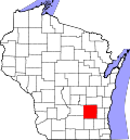
Reeseville, Wisconsin

Last updated
Reeseville, Wisconsin
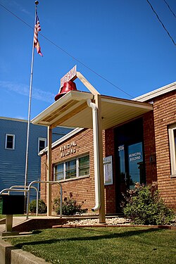
Reeseville Village Hall.jpg
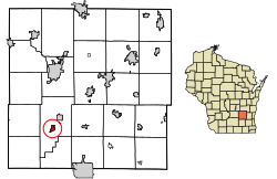
Dodge County Wisconsin Incorporated and Unincorporated areas Reeseville Highlighted.svg
Location of Reeseville in Dodge County, Wisconsin.
Coordinates: 43°18′20″N88°50′38″W / 43.30556°N 88.84389°W / 43.30556; -88.84389
Country Flag of the United States.svg  United States
State Flag of Wisconsin.svg  Wisconsin
County Dodge
Area
[1]
  Total0.63 sq mi (1.62 km2)
  Land0.63 sq mi (1.62 km2)
  Water0.00 sq mi (0.00 km2)
Elevation
[2]
824 ft (251 m)
Population
 (2020) [3]
  Total763
  Density1,088.00/sq mi (420.07/km2)
Time zone UTC-6 (Central (CST))
  Summer (DST) UTC-5 (CDT)
Area code 920
FIPS code 55-66900 [4]
GNIS feature ID1572180 [2]
Website www.reeseville.com

Reeseville is a village in Dodge County, Wisconsin, United States. The population was 763 at the 2020 census.

Contents

History

Reeseville was named after an early settler, Samuel Reese, by his son Adam Reese who surveyed and platted the area. [5] Samuel Reese settled here in 1845.

Geography

Reeseville is located at 43°18′20″N88°50′38″W / 43.30556°N 88.84389°W / 43.30556; -88.84389 (43.305452, -88.843847). [6]

According to the United States Census Bureau, the village has a total area of 0.63 square miles (1.63 km2), all of it land. [7]

Demographics

Historical population
CensusPop.Note
1880 248
1890 32932.7%
1900 39319.5%
1910 352−10.4%
1920 42320.2%
1930 422−0.2%
1940 407−3.6%
1950 47015.5%
1960 4914.5%
1970 56615.3%
1980 64914.7%
1990 6733.7%
2000 7034.5%
2010 7080.7%
2020 7637.8%
U.S. Decennial Census [8]

2010 census

As of the census [3] of 2010, there were 708 people, 288 households, and 181 families living in the village. The population density was 1,123.8 inhabitants per square mile (433.9/km2). There were 322 housing units at an average density of 511.1 per square mile (197.3/km2). The racial makeup of the village was 95.3% White, 0.7% African American, 1.0% Asian, 1.4% from other races, and 1.6% from two or more races. Hispanic or Latino of any race were 2.7% of the population.

There were 288 households, of which 32.6% had children under the age of 18 living with them, 49.7% were married couples living together, 6.9% had a female householder with no husband present, 6.3% had a male householder with no wife present, and 37.2% were non-families. 29.5% of all households were made up of individuals, and 10% had someone living alone who was 65 years of age or older. The average household size was 2.45 and the average family size was 3.02.

The median age in the village was 37.2 years. 26% of residents were under the age of 18; 7.7% were between the ages of 18 and 24; 25.6% were from 25 to 44; 29.6% were from 45 to 64; and 11.2% were 65 years of age or older. The gender makeup of the village was 51.0% male and 49.0% female.

2000 census

As of the census [4] of 2000, there were 703 people, 287 households, and 185 families living in the village. The population density was 1,158.8 people per square mile (445.0/km2). There were 315 housing units at an average density of 519.2 per square mile (199.4/km2). The racial makeup of the village was 98.86% White, 0.14% African American, 0.43% Native American, and 0.57% from two or more races. Hispanic or Latino of any race were 1.14% of the population.

There were 287 households, out of which 34.1% had children under the age of 18 living with them, 51.9% were married couples living together, 8.0% had a female householder with no husband present, and 35.5% were non-families. 30.0% of all households were made up of individuals, and 13.6% had someone living alone who was 65 years of age or older. The average household size was 2.45 and the average family size was 3.06.

In the village, the population was spread out, with 27.0% under the age of 18, 8.5% from 18 to 24, 33.1% from 25 to 44, 19.5% from 45 to 64, and 11.8% who were 65 years of age or older. The median age was 34 years. For every 100 females, there were 107.4 males. For every 100 females age 18 and over, there were 98.8 males.

The median income for a household in the village was $37,120, and the median income for a family was $44,375. Males had a median income of $31,932 versus $22,000 for females. The per capita income for the village was $16,036. About 7.3% of families and 9.9% of the population were below the poverty line, including 16.0% of those under age 18 and 12.2% of those age 65 or over.
Industry

J&R Plasticraft Corporation was located in Reeseville in the mid- to late 1950s. J&R Plasticraft is best known today for the line of Glass-Jet fiberglass runabout boats manufactured in this time period. The Glass-Jet boats featured the distinctive automotive styling of the era, including tail fins and two-tone color schemes. Boat manufacturing was later taken up by a subsequent firm, Quality Plastics, Inc., also of Reeseville, and a product line of boat models were marketed as "Quality Glass" Boats. This firm ceased operations after 1960.

The 2003 film Reeseville starring Majandra Delfino, Brad Hunt, Angela Featherstone, Mark Hamill, and Cotter Smith was based and filmed in Reeseville. [9]

Related Research Articles

<span class="mw-page-title-main">Hamel, Illinois</span> Village in Illinois, United States

Hamel is a village in Madison County, Illinois, United States. The population was 929 at the 2020 census, up from 816 in 2010. It is a part of the Illinois Metro East portion of the Greater St. Louis metropolitan area.

<span class="mw-page-title-main">Lexington, Michigan</span> Village in Michigan, United States

Lexington is a village in Sanilac County in the U.S. state of Michigan. The population was 1,178 at the 2010 census. The village is located within Lexington Township.

<span class="mw-page-title-main">Fairfield Township, Shiawassee County, Michigan</span> Civil township in Michigan, United States

Fairfield Township is a civil township of Shiawassee County in the U.S. state of Michigan. As of the 2010 census, the township population was 755.

Gilford Township is a civil township of Tuscola County in the U.S. state of Michigan. The population was 741 at the 2010 Census.

<span class="mw-page-title-main">Unionville, Michigan</span> Village in Michigan, United States

Unionville is a village in Tuscola County in the U.S. state of Michigan. The population was 508 at the 2010 census. The village is located in the northwestern corner of Columbia Township.

<span class="mw-page-title-main">Oak City, North Carolina</span> Town in North Carolina, United States

Oak City, formerly known as Goose Nest, is a town in Martin County, North Carolina, United States. The population was 317 at the 2010 census.

<span class="mw-page-title-main">Seagate, North Carolina</span> Former CDP in North Carolina, United States

Seagate was a census-designated place (CDP) in New Hanover County, North Carolina, United States. The last census count in 2000 was 4,590. It was annexed by the city of Wilmington in 1998.

<span class="mw-page-title-main">Thurston, Ohio</span> Village in Ohio, United States

Thurston is a village in Fairfield County, Ohio, United States. The population was 604 at the 2010 census.

<span class="mw-page-title-main">East Butler, Pennsylvania</span> Borough in Pennsylvania, United States

East Butler is a borough in Butler County, Pennsylvania, United States. The population was 732 at the 2010 census.

<span class="mw-page-title-main">Washington Township, Butler County, Pennsylvania</span> Township in Pennsylvania, United States

Washington Township is a township in Butler County, Pennsylvania, United States. The population was 1,300 at the 2010 census.

<span class="mw-page-title-main">Walla Walla East, Washington</span> CDP in Washington, United States

Walla Walla East is a census-designated place (CDP) in Walla Walla County, Washington, United States. The population was 1,672 at the 2010 census.

<span class="mw-page-title-main">Friesland, Wisconsin</span> Village in Wisconsin, United States

Friesland is a village in Columbia County, Wisconsin, United States. The population was 320 at the 2020 census. It is part of the Madison Metropolitan Statistical Area.

<span class="mw-page-title-main">Mount Sterling, Wisconsin</span> Village in Wisconsin, United States

Mount Sterling is a village in Crawford County, Wisconsin, United States. The population was 211 at the 2010 census.

<span class="mw-page-title-main">Yuba, Wisconsin</span> Village in Wisconsin, United States

Yuba is a village in Richland County, Wisconsin, United States. The population was 74 at the 2010 census. Yuba is 11 miles southwest of Hillsboro and 17 miles north of Richland Center. County Hwy C runs through the village.

<span class="mw-page-title-main">Ontario, Wisconsin</span> Village in Wisconsin, United States

Ontario is a village in Vernon County, Wisconsin, United States. The population was 554 at the 2010 census.

<span class="mw-page-title-main">Readstown, Wisconsin</span> Village in Wisconsin, United States

Readstown is a village in Vernon County, Wisconsin, United States. The population was 415 at the 2010 census.

<span class="mw-page-title-main">Eastman, Wisconsin</span> Village in Wisconsin, United States

Eastman is a village in Crawford County, Wisconsin, United States. The population was 428 at the 2010 census. The village is located within the Town of Eastman.

<span class="mw-page-title-main">Lowell, Wisconsin</span> Village in Wisconsin, United States

Lowell is a village in Dodge County, Wisconsin, United States, along the Beaver Dam River. The population was 340 at the 2010 census. The village is located within the Town of Lowell.

<span class="mw-page-title-main">Arena, Wisconsin</span> Village in Wisconsin, United States

Arena is a village in Iowa County, Wisconsin, United States. The population was 834 at the 2010 census. The village is located within the Town of Arena. It is part of the Madison Metropolitan Statistical Area.

<span class="mw-page-title-main">Highland, Wisconsin</span> Village in Wisconsin, United States

Highland is a village in Iowa County, Wisconsin, United States. The population was 842 at the 2010 census. It is part of the Madison Metropolitan Statistical Area. The village is located within the Town of Highland.

References

  1. "2019 U.S. Gazetteer Files". United States Census Bureau. Retrieved August 7, 2020.
  2. 1 2 U.S. Geological Survey Geographic Names Information System: Reeseville, Wisconsin
  3. 1 2 "U.S. Census website". United States Census Bureau . Retrieved 2012-11-18.
  4. 1 2 "U.S. Census website". United States Census Bureau . Retrieved 2008-01-31.
  5. "Reeseville [origin of place name]". www.wisconsinhistory.org. Archived from the original on 2011-06-11.
  6. "US Gazetteer files: 2010, 2000, and 1990". United States Census Bureau. 2011-02-12. Retrieved 2011-04-23.
  7. "US Gazetteer files 2010". United States Census Bureau. Archived from the original on 2011-02-20. Retrieved 2012-11-18.
  8. "Census of Population and Housing". Census.gov. Retrieved June 4, 2015.
  9. https://www.imdb.com/title/tt0327594/locations [ user-generated source ]