Trenton, Dodge County, Wisconsin

Last updated

Trenton, Wisconsin
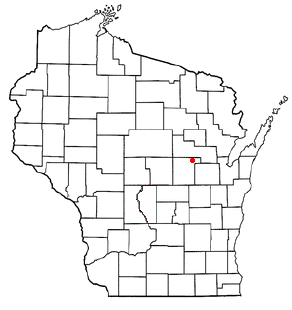
WIMap-doton-Trenton.png
Location of Trenton, Wisconsin
Coordinates: 43°33′51″N88°50′7″W / 43.56417°N 88.83528°W / 43.56417; -88.83528
Country Flag of the United States.svg  United States
State Flag of Wisconsin.svg  Wisconsin
County Dodge
Area
  Total54.4 sq mi (140.9 km2)
  Land53.9 sq mi (139.5 km2)
  Water0.5 sq mi (1.4 km2)
Elevation
[1]
991 ft (302 m)
Population
 (2000)
  Total1,301
  Density24.2/sq mi (9.3/km2)
Time zone UTC-6 (Central (CST))
  Summer (DST) UTC-5 (CDT)
FIPS code 55-80525 [2]
GNIS feature ID1584292 [1]

Trenton is a town in Dodge County, Wisconsin, United States. The population was 1,301 at the 2000 census.

Contents

Geography

According to the United States Census Bureau, the town has a total area of 54.4 square miles (140.8 km2), of which, 53.9 square miles (139.5 km2) of it is land and 0.5 square miles (1.3 km2) of it (0.96%) is water.

Demographics

At the 2000 census there were 1,301 people, 456 households, and 378 families living in the town. The population density was 24.2 people per square mile (9.3/km2). There were 471 housing units at an average density of 8.7 per square mile (3.4/km2). The racial makeup of the town was 98.31% White, 0.61% African American, 0.38% Native American, 0.23% Asian, and 0.46% from two or more races. Hispanic or Latino of any race were 0.92%. [2]

Of the 456 households 36.8% had children under the age of 18 living with them, 75.2% were married couples living together, 3.9% had a female householder with no husband present, and 17.1% were non-families. 12.7% of households were one person and 5.0% were one person aged 65 or older. The average household size was 2.85 and the average family size was 3.14.

The age distribution was 27.1% under the age of 18, 6.6% from 18 to 24, 29.5% from 25 to 44, 26.1% from 45 to 64, and 10.7% 65 or older. The median age was 39 years. For every 100 females, there were 112.6 males. For every 100 females age 18 and over, there were 111.8 males.

The median household income was $50,820 and the median family income was $52,407. Males had a median income of $35,167 versus $23,750 for females. The per capita income for the town was $19,374. About 4.8% of families and 4.4% of the population were below the poverty line, including 2.5% of those under age 18 and 7.0% of those age 65 or over.

Related Research Articles

<span class="mw-page-title-main">Corunna, Indiana</span> Town in Indiana, United States

Corunna is a town in Richland Township, DeKalb County, Indiana, United States. The population was 236 at the 2020 census estimate.

<span class="mw-page-title-main">Morristown, Indiana</span> Town in Indiana, United States

Morristown is a town in Hanover Township, Shelby County, in the U.S. state of Indiana. The population was 1,218 at the 2010 census.

<span class="mw-page-title-main">Cherokee, Kansas</span> City in Crawford County, Kansas

Cherokee is a city in Crawford County, Kansas, United States. As of the 2020 census, the population of the city was 590.

Topsfield is a town in Washington County, Maine, United States. The population was 179 at the 2020 census.

<span class="mw-page-title-main">Queenstown, Maryland</span> Town in Maryland, United States

Queenstown is a town in Queen Anne's County, Maryland, United States. The population was 664 at the 2010 census.

<span class="mw-page-title-main">Leadwood, Missouri</span> City in Missouri, United States

Leadwood is a city in St. Francois County, Missouri, United States. The population was 1,282 at the 2010 census.

<span class="mw-page-title-main">Mendon, Ohio</span> Village in Ohio, United States

Mendon is a village in Mercer County, Ohio, United States. The population was 662 at the 2010 census.

<span class="mw-page-title-main">Joseph, Utah</span> Town in the state of Utah, United States

Joseph is a town in Sevier County, Utah, United States. The population was 269 at the 2000 census. The town was named for Joseph Angell Young, an apostle of the Church of Jesus Christ of Latter-day Saints. Joseph was settled in 1871.

<span class="mw-page-title-main">Peterstown, West Virginia</span> Town in West Virginia, United States

Peterstown is a town in Monroe County, West Virginia, United States. The population was 456 at the 2020 census.

<span class="mw-page-title-main">Newburg, West Virginia</span> Town in West Virginia, United States

Newburg is a town in western Preston County, West Virginia, United States. The population was 275 at the 2020 census. It is part of the Morgantown metropolitan area.

<span class="mw-page-title-main">North Hills, West Virginia</span> Town in West Virginia, United States

North Hills is a town in Wood County, West Virginia, United States. It is a suburb of Parkersburg. The population was 837 at the 2020 census. North Hills was incorporated on February 15, 1979.

<span class="mw-page-title-main">Freeman, Wisconsin</span> Town in Wisconsin, United States

Freeman is a town in Crawford County, Wisconsin, United States. The population was 719 at the 2000 census. The villages of Ferryville and De Soto are located in the town. The unincorporated community of Reed is also located in the town.

<span class="mw-page-title-main">Liberty, Manitowoc County, Wisconsin</span> Town in Wisconsin, United States

Liberty is a town in Manitowoc County, Wisconsin, United States. The population was 1,287 at the 2000 census.

<span class="mw-page-title-main">Shields, Marquette County, Wisconsin</span> Town in Wisconsin, United States

Shields is a town in Marquette County, Wisconsin, United States. The population was 456 at the 2000 census. The unincorporated community of Germania is located in the town.
<span class="mw-page-title-main">Grant, Monroe County, Wisconsin</span> Town in Wisconsin, United States

Grant is a town in Monroe County, Wisconsin, United States. The population was 483 at the 2000 census.

<span class="mw-page-title-main">Townsend, Wisconsin</span> Town in Wisconsin, United States

Townsend is a town in Oconto County, Wisconsin, United States. The population was 963 at the 2000 census. The census-designated place of Townsend is located in the town.

<span class="mw-page-title-main">Larrabee, Wisconsin</span> Town in Wisconsin, United States

Larrabee is a town in Waupaca County, Wisconsin, United States. The population was 1,301 at the 2000 census. The unincorporated community of Buckbee is located in the town.

<span class="mw-page-title-main">Lebanon, Waupaca County, Wisconsin</span> Town in Wisconsin, United States

Lebanon is a town in Waupaca County, Wisconsin, United States. The population was 1,648 at the 2000 census. The unincorporated community of Carmel is located in the town. The ghost town of Nowell was also located in the town.

<span class="mw-page-title-main">Beaver Dam (town), Wisconsin</span> Town in Wisconsin, United States

Beaver Dam is a town in Dodge County, Wisconsin, United States. The population was 3,440 at the 2000 census. The City of Beaver Dam is encircled by the town. The unincorporated communities of Beaver Edge, Leipsig and Sunset Beach are located in the town. The ghost town of Clason Prairie was also located in the town.

Lowell is a town in Dodge County, Wisconsin, United States. The population was 1,169 at the 2000 census. The Village of Lowell and the unincorporated community of North Lowell are located in the town.

References

  1. 1 2 "US Board on Geographic Names". United States Geological Survey. October 25, 2007. Retrieved January 31, 2008.
  2. 1 2 "U.S. Census website". United States Census Bureau . Retrieved January 31, 2008.