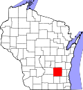
Hustisford, Wisconsin

Last updated

Hustisford, Wisconsin
HustisfordWisconsinDowntown.jpg
Downtown Hustisford
Nickname: 
Husty
Dodge County Wisconsin Incorporated and Unincorporated areas Hustisford Highlighted.svg
Location of Hustisford in Dodge County, Wisconsin
Coordinates: 43°20′1″N88°35′51″W / 43.33361°N 88.59750°W / 43.33361; -88.59750
Country Flag of the United States.svg  United States
State Flag of Wisconsin.svg  Wisconsin
County Dodge
Area
[1]
  Total1.33 sq mi (3.45 km2)
  Land1.11 sq mi (2.89 km2)
  Water0.22 sq mi (0.56 km2)
Elevation
[2]
863 ft (263 m)
Population
 (2020) [3]
  Total1,101
  Estimate 
(2022) [4]
1,085
  Density977.48/sq mi (375.43/km2)
Time zone UTC-6 (Central (CST))
  Summer (DST) UTC-5 (CDT)
Area code 920
FIPS code 55-36650 [5]
GNIS feature ID1566830 [2]
Website www.hustisford.com

Hustisford is a village in Dodge County, Wisconsin, United States. The population was 1,101 at the 2020 census. The village is located within the town of Hustisford.

Contents

History

The village was named for John Hustis, a pioneer settler. [6]

Geography

Hustisford is located at 43°20′43″N88°36′4″W / 43.34528°N 88.60111°W / 43.34528; -88.60111 (43.345528, -88.60135). [7]

According to the United States Census Bureau, the village has a total area of 1.10 square miles (2.85 km2), of which, 0.89 square miles (2.31 km2) is land and 0.21 square miles (0.54 km2) is water. [8]

The village is bordered to the north by Lake Sinissippi, a shallow lake fed by the Rock River flowing from the Horicon Marsh, a bird sanctuary north of Hustisford. The lake hosts ice racing on Sundays in January and February.

Demographics

Historical population
CensusPop.Note
1880 488
1890 5135.1%
1900 5405.3%
1910 61513.9%
1920 595−3.3%
1930 537−9.7%
1940 5645.0%
1950 62210.3%
1960 70813.8%
1970 78911.4%
1980 87410.8%
1990 97912.0%
2000 1,13515.9%
2010 1,123−1.1%
2020 1,101−2.0%
2022 (est.)1,085 [4] −1.5%
U.S. Decennial Census [9]

Beginning in the middle of the 1800s Hustisford had a German immigrant community. At one time it had two German-speaking churches, with one, Bethany Lutheran Church, continuing to have German worship in the 1970s. In addition, two of three schools in the period used German as a language of instruction. [10]

2010 census

As of the census [3] of 2010, there were 1,123 people, 477 households, and 309 families living in the village. The population density was 1,261.8 inhabitants per square mile (487.2/km2). There were 532 housing units at an average density of 597.8 per square mile (230.8/km2). The racial makeup of the village was 97.2% White, 0.5% African American, 1.0% Native American, 0.6% Asian, 0.1% from other races, and 0.5% from two or more races. Hispanic or Latino people of any race were 2.9% of the population.

There were 477 households, of which 29.8% had children under the age of 18 living with them, 49.5% were married couples living together, 8.6% had a female householder with no husband present, 6.7% had a male householder with no wife present, and 35.2% were non-families. 28.9% of all households were made up of individuals, and 10% had someone living alone who was 65 years of age or older. The average household size was 2.35 and the average family size was 2.89.

The median age in the village was 39.4 years. 22.4% of residents were under the age of 18; 8.5% were between the ages of 18 and 24; 27.4% were from 25 to 44; 27.4% were from 45 to 64; and 14.4% were 65 years of age or older. The gender makeup of the village was 52.1% male and 47.9% female.

2000 census

As of the census [5] of 2000, there were 1,135 people, 472 households, and 296 families living in the village. The population density was 1,402.6 people per square mile (541.0/km2). There were 498 housing units at an average density of 615.4 per square mile (237.4/km2). The racial makeup of the village was 99.21% White, 0.09% Black or African American, 0.35% Native American, 0.35% from other races. 1.23% of the population were Hispanic or Latino of any race.

There were 472 households, out of which 31.4% had children under the age of 18 living with them, 51.7% were married couples living together, 7.6% had a female householder with no husband present, and 37.1% were non-families. 31.1% of all households were made up of individuals, and 15.5% had someone living alone who was 65 years of age or older. The average household size was 2.40 and the average family size was 3.03.

In the village, the population was spread out, with 26.3% under the age of 18, 6.9% from 18 to 24, 30.6% from 25 to 44, 20.6% from 45 to 64, and 15.6% who were 65 years of age or older. The median age was 36 years. For every 100 females, there were 96.7 males. For every 100 females age 18 and over, there were 97.6 males.

The median income for a household in the village was $40,929, and the median income for a family was $52,262. Males had a median income of $31,951 versus $23,333 for females. The per capita income for the village was $20,599. About 1.7% of families and 2.7% of the population were below the poverty line, including 2.0% of those under age 18 and 6.5% of those age 65 or over.

Education

Hustisford School District operates public schools, including Hustisford High School.

Bethany Lutheran School is a Christian Pre-K through 8th grade school of the Wisconsin Evangelical Lutheran Synod in Hustisford. [11]

Toilet Bowl

Each year on January 1, the Hustisford Fire Department hosts the Toilet Bowl Parade and Toilet Bowl game. The parade goes through downtown Hustisford twice. The game is held at the Fireman's Park in Hustisford and is an unpadded, tackle football game. In order to play in the game, one must have lived in Hustisford, attended Hustisford High School, or worked in Hustisford.

Notable residents

Images

Related Research Articles

<span class="mw-page-title-main">Bethany, Illinois</span> Village in Illinois, United States

Bethany is a village in Moultrie County, Illinois, United States. The population was 1,255 at the 2020 census, down from 1,352 in 2010.

<span class="mw-page-title-main">Bethany, Indiana</span> Town in Indiana, United States

Bethany is a town in Clay Township, Morgan County, in the U.S. state of Indiana. The population was 95 at the 2020 census.

<span class="mw-page-title-main">Stevensville, Michigan</span> Village in Michigan, United States

Stevensville is a village in Berrien County in the U.S. state of Michigan. The village lies within Lincoln Township. The population was 1,147 at the 2020 census.

Bethany Township is a civil township of Gratiot County in the U.S. state of Michigan. As of the 2020 census, the township population was 1,773, up from 1,407 in 2010.

Le Roy Township is a township in Mower County, Minnesota, United States. The population was 396 at the 2000 census. The town in the township with the largest population is Le Roy with 925 people. The township is also home to Lake Louise State Park, the only Minnesota State Park in Mower County and the southernmost in the state. The Old Village of Le Roy was the first area in the township to be settled.

<span class="mw-page-title-main">Plymouth, Nebraska</span> Village in Nebraska, United States

Plymouth is a village in Jefferson County, Nebraska, United States. The population was 363 at the 2020 census.

<span class="mw-page-title-main">Waco, Nebraska</span> Village in York County, Nebraska, United States

Waco is a village in York County, Nebraska, United States. The population was 236 at the 2010 census.

<span class="mw-page-title-main">Pardeeville, Wisconsin</span> Village in Wisconsin, United States

Pardeeville is a village in Columbia County, Wisconsin, United States. The population was 2,115 at the 2010 census. It is part of the Madison Metropolitan Statistical Area.

<span class="mw-page-title-main">Iron Ridge, Wisconsin</span> Village in Wisconsin, United States

Iron Ridge is a village in Dodge County, Wisconsin, United States. The population was 929 at the 2010 census. The village was founded on a railroad line, named for the iron mined in the area. Its ZIP code is 53035.

<span class="mw-page-title-main">North Fond du Lac, Wisconsin</span> Village in Wisconsin, United States

North Fond du Lac is a village in Fond du Lac County, Wisconsin, United States. The population was 5,378 at the 2020 census. Despite the name, North Fond du Lac is actually located northwest of Fond du Lac, as Lake Winnebago is directly north of Fond du Lac.

<span class="mw-page-title-main">Stoddard, Wisconsin</span> Village in Wisconsin, United States

Stoddard is a village in Vernon County, Wisconsin, United States. The population was 840 at the 2020 census.

<span class="mw-page-title-main">Hartland, Wisconsin</span> Village in Wisconsin, United States

Hartland is a village along the Bark River in Waukesha County, Wisconsin, United States, that is a suburb of Milwaukee. The population was 9,501 at the 2020 census.

<span class="mw-page-title-main">Wales, Wisconsin</span> Village in Wisconsin, United States

Wales is a village in Waukesha County, Wisconsin, first settled by Welsh immigrants. The population was 2,862 at the time of the 2020 census.

<span class="mw-page-title-main">North Cass, Minnesota</span> Unorganized territory of Cass County, Minnesota, United States

North Cass is an unorganized territory in Cass County, Minnesota, United States. The population was 282 at the 2020 census. It is part of the Brainerd Micropolitan Statistical Area.

<span class="mw-page-title-main">Alexander, New York</span> Town in New York, United States

Alexander is a town in Genesee County, New York, United States. The population was 2,491 at the 2020 census. The town is named after Alexander Rea, an early settler, and is on the southern border of the county. It includes a village also named Alexander.

<span class="mw-page-title-main">Wrightstown, Wisconsin</span> Village in Wisconsin, United States

Wrightstown is a village in Brown and Outagamie counties in the U.S. state of Wisconsin. The population was 3,179 at the 2020 census. The village is surrounded mostly by the westernmost part of the Town of Wrightstown in Brown County. On February 28, 2002, the village annexed a portion of land within the adjacent Town of Kaukauna in Outagamie County.

<span class="mw-page-title-main">Hustisford (town), Wisconsin</span> Town in Wisconsin, United States

Hustisford is a town in Dodge County, Wisconsin, United States. The population was 1,379 at the 2000 census. Most of the town residents live in the village of Hustisford, within the town.

<span class="mw-page-title-main">Monroe (town), Green County, Wisconsin</span> Township in Wisconsin, United States

Monroe is a town in Green County, Wisconsin, United States. The population was 1,142 at the 2000 census. The City of Monroe is located partially within the town. The unincorporated community of Stearns is also located in the town.

<span class="mw-page-title-main">Marquette, Wisconsin</span> Village in Wisconsin, United States

Marquette is a village in Green Lake County, Wisconsin, United States. The population was 150 at the 2010 census. The village is located within the Town of Marquette. Marquette uses the postal code 53947.

<span class="mw-page-title-main">Bangor, Wisconsin</span> Village in Wisconsin, United States

Bangor is a village in La Crosse County, Wisconsin, United States, along the La Crosse River. It is part of the La Crosse-Onalaska, WI-MN Metropolitan Statistical Area. The population was 1,437 as of the 2020 Census. The village is located partially within the Town of Bangor.

References

  1. "2019 U.S. Gazetteer Files". United States Census Bureau. Retrieved August 7, 2020.
  2. 1 2 U.S. Geological Survey Geographic Names Information System: Hustisford, Wisconsin
  3. 1 2 "U.S. Census website". United States Census Bureau . Retrieved November 18, 2012.
  4. 1 2 "City and Town Population Totals". United States Census Bureau. July 1, 2022. Retrieved October 25, 2023.
  5. 1 2 "U.S. Census website". United States Census Bureau . Retrieved January 31, 2008.
  6. Gannett, Henry (1905). The Origin of Certain Place Names in the United States. Govt. Print. Off. pp.  164.
  7. "US Gazetteer files: 2010, 2000, and 1990". United States Census Bureau. February 12, 2011. Retrieved April 23, 2011.
  8. "US Gazetteer files 2010". United States Census Bureau. Archived from the original on January 25, 2012. Retrieved November 18, 2012.
  9. "Census of Population and Housing". Census.gov. Retrieved June 4, 2015.
  10. Ludden, Jennifer (April 1, 2009). "In Rural Wisconsin, German Reigned For Decades". National Public Radio . Retrieved January 6, 2019.
  11. "Bethany Lutheran School" . Retrieved January 1, 2020.
  12. Collins, Bob (February 1, 2017). "Gwen Gillen was much more than the Mary Tyler Moore statue". Minnesota Public Radio . Retrieved February 27, 2017.