Neosho, Wisconsin

Last updated

Neosho, Wisconsin
Neosho Wisconsin Downtown Looking South WIS67.jpg
Looking south in Neosho
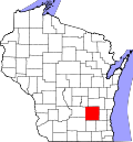
Dodge County Wisconsin Incorporated and Unincorporated areas Neosho Highlighted.svg
Location of Neosho in Dodge County, Wisconsin.
Coordinates: 43°18′37″N88°31′5″W / 43.31028°N 88.51806°W / 43.31028; -88.51806
Country Flag of the United States.svg  United States
State Flag of Wisconsin.svg  Wisconsin
County Dodge
Area
[1]
  Total0.56 sq mi (1.44 km2)
  Land0.53 sq mi (1.36 km2)
  Water0.03 sq mi (0.08 km2)
Elevation
[2]
902 ft (275 m)
Population
 (2010) [3]
  Total574
  Estimate 
(2019) [4]
551
  Density1,047.53/sq mi (404.49/km2)
Time zone UTC-6 (Central (CST))
  Summer (DST) UTC-5 (CDT)
FIPS code 55-56075 [5]
GNIS feature ID1570176 [2]
Website www.villageofneosho.org

Neosho is a village in Dodge County, Wisconsin, United States. The population was 574 at the 2010 census.

Contents

Geography

Neosho is located at 43°18′37″N88°31′5″W / 43.31028°N 88.51806°W / 43.31028; -88.51806 (43.310165, -88.517933). [6]

According to the United States Census Bureau, the village has a total area of 0.55 square miles (1.42 km2), of which, 0.52 square miles (1.35 km2) of it is land and 0.03 square miles (0.08 km2) is water. [7]

Demographics

Historical population
CensusPop.Note
1880 197
1910 304
1920 296−2.6%
1930 262−11.5%
1940 255−2.7%
1950 28712.5%
1960 34520.2%
1970 40015.9%
1980 57543.8%
1990 65814.4%
2000 593−9.9%
2010 574−3.2%
2019 (est.)551 [4] −4.0%
U.S. Decennial Census [8]

2010 census

As of the census [3] of 2010, there were 574 people, 241 households, and 154 families living in the village. The population density was 1,103.8 inhabitants per square mile (426.2/km2). There were 255 housing units at an average density of 490.4 per square mile (189.3/km2). The racial makeup of the village was 97.2% White, 0.5% African American, 0.7% Native American, 0.2% Asian, and 1.4% from two or more races. Hispanic or Latino of any race were 0.7% of the population.

There were 241 households, of which 29.0% had children under the age of 18 living with them, 49.8% were married couples living together, 9.1% had a female householder with no husband present, 5.0% had a male householder with no wife present, and 36.1% were non-families. 27.4% of all households were made up of individuals, and 5.4% had someone living alone who was 65 years of age or older. The average household size was 2.38 and the average family size was 2.93.

The median age in the village was 42 years. 22.5% of residents were under the age of 18; 7.2% were between the ages of 18 and 24; 27% were from 25 to 44; 34% were from 45 to 64; and 9.1% were 65 years of age or older. The gender makeup of the village was 52.3% male and 47.7% female.

2000 census

As of the census [5] of 2000, there were 593 people, 213 households, and 156 families living in the village. The population density was 991.4 people per square mile (381.6/km2). There were 223 housing units at an average density of 372.8 per square mile (143.5/km2). The racial makeup of the village was 98.99% White, 0.67% Native American, and 0.34% from two or more races. Hispanic or Latino of any race were 0.51% of the population.

There were 213 households, out of which 44.6% had children under the age of 18 living with them, 62.4% were married couples living together, 6.1% had a female householder with no husband present, and 26.3% were non-families. 18.8% of all households were made up of individuals, and 7.5% had someone living alone who was 65 years of age or older. The average household size was 2.78 and the average family size was 3.25.

In the village, the population was spread out, with 30.2% under the age of 18, 9.4% from 18 to 24, 32.2% from 25 to 44, 20.9% from 45 to 64, and 7.3% who were 65 years of age or older. The median age was 34 years. For every 100 females, there were 99.7 males. For every 100 females age 18 and over, there were 102.0 males.

The median income for a household in the village was $50,167, and the median income for a family was $50,167. Males had a median income of $38,000 versus $27,031 for females. The per capita income for the village was $19,134. About 0.6% of families and 1.8% of the population were below the poverty line, including 2.2% of those under age 18 and 5.8% of those age 65 or over.

Notable people

Images

Related Research Articles

<span class="mw-page-title-main">Neosho Rapids, Kansas</span> City in Lyon County, Kansas

Neosho Rapids is a city in Lyon County, Kansas, United States. As of the 2020 census, the population of the city was 229.

<span class="mw-page-title-main">Neosho Falls, Kansas</span> City in Woodson County, Kansas, United States

Neosho Falls is a city in Woodson County, Kansas, United States. As of the 2020 census, the population of the city was 134.

<span class="mw-page-title-main">Friendship (village), Wisconsin</span> Village in Wisconsin, United States

Friendship is a village in Adams County in the U.S. state of Wisconsin. It is the county seat of Adams County. The population was 725 at the 2010 census.

<span class="mw-page-title-main">Sherwood, Wisconsin</span> Village in Wisconsin, United States

Sherwood is a village in Calumet County, Wisconsin, United States. The population was 2,713 at the 2010 census. The former historical unincorporated community of High Cliff is located within present-day Sherwood.

<span class="mw-page-title-main">Ferryville, Wisconsin</span> Village in Wisconsin, United States

Ferryville is a village in Crawford County, Wisconsin, United States. The population was 176 at the 2010 census. It is located on Wisconsin Highway 35 along the Great River Road.

<span class="mw-page-title-main">Downing, Wisconsin</span> Village in Wisconsin, United States

Downing is a village in Dunn County, Wisconsin, United States. Bordering St. Croix County to the west, the village is otherwise surrounded by the Town of Tiffany. The population was 234 at the 2020 census.

<span class="mw-page-title-main">Fall Creek, Wisconsin</span> Village in Wisconsin, United States

Fall Creek is a village in Eau Claire County, Wisconsin, United States. The population was 1,315 at the 2010 census. The village is bordered by the Town of Lincoln.

<span class="mw-page-title-main">Cleveland (village), Wisconsin</span> Village in Wisconsin, United States

Cleveland is a village in Manitowoc County, Wisconsin, United States. The population was 1,485 at the 2010 census.

<span class="mw-page-title-main">Athens, Wisconsin</span> Village in Wisconsin, United States

Athens is a village in Marathon County, Wisconsin, United States. The population was 1,105 at the 2010 census. It is part of the Wausau, Wisconsin Metropolitan Statistical Area.

<span class="mw-page-title-main">Yuba, Wisconsin</span> Village in Wisconsin, United States

Yuba is a village in Richland County, Wisconsin, United States. The population was 74 at the 2010 census. Yuba is 11 miles southwest of Hillsboro and 17 miles north of Richland Center. County Hwy C runs through the village.

<span class="mw-page-title-main">Ingram, Wisconsin</span> Village in Wisconsin, United States

Ingram is a village in Rusk County, Wisconsin, United States. The population was 78 at the 2010 census.

<span class="mw-page-title-main">Sheldon, Rusk County, Wisconsin</span> Village in Wisconsin, United States

Sheldon is a village in Rusk County, Wisconsin, United States. The population was 237 at the 2010 census.

<span class="mw-page-title-main">Pigeon Falls, Wisconsin</span> Village in Wisconsin, United States

Pigeon Falls is a village in Trempealeau County, Wisconsin, United States. The population was 411 at the 2010 census.

<span class="mw-page-title-main">Viola, Wisconsin</span> Village in Wisconsin, United States

Viola is a village in Richland (mostly) and Vernon Counties in the U.S. state of Wisconsin, United States. The population was 699 at the 2010 census. Of this, 477 were in Richland County, and 222 were in Vernon County.

<span class="mw-page-title-main">Eastman, Wisconsin</span> Village in Wisconsin, United States

Eastman is a village in Crawford County, Wisconsin, United States. The population was 428 at the 2010 census. The village is located within the Town of Eastman.

<span class="mw-page-title-main">Hixton, Wisconsin</span> Village in Wisconsin, United States

Hixton is a village in Jackson County, Wisconsin, United States, along the Trempealeau River. The population was 433 at the 2010 census. The village is located within the Town of Hixton.

<span class="mw-page-title-main">Melrose, Wisconsin</span> Village in Wisconsin, United States

Melrose is a village in Jackson County, Wisconsin, United States. The population was 503 at the 2010 census. The village is located within the Town of Melrose.

<span class="mw-page-title-main">Clear Lake, Wisconsin</span> Village in Wisconsin, United States

Clear Lake is a village in Polk County, Wisconsin, United States. The population was 1,070 at the 2010 census. The village is adjacent to the Town of Clear Lake along U.S. Highway 63.

<span class="mw-page-title-main">Coloma, Wisconsin</span> Village in Wisconsin, United States

Coloma is a village in Waushara County, Wisconsin, United States. The population was 450 at the 2010 census. The village is located within the Town of Coloma. Coloma is home of the annual Coloma Chicken Chew, held at the end of June.

<span class="mw-page-title-main">Plainfield, Wisconsin</span> Village in Wisconsin, United States

Plainfield is a village in Waushara County, Wisconsin, United States. The village is located almost entirely within the Town of Plainfield. A tiny portion extends into adjacent Town of Oasis. The population was 897 at the 2010 census.

References

  1. "2019 U.S. Gazetteer Files". United States Census Bureau. Retrieved August 7, 2020.
  2. 1 2 U.S. Geological Survey Geographic Names Information System: Neosho, Wisconsin
  3. 1 2 "U.S. Census website". United States Census Bureau . Retrieved November 18, 2012.
  4. 1 2 "Population and Housing Unit Estimates". United States Census Bureau. May 24, 2020. Retrieved May 27, 2020.
  5. 1 2 "U.S. Census website". United States Census Bureau . Retrieved January 31, 2008.
  6. "US Gazetteer files: 2010, 2000, and 1990". United States Census Bureau. February 12, 2011. Retrieved April 23, 2011.
  7. "US Gazetteer files 2010". United States Census Bureau. Archived from the original on January 25, 2012. Retrieved November 18, 2012.
  8. "Census of Population and Housing". Census.gov. Retrieved June 4, 2015.