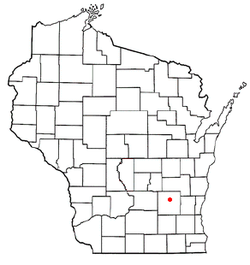
Burnett, Wisconsin | |
---|---|
Coordinates: 43°30′15″N88°42′38″W / 43.50417°N 88.71056°W | |
Country | United States |
State | Wisconsin |
County | Dodge |
Area | |
• Total | 36.5 sq mi (94.4 km2) |
• Land | 36.2 sq mi (93.7 km2) |
• Water | 0.3 sq mi (0.7 km2) |
Elevation | 869 ft (265 m) |
Population (2000) | |
• Total | 919 |
• Density | 25.4/sq mi (9.8/km2) |
Time zone | UTC-6 (Central (CST)) |
• Summer (DST) | UTC-5 (CDT) |
FIPS code | 55-11275 [2] |
GNIS feature ID | 1582890 [1] |
Website | http://www.townofburnett.com |
Burnett is a town in Dodge County, Wisconsin, United States. The population was 919 at the 2000 census. The census-designated place of Burnett is located in the town, and the unincorporated community of Rolling Prairie is located partially in the town.
The town was named for Ellsworth Burnett(e), [3] [4] a government surveyor who was killed by Indians in November 1835. [5] [6]
According to the United States Census Bureau, the town has a total area of 36.5 square miles (95 km2), of which 36.2 square miles (94 km2) is land and 0.3 square miles (0.78 km2) (0.74%) is water.
As of the census [2] of 2000, there were 919 people, 330 households, and 265 families residing in the town. The population density was 25.4 people per square mile (9.8 people/km2). There were 353 housing units at an average density of 9.8 per square mile (3.8/km2). The racial makeup of the town was 98.59% White, 0.33% African American, 0.65% from other races, and 0.44% from two or more races. Hispanic or Latino of any race were 0.87% of the population.
There were 330 households, out of which 34.2% had children under the age of 18 living with them, 70.9% were married couples living together, 4.5% had a female householder with no husband present, and 19.4% were non-families. 17.0% of all households were made up of individuals, and 8.5% had someone living alone who was 65 years of age or older. The average household size was 2.78 and the average family size was 3.14.
In the town, the population was spread out, with 26.7% under the age of 18, 6.9% from 18 to 24, 28.8% from 25 to 44, 26.1% from 45 to 64, and 11.5% who were 65 years of age or older. The median age was 38 years. For every 100 females, there were 107.9 males. For every 100 females age 18 and over, there were 106.1 males.
The median income for a household in the town was $55,000, and the median income for a family was $59,750. Males had a median income of $35,263 versus $24,875 for females. The per capita income for the town was $22,043. About 4.2% of families and 5.8% of the population were below the poverty line, including 7.5% of those under age 18 and 7.0% of those age 65 or over.
Anderson is a town in Burnett County in the U.S. state of Wisconsin. The population was 398 at the 2010 census. The unincorporated communities of Benson, Randall, and Trade River are located within the town.
Daniels is a town in Burnett County in the U.S. state of Wisconsin. The population was 649 at the 2010 census. The unincorporated community of Falun is located within the town.
Dewey is a town in Burnett County in the U.S. state of Wisconsin. The population was 516 at the 2010 census. The unincorporated community of Bashaw is located in the town.
Jackson is a town in Burnett County in the U.S. state of Wisconsin. The population was 773 at the 2010 census.
La Follette is a town in Burnett County in the U.S. state of Wisconsin. The population was 536 at the 2010 census. The unincorporated communities of Coomer and Hertel are located in the town.
Lincoln is a town in Burnett County in the U.S. state of Wisconsin. The population was 309 at the 2010 census.
Oakland is a town in Burnett County in the U.S. state of Wisconsin. The population was 827 at the 2010 census. It is along Wisconsin Highway 35. The unincorporated communities of Oakland and Yellow Lake are located in the town.
Roosevelt is a town in Burnett County in the U.S. state of Wisconsin. The population was 199 at the 2010 census. The unincorporated community of Timberland is located in the town.
Sand Lake is a town in Burnett County in the U.S. state of Wisconsin. The population was 531 at the 2010 census.
Scott is a town in Burnett County in the U.S. state of Wisconsin. The population was 494 at the 2010 census, down from 590 at the 2000 census.
Union is a town in Burnett County in the U.S. state of Wisconsin. The population was 340 at the 2010 census.
West Marshland is a town in Burnett County in the U.S. state of Wisconsin. The population was 367 at the 2010 census.
Mayville is a town in Clark County in the U.S. state of Wisconsin. The population was 919 at the 2000 census.
Poynette is a village in Columbia County, Wisconsin, United States. The population was 2,575 at the 2022 United States census. It is part of the Madison Metropolitan Statistical Area.
Burke is a town in Dane County, Wisconsin, United States. The population was 3,265 at the 2020 census. The unincorporated communities of Burke and Seminary Springs are in the town.
Rutland is a town in Dane County, Wisconsin, United States. The population was 1,977 by the US Census Bureau 2020 census The population was 1,887 at the 2000 census. However, for 2021, the Wisconsin Dept. of Administration declared the population of the Town to be 2,032. The unincorporated communities of Rutland and Stone are located in the town.
Pleasant Valley is a town in Eau Claire County, Wisconsin, United States. The population was 3,044 at the 2010 census. The town government is headquartered in the unincorporated community of Cleghorn. The remains of the historic community of Hadleyville are also located in the town.
The Town of Center is located in Rock County, Wisconsin, United States. The population was 1,046 at the 2020 census. The unincorporated community of Center is in the town. The ghost town of Fellows was also located in the town.
Chimney Rock is a town in Trempealeau County, Wisconsin, United States. The population was 276 at the 2000 census. The unincorporated community of Russell is located in the town.
Grantsburg is a town in Burnett County in the U.S. state of Wisconsin. The population was 1,136 at the 2010 census. The village of Grantsburg is located within the town. The unincorporated communities of Branstad and Lind are located in the town.
{{cite book}}
: CS1 maint: location missing publisher (link){{cite web}}
: CS1 maint: bot: original URL status unknown (link){{cite book}}
: CS1 maint: location missing publisher (link)