Calamus, Wisconsin

Last updated

Calamus, Wisconsin
Motto: 
"Proud of our Farming Heritage"
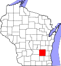
WIMap-doton-Calamus.png
Location of Calamus, Wisconsin
Coordinates: 43°25′13″N88°56′51″W / 43.42028°N 88.94750°W / 43.42028; -88.94750
Country Flag of the United States.svg  United States
State Flag of Wisconsin.svg  Wisconsin
County Dodge
Area
  Total36.6 sq mi (94.7 km2)
  Land36.1 sq mi (93.5 km2)
  Water0.5 sq mi (1.2 km2)
Elevation
[1]
886 ft (270 m)
Population
 (2000)
  Total1,005
  Density27.9/sq mi (10.8/km2)
Time zone UTC-6 (Central (CST))
  Summer (DST) UTC-5 (CDT)
Area code 920
FIPS code 55-11850 [2]
GNIS feature ID1582902 [1]
Website Town of Calamus, Dodge County, Wisconsin

Calamus is a town in Dodge County, Wisconsin, United States. The population was 1,005 at the 2000 census. The unincorporated community of South Beaver Dam is located in the town. The unincorporated community of Lost Lake is also located partially in the town.

Contents

History

The town was founded on January 22, 1846. [3]

Geography

According to the United States Census Bureau, the town has a total area of 36.5 square miles (94.7 km2), of which, 36.1 square miles (93.4 km2) of it is land and 0.5 square miles (1.2 km2) of it (1.29%) is water.

Demographics

As of the census [2] of 2000, there were 1,005 people, 379 households, and 297 families living in the town. The population density was 27.9 people per square mile (10.8/km2). There were 396 housing units at an average density of 11.0 per square mile (4.2/km2). The racial makeup of the town was 97.71% White, 0.70% African American, 0.90% Native American, 0.30% from other races, and 0.40% from two or more races. Hispanic or Latino of any race were 1.00% of the population.

There were 379 households, out of which 31.9% had children under the age of 18 living with them, 67.0% were married couples living together, 5.8% had a female householder with no husband present, and 21.6% were non-families. 14.8% of all households were made up of individuals, and 4.2% had someone living alone who was 65 years of age or older. The average household size was 2.65 and the average family size was 2.95.

In the town, the population was spread out, with 23.2% under the age of 18, 7.7% from 18 to 24, 29.8% from 25 to 44, 26.8% from 45 to 64, and 12.6% who were 65 years of age or older. The median age was 39 years. For every 100 females, there were 105.1 males. For every 100 females age 18 and over, there were 110.4 males.

The median income for a household in the town was $50,000, and the median income for a family was $54,107. Males had a median income of $33,636 versus $24,671 for females. The per capita income for the town was $19,818. About 5.5% of families and 7.8% of the population were below the poverty line, including 13.0% of those under age 18 and 5.4% of those age 65 or over.

Related Research Articles

<span class="mw-page-title-main">Toronto, Iowa</span> City in Iowa, United States

Toronto is a town in Clinton County, Iowa, United States. The population was 102 at the time of the 2020 census.

<span class="mw-page-title-main">Wheatland, Iowa</span> City in Iowa, United States

Wheatland is a city in Clinton County, Iowa, United States. The population was 775 at the time of the 2020 census.

Garland is a town in Penobscot County, Maine, United States. The population was 1,026 at the 2020 census.

<span class="mw-page-title-main">Bird Island, Minnesota</span> City in Minnesota, United States

Bird Island is a city located on U.S. Route 212 in Renville County, Minnesota, United States. The population was 1,005 at the 2020 census.

<span class="mw-page-title-main">Laurelville, Ohio</span> Village in Ohio, United States

Laurelville is a village in Hocking County, Ohio, United States. The population was 512 at the 2020 census.

<span class="mw-page-title-main">Waynesville, Ohio</span> Village in Ohio, United States

Waynesville is a village in Wayne Township, Warren County, Ohio, United States. The population was 2,669 at the 2020 census. It is named for General "Mad" Anthony Wayne. The village, located at the crossroads of U.S. Route 42 and State Route 73, is known for its antique stores and its annual sauerkraut festival. Caesar Creek State Park is located 5 miles (8.0 km) east of the village.

<span class="mw-page-title-main">Union Township, Huntingdon County, Pennsylvania</span> Township in Pennsylvania, United States

Union Township is a township in Huntingdon County, Pennsylvania, United States. The population was 951 at the 2020 census.

<span class="mw-page-title-main">Spencer, West Virginia</span> City in West Virginia, United States

Spencer is a city in and the county seat of Roane County, West Virginia, United States. Originally known as "California," Spencer was chartered in 1858, and named after Spencer Roane (1762–1822), a distinguished jurist from Virginia, who served on the Virginia Supreme Court of Appeals, and for whom Roane County was named. The population was 2,062 at the 2020 census. Spencer is the home of the annual West Virginia Black Walnut Festival. Points of interest include Charles Fork Lake, Chrystal Water and Power Company-Spencer Water and Ice Company, the McIntosh Mansion, and the Robey Theatre.

<span class="mw-page-title-main">Elba, Wisconsin</span> Town in Wisconsin, United States

Elba is a town in Dodge County, Wisconsin, United States. The population was 1,086 at the 2000 census. The unincorporated communities of Astico and Danville are located in the town.

<span class="mw-page-title-main">Portland, Dodge County, Wisconsin</span> Town in Wisconsin, United States

Portland is a town in Dodge County, Wisconsin, United States. The population was 1,106 at the 2000 census. The unincorporated community of Portland is located partially in the town.

<span class="mw-page-title-main">Rubicon, Wisconsin</span> Town in Wisconsin, United States

Rubicon is a town in Dodge County, Wisconsin, United States. The population was 2,005 at the 2000 census. The unincorporated communities of Rubicon and Saylesville are located in the town. The unincorporated community of Woodland is also located partially in the town.

<span class="mw-page-title-main">Trenton, Dodge County, Wisconsin</span> Town in Wisconsin, United States

Trenton is a town in Dodge County, Wisconsin, United States. The population was 1,301 at the 2000 census.

<span class="mw-page-title-main">Westford, Dodge County, Wisconsin</span> Town in Wisconsin, United States

Westford is a town in Dodge County, Wisconsin, United States. The population was 1,400 at the 2000 census. The unincorporated community of South Randolph is located in the town. The unincorporated community of Lost Lake is also located partially in the town.

<span class="mw-page-title-main">Lincoln, Forest County, Wisconsin</span> Town in Wisconsin, United States

Lincoln is a town in Forest County, Wisconsin, United States. The population was 955 at the 2010 census. The ghost town of Keith was located within Lincoln.

<span class="mw-page-title-main">Corning, Wisconsin</span> Town in Wisconsin, United States

Corning is a town in Lincoln County, Wisconsin, United States. The population was 883 at the 2010 census, up from 826 at the 2000 census.

<span class="mw-page-title-main">Center, Rock County, Wisconsin</span> Town in Wisconsin, United States

The Town of Center is located in Rock County, Wisconsin, United States. The population was 1,046 at the 2020 census. The unincorporated community of Center is in the town. The ghost town of Fellows was also located in the town.

<span class="mw-page-title-main">Van Buren (CDP), Maine</span> Census-designated place in Maine, United States

Van Buren is a census-designated place (CDP) comprising the main village within the town of Van Buren in Aroostook County, Maine, United States. The population of the CDP was 1,937 at the 2010 census, out of a population of 2,171 for the entire town.

<span class="mw-page-title-main">Randolph, Wisconsin</span> Village in Wisconsin, United States

Randolph is a village in Columbia and Dodge Counties in the U.S. state of Wisconsin. The population was 1,811 at the 2010 census. Of this, 1,339 were in Dodge County, and 472 were in Columbia County. The village is located at the southeast corner of the Town of Randolph in Columbia County, although only a tiny portion of the village lies within the town. Most of the village lies within the Town of Westford in Dodge County. Small portions also lie within the Town of Fox Lake to the north and the Town of Courtland in Columbia County.

Lomira is a town in Dodge County, Wisconsin, United States. The population was 1,228 at the 2000 census. The Village of Lomira is located within the town. The unincorporated communities of Knowles and Nasbro are located in the town.

Lowell is a town in Dodge County, Wisconsin, United States. The population was 1,169 at the 2000 census. The Village of Lowell and the unincorporated community of North Lowell are located in the town.

References

  1. 1 2 "US Board on Geographic Names". United States Geological Survey. October 25, 2007. Retrieved January 31, 2008.
  2. 1 2 "U.S. Census website". United States Census Bureau . Retrieved January 31, 2008.
  3. "Calamus, Town of, Dodge Co". Wisconsin Historical Society. Retrieved July 20, 2012.