
Dodge County is a county located in the U.S. state of Wisconsin. As of the 2020 census, the population was 89,396. Its county seat is Juneau. The county was created from the Wisconsin Territory in 1836 and organized in 1844.

Mower County is a county in the U.S. state of Minnesota. As of the 2020 census, the population was 40,029. The county seat is Austin. Mower County comprises the Austin Micropolitan Statistical Area and is included in the Rochester-Austin Combined Statistical Area. Lake Louise State Park is in southeastern Mower County, near Le Roy.

LeRoy is a town in Dodge County, Wisconsin, United States. The population was 1,116 at the 2000 census. The unincorporated communities of Farmersville and LeRoy are located in the town.

Shawano is a city in Shawano County, Wisconsin, United States. The population was 9,305 at the 2010 census. It is the county seat of Shawano County.

Elkhorn is a city in Walworth County, Wisconsin, United States. It is located 40 miles (64 km) southwest of Milwaukee. As of the 2020 census, it was home to 10,247 people, up from 10,084 at the 2010 census. It is the county seat.

Abbotsford is a city in Clark (mostly) and Marathon counties in the U.S. state of Wisconsin. The population was 2,275 at the 2020 census. Of this, 1,665 were in Clark County, and 610 were in Marathon County. Abbotsford is nicknamed "Wisconsin's First City" due to its alphabetical place on a list of Wisconsin cities.

Le Roy, or more commonly LeRoy, is a town in Genesee County, New York, United States. The population was 7,641 at the time of the 2010 census. The town is named after one of the original land owners, Herman Le Roy. The town lies on the southwestern edge of Monroe County. Within the town is a village of Le Roy. The Jell-O gelatin dessert was invented and first manufactured in Le Roy.

Alma is a city in and the county seat of Buffalo County, Wisconsin, United States. The population was 716 at the 2020 census.

Ripon is a city in Fond du Lac County, Wisconsin, United States. The population was 7,863 at the 2020 census. The city is surrounded by the Town of Ripon.
Leroy or Le Roy may refer to:
Belgian Americans are Americans who can trace their ancestry to people from Belgium who immigrated to the United States. While the first natives of the then-Southern Netherlands arrived in America in the 17th century, the majority of Belgian immigrants arrived during the 19th and 20th centuries.
Collins is an unincorporated census-designated place in the town of Rockland, Manitowoc County, Wisconsin, United States, in the east central part of the state. Its zip code is 54207, although its post office is being studied for closure. As of the 2010 census, its population is 164. The Collins Marsh Wildlife Area is located east of the community. Wisconsin Highway 32 ran through the community; the route later became Wisconsin Highway 67 before it became County Highway W. County Highway JJ and the Wisconsin Central Ltd. railroad runs east–west through the community. Collins has an area of 0.496 square miles (1.28 km2), all of it land. The community was named for Sumner J. Collins, who was the general superintendent of the Wisconsin Central Railroad in the 1890s.
LeRoy Township is one of the five townships of Lake County, Ohio, United States. As of the 2020 census the population was 3,128.
Daniel Roy LeMahieu was an American politician and legislator in Wisconsin.

Woodland is an unincorporated community located, in the towns of Herman and Rubicon, in Dodge County, Wisconsin, United States. It is located at the intersection of Wisconsin Highway 67 and County highway WS.

Farmersville is an unincorporated community located in the town of LeRoy, Dodge County, Wisconsin, United States.
Edward L. Browne was a member of the Wisconsin State Senate.

Edward Webster LeRoy was an American newspaper editor and politician.
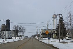

 Looking east at downtown LeRoy
 Looking north at LeRoy's welcome sign
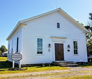
 St. Andrew's Church, listed on the National Register of Historic Places


