Rubicon, Wisconsin

Last updated

Rubicon, Wisconsin
Rubicon (1).jpg
Rubicon Town Hall
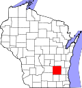
WIMap-doton-Rubicon.png
Location of Rubicon, Wisconsin
Coordinates: 43°19′58″N88°28′8″W / 43.33278°N 88.46889°W / 43.33278; -88.46889
Country Flag of the United States.svg  United States
State Flag of Wisconsin.svg  Wisconsin
County Dodge
Area
  Total34.9 sq mi (90.5 km2)
  Land34.5 sq mi (89.4 km2)
  Water0.4 sq mi (1.1 km2)
Elevation
[1]
1,102 ft (336 m)
Population
 (2000)
  Total2,005
  Density58.1/sq mi (22.4/km2)
Time zone UTC-6 (Central (CST))
  Summer (DST) UTC-5 (CDT)
FIPS code 55-69962 [2]
GNIS feature ID1584072 [1]
Website https://rubiconwi.gov/

Rubicon is a town in Dodge County, Wisconsin, United States. The population was 2,005 at the 2000 census. The unincorporated communities of Rubicon and Saylesville are located in the town. The unincorporated community of Woodland is also located partially in the town.

Contents

Geography

According to the United States Census Bureau, the town has a total area of 34.9 square miles (90.5 km2), of which, 34.5 square miles (89.4 km2) of it is land and 0.4 square miles (1.1 km2) of it (1.17%) is water.

Demographics

As of the census [2] of 2000, there were 2,005 people, 662 households, and 544 families living in the town. The population density was 58.1 people per square mile (22.4/km2). There were 680 housing units at an average density of 19.7 per square mile (7.6/km2). The racial makeup of the town was 98.70% White, 0.15% African American, 0.05% Native American, 0.10% Asian, 0.15% from other races, and 0.85% from two or more races. Hispanic or Latino of any race were 0.70% of the population.

There were 662 households, out of which 41.4% had children under the age of 18 living with them, 73.9% were married couples living together, 4.7% had a female householder with no husband present, and 17.8% were non-families. 13.3% of all households were made up of individuals, and 5.1% had someone living alone who was 65 years of age or older. The average household size was 3.03 and the average family size was 3.35.

In the town, the population was spread out, with 30.4% under the age of 18, 7.5% from 18 to 24, 29.0% from 25 to 44, 24.4% from 45 to 64, and 8.6% who were 65 years of age or older. The median age was 36 years. For every 100 females, there were 107.1 males. For every 100 females age 18 and over, there were 111.0 males.

The median income for a household in the town was $54,583, and the median income for a family was $59,231. Males had a median income of $37,234 versus $23,359 for females. The per capita income for the town was $20,964. About 2.2% of families and 3.9% of the population were below the poverty line, including 4.8% of those under age 18 and 5.6% of those age 65 or over.

Notable people

Related Research Articles

<span class="mw-page-title-main">Romoland, California</span> Census-designated place in California, United States

Romoland is a census-designated place (CDP) in Riverside County, California, United States. The population was 2,005 at the 2020 census, up from 1,684 at the 2010 census.

<span class="mw-page-title-main">Rubicon Township, Michigan</span> Civil township in Michigan, United States

Rubicon Township is a civil township of Huron County in the U.S. state of Michigan. The population was 732 at the 2010 census.

<span class="mw-page-title-main">Shelby, New York</span> Town in New York, United States

Shelby is a town in Orleans County, New York, United States. The population was 5,319 at the 2010 census.

<span class="mw-page-title-main">Upper Frankford Township, Pennsylvania</span> Township in Pennsylvania, United States

Upper Frankford Township is a township in Cumberland County, Pennsylvania, United States. The population was 2,005 at the 2010 census.

<span class="mw-page-title-main">Conewago Township, York County, Pennsylvania</span> Township in Pennsylvania, United States

Conewago Township is a township in York County, Pennsylvania, United States. The township encompasses the land between the Conewago Creek and the Little Conewago Creek, west of their conjunction. The township was formed in 1818 from the northeastern portion of Dover Township and the southeastern portion of Newberry Township and consists of approximately 11,000 acres. The population was 8,527 at the 2020 census.

<span class="mw-page-title-main">Pine Valley, Wisconsin</span> Town in Wisconsin, United States

Pine Valley is a town in Clark County in the U.S. state of Wisconsin. The population was 1,121 at the 2000 census. The unincorporated community of Sidney is located in the town.

<span class="mw-page-title-main">Marietta, Wisconsin</span> Town in Wisconsin, United States

Marietta is a town in Crawford County, Wisconsin, United States. The population was 510 at the 2000 census. The unincorporated community of Easter Rock is located in the town. The unincorporated community of Boydtown is located partially in the town.

<span class="mw-page-title-main">Calamus, Wisconsin</span> Town in Wisconsin, United States

Calamus is a town in Dodge County, Wisconsin, United States. The population was 1,005 at the 2000 census. The unincorporated community of South Beaver Dam is located in the town. The unincorporated community of Lost Lake is also located partially in the town.

<span class="mw-page-title-main">Westford, Dodge County, Wisconsin</span> Town in Wisconsin, United States

Westford is a town in Dodge County, Wisconsin, United States. The population was 1,400 at the 2000 census. The unincorporated community of South Randolph is located in the town. The unincorporated community of Lost Lake is also located partially in the town.

Friendship is a town in Fond du Lac County, Wisconsin, United States. The population was 2,406 at the 2000 census. The unincorporated communities of Dexter and Van Dyne are located within the town.

<span class="mw-page-title-main">Manchester, Jackson County, Wisconsin</span> Town in Wisconsin, United States

Manchester is a town in Jackson County, Wisconsin, United States. The population was 680 at the 2000 census. The unincorporated communities of Fall Hall Glen and Shamrock are located in the town.

<span class="mw-page-title-main">Morgan, Wisconsin</span> Town in Wisconsin, United States

Morgan is a town in Oconto County, Wisconsin, United States. The population was 882 at the 2000 census.

<span class="mw-page-title-main">Jefferson, Vernon County, Wisconsin</span> Town in Wisconsin, United States

Jefferson is a town in Vernon County, Wisconsin, United States. The population was 974 at the 2000 census. The unincorporated communities of Bud, Esofea, and Springville are located with the town.

<span class="mw-page-title-main">Mukwonago (town), Wisconsin</span> Town in Wisconsin, United States

Mukwonago is a town in Waukesha County, Wisconsin, United States. The population was 7,781 at the 2020 census. The Village of Mukwonago is located mostly within the town. The unincorporated community of Jericho is also located in the town.

<span class="mw-page-title-main">St. Albans, Maine</span> Town in the state of Maine, United States

St. Albans is a town in Somerset County, Maine, United States. The population was 2,045 at the 2020 census.

<span class="mw-page-title-main">Randolph (town), Wisconsin</span> Town in Wisconsin, United States

Randolph is a town in Columbia County, Wisconsin, United States. The population was 699 at the 2000 census. The Village of Randolph lies to the southeast of the town and only a tiny portion of the village is within the town. The unincorporated community of East Friesland is located in the town. The unincorporated community of Ingle is also located partially in the town.

<span class="mw-page-title-main">Theresa (town), Wisconsin</span> Town in Wisconsin, United States

Theresa is a town in Dodge County, Wisconsin, United States. As of the census in 2000, the town population was 1,080. The Village of Theresa is located within the town. The unincorporated community of Theresa Station is located in the town. The unincorporated community of Hochheim is also located partially in the town.

Balsam Lake is a town in Polk County, Wisconsin, United States. The population was 1,384 at the 2000 census. The Village of Balsam Lake is located within the town. The unincorporated community of Lykens is also located in the town.

Luck is a town in Polk County, Wisconsin, United States. The population was 881 at the 2000 census. The village of Luck is located within the town. The unincorporated community of West Denmark is located in the town. The unincorporated community of Pole Cat Crossing is also located partially in the town.

Darien is a town in Walworth County, Wisconsin, United States. The population was 1,651 at the 2020 census. The Village of Darien is located within the town. The unincorporated community of Bardwell is located in the town. The unincorporated communities of Allen's Grove and Fairfield are also located partially in the town.

References

  1. 1 2 "US Board on Geographic Names". United States Geological Survey. October 25, 2007. Retrieved January 31, 2008.
  2. 1 2 "U.S. Census website". United States Census Bureau . Retrieved January 31, 2008.