Williamstown, Wisconsin

Last updated

Williamstown, Wisconsin
WIMap-doton-Williamstown.png
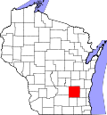
Location of Williamstown, Wisconsin
Coordinates: 43°30′2″N88°34′10″W / 43.50056°N 88.56944°W / 43.50056; -88.56944
Country Flag of the United States.svg  United States
State Flag of Wisconsin.svg  Wisconsin
County Dodge
Area
  Total33.6 sq mi (86.9 km2)
  Land32.9 sq mi (85.2 km2)
  Water0.7 sq mi (1.7 km2)
Elevation
[1]
873 ft (266 m)
Population
 (2000)
  Total646
  Density19.6/sq mi (7.6/km2)
Time zone UTC-6 (Central (CST))
  Summer (DST) UTC-5 (CDT)
FIPS code 55-87225 [2]
GNIS feature ID1584440 [1]
Website http://williamstown-wi.com/

Williamstown is a town in Dodge County, Wisconsin, United States. The population was 646 at the 2000 census.

Contents

Geography

According to the United States Census Bureau, the town has a total area of 33.6 square miles (86.9 km2), of which, 32.9 square miles (85.2 km2) of it is land and 0.7 square miles (1.8 km2) of it (2.03%) is water.

Demographics

At the 2000 census there were 646 people, 235 households, and 195 families living in the town. The population density was 19.6 people per square mile (7.6/km2). There were 242 housing units at an average density of 7.4 per square mile (2.8/km2). The racial makeup of the town was 98.61% White, 0.15% African American, 0.15% Native American, 0.31% Asian, 0.15% from other races, and 0.62% from two or more races. Hispanic or Latino of any race were 1.08%. [2]

Of the 235 households 32.3% had children under the age of 18 living with them, 74.5% were married couples living together, 3.8% had a female householder with no husband present, and 17.0% were non-families. 13.6% of households were one person and 4.7% were one person aged 65 or older. The average household size was 2.75 and the average family size was 3.03.

The age distribution was 23.5% under the age of 18, 7.6% from 18 to 24, 28.6% from 25 to 44, 28.6% from 45 to 64, and 11.6% 65 or older. The median age was 40 years. For every 100 females, there were 107.1 males. For every 100 females age 18 and over, there were 112.9 males.

The median household income was $62,969 and the median family income was $69,688. Males had a median income of $41,313 versus $26,875 for females. The per capita income for the town was $25,167. About 2.1% of families and 1.9% of the population were below the poverty line, including none of those under age 18 and 2.6% of those age 65 or over.

Related Research Articles

<span class="mw-page-title-main">Utica, Indiana</span> Town in Indiana, United States

Utica is a town in Utica Township, Clark County, Indiana, United States. The population was 776 at the 2010 census.

<span class="mw-page-title-main">Albany, Indiana</span> Town in Indiana, United States

Albany is a town in Delaware and Randolph counties in the U.S. state of Indiana, along the Mississinewa River. The population was 2,295 at the 2020 census. It is part of the Muncie, IN Metropolitan Statistical Area.

<span class="mw-page-title-main">Oldenburg, Indiana</span> Town in Indiana, United States

Oldenburg is a town in Ray Township, Franklin County, Indiana, United States. The population was 674 at the 2010 census.

<span class="mw-page-title-main">Greensboro, Indiana</span> Town in Indiana, United States

Greensboro is a town in Greensboro Township, Henry County, Indiana, United States. The population was 143 at the 2010 census. The town was a 'station' on the Underground Railroad and was recognized for its active abolitionists.

<span class="mw-page-title-main">Pottawattamie Park, Indiana</span> Town in Indiana, United States

Pottawattamie Park is a town in Michigan Township, LaPorte County, Indiana, United States. The population was 235 at the 2010 census. It is included in the Michigan City, Indiana-La Porte, Indiana Metropolitan Statistical Area.

<span class="mw-page-title-main">Milton, Indiana</span> Town in Indiana, United States

Milton is a town in Washington Township, Wayne County, in the U.S. state of Indiana. The population was 490 at the 2010 census.

<span class="mw-page-title-main">St. Agatha, Maine</span> Town in the state of Maine, United States

St. Agatha is a town in Aroostook County, Maine, United States. The population was 730 at the 2020 census.

<span class="mw-page-title-main">Appleton, Maine</span> Town in the state of Maine, United States

Appleton is a town in Knox County, Maine, United States. It is about 15 miles inland from Penobscot Bay and coastal towns such as Camden and Rockland, about 30 miles east of the state capital of Augusta. The population was 1,411 at the 2020 census.

<span class="mw-page-title-main">Big Lake, Missouri</span> Village in Missouri, United States

Big Lake is a village in Holt County, Missouri, United States. The population was 65 at the 2020 census.

<span class="mw-page-title-main">Stratford, New Hampshire</span> Town in New Hampshire, United States

Stratford is a town located on the Connecticut River in Coös County, New Hampshire, United States. The population was 662 at the 2020 census, a decline from the figure of 746 tabulated in 2010. Within the town are the villages of North Stratford, Stratford Hollow, and Beatties. U.S. Route 3 passes through the center of town, as does the St. Lawrence and Atlantic Railroad, formerly a part of the Grand Trunk Railway.

<span class="mw-page-title-main">Martinsburg, Ohio</span> Village in Ohio, United States

Martinsburg is a village in Knox County, Ohio, United States. The population was 222 at the 2020 census.

<span class="mw-page-title-main">Shawnee, Perry County, Ohio</span> Village in Ohio, United States

Shawnee is a village in Perry County, Ohio, United States. The population was 505 at the 2020 census. It is 9 miles (14 km) south of the county seat of New Lexington.

<span class="mw-page-title-main">Mound City, South Dakota</span> Town in South Dakota, United States

Mound City is a town in and the county seat of Campbell County, South Dakota, United States. The population was 69 at the 2020 census.

<span class="mw-page-title-main">Sterling, Utah</span> Town in Utah, United States

Sterling is a town in Sanpete County, Utah, United States. The population was 235 at the 2000 census.

<span class="mw-page-title-main">Durbin, West Virginia</span> Town in West Virginia, United States

Durbin is a town in Pocahontas County, West Virginia, United States. The population was 235 at the 2020 census.

<span class="mw-page-title-main">Womelsdorf (Coalton), West Virginia</span> Town in West Virginia, United States

Womelsdorf (Coalton) is a town in Randolph County, West Virginia, United States. The population was 190 at the 2020 census.

<span class="mw-page-title-main">Howard, Chippewa County, Wisconsin</span> Town in Wisconsin, United States

The Town of Howard is located in southwestern Chippewa County in the U.S. state of Wisconsin. The population was 798 at the 2010 census, up from 648 at the 2000 census. The unincorporated communities of Albertville and Howard are located in the town.

<span class="mw-page-title-main">Knight, Wisconsin</span> Town in Wisconsin, United States

Knight is a town in Iron County, Wisconsin, United States. The population was 284 at the 2000 census. The unincorporated communities of Hoyt and Iron Belt are located in the town.

<span class="mw-page-title-main">Lincoln, Monroe County, Wisconsin</span> Town in Wisconsin, United States

Lincoln is a town in Monroe County, Wisconsin, United States. The population was 827 at the 2000 census. The unincorporated community of Kirby is located in the town.

<span class="mw-page-title-main">Fairbanks, Wisconsin</span> Town in Wisconsin, United States

Fairbanks is a town in Shawano County, Wisconsin, United States. The population was 687 at the 2000 census. The unincorporated community of Split Rock is located in the town.

References

  1. 1 2 "US Board on Geographic Names". United States Geological Survey. October 25, 2007. Retrieved January 31, 2008.
  2. 1 2 "U.S. Census website". United States Census Bureau . Retrieved January 31, 2008.