Oak Grove, Dodge County, Wisconsin

Last updated
Oak Grove, Wisconsin
WIMap-doton-Oak Grove b.png
Location of Oak Grove, Wisconsin
Coordinates: 43°26′7″N88°41′59″W / 43.43528°N 88.69972°W / 43.43528; -88.69972
Country Flag of the United States.svg  United States
State Flag of Wisconsin.svg  Wisconsin
County Dodge
Area
  Total34.2 sq mi (88.6 km2)
  Land34.1 sq mi (88.3 km2)
  Water0.1 sq mi (0.3 km2)
Elevation
[1]
935 ft (285 m)
Population
 (2000)
  Total1,126
  Density33.0/sq mi (12.8/km2)
Time zone UTC-6 (Central (CST))
  Summer (DST) UTC-5 (CDT)
Area code 920
FIPS code 55-59000 [2]
GNIS feature ID1583841 [1]

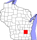
Oak Grove (originally called Fairfield) is a town in Dodge County, Wisconsin, United States. The population was 1,126 at the 2000 census. The unincorporated community of Minnesota Junction is located in the town. The unincorporated community of Rolling Prairie is also located partially in the town.

Contents

Geography

According to the United States Census Bureau, the town has a total area of 34.2 square miles (88.6 km2), of which, 34.1 square miles (88.3 km2) of it is land and 0.1 square miles (0.3 km2) of it (0.32%) is water.

Demographics

As of the census [2] of 2000, there were 1,126 people, 428 households, and 335 families living in the town. The population density was 33.0 people per square mile (12.8/km2). There were 448 housing units at an average density of 13.1 per square mile (5.1/km2). The racial makeup of the town was 98.13% White, 0.36% African American, 0.44% Asian, 0.53% from other races, and 0.53% from two or more races. Hispanic or Latino of any race were 1.60% of the population.

There were 428 households, out of which 31.5% had children under the age of 18 living with them, 69.6% were married couples living together, 4.2% had a female householder with no husband present, and 21.7% were non-families. 18.0% of all households were made up of individuals, and 7.2% had someone living alone who was 65 years of age or older. The average household size was 2.63 and the average family size was 2.98.

In the town, the population was spread out, with 24.8% under the age of 18, 6.8% from 18 to 24, 29.3% from 25 to 44, 26.3% from 45 to 64, and 12.8% who were 65 years of age or older. The median age was 39 years. For every 100 females, there were 107.7 males. For every 100 females age 18 and over, there were 110.2 males.

The median income for a household in the town was $53,068, and the median income for a family was $58,333. Males had a median income of $36,793 versus $23,654 for females. The per capita income for the town was $20,277. About 5.4% of families and 7.4% of the population were below the poverty line, including 11.3% of those under age 18 and 13.5% of those age 65 or over.

Coordinates: 43°23′10″N88°44′44″W / 43.38611°N 88.74556°W / 43.38611; -88.74556

Related Research Articles

<span class="mw-page-title-main">Interlaken, California</span> Census-designated place in California, United States

Interlaken is a census-designated place (CDP) in Santa Cruz County, California, United States. The population was 7,368 at the 2020 census.

<span class="mw-page-title-main">Ludlow, Illinois</span> Village in Illinois, United States

Ludlow is a village in Champaign County, Illinois, United States. The population was 308 at the 2020 census.

<span class="mw-page-title-main">Stockholm, Maine</span> Town in the state of Maine, United States

Stockholm is a town in Aroostook County, Maine, United States. The population was 250 at the 2020 census.

Wesley is a town in Washington County, Maine, United States. The town was named after John Wesley, founder of the English Methodist movement. The population was 122 at the 2020 census.

<span class="mw-page-title-main">Lynd, Minnesota</span> City in Minnesota, United States

Lynd is a city in Lyon County, Minnesota, United States. The population was 448 at the 2010 census. Lynd is a small but growing community in southwestern Minnesota. The development of a new golf course and an additional housing development have started a growth trend that may eventually double the size of the community. It is primarily a bedroom community for individuals who work in the nearby city of Marshall. Despite being much smaller in size, it historically played a more significant role in the area. The Kiel and Morgan Hotel in the town was the original Lyon County seat.

<span class="mw-page-title-main">Parkers Prairie, Minnesota</span> City in Minnesota, United States

Parkers Prairie is a city in Otter Tail County, Minnesota, United States. The population was 1,020 at the 2020 census.

<span class="mw-page-title-main">Hubbard, Nebraska</span> Village in Nebraska, United States

Hubbard is a village in Dakota County, Nebraska, United States. It is part of the Sioux City, IA–NE–SD Metropolitan Statistical Area. The population was 236 at the 2010 census.

<span class="mw-page-title-main">Reeds Spring, Missouri</span> City in Missouri, United States

Reeds Spring is a city in Stone County, Missouri, United States. The population was 1,136 at the 2020 census. It is part of the Branson, Missouri Micropolitan Statistical Area.

<span class="mw-page-title-main">Attica, Ohio</span> Village in Ohio, United States

Attica is a village in Seneca County, Ohio, United States. The population was 899 at the 2010 census.

<span class="mw-page-title-main">Troy Township, Bradford County, Pennsylvania</span> Township in Pennsylvania, United States

Troy Township is a township in Bradford County, Pennsylvania. It is part of Northeastern Pennsylvania. The population was 1,645 at the 2010 census. Children residing in the township are assigned to attend the Troy Area School District.

<span class="mw-page-title-main">Ruby, South Carolina</span> Town in South Carolina, United States

Ruby is a town in Chesterfield County, South Carolina, United States. The population was 360 at the 2010 census.

<span class="mw-page-title-main">Mabscott, West Virginia</span> Town in West Virginia, United States

Mabscott is a town in Raleigh County, West Virginia, United States. The population was 1,333 at the 2020 census. The town's name is a contraction of the name Mabel Scott, wife of local coal operator Cyrus H. Scott.

<span class="mw-page-title-main">Curran, Wisconsin</span> Town in Wisconsin, United States

Curran is a town in Jackson County, Wisconsin, United States. The population was 343 at the 2010 census.

<span class="mw-page-title-main">Beaver, Marinette County, Wisconsin</span> Town in Wisconsin, United States

Beaver is a town in Marinette County, Wisconsin, United States. The population was 1,123 at the 2000 census. The unincorporated community of Beaver is located in the town.

Whitewater is a town in Walworth County, Wisconsin, United States. The population was 1,433 at the 2020 census.

<span class="mw-page-title-main">Lebanon, Waupaca County, Wisconsin</span> Town in Wisconsin, United States

Lebanon is a town in Waupaca County, Wisconsin, United States. The population was 1,648 at the 2000 census. The unincorporated community of Carmel is located in the town. The ghost town of Nowell was also located in the town.

Lomira is a town in Dodge County, Wisconsin, United States. The population was 1,228 at the 2000 census. The Village of Lomira is located within the town. The unincorporated communities of Knowles and Nasbro are located in the town.

The Town of Elderon is located in Marathon County, Wisconsin, United States. It is part of the Wausau, Wisconsin Metropolitan Statistical Area. The population was 606 at the 2010 census. The unincorporated community of Ingersoll is located in the town.

<span class="mw-page-title-main">Tomah (town), Wisconsin</span> Town in Wisconsin, United States

The Town of Tomah is located in Monroe County, Wisconsin, United States. The population was 1,194 at the 2000 census. It lies adjacent to the city of Tomah.

The Town of Prairie du Sac is located in Sauk County, Wisconsin, United States. The population was 1,138 at the 2000 census. The Village of Prairie du Sac is located within the town. The unincorporated community of Loddes Mill is also located in the town.

References

  1. 1 2 "US Board on Geographic Names". United States Geological Survey. 2007-10-25. Retrieved 2008-01-31.
  2. 1 2 "U.S. Census website". United States Census Bureau . Retrieved 2008-01-31.