Florence County, Wisconsin | |
|---|---|
 | |
 Location within the U.S. state of Wisconsin | |
| Coordinates: 45°51′N88°24′W / 45.85°N 88.4°W | |
| Country | |
| State | |
| Founded | 1882 |
| Named after | Florence Terry Hulst |
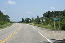
| Seat | Florence |
| Largest town | Florence |
| Area | |
• Total | 498 sq mi (1,290 km2) |
| • Land | 488 sq mi (1,260 km2) |
| • Water | 9.3 sq mi (24 km2) 1.9% |
| Population | |
• Total | 4,558 |
• Estimate (2024) | 4,673 |
| • Density | 9.3/sq mi (3.6/km2) |
| Time zone | UTC−6 (Central) |
| • Summer (DST) | UTC−5 (CDT) |
| Congressional district | 7th |
| Website | www |
Florence County is a county located in the U.S. state of Wisconsin. As of the 2020 census, the population was 4,558, [2] making it the second-least populous county in Wisconsin after Menominee County. Its county seat is Florence. [3] The county is considered a high-recreation retirement destination by the U.S. Department of Agriculture. [4]
Contents
- History
- Geography
- Adjacent counties
- Major highways
- Buses
- National protected area
- Demographics
- 2020 census
- 2000 census
- Communities
- Towns
- Census-designated places
- Unincorporated communities
- Politics
- See also
- References
- External links
Florence County is part of the Iron Mountain, MI–WI Micropolitan Statistical Area.