Long Lake, Florence County, Wisconsin

Last updated

Long Lake, Wisconsin
Long Lake Wisconsin Town Hall.jpg
Town hall
USA Wisconsin location map.svg
Red pog.svg
Long Lake, Wisconsin
Coordinates: 45°51′15″N88°37′22″W / 45.85417°N 88.62278°W / 45.85417; -88.62278
Country Flag of the United States.svg  United States
State Flag of Wisconsin.svg  Wisconsin
County Florence
Area
  Total35.8 sq mi (92.8 km2)
  Land34.0 sq mi (88.0 km2)
  Water1.9 sq mi (4.8 km2)
Elevation
[1]
1,503 ft (458 m)
Population
 (2000)
  Total197
  Density5.8/sq mi (2.2/km2)
Time zone UTC-6 (Central (CST))
  Summer (DST) UTC-5 (CDT)
Area code(s) 715 & 534
FIPS code 55-45625 [2]
GNIS feature ID1583596 [1]

Long Lake is a town in Florence County, Wisconsin, United States. The population was 197 at the 2000 census. The census-designated place of Long Lake is located in the town.

Contents

Geography

According to the United States Census Bureau, the town has a total area of 35.8 square miles (92.8 km2), of which, 34.0 square miles (88.0 km2) of it is land and 1.9 square miles (4.8 km2) of it (5.16%) is water.

Demographics

As of the census [2] of 2000, there were 197 people, 91 households, and 62 families residing in the town. The population density was 5.8 inhabitants per square mile (2.2/km2). There were 296 housing units at an average density of 8.7 per square mile (3.4/km2). The racial makeup of the town was 96.45% White, 0.51% Native American, 0.51% Asian, and 2.54% from two or more races.

There were 91 households, out of which 16.5% had children under the age of 18 living with them, 65.9% were married couples living together, 1.1% had a female householder with no husband present, and 30.8% were non-families. 27.5% of all households were made up of individuals, and 14.3% had someone living alone who was 65 years of age or older. The average household size was 2.16 and the average family size was 2.59.

The population age distribution was: 15.2% under the age of 18, 6.6% from 18 to 24, 19.3% from 25 to 44, 35.0% from 45 to 64, and 23.9% who were 65 years of age or older. The median age was 51 years. For every 100 females, there were 121.3 males. For every 100 females age 18 and over, there were 111.4 males.

The median income for a household in the town was $27,500, and the median income for a family was $28,958. Males had a median income of $22,083 versus $17,250 for females. The per capita income for the town was $15,818. About 10.9% of families and 18.5% of the population were below the poverty line, including 34.5% of those under the age of eighteen and none of those 65 or over.
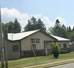
Long Lake has one Catholic Church, St. Norbert Parish, located at 3402 State Highway 139. St. Norbert Parish is a mission church served from St. Leonard Parish in Laona, WI. St. Norbert Parish first served as a mission church from Laona in 1927, became a mission church of the Florence, WI parish for a time starting in 1954, then returned to the Laona parish.

Related Research Articles

<span class="mw-page-title-main">Glenwood, Alabama</span> Town in Alabama, United States

Glenwood is a town in Crenshaw County, Alabama, United States. At the 2020 census, the population was 152. Glenwood was incorporated in 1907.

<span class="mw-page-title-main">Harristown, Illinois</span> Village in Illinois, United States

Harristown is a village in Macon County, Illinois, United States. The population was 1,310 at the 2020 census. It is included in the Decatur, Illinois Metropolitan Statistical Area.

<span class="mw-page-title-main">Fairbanks Township, Michigan</span> Civil township in Michigan, United States

Fairbanks Township is a civil township of Delta County in the U.S. state of Michigan. As of the 2020 census, the township population was 297, up from 281 at the 2010 census.

<span class="mw-page-title-main">Mayfield Township, Grand Traverse County, Michigan</span> Civil township in Michigan, United States

Mayfield Township is a civil township of Grand Traverse County in the U.S. state of Michigan. The population was 1,786 at the 2020 census, an increase from 1,550 at the 2010 census.

<span class="mw-page-title-main">Osgood, Ohio</span> Village in Ohio, United States

Osgood is a village in Darke County, Ohio, United States. The population was 306 at the 2020 census.

<span class="mw-page-title-main">Hendren, Wisconsin</span> Town in Wisconsin, United States

Hendren is a town in Clark County in the U.S. state of Wisconsin. The population was 499 at the 2010 census. The unincorporated communities of Tioga and Willard are located in the town.

<span class="mw-page-title-main">Eldorado, Wisconsin</span> Town in Wisconsin, United States

Eldorado is a town in Fond du Lac County, Wisconsin, United States. The population was 1,447 at the 2000 census. The unincorporated community of Eldorado is located in the town.

<span class="mw-page-title-main">Mount Calvary, Wisconsin</span> Village in Wisconsin, United States

Mount Calvary is a village in Fond du Lac County, Wisconsin, United States. The population was 548 at the 2020 census, down from 762 at the 2010 census.

<span class="mw-page-title-main">St. Cloud, Wisconsin</span> Village in Wisconsin, United States

St. Cloud is a village in Fond du Lac County, Wisconsin, United States, along the Sheboygan River. The population was 477 at the 2010 census. St. Cloud is part of The Holyland region in northeastern Fond du Lac County.

<span class="mw-page-title-main">Blackwell, Wisconsin</span> Town in Wisconsin, United States

Blackwell is a town in Forest County, Wisconsin. The population was 332 at the time of the 2010 census. The unincorporated community of Blackwell is located in the town. The unincorporated community of Blackwell Junction is also located partially in the town. The town was named for sawmill owner John Blackwell.

<span class="mw-page-title-main">Laona, Wisconsin</span> Town in Wisconsin, United States

Laona is a town in Forest County, Wisconsin, United States. The population was 1,212 at the 2010 census. The census-designated place of Laona is located in the town. The unincorporated community of Blackwell Junction is also located partially in the town.

<span class="mw-page-title-main">Wabeno, Wisconsin</span> Town in Wisconsin, United States

Wabeno is a town in Forest County, Wisconsin, United States. The population was 1,166 at the 2010 census. The census-designated place of Wabeno and the unincorporated communities of Carter, Padus, and Soperton are located in the town. Wabeno is situated within Wisconsin's 7th congressional district.

<span class="mw-page-title-main">Rewey, Wisconsin</span> Village in Wisconsin, United States

Rewey is a village in Iowa County, Wisconsin, United States. The population was 292 at the 2010 census. It is part of the Madison Metropolitan Statistical Area.

<span class="mw-page-title-main">West Salem, Wisconsin</span> Village in Wisconsin, United States

West Salem is a village in La Crosse County, Wisconsin, United States, along the La Crosse River. It is part of the La Crosse-Onalaska, WI-MN Metropolitan Statistical Area. The population was 5,277 as of the 2020 census.

<span class="mw-page-title-main">Stanton, St. Croix County, Wisconsin</span> Town in Wisconsin, United States

Stanton is a town in St. Croix County, Wisconsin, United States. The population was 1,003 at the 2000 census. The unincorporated community of Stanton is located in the town. The Stanton Town Hall is located at 2245 County Road T Deer Park.

<span class="mw-page-title-main">Lyons, Wisconsin</span> Town in Wisconsin, United States

Lyons is a town in Walworth County, Wisconsin, United States. The population was 3,648 at the 2020 census. The unincorporated communities of Lyons and Springfield are located within the town.

<span class="mw-page-title-main">St. Marys, Kansas</span> City in Pottawatomie and Wabaunsee Counties of Kansas

St. Marys or Saint Marys is a city in Pottawatomie and Wabaunsee counties in the U.S. state of Kansas in the United States. As of the 2020 census, the population of the city was 2,759. It is home of Saint Mary's Academy and College.

The Town of Potosi is located in Grant County, Wisconsin, United States. The population was 831 at the 2000 census. The Village of Potosi and the unincorporated communities of British Hollow, Buena Vista, Rockville, and Van Buren are located in the town.

<span class="mw-page-title-main">Gillett, Wisconsin</span> City in Wisconsin, United States

Gillett is a city in Oconto County, Wisconsin, United States. The population was 1,386 at the 2010 census. It is part of the Green Bay Metropolitan Statistical Area. The city is adjacent to the Town of Gillett.

<span class="mw-page-title-main">Pepperell (CDP), Massachusetts</span> Census-designated place in Massachusetts, United States

Pepperell is a census-designated place (CDP) comprising the main village in the town of Pepperell in Middlesex County, Massachusetts, United States. The population was 2,390 at the 2020 census, out of 11,604 in the entire town of Pepperell.

References

  1. 1 2 "US Board on Geographic Names". United States Geological Survey. October 25, 2007. Retrieved January 31, 2008.
  2. 1 2 "U.S. Census website". United States Census Bureau . Retrieved January 31, 2008.

45°50′34″N88°40′04″W / 45.84278°N 88.66778°W / 45.84278; -88.66778