Iron County, Michigan

Last updated

Iron County
Courthouse Crystal Falls MI.jpg
Map of Michigan highlighting Iron County.svg
Location within the U.S. state of Michigan
Michigan in United States.svg
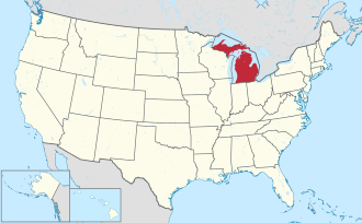
Michigan's location within the U.S.
Coordinates: 46°13′N88°31′W / 46.21°N 88.51°W / 46.21; -88.51
CountryFlag of the United States.svg United States
StateFlag of Michigan.svg  Michigan
FoundedApril 3, 1885 [1] [2]
Named for Iron ore
Seat Crystal Falls
Largest city Iron River
Area
  Total
1,211 sq mi (3,140 km2)
  Land1,166 sq mi (3,020 km2)
  Water45 sq mi (120 km2)  3.7%
Population
 (2020)
  Total
11,631
  Density10/sq mi (4/km2)
Time zone UTC−6 (Central)
  Summer (DST) UTC−5 (CDT)
Congressional district 1st
Website ironmi.com

Iron County is one of two landlocked counties in the Upper Peninsula of the U.S. state of Michigan. As of the 2020 census, the population was 11,631. [3] The county seat is Crystal Falls. [4]

Contents

History

Iron County was organized in 1885, with territory partitioned from Marquette and Menominee counties. In 1890, the county's population was 4,432. [1] [5] It was named for the valuable iron ore found within its borders. [1] [6]

Geography

According to the U.S. Census Bureau, the county has an area of 1,211 square miles (3,140 km2), of which 1,166 square miles (3,020 km2) is land and 45 square miles (120 km2) (3.7%) is water. [7] Along with its southeastern neighbor Dickinson County, it is one of only two landlocked counties in the Upper Peninsula.

Major highways

Entering Iron County on US 2 / US 141 IronCountyMichiganSignUS2US141.jpg
Entering Iron County on US 2 / US 141

Adjacent counties

National protected area

Communities

Cities

Village

Census-designated place

Unincorporated communities

Townships

Demographics

Historical population
CensusPop.Note
1890 4,432
1900 8,990102.8%
1910 15,16468.7%
1920 22,10745.8%
1930 20,805−5.9%
1940 20,243−2.7%
1950 17,692−12.6%
1960 17,184−2.9%
1970 13,813−19.6%
1980 13,635−1.3%
1990 13,175−3.4%
2000 13,138−0.3%
2010 11,817−10.1%
2020 11,631−1.6%
2023 (est.)11,740 [9] 0.9%
US Decennial Census [10]
1790-1960 [11] 1900-1990 [12]
1990-2000 [13] 2010-2018 [3]

In 2020, its population was 11,631. [3] The 2010 United States census indicates Iron County had a population of 11,817. [14] This decrease of 1,321 people from the 2000 United States census represents a 10.1% population decrease. In 2010 there were 5,577 households and 3,284 families in the county. The population density was 10 people per square mile (3.9 people/km2). There were 9,197 housing units at an average density of 8 per square mile (3.1/km2). 97.1% of the population were White, 2.9% Native American, 0.3% Asian, 0.1% Black or African American, 0.2% of some other race and 1.4% of two or more races; 1.4% were Hispanic or Latino (of any race). Culturally, 14.3% were of German, 11.5% Finnish, 11.3% Italian, 8.6% French, French Canadian or Cajun, 8.0% Swedish, 6.5% English, 5.8% American and 5.4% Irish ancestry. [15]

In 2010, there were 5,577 households, out of which 18.1% had children under the age of 18 living with them, 46.6% were married couples living together, 8.3% had a female householder with no husband present, and 41.1% were non-families. 36.8% of all households were made up of individuals, and 19.1% had someone living alone who was 65 years of age or older. The average household size was 2.06 and the average family size was 2.65.

The county population contained 17.1% under the age of 18, 5.4% from 18 to 24, 17.2% from 25 to 44, 34.1% from 45 to 64, and 26.3% who were 65 years of age or older. The median age was 51.9 years. 49.3% of the population was male, 50.7% was female.

In 2010, the median income for a household in the county was $35,390, and the median income for a family was $46,337. The per capita income for the county was $20,099. About 6.5% of families and 11.7% of the population were below the poverty line, including 18.0% of those under age 18 and 8.8% of those age 65 or over.

Government

Iron County was reliably Republican during its first three decades. However, since 1936 its voters have selected the Democratic Party nominee in 16 (out of 23) of the national elections through 2024, though it has voted Republican in the four most recent elections and five of the last six.

United States presidential election results for Iron County, Michigan [16]
Year Republican Democratic Third party(ies)
No.%No.%No.%
2024 4,50164.00%2,44134.71%911.29%
2020 4,21662.05%2,49336.69%861.27%
2016 3,67561.66%2,00433.62%2814.71%
2012 3,22453.63%2,68744.69%1011.68%
2008 2,94747.83%3,08049.98%1352.19%
2004 3,22449.52%3,21549.38%721.11%
2000 2,96747.95%3,01448.71%2073.35%
1996 2,01433.24%3,23253.34%81313.42%
1992 1,97128.16%3,64852.11%1,38119.73%
1988 2,86642.94%3,77456.55%340.51%
1984 3,46849.15%3,55950.44%290.41%
1980 3,50745.36%3,74248.40%4836.25%
1976 3,22441.77%4,40157.02%931.20%
1972 3,63049.21%3,51247.61%2343.17%
1968 3,29242.36%4,13053.14%3504.50%
1964 2,39928.48%6,01171.36%130.15%
1960 3,91942.76%5,23257.09%140.15%
1956 4,95552.39%4,49047.47%130.14%
1952 4,56449.52%4,59749.88%550.60%
1948 3,65944.56%4,12550.23%4285.21%
1944 3,94546.16%4,53753.09%640.75%
1940 4,76649.33%4,80849.77%870.90%
1936 3,83441.99%5,21657.13%800.88%
1932 4,34753.56%3,41642.09%3534.35%
1928 4,10363.96%2,26235.26%500.78%
1924 2,80265.06%2475.73%1,25829.21%
1920 3,51582.80%49711.71%2335.49%
1916 2,13967.54%87727.69%1514.77%
1912 1,03145.24%2189.57%1,03045.20%
1908 2,05585.63%26010.83%853.54%
1904 1,62090.50%1397.77%311.73%
1900 1,56184.88%25713.97%211.14%
1896 1,04879.70%23617.95%312.36%
1892 91859.26%58737.90%442.84%
1888 59853.39%52046.43%20.18%

Iron County operates the County jail, maintains rural roads, operates the major local courts, records deeds, mortgages, and vital records, administers public health regulations, and participates with the state in the provision of social services. The county board of commissioners controls the budget and has limited authority to make laws or ordinances. In Michigan, most local government functions – police and fire, building and zoning, tax assessment, street maintenance etc. – are the responsibility of individual cities and townships.

Education

See also

Related Research Articles

<span class="mw-page-title-main">Ontonagon County, Michigan</span> County in Michigan, United States

Ontonagon County is a county in the Upper Peninsula of the U.S. state of Michigan. As of the 2020 census, the population was 5,816, making it Michigan's third-least populous county. The county seat is Ontonagon. The county was set off in 1843, and organized in 1848. Its territory had been organized as part of Chippewa and Mackinac counties. With increasing population in the area, more counties were organized. After Ontonagon was organized, it was split to create Gogebic County. It is also the westernmost county in United States that lies within the Eastern Time Zone.

<span class="mw-page-title-main">Houghton County, Michigan</span> County in Michigan, United States

Houghton County is a county in the Upper Peninsula in the U.S. state of Michigan. As of the 2020 census, the population was 37,361. The county seat and largest city is Houghton. Both the county and the city were named for Michigan State geologist and Detroit Mayor Douglass Houghton.

<span class="mw-page-title-main">Gogebic County, Michigan</span> County in Michigan, United States

Gogebic County is a county in the Upper Peninsula of the U.S. state of Michigan. As of the 2020 census, the population was 14,380. The county seat is Bessemer. Gogebic County is the westernmost county in Michigan, and is one of four Michigan counties within the Central Time Zone. Gogebic County borders Wisconsin to the south, and has a shoreline on Lake Superior to the north.

<span class="mw-page-title-main">Dickinson County, Michigan</span> County in Michigan, United States

Dickinson County is a county in the Upper Peninsula of the U.S. state of Michigan. As of the 2020 census, the population was 25,947. The county seat is Iron Mountain. Dickinson is Michigan's newest county, formed in 1891 from parts of Marquette, Menominee, and Iron counties. It was named for Donald M. Dickinson, who served as U.S. Postmaster General under President Grover Cleveland.

<span class="mw-page-title-main">Benzie County, Michigan</span> County in Michigan, United States

Benzie County is a county in the U.S. state of Michigan. As of the 2020 census, the population was 17,970. The county seat is Beulah. The county was initially set off in 1863 and organized in 1869. At 321 square miles (830 km2), Benzie County is the smallest of the 83 counties in Michigan in terms of land area.

<span class="mw-page-title-main">Baraga County, Michigan</span> County in Michigan, United States

Baraga County is a county in the Upper Peninsula in the U.S. state of Michigan. As of the 2020 census, the population was 8,158, making it Michigan's fifth-least populous county. The county seat is L'Anse. The county is named after Bishop Frederic Baraga, a Catholic missionary who ministered to the Ojibwa Indians in the Michigan Territory.

<span class="mw-page-title-main">Arvon Township, Michigan</span> Civil township in Michigan, United States

Arvon Township is a civil township of Baraga County in the U.S. state of Michigan. As of the 2020 census, the township population was 492. Despite its name, Mount Arvon, the highest point in Michigan, is located just south of the township, in neighboring L'Anse Township.

<span class="mw-page-title-main">Baraga, Michigan</span> Village in Michigan, United States

Baraga is a village in Baraga County in the U.S. state of Michigan. The population was 1,883 at the 2020 census. The village is named after Bishop Frederic Baraga.

<span class="mw-page-title-main">L'Anse, Michigan</span> Village in Michigan, United States

L'Anse is a village and the county seat of Baraga County, Michigan. The population was 1,874 at the 2020 census. The village is located within L'Anse Township in the Upper Peninsula, and partially inside the L'Anse Indian Reservation.

<span class="mw-page-title-main">Spurr Township, Michigan</span> Civil township in Michigan, United States

Spurr Township is a civil township of Baraga County in the U.S. state of Michigan. The population was 262 at the 2020 census.

<span class="mw-page-title-main">Iron Mountain, Michigan</span> City in Michigan, United States

Iron Mountain is a city in and the county seat of Dickinson County, Michigan. The population was 7,518 at the 2020 census, down from 7,624 at the 2010 census. Located in the state's Upper Peninsula, Iron Mountain was named for the valuable iron ore found in the vicinity.

<span class="mw-page-title-main">Norway, Michigan</span> City in Michigan, United States

Norway is a city in Dickinson County in the U.S. state of Michigan. The population was 2,840 at the 2020 census. It is part of the Iron Mountain, MI–WI micropolitan statistical area.

<span class="mw-page-title-main">Quinnesec, Michigan</span> Census-designated place & unincorporated community in Michigan, United States

Quinnesec is an unincorporated community in Dickinson County in the U.S. state of Michigan. It is a census-designated place (CDP) for statistical purposes and has no legally recognized status as a municipality. The population was 1,083 at the 2020 census. It is part of the Iron Mountain, MI–WI Micropolitan Statistical Area.

<span class="mw-page-title-main">Sagola Township, Michigan</span> Civil township in Michigan, United States

Sagola Township is a civil township of Dickinson County in the U.S. state of Michigan. The population was 1,066 at the 2020 census.

<span class="mw-page-title-main">Ironwood, Michigan</span> City in Michigan, United States

Ironwood is a city in Gogebic County in the Upper Peninsula of the U.S. state of Michigan, about 18 miles (29 km) south of Lake Superior. The city is on US Highway 2 across the Montreal River from Hurley, Wisconsin. It is the westernmost city in Michigan, situated on the same line of longitude as Clinton, Iowa and St. Louis, Missouri. The population was 5,045 at the 2020 census, down from 5,387 at the 2010 census. The city is bordered by Ironwood Township to the north, but the two are administered autonomously.

<span class="mw-page-title-main">Crystal Falls, Michigan</span> City in Michigan, United States

Crystal Falls is a city and the county seat of Iron County, Michigan. As of the 2020 census, the city population was 1,598. The city is located within Crystal Falls Township, but is a separate municipal entity. The area first developed as a major center for iron mining and the timber industry; it has become increasingly popular for tourism in recent years.

<span class="mw-page-title-main">Iron River, Michigan</span> City in Michigan, United States

Iron River is a city in Iron County in the U.S. state of Michigan. As of the 2020 census, the city population was 3,007. The city is situated at the southeast corner of Iron River Township, but is administratively autonomous.

<span class="mw-page-title-main">Eagle Harbor Township, Michigan</span> Civil township in Michigan, United States

Eagle Harbor Township is a civil township of Keweenaw County in the U.S. state of Michigan. The population was 217 at the 2020 census. The township is located on the Keweenaw Peninsula and also includes the southwestern portion of Isle Royale National Park.

<span class="mw-page-title-main">Republic Township, Michigan</span> Civil township in Michigan, United States

Republic Township is a civil township of Marquette County in the U.S. state of Michigan. The population was 994 at the 2020 census. The unincorporated community of Republic is located within the township.

<span class="mw-page-title-main">Ontonagon, Michigan</span> Village in Michigan, United States

Ontonagon is a village in the Upper Peninsula of the U.S. state of Michigan. The population was 1,285 at the 2020 census. It is the county seat of Ontonagon County, and is the only incorporated place within the county.

References

  1. 1 2 3 "Bibliography on Iron County". Clarke Historical Library, Central Michigan University . Retrieved June 29, 2013.
  2. "jengod.com". Archived from the original on June 20, 2006. Retrieved June 16, 2006.
  3. 1 2 3 "State & County QuickFacts". US Census Bureau. Retrieved September 15, 2021.
  4. "Find a County". National Association of Counties. Retrieved June 7, 2011.
  5. Michigan Department of State (1893). Michigan and Its Resources, pp. 241-42. Robert Smith & Co.
  6. Gannett, Henry (1905). The Origin of Certain Place Names in the United States. Govt. Print. Off. p. 166.
  7. "2010 Census Gazetteer Files". US Census Bureau. August 22, 2012. Retrieved September 25, 2014.
  8. 1 2 3 4 Iron County MI Google Maps (accessed 18 September 2018)
  9. "Annual Estimates of the Resident Population for Counties: April 1, 2020 to July 1, 2023". United States Census Bureau. Retrieved April 4, 2024.
  10. "US Decennial Census". US Census Bureau. Retrieved September 25, 2014.
  11. "Historical Census Browser". University of Virginia Library. Retrieved September 25, 2014.
  12. "Population of Counties by Decennial Census: 1900 to 1990". US Census Bureau. Retrieved September 25, 2014.
  13. "Census 2000 PHC-T-4. Ranking Tables for Counties: 1990 and 2000" (PDF). US Census Bureau. Archived (PDF) from the original on March 27, 2010. Retrieved September 25, 2014.
  14. "U.S. Census website" . Retrieved July 6, 2013.
  15. Data Access and Dissemination Systems (DADS). "U.S. Census website". census.gov.
  16. Leip, David. "US Election Atlas". uselectionatlas.org. Retrieved April 9, 2018.

46°13′N88°31′W / 46.21°N 88.51°W / 46.21; -88.51