East Lansing, Michigan

Last updated

East Lansing
City of East Lansing
Downtown East Lansing (2022).jpg
Downtown East Lansing c.2022
East Lansing, MI location.png
Location within Clinton County (top) and Ingham County (bottom)
USA Michigan location map.svg
Red pog.svg
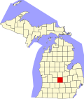
East Lansing
Location within the state of Michigan
Usa edcp location map.svg
Red pog.svg
East Lansing
Location within the United States
North America laea location map.svg
Red pog.svg
East Lansing
East Lansing (North America)
Coordinates: 42°44′53″N84°29′01″W / 42.74806°N 84.48361°W / 42.74806; -84.48361
CountryUnited States
State Michigan
Counties Clinton and Ingham
Settled1847
Incorporated1907
Government
  Type Council–manager
   Mayor George Brookover
   Manager Robert Belleman
Area
[1]
  Total13.51 sq mi (35.00 km2)
  Land13.43 sq mi (34.79 km2)
  Water0.08 sq mi (0.21 km2)
Elevation
[2]
856 ft (261 m)
Population
 (2020)
  Total47,741
  Density3,554.54/sq mi (1,372.37/km2)
Time zone UTC-5 (EST)
  Summer (DST) UTC-4 (EDT)
ZIP code(s)
48808 (Bath)
48823–48826
48906, 48910, 48912 (Lansing)
Area code 517
FIPS code 26-24120 [3]
GNIS feature ID1626207 [2]
Website www.cityofeastlansing.com OOjs UI icon edit-ltr-progressive.svg

East Lansing is a city in the U.S. state of Michigan. Most of the city lies within Ingham County with a smaller portion extending north into Clinton County. At the 2020 Census the population was 47,741. [4] Located directly east of the state capital of Lansing, East Lansing is well-known as the home of Michigan State University. The city is part of the Lansing–East Lansing metropolitan area.

Contents

History

East Lansing is located on land that was an important junction of two major Native American groups: the Potawatomi and the Fox. [5] By 1850, the Lansing and Howell Plank Road Company was established to connect a toll road to the Detroit and Howell Plank Road, improving travel between Detroit and Lansing, which cut right through what is now East Lansing. The toll road was finished in 1853, and included seven toll houses between Lansing and Howell. [6]

Michigan State University was founded in 1855 and established in what is now East Lansing in 1857. For the first four decades, the students and faculty lived almost entirely on the college campus. A few commuted from Lansing, and that number increased when a streetcar line was built in the 1890s, but there were few places to live in the then-rural area surrounding the campus.

That started to change in 1887, when professors William J. Beal and Rolla C. Carpenter created Collegeville, along what is now Harrison Road and Center and Beal Streets, north of Michigan Avenue. Few faculty were attracted to the location, and the first residents were "teamsters and laborers". [7] In 1898, the College Delta subdivision (including what is now Delta Street) had the support of the college itself, which provided utilities, and several professors built homes there (one of which survives today at 243 W. Grand River Ave.). [8] Other subdivisions followed.

At that time, the post office address was "Agricultural College, Michigan". A school district encompassing the nascent community was created in 1900. In 1907, incorporation as a city was proposed under the name "College Park"; the legislature approved the charter but changed the name to "East Lansing". The first seven mayors, starting with Clinton D. Smith in 1907 and Warren Babcock in 1908, were professors or employees of the college.

The city charter in 1907 prohibited the possession, sale, or consumption of alcoholic beverages, and East Lansing was a "dry" city until voters modified the charter provision in 1968. In the 21st Century, downtown East Lansing has enjoyed a construction boom. Multiple city center complexes have resulted in the redevelopment of large parts of the historic downtown area, at a greatly increased population density.[ citation needed ]

Geography

Downtown East Lansing at night, overlooking Albert Street Eastlansing.jpg
Downtown East Lansing at night, overlooking Albert Street
Beaumont Tower at Michigan State University MSU Beaumont Tower 1.jpg
Beaumont Tower at Michigan State University

According to the United States Census Bureau, the city has a total area of 13.67 square miles (35.41 km2), of which 13.59 square miles (35.20 km2) is land and 0.08 square miles (0.21 km2) is water. [9]

Since 1998, East Lansing has expanded its borders through the use of 425 Agreements. The city is currently in three 425 Agreements with Bath Township, DeWitt Township, and Meridian Township, and has effectively added thousands of acres of land to its border.

The city has also made use of annexation of surrounding township lands in recent years. It annexed the 66.5 acres (26.9 ha) of the Four Winds Golf Course in Meridian Township in 2001, and another 6 acres (2.4 ha) of the township in 2006. The city also annexed from DeWitt Township the land that is currently the East Lansing Soccer Complex.

Description

The city's downtown area is centered around Grand River Avenue, a wide, tree-lined boulevard that evolved out of the 19th-century plank road that connected Lansing to Detroit. Grand River Avenue and Michigan Avenue serve as a dividing line between the Michigan State University campus and the rest of the city. Immediately north of downtown are college town neighborhoods, where students and year-round residents can live close to the city's downtown and MSU's campus.

Neighborhoods

East Lansing has more than 25 neighborhoods, many of which have neighborhood associations that sponsor social events, attend to neighborhood issues, and often advocate for neighborhood interests in meetings of the City Council and city commissions. [10]

A section of the city has been designated a Historic District, and a Historic District Commission has been established by the City Council. [11] In addition, many landmark structures in the older neighborhoods have been identified within a Landmark Structures Historic District of the Historic Preservation Code. [12]

Demographics

Historical population
CensusPop.Note
1910 802
1920 1,889135.5%
1930 4,380131.9%
1940 5,83933.3%
1950 20,325248.1%
1960 30,19848.6%
1970 47,54057.4%
1980 51,3928.1%
1990 50,677−1.4%
2000 46,525−8.2%
2010 48,5794.4%
2020 47,741−1.7%
U.S. Decennial Census [13]

2010 census

As of the census [14] of 2010, there were 48,579 people, 14,774 households, and 4,811 families residing in the city. The population density was 3,574.6 inhabitants per square mile (1,380.2/km2). There were 15,787 housing units at an average density of 1,161.7 per square mile (448.5/km2). The racial makeup of the city was 78.4% White, 10.6% Asian, 6.8% African American, 0.3% Native American, 1.0% from other races, and 2.9% from two or more races. Hispanic or Latino people of any race were 3.4% of the population.

There were 14,774 households, of which 13.8% had children under the age of 18 living with them, 24.7% were married couples living together, 5.6% had a female householder with no husband present, 2.2% had a male householder with no wife present, and 67.4% were non-families. 33.3% of all households were made up of individuals, and 7.6% had someone living alone who was 65 years of age or older. The average household size was 2.23 and the average family size was 2.80.

The median age in the city was 21.6 years. 7.5% of residents were under the age of 18; 62.4% were between the ages of 18 and 24; 14.6% were from 25 to 44; 9.2% were from 45 to 64; and 6.4% were 65 years of age or older. The gender makeup of the city was 48.5% male and 51.5% female.

2000 census

As of the census [3] of 2000, there were 46,525 people, 14,390 households, and 5,094 families residing in the city. The population density was 4,136.6 inhabitants per square mile (1,597.2/km2). There were 15,321 housing units at an average density of 1,362.2 per square mile (525.9/km2). The racial makeup of the city was 80.91% White, 8.21% Asian, 7.40% African American, 0.33% Native American, 0.08% Pacific Islander, 0.95% from other races, and 2.12% from two or more races. Hispanic or Latino people of any race were 2.69% of the population.

There were 14,390 households, out of which 16.1% had children under the age of 18 living with them, 27.6% were married couples living together, 5.7% had a female householder with no husband present, and 64.6% were non-families. 36.2% of all households were made up of individuals, and 7.2% had someone living alone who was 65 years of age or older. The average household size was 2.22 and the average family size was 2.82.

In the city, the population was spread out, with 9.0% under the age of 18, 58.6% from 18 to 24, 16.4% from 25 to 44, 9.9% from 45 to 64, and 6.0% who were 65 years of age or older. The median age was 22 years. For every 100 females, there were 92.7 males. For every 100 females age 18 and over, there were 91.7 males.

The median income for a household in the city was $28,217, and the median income for a family was $61,985 (these figures had risen to $29,885 and $81,941 respectively as of a 2007 estimate [15] ). Males had a median income of $43,767 versus $30,556 for females. The per capita income for the city was $16,333. About 11.0% of families and 34.8% of the population were below the poverty line, including 13.8% of those under age 18 and 3.7% of those age 65 or over.

Government

East Lansing has a council-manager government, in which the city council appoints one of its members as mayor and another as mayor pro tem – a city council member with extra ceremonial duties who chairs council meetings in the mayor's absence. The city council consists of 5 at-large council members who are elected in non-partisan elections to 4-year terms in November of odd-numbered years. The city council chooses the city manager, the city's chief administrative officer. The manager is appointed by and answers to the council.

The current Mayor is George Brookover, who was elected to the city council in 2021. Kerry Ebersole Singh is the current Mayor Pro Tem and was elected to city council in 2023. The other members of the city council are Dana Watson, elected in 2021; Erik Altmann, elected in 2023; and Mark Meadows, elected in 2023. [16]

An important aspect of East Lansing's government is its system of commissions. The commission members are ordinary East Lansing citizens appointed by the city council and advised by members of the city staff. Commissions may propose or review policies in their bailiwicks and make recommendations to the council. Major East Lansing commissions and boards include those for Planning, Zoning, Housing, Transportation, and Parks and Recreation. Other commissions and boards that also involve active engagement of ordinary citizens play a role in East Lansing's governance. [17]

East Lansing Government founded the Technology Innovation Center, an incubator for technology start-ups. [18]

Education

Higher education

Michigan State University, a member of the Big Ten Conference, is the largest education institution in the State of Michigan (9th largest in the United States), [19] reflecting East Lansing's history as a college town. MSU has more than 200 programs of study including both the allopathic College of Human Medicine (MD) and osteopathic College of Osteopathic Medicine (DO) medical school and one veterinary medicine school (DVM), a law school (JD, L.L.M., and M.J.), and numerous PhD programs. There is also a Master of Arts in Technology (MAET) program. [20]

Nearby Lansing is home to several other colleges, including Thomas M. Cooley Law School which is the largest law school in the United States (by attendees), Davenport University, and Lansing Community College.

Public primary and secondary schools

Most of the city is covered by the East Lansing Public Schools district.

Within Ingham County, portions of East Lansing are within the East Lansing school district, the Lansing School District, Okemos Public Schools, and Haslett Public Schools. [21]

Within Clinton County, portions of East Lansing are within the Lansing School District, the East Lansing School District, and Bath Community Schools. [22]

The East Lansing district has an enrollment of just over 3,400 students in grades K-12. The district also includes small portions of neighboring Lansing, Lansing Township, and Meridian Township. The district consists of six elementary schools, one middle school (MacDonald Middle School), and East Lansing High School. One fifth of the district's students come from outside of East Lansing through Michigan's Schools of Choice program.

Private schools

Transportation

Local transportation

Capital Area Transportation Authority (CATA) provides public bus transit throughout East Lansing, Lansing, and surrounding areas.

The Northern Tier Trail [25] is a shared-use pedestrian and bicycle path system connecting some parts of the northern half of the city; the Lansing River Trail begins on the campus of Michigan State University and extends west into downtown Lansing and then north towards the airport.

Intercity transportation

Amtrak and Indian Trails [26] provide intercity rail and bus services at the Capital Area Multimodal Gateway, which is located at 1240 South Harrison Road, within walking distance of the Michigan State University main campus. CATA transportation is also based out of the CAMG.

Amtrak offers daily service to East Lansing on its Port Huron to Union Station, Chicago train, the Blue Water. Two class one freight railroads serve the city including Canadian National Railway (CN) and CSX Transportation (CSXT).

Bus transportation is offered between East Lansing and Detroit Metro Airport twelve times daily by Michigan Flyer.

The Capital Region International Airport in nearby Lansing offers regional non-stop domestic flights; connections between East Lansing and the airport are offered by CATA (with a transfer in downtown Lansing); rental cars are also available at the airport.

Three major interstates and one U.S. Highway serve the East Lansing area including Interstate 96 (I-96), I-69, I-496, and U.S. Highway 127 (US 127).

Major highways

Culture

The Great Lakes Folk Festival in East Lansing's Ann Street Plaza Great Lakes Folk Festival Aerial.jpg
The Great Lakes Folk Festival in East Lansing's Ann Street Plaza

The city has several neighborhoods of detached, single-family houses within a mile of the Michigan State University campus. [27] Under a 2004 city zoning ordinance, several of those neighborhoods have used a petition process to establish zones that prohibit or severely restrict renting. The net size of the area where renting is prohibited has increased since 2004. [28]

East Lansing has a very large student population; in 2006 the city's population was about 45,931, [29] while the university's 2006–07 enrollment was 45,520. Granted, not all students enrolled live in East Lansing or on campus. [30]

Centennial

In 2007, the City of East Lansing celebrated its Centennial. The celebration began in January 2007 with a kick-off press conference at the Marriott Hotel in downtown East Lansing. Events throughout the year included an old fashion concert, a birthday party, and a historic homes tour. A fireworks show took place in August, along with many more events throughout the year.[ citation needed ]

Sites of interest

On campus

Broad Art Museum at Michigan State University MSU Broad Art Museum exterior 4.jpg
Broad Art Museum at Michigan State University

Off campus

Outside East Lansing

Newspapers

Local events

Notable people

Notes

  1. "2020 U.S. Gazetteer Files". United States Census Bureau. Retrieved May 21, 2022.
  2. 1 2 U.S. Geological Survey Geographic Names Information System: East Lansing, Michigan
  3. 1 2 "U.S. Census website". United States Census Bureau . Retrieved January 31, 2008.
  4. "United States Census Bureau QuickFacts". Census.gov. United States Census Bureau. Retrieved August 26, 2022.
  5. "American Indians in Michigan" . Retrieved October 31, 2014.
  6. Forsyth, Kevin S. "East Lansing – Origins". A Brief History of East Lansing, Michigan. Retrieved October 31, 2007.
  7. James D. Towar, History of the City of East Lansing, 1933.
  8. Forsyth, Kevin S. "East Lansing – College Delta". A Brief History of East Lansing, Michigan. Retrieved October 31, 2007.
  9. "US Gazetteer files 2010". United States Census Bureau. Archived from the original on January 25, 2012. Retrieved November 25, 2012.
  10. "Neighborhood Associations". Archived from the original on August 18, 2009.
  11. "Historic District Commission". Archived from the original on April 3, 2011.
  12. Forsyth, Kevin S. "Landmark Structures". A Brief History of East Lansing, Michigan. Retrieved February 7, 2011.
  13. "Census of Population and Housing". Census.gov. Retrieved June 4, 2015.
  14. "U.S. Census website". United States Census Bureau . Retrieved November 25, 2012.
  15. East Lansing city, Michigan, 2005–2007 American Community Survey 3-Year Estimates, United States Census Bureau
  16. "Meet the Council | East Lansing, MI - Official Website". www.cityofeastlansing.com. Retrieved November 24, 2023.
  17. "East Lansing, MI – Official Website". cityofeastlansing.com. Archived from the original on February 9, 2009.
  18. "East Lansing TIC – Technology Innovation Center – LEAP". cityofeastlansing.com.
  19. List of United States university campuses by enrollment
  20. "Master of Arts in Educational Technology (MAET)". Archived from the original on June 10, 2010.
  21. "2020 CENSUS - SCHOOL DISTRICT REFERENCE MAP: Ingham County, MI" (PDF). U.S. Census Bureau . Retrieved March 5, 2023.
  22. "2020 CENSUS - SCHOOL DISTRICT REFERENCE MAP: Clinton County, MI" (PDF). U.S. Census Bureau . Retrieved March 5, 2023.
  23. "St. Thomas Aquinas Parish School". stthomasaquinasparishschool.org.
  24. "Home". steppingstoneseastlansing.org.
  25. "Northern Tier Trail website". Archived from the original on September 23, 2008.
  26. "Indian Trails". indiantrails.com.
  27. "Neighborhood Associations". Archived from the original on August 18, 2009.
  28. "Residential Rental Restriction Overlay District". Archived from the original on February 13, 2011.
  29. US Census Bureau 2006–08 population estimate, available at:. http://factfinder.census.gov/servlet/ADPTable?_bm=y&-geo_id=16000US2624120&-qr_name=ACS_2008_3YR_G00_DP3YR2&-ds_name=ACS_2008_3YR_G00_&-_lang=en&-_sse=on Archived February 11, 2020, at archive.today
  30. Michigan State University Board of Trustees announcement, September 12, 2007, available at: http://trustees.msu.edu/decisions-news/2007-09/enrollment.html
  31. "Michigan State University Department of Theatre :: Productions". msu.edu.
  32. "Kresge Art Museum WPA Walking Tour". msu.edu.
  33. "Abrams Planetarium". msu.edu.
  34. "Forest Akers Golf Courses". msu.edu.
  35. "Hannah Center website". Archived from the original on August 30, 2006.
  36. Boxcar Studio. "East Lansing Public Library – Your Life. Value Added". elpl.org.
  37. "Saper Galleries and Custom Framing full service, award-winning, fine arts gallery of international acclaim". sapergalleries.com.
  38. "Aquatic Center website". Archived from the original on August 4, 2012.
  39. "Yahoo Maps, Driving Directions and Traffic". Yahoo Maps.
  40. "Michigan Library and Historical Center".
  41. "Lansing City Market". lansingcitymarket.com. Archived from the original on November 20, 2012. Retrieved October 12, 2008.
  42. hostmaster (November 16, 2016). "Haslett". Michigan. Retrieved May 30, 2017.
  43. "Untitled Document". msu.edu.
  44. "City Pulse". lansingcitypulse.com. Archived from the original on May 6, 2006. Retrieved August 6, 2006.
  45. "Spartanedge – So close to the edge we're practically falling off". spartanedge.com. Archived from the original on October 10, 2009. Retrieved December 12, 2018.
  46. East Lansing Film Festival/
  47. "2015 East Lansing Art Festival – East Lansing Art Festival". elartfest.com.
  48. "Art Fair and Craft Show Listings – Art Fair SourceBook". artfairsourcebook.com.
  49. "East Lansing Art Festival Receives National Ranking > City of East Lansing > News Releases". Archived from the original on May 5, 2011.
  50. "Great Lakes Folk Festival". greatlakesfolkfest.net. Archived from the original on January 28, 2003.
  51. "Boys Basketball". mhsaa.com.
  52. "Odyssey of the Mind – 2007 World Finals". odysseyofthemind.com.
  53. "World Finals – Odyssey of the Mind". www.odysseyofthemind.com. Retrieved August 14, 2023.
  54. "Pecatonica Problem Solvers are Grand Champions", Wisconsin State Journal, June 15, 2009 [ permanent dead link ].
  55. "Children's Concert". Archived from the original on May 4, 2011.
  56. "Crystal Awards". Archived from the original on May 4, 2011.
  57. Summer Solstice Jazz Festival/
  58. "Summer Concert Series". Archived from the original on May 4, 2011.
  59. Moonlight Film Festival Archived May 4, 2011, at the Wayback Machine /
  60. "One Book One Community East Lansing > Home". onebookeastlansing.com.
  61. Winter Soup & Chili Cookoff Archived May 4, 2011, at the Wayback Machine /

Further reading

Related Research Articles

<span class="mw-page-title-main">Ann Arbor, Michigan</span> City in Michigan, United States

Ann Arbor is a city in and the county seat of Washtenaw County, Michigan, United States. The 2020 census recorded its population to be 123,851, making it the fifth-largest city in Michigan. It is the principal city of the Ann Arbor Metropolitan Statistical Area, which encompasses all of Washtenaw County. Ann Arbor is also included in the Greater Detroit Combined Statistical Area and the Great Lakes megalopolis, the most populated and largest megalopolis in North America.

<span class="mw-page-title-main">Lansing, Michigan</span> Capital city of Michigan, United States

Lansing is the capital of the U.S. state of Michigan. It is mostly in Ingham County, although portions of the city extend west into Eaton County and north into Clinton County. The 2020 census placed the city's population at 112,644, making it the sixth most populous city in Michigan. The population of its metropolitan statistical area (MSA) was 541,297 at the 2020 census, the third largest in the state after metropolitan Detroit and Grand Rapids. It was named the new state capital of Michigan in 1847, ten years after Michigan became a state.

<span class="mw-page-title-main">Clinton County, Michigan</span> County in Michigan, United States

Clinton County is a county in the U.S. state of Michigan. As of the 2020 Census, the population was 79,128. The county seat is St. Johns. The county was created in 1831 and organized in 1839. It is named after early American politician DeWitt Clinton. Clinton County is included in the Lansing-East Lansing, MI Metropolitan Statistical Area.

<span class="mw-page-title-main">Ingham County, Michigan</span> County in Michigan, United States

Ingham County is a county located in the U.S. state of Michigan. As of the 2020 Census, the population was 284,900. The county seat is Mason. Lansing, the state capital of Michigan, is largely located within the county. Lansing is the only state capital in the United States located in a county of which it is not also the seat of government. The county is home to Michigan State University, Lansing Community College, and the Class A minor league baseball team Lansing Lugnuts. Ingham County is included in the Lansing–East Lansing, MI Metropolitan Statistical Area. It is considered to be a part of Mid Michigan.

<span class="mw-page-title-main">Eaton County, Michigan</span> County in Michigan, United States

Eaton County is a county in the U.S. state of Michigan. As of the 2020 United States Census, the population was 109,175. The county seat is Charlotte. The county was organized in 1837 and was named for John Eaton, who was Secretary of War under U.S. President Andrew Jackson, making it one of Michigan's Cabinet counties. Eaton County is included in the Lansing-East Lansing, Metropolitan Statistical area in Central Michigan.

<span class="mw-page-title-main">Chippewa County, Michigan</span> County in Michigan, United States

Chippewa County is a county in the eastern Upper Peninsula of the U.S. state of Michigan. As of the 2020 census, the population was 36,785. The county seat is Sault Ste. Marie. The county is named for the Ojibwe (Chippewa) people, and was set off and organized in 1826. Chippewa County comprises the Sault Ste. Marie, MI micropolitan statistical area.

<span class="mw-page-title-main">St. Johns, Michigan</span> City in Michigan, United States

St. Johns or Saint Johns is the largest city and county seat of Clinton County in the U.S. state of Michigan. The population was 7,698 at the 2020 census.

<span class="mw-page-title-main">Alaiedon Township, Michigan</span> Civil township in Michigan, United States

Alaiedon Township is a civil township of Ingham County in the U.S. state of Michigan. As of the 2020 census, the township population was 2,910.

<span class="mw-page-title-main">Haslett, Michigan</span> Census-designated place in Michigan, United States

Haslett is a census-designated place (CDP) in Ingham County in the U.S. state of Michigan. It is located mostly within Meridian Charter Township with a small portion extending east into Williamstown Township. The population was 19,220 at the 2010 census. Haslett contains its own school district, as well as its own post office with the 48840 ZIP Code.

<span class="mw-page-title-main">Lansing Charter Township, Michigan</span> Charter township in Michigan, United States

Lansing Charter Township is a charter township of Ingham County in the U.S. state of Michigan. The population was 8,143 at the 2020 census.

<span class="mw-page-title-main">Meridian Charter Township, Michigan</span> Charter township in Michigan, United States

Meridian Charter Township is a charter township of Ingham County in the U.S. state of Michigan. As of the 2020 census, the township had a population of 43,916.

<span class="mw-page-title-main">Okemos, Michigan</span> Census-designated place in Michigan, US

Okemos is a census-designated place (CDP) in Ingham County in the U.S. state of Michigan. The population of the CDP was 25,121 at the 2020 census. Okemos is part of the urban area of Lansing–East Lansing, and is located nearby the campus of Michigan State University. Okemos is located mostly within Meridian Charter Township, with a small portion extending south into Alaiedon Township and east into Williamstown Township.

<span class="mw-page-title-main">Williamston, Michigan</span> City in Michigan, United States

Williamston is a city in Ingham County in the U.S. state of Michigan. The population was 3,854 at the 2010 census. Williamston is located east of the city of Lansing and borders Williamstown Township to the north and Wheatfield Township to the south. The Red Cedar River and M-43 run through the center of the city.

<span class="mw-page-title-main">Rochester, Michigan</span> City in Michigan

Rochester is a city in Oakland County in the U.S. state of Michigan. The population was 12,711 at the 2010 census. It is a northern suburb in Metro Detroit located 20 miles north of the city of Detroit.

<span class="mw-page-title-main">Southfield, Michigan</span> City in Michigan, United States

Southfield is a city in Oakland County in the U.S. state of Michigan. An inner-ring suburb of Detroit, Southfield borders Detroit to the north, lying roughly 15 miles (24.1 km) northwest of downtown. As of the 2020 census, the city had a population of 76,618.

<span class="mw-page-title-main">Saginaw, Michigan</span> City in Michigan, United States

Saginaw is a city in the U.S. state of Michigan and the seat of Saginaw County. The city of Saginaw and Saginaw County are both in the area known as Mid-Michigan. Saginaw is adjacent to Saginaw Charter Township and considered part of Greater Tri-Cities region of Central Michigan. The Saginaw County MSA had a population of 190,124 in 2020. The city is also the largest municipality in the Saginaw, Midland, and Bay City Metropolitan Area, with a combined population of 377,474 in the combined statistical area in 2020. The city proper had a population of 44,202 at the 2020 census.

<span class="mw-page-title-main">Livonia, Michigan</span> City in Michigan, United States

Livonia is a city in Wayne County, Michigan, United States. A western suburb of Detroit, Livonia is located roughly 20 miles (32.2 km) northwest of downtown Detroit. As of the 2020 census, the city had a population of 95,535. Originally organized as Livonia Township in 1835, it incorporated as a city in 1950.

<span class="mw-page-title-main">State College, Pennsylvania</span> Home rule municipality in Pennsylvania, United States

State College is a home rule municipality in Centre County, Pennsylvania, United States. It is a college town, dominated economically, culturally, and demographically by the presence of the University Park campus of Penn State University.

<span class="mw-page-title-main">Capital Area Transportation Authority</span>

The Capital Area Transportation Authority (CATA) is the public transit operator serving the Lansing, Michigan area, including service on the campus of Michigan State University. In 2022, the system had a ridership of 5,874,100, or about 24,300 per weekday as of the third quarter of 2023.

<span class="mw-page-title-main">Ypsilanti, Michigan</span> City in Michigan, United States

Ypsilanti, commonly shortened to Ypsi, is a city in Washtenaw County in the U.S. state of Michigan. As of the 2020 census, the city's population was 20,648. The city is bounded to the north by Superior Township and on the west, south, and east by Ypsilanti Township. It is home of Eastern Michigan University. Ypsilanti is the historic site of the Michigan State Normal College, now Eastern Michigan University, the fourth normal school established in the United States. Ypsilanti was home to the historical campus of the Cleary Business College, now Cleary University currently located in Livingston County, Michigan. It is also the location of the first Domino's Pizza restaurant.