Lake Victoria, Michigan | |
|---|---|
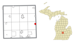 Location within Clinton County | |
 Lake Victoria Location within the state of Michigan  Lake Victoria Location within the United States | |
| Coordinates: 42°55′02″N84°22′47″W / 42.91722°N 84.37972°W | |
| Country | United States |
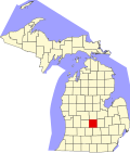
| State | Michigan |
| County | Clinton |
| Township | Victor |
| Area | |
• Total | 1.05 sq mi (2.72 km2) |
| • Land | 0.82 sq mi (2.13 km2) |
| • Water | 0.23 sq mi (0.59 km2) |
| Elevation | 791 ft (241 m) |
| Population (2020) | |
• Total | 984 |
| • Density | 1,196.7/sq mi (462.06/km2) |
| Time zone | UTC-5 (Eastern (EST)) |
| • Summer (DST) | UTC-4 (EDT) |
| ZIP code(s) | 48848 (Laingsburg) |
| Area code | 517 |
| FIPS code | 26-45190 [3] |
| GNIS feature ID | 2583748 [2] |
Lake Victoria is an unincorporated community and census-designated place (CDP) in Clinton County in the U.S. state of Michigan. It is located in Victor Township. As of the 2010 census, it had a population of 930. [4]