Watertown Charter Township, Michigan

Last updated

Watertown Township, Michigan
Watertown Charter Township
Watertown Charter Township, MI location.png
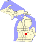
Location within Clinton County (red) and the administered CDP of Wacousta (pink)
USA Michigan location map.svg
Red pog.svg
Watertown Township
Location within the state of Michigan
Usa edcp location map.svg
Red pog.svg
Watertown Township
Location within the United States
Coordinates: 42°48′30″N84°39′17″W / 42.80833°N 84.65472°W / 42.80833; -84.65472
CountryUnited States
State Michigan
County Clinton
Established1837
Government
  SupervisorJohn Maahs
   Clerk Deborah Adams
Area
  Total
35.72 sq mi (92.51 km2)
  Land35.51 sq mi (91.97 km2)
  Water0.21 sq mi (0.54 km2)
Elevation
827 ft (252 m)
Population
 (2020)
  Total
5,563
  Density160/sq mi (60/km2)
Time zone UTC-5 (Eastern (EST))
  Summer (DST) UTC-4 (EDT)
ZIP code(s)
48820 (DeWitt)
48822 (Eagle)
48837 (Grand Ledge)
48906 (Lansing)
Area code 517
FIPS code 26-84400 [1]
GNIS feature ID1627221 [2]
Website Official website

Watertown Charter Township is a charter township of Clinton County in the U.S. state of Michigan. The population was 5,563 in the 2020 census, [3] which was a big increase from 4,836 at the 2010 census. [4]

Contents

Communities

Wacousta is a small unincorporated community and census-designated place within the township. [5]

Geography

According to the United States Census Bureau, the township has a total area of 35.72 square miles (92.51 km2), of which 35.51 square miles (91.97 km2) is land and 0.21 square miles (0.54 km2) (0.59%) is water. [4]

Demographics

Historical population
CensusPop.Note
1960 2,008
1970 3,14656.7%
1980 3,60214.5%
1990 3,7313.6%
2000 4,16211.6%
2010 4,83616.2%
U.S. Decennial Census

As of the census [1] of 2000, there were 4,162 people, 1,469 households, and 1,213 families residing in the township. The population density was 116.5 inhabitants per square mile (45.0/km2). There were 1,502 housing units at an average density of 42.0 per square mile (16.2/km2). The racial makeup of the township was 96.11% White, 0.70% African American, 0.19% Native American, 0.77% Asian, 0.12% Pacific Islander, 1.15% from other races, and 0.96% from two or more races. Hispanic or Latino of any race were 2.40% of the population.

There were 1,469 households, out of which 38.7% had children under the age of 18 living with them, 74.1% were married couples living together, 6.3% had a female householder with no husband present, and 17.4% were non-families. 14.6% of all households were made up of individuals, and 5.3% had someone living alone who was 65 years of age or older. The average household size was 2.81 and the average family size was 3.11.

In the township the population was spread out, with 27.5% under the age of 18, 6.6% from 18 to 24, 27.4% from 25 to 44, 30.4% from 45 to 64, and 8.2% who were 65 years of age or older. The median age was 39 years. For every 100 females, there were 102.5 males. For every 100 females age 18 and over, there were 96.6 males.

The median income for a household in the township was $67,034, and the median income for a family was $71,354. Males had a median income of $50,536 versus $31,875 for females. The per capita income for the township was $26,631. About 1.1% of families and 2.2% of the population were below the poverty line, including 2.4% of those under age 18 and none of those age 65 or over.

References

  1. 1 2 "U.S. Census website". United States Census Bureau . Retrieved January 31, 2008.
  2. U.S. Geological Survey Geographic Names Information System: Watertown Charter Township, Michigan
  3. "Explore Census Data". data.census.gov. Retrieved April 24, 2024.
  4. 1 2 "Michigan: 2010 Population and Housing Unit Counts 2010 Census of Population and Housing" (PDF). 2010 United States Census . United States Census Bureau. September 2012. p. 19 Michigan. Retrieved January 19, 2021.
  5. U.S. Geological Survey Geographic Names Information System: Wacousta, Michigan