
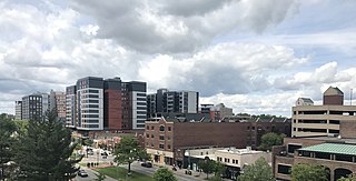
Lansing is the capital of the U.S. state of Michigan and the most populous city in Ingham County. It is mostly in the county, although portions of the city extend west into Eaton County and north into Clinton County. The 2020 census placed the city's population at 112,644, making it the sixth most populous city in Michigan. The population of its metropolitan statistical area (MSA) was 541,297 at the 2020 census, the third largest in the state after metropolitan Detroit and Grand Rapids. It was named the new state capital of Michigan in 1847, ten years after Michigan became a state.
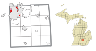
Lansing Charter Township is a charter township of Ingham County in the U.S. state of Michigan. The population was 8,143 at the 2020 census.
East Lansing is a city in the U.S. state of Michigan. Most of the city lies within Ingham County with a smaller portion extending north into Clinton County. At the 2020 census the population was 47,741. Located directly east of the state capital of Lansing, East Lansing is well known as the home of Michigan State University. The city is part of the Lansing–East Lansing metropolitan area.

M-78 is a state trunkline highway in the US state of Michigan. The western terminus is the intersection with M-66 north of Battle Creek in Pennfield Township. The roadway runs 10.744 miles (17.291 km) through rural farmland and the community of Bellevue as it approaches its eastern terminus at an interchange with Interstate 69 (I-69) near Olivet. The highway is used by between 3,100 and 5,300 vehicles on a daily basis.

Interstate 496 (I-496) is an auxiliary Interstate Highway that passes through downtown Lansing in the US state of Michigan. Also a component of the State Trunkline Highway System, the freeway connects I-96 to the downtown area. It has been named the R.E. Olds Freeway for Ransom E. Olds, the founder of Oldsmobile and the REO Motor Car Company. I-496 runs east–west from I-96/I-69 near the downtown area and north–south along a section that runs concurrently with US Highway 127 (US 127). The trunkline also passes a former assembly plant used by Oldsmobile and runs along or crosses parts of the Grand and Red Cedar rivers.
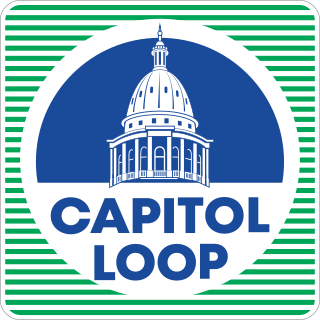
The Capitol Loop was a state trunkline highway running through Lansing, Michigan, in the United States that was commissioned on October 13, 1989. It formed a loop route off Interstate 496 (I-496) through downtown near the Michigan State Capitol complex, home of the state legislature and several state departments. The Michigan Department of Transportation (MDOT) had labeled it as Capitol Loop I-496 or CL I-496 on some maps, similar to the Business Loop Interstate nomenclature. However, unlike other business loops in Michigan, it had unique reassurance markers—the signs that served as regular reminders of the name and number of the highway. It was known internally at MDOT as Connector 496 for inventory purposes. The route followed a series of one-way and two-way streets through downtown Lansing, directing traffic downtown to the State Capitol and other government buildings. Unlike the other streets downtown, the seven streets comprising the Capitol Loop were under state maintenance and jurisdiction.
M-331 was an unsigned state trunkline highway in the U.S. state of Michigan located within the city of Kalamazoo. It ran from the southern city limits north into downtown Kalamazoo. This was one of many highways to be established or realigned as a result of a rationalization process initiated in 1998 during the tenure of Governor John Engler. M-331 used streets in Kalamazoo that were once part of US Highway 131 (US 131) before a freeway was built that bypassed the downtown area. In 2019, the City of Kalamazoo and the Michigan Department of Transportation (MDOT) agreed to transfer control of various streets from state to city jurisdiction, and M-331 was decommissioned as a result.

The neighborhoods of Milwaukee include a number of areas in southeastern Wisconsin within the state's largest city at nearly 600,000 residents.

Downtown Columbus is the central business district of Columbus, Ohio. Downtown is centered on the intersection of Broad and High Streets, and encompasses all of the area inside the Inner Belt. Downtown is home to most of the tallest buildings in Columbus.
Columbus, the state capital and Ohio's largest city, has numerous neighborhoods within its city limits. Neighborhood names and boundaries are not officially defined. They may vary or change from time to time due to demographic and economic variables.

The city of Kalamazoo, Michigan consists of multiple neighborhoods. While the number, borders, and naming of neighborhoods can vary by source, the list below gives the most widely agreed upon arrangement, as defined by the City of Kalamazoo. Many of the neighborhoods have a corresponding neighborhood association.

US Highway 12 (US 12) is an east–west United States Numbered Highway that runs from Aberdeen, Washington, to Detroit, Michigan. In Michigan, it runs for 210 miles (340 km) between New Buffalo and Detroit as a state trunkline highway and Pure Michigan Byway. On its western end, the highway is mostly a two-lane road that runs through the southern tier of counties roughly parallel to the Indiana state line. It forms part of the Niles Bypass, a four-lane expressway south of Niles in the southwestern part of the state, and it runs concurrently with the Interstate 94 (I-94) freeway around the south side of Ypsilanti in southeastern Michigan. In between Coldwater and the Ann Arbor area, the highway angles northeasterly and passes Michigan International Speedway. East of Ypsilanti, US 12 follows a divided highway routing on Michigan Avenue into Detroit, where it terminates at an intersection with Cass Avenue.

There are currently eight business routes of Interstate 94 (I-94) in the US state of Michigan. These business routes connect I-94 to the downtown business districts of neighboring cities. Seven of the eight routes are business loops which bear the Business Loop I-94 designation while one is a business spur that bears the Business Spur I-94. These loops are former routings of I-94's two predecessors in Michigan: US Highway 12 (US 12) or US 25. The westernmost BL I-94 runs through the twin cities of Benton Harbor and St. Joseph along the former routing of US 12 and US 31/US 33 that now includes a section of the Lake Michigan Circle Tour in the state. The loops in Kalamazoo, Battle Creek, Marshall, Albion, and Jackson were also formerly segments of US 12 which were later designated as separate version of Business US Highway 12 through their respective cities before becoming BL I-94s in 1960. The BL I-94 in Kalamazoo was converted into BS I-94 in 2019. The route of the business loop through Ann Arbor was previously US 12 and then later M-14 before receiving its current moniker. The BL I-94 through Port Huron was previously US 25 and then Business US Highway 25.

There are six business routes of US Highway 131 in the state of Michigan, and previously there was one bypass route and an additional business route. All of the business routes are former sections of US Highway 131 (US 131). These former sections of the mainline highway, along with the necessary connecting roads, allow traffic to access the downtowns business districts of cities bypassed by sections of US 131 built since the 1950s. The extant business loops connect to Constantine, Three Rivers, Kalamazoo, Big Rapids, Cadillac, and Manton. The former bypass route in Grand Rapids allowed traffic to bypass that city's downtown at a time when US 131 still ran through the heart of the city, and the later business route connected through downtown while US 131 ran on a freeway bypassing the central business district.

There are currently four business routes of Interstate 69 (I-69) in the US state of Michigan. Designated Business Loop Interstate 69, they are all former routings of I-69's predecessor highways, US Highway 27 (US 27), M-78 or M-21, in whole or in part. The BL I-69 in Coldwater and the one in Charlotte were both parts of US 27 before the freeway bypassed those two cities in 1967 and the early 1970s, respectively. The BL I-69 through Lansing and East Lansing was previously part of M-78 and Temporary I-69 until it was redesignated in 1987. Before 1984, the loop in Port Huron was originally part of M-21 and was initially a business spur numbered Business Spur Interstate 69. It was later redesignated when it was extended to run concurrently with that city's BL I-94 which was originally part of I-94's predecessor, US 25. Each business loop follows streets through each city's downtown areas and connects to I-69 on both ends, giving traffic a route through the downtown and back to the freeway.
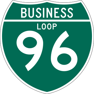
There have been six business routes of Interstate 96 (I-96) in the US state of Michigan. There are two business loops designated Business Loop Interstate 96 : one through Lansing and one through Howell. Both follow the old route of US Highway 16 (US 16), with appropriate connections to I-96. There are three former business spurs that were designated Business Spur Interstate 96. One connected to the carferry docks in Muskegon, running concurrently with part of Business US 31 along former US 16, but it has been eliminated. The second spur ran into downtown Portland until it was decommissioned in 2007. Two routes in the Detroit area—a loop through Farmington and a spur into Detroit—both using Grand River Avenue, and meeting at the temporary end of I-96 near Purdue Avenue, were eliminated when I-96 was moved to the completed Jeffries Freeway in 1977. The Farmington business route is still state-maintained as an unsigned highway, while the Detroit business route remained unsigned until it was decommissioned in 2016 and replaced by an extension of M-5.
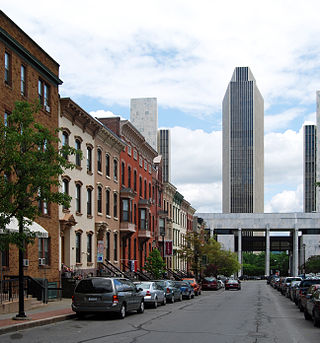
The Center Square/Hudson–Park Historic District is located between Empire State Plaza and Washington Park in Albany, New York, United States. It is a 27-block, 99-acre (40 ha) area taking in both the Center Square and Hudson/Park neighborhoods, and Lark Street on the west. In 1980 it was recognized as a historic district and listed on the National Register of Historic Places.
Cooley Law School (Cooley) is a private law school in Lansing, Michigan, and Riverview, Florida. It was established in 1972. At its peak in 2010, Cooley had over 3,900 students and was the largest US law school by enrollment; as of the Spring of 2022, Cooley had approximately 500 students between its two campuses. In November 2020, Western Michigan University's board of trustees voted to end its affiliation with Cooley, which began in 2014, with disassociation effective November 5, 2023. As of 2024, Cooley has failed to reach the 75% two year bar passage required of ABA Standard 316 for continued accreditation. Multiple media outlets have labeled Cooley the "worst law school in America".

The Lansing Downtown Historic District is a primarily commercial and office historic district located in downtown Lansing, Michigan. The district stretches along the east side of Capitol Avenue from Ionia Street to Lenawee Street, and along both sides of Grand Avenue between Michigan and Washtenaw, with additional structures along Kalamazoo Street between Walnut and Grand and along Lenawee Street between Washington and Walnut. The district was listed on the National Register of Historic Places in 2009.
