West Michigan

Last updated
West Michigan
Michigan Regions.png
A broad definition of West Michigan.
CountryUnited States
State Michigan
Largest city Grand Rapids
Other cities
Map of the region, employing a narrow definition. WestMichiganNarrowDefinition.svg
Map of the region, employing a narrow definition.

West Michigan and Western Michigan are terms for a region in the U.S. state of Michigan's Lower Peninsula. Generally, it refers to the Grand Rapids-Muskegon-Holland area, and more broadly to most of the region along the Lower Peninsula's Lake Michigan shoreline, but there is no official definition.

Contents

Definition

In general, "West Michigan" often refers to the area bounded by the cities of Muskegon (in the north), Grand Rapids (in the northeast), KalamazooBattle Creek (in the southeast) and St. JosephBenton Harbor (in the southwest). However, definitions of the boundaries of the region vary widely; in some contexts, the term "West Michigan" is applied only to the counties of Allegan, Kent, Muskegon, and Ottawa, which together compose the Grand Rapids-Kentwood-Muskegon CSA. Other definitions include the Kalamazoo–Battle Creek and Benton Harbor–St. Joseph regions, which can be considered distinct regions or parts of other regions such as Michiana , Southern Michigan , or Southwest Michigan, [1] [2] [3] the latter according to one definition comprising Berrien County, Cass County, and Van Buren County. [4]

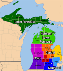
The northern boundary of the region is also poorly defined; the population density, land use, economic and cultural character, and physical geography most often associated with West Michigan fades in northern Muskegon and Kent Counties, however areas as far north as Ludington and White Cloud may be included because of their close economic ties to the cities to the south. Other areas, such as Montcalm County in the northeast corner of the region, are transitional areas that straddle Michigan regions but are sometimes included for classification purposes. Greenville, in Montcalm County's southwest corner, is closely tied economically with Grand Rapids; however, the northeastern corner, around Vestaburg and Edmore, has historically more closely associated with the cities of Mount Pleasant and Alma, which are almost universally reckoned as part of Central Michigan .

Geography

See also List of Michigan state parks and Geography of Michigan.

Municipalities

Grand Rapids at night in 2016 from the International Space Station. Grand Rapids is the largest city in western Michigan. ISS047-E-125688.jpg
Grand Rapids at night in 2016 from the International Space Station. Grand Rapids is the largest city in western Michigan.

The following table contains the largest municipalities of West Michigan according to the 2010 Census. This defines the region fairly broadly, but not at its most broadly; if Battle Creek were included, it would be ranked fourth.

RankMunicipalityCountyPopulation
1 Grand Rapids Kent 198,917
2 Wyoming Kent 76,501
3 Kalamazoo Kalamazoo 73,598
4 Kentwood Kent 54,304
5 Georgetown Charter Township Ottawa 54,091
6 Portage Kalamazoo 48,891
7 Muskegon Muskegon 38,318
8 Holland Charter Township Ottawa 38,276
9 Holland Ottawa/Allegan 34,378
10 Plainfield Charter Township Kent 33,535
11 Gaines Charter Township Kent 28,812
12 Walker Kent 25,132
13 Norton Shores Muskegon 25,030
14 Kalamazoo Charter Township Kalamazoo 21,918
15 Oshtemo Charter Township Kalamazoo 21,705
16 Allendale Charter Township Ottawa 20,708
17 Byron Township Kent 20,317
18 Muskegon Charter Township Muskegon 17,840
19 Park Township Ottawa 17,802
20 Cascade Charter Township Kent 17,134
21 Grand Rapids Charter Township Kent 16,661
22 Grandville Kent 15,378
23 Grand Haven Charter Township Ottawa 15,178

Five of the above cities, Wyoming, Kentwood, Portage, Norton Shores, and Walker, are former suburban townships that incorporated in the 1960s in order to prevent annexation by an adjacent city. The presence of these cities in the top ten reflects both the large geographic area of these cities, as well as the long and continuing growth of suburban areas in West Michigan.

Events

Attractions

Universities and colleges

Business

Prominent West Michigan corporations include:

Transportation

Major airports

Railways

Amtrak operates its Pere Marquette service in West Michigan, with daily service between Grand Rapids and Chicago.

Major roads

Interstate highways

US highways

Michigan highways

Other

Notable residents or former residents

More comprehensive lists are available at individual cities, villages, etc.

Notes

  1. "About the Southwest Michigan Planning Commission". Southwest Michigan Planning Commission [Metropolitan planning organization]. Retrieved 6 August 2021.
  2. "Southwestern Michigan Tourist Council". www.swmichigan.org. Retrieved 6 August 2021.
  3. "The Newspaper for Southwest Michigan". The Herald-Palladium . 11 March 2021. p. A1. Retrieved 4 January 2023. [representative sample]
  4. Knot, Juliana (June 24, 2023). "Smaller and Shrinking: Southwest Michigan population decline spells trouble for region's economy" . The Herald-Palladium. Retrieved June 24, 2023.
  5. "Diocese of Grand Rapids, Michigan". dioceseofgrandrapids.org. Archived from the original on 3 March 2008. Retrieved 23 March 2018.
  6. "M-46 Endpoint Photos". state-ends.com. Archived from the original on 14 April 2005. Retrieved 23 March 2018.
  7. "About The West Michigan Tourist Association - WMTA". wmta.org. Retrieved 23 March 2018.

See also

Related Research Articles

<span class="mw-page-title-main">Kalamazoo, Michigan</span> City in Michigan, United States

Kalamazoo is a city in the southwest region of the U.S. state of Michigan. It is the county seat of Kalamazoo County. At the 2020 census, Kalamazoo had a population of 73,598. Kalamazoo is the major city of the Kalamazoo-Portage Metropolitan Statistical Area, which had a population of 261,670 in 2020.

<span class="mw-page-title-main">Berrien County, Michigan</span> County in Michigan, United States

Berrien County is a county in the U.S. state of Michigan. It is located at the southwest corner of the state's Lower Peninsula, located on the shore of Lake Michigan and sharing a land border with Indiana. As of the 2020 Census, the population was 154,316. The county seat is St. Joseph.

<span class="mw-page-title-main">Muskegon, Michigan</span> City in Michigan, United States

Muskegon is a city in and the county seat of Muskegon County, Michigan, United States. Situated around a harbor of Lake Michigan, Muskegon is known for fishing, sailing regattas, and pleasure boating, and as a commercial- and cruise-ship port. It is a popular vacation destination because of its freshwater beaches, architecture, and public art collection. It is the most populous city along Lake Michigan's eastern shore. At the 2020 census, the city's population was 38,318. The city is administratively autonomous from adjacent Muskegon Township.

Chester Township is a civil township of Ottawa County in the U.S. state of Michigan. As of the 2000 United States Census, the township population was 2,315.

<span class="mw-page-title-main">M-37 (Michigan highway)</span> State highway in Michigan, United States

M-37 is a north–south state trunkline highway in the US state of Michigan. The southern terminus is near the border between Kalamazoo and Calhoun counties at exit 92 of Interstate 94 (I-94) southwest of Battle Creek. The northern terminus is at the Mission Point Light on Old Mission Point in Grand Traverse County. In between, the highway connects Battle Creek, Grand Rapids and Traverse City. Motorists will travel through agricultural land, forests, suburbs and large cities along the way. The section of M-37 on the Old Mission Peninsula was designated what is now a Pure Michigan Scenic Byway in 2008.

<span class="mw-page-title-main">Interstate 196</span> Interstate Highway in Michigan

Interstate 196 (I-196) is an auxiliary Interstate Highway that runs for 80.6 miles (129.7 km) in the US state of Michigan. It is a state trunkline highway that links Benton Harbor, South Haven, Holland, and Grand Rapids. In Kent, Ottawa, and Allegan counties, I-196 is known as the Gerald R. Ford Freeway, or simply the Ford Freeway, after President Gerald Ford, who was raised in Grand Rapids and served Michigan in the House of Representatives for 25 years. This name generally refers only to the section between Holland and Grand Rapids. I-196 changes direction; it is signed as a north–south highway from its southern terminus to the junction with US Highway 31 (US 31) just south of Holland, and as an east–west trunkline from this point to its eastern terminus at an interchange with I-96, its parent highway. There are three business routes related to the main freeway. There are two business loops and one business spur that serve South Haven, Holland and the Grand Rapids areas. Another business spur for Muskegon had been designated relative to the I-196 number.

<span class="mw-page-title-main">Grand Rapids and Indiana Railroad</span> Former railway line in Michigan and Indiana, US

The Grand Rapids and Indiana Railroad at its height provided passenger and freight railroad services between Cincinnati, Ohio, and the Straits of Mackinac in Michigan, USA. The company was formed on January 18, 1854.

<span class="mw-page-title-main">U.S. Route 131</span> US Highway in Indiana and Michigan

US Highway 131 (US 131) is a north–south United States Highway, of which all but 0.64 of its 269.96 miles are within the state of Michigan. The highway starts in rural Indiana south of the state line as a state road connection to the Indiana Toll Road. As the road crosses into Michigan it becomes a state trunkline highway that connects to the metropolitan areas of Kalamazoo and Grand Rapids before continuing north to its terminus at Petoskey. US 131 runs as a freeway from south of Portage through to Manton in the north. Part of this freeway runs concurrently with Interstate 296 (I-296) as an unsigned designation through Grand Rapids. US 131 forms an important corridor along the western side of the Lower Peninsula of Michigan, running through rural farm and forest lands as well as urban cityscapes. Various names have been applied to the roadway over the years. The oldest, the Mackinaw Trail, originated from an Indian trail in the area while other names honored politicians. An attempt to dedicate the highway to poet James Whitcomb Riley failed to gain official support in Michigan.

<span class="mw-page-title-main">Area code 616</span> Area code for Western Michigan

Area code 616 is the telephone area code in the North American Numbering Plan (NANP) for Greater Grand Rapids, Michigan. The numbering plan area also includes the towns of Holland, Greenville, and Grand Haven. This comprises all of Kent and Ottawa counties, and parts of neighboring counties, including the western and central parts of Ionia County. It was one of the original North American area codes created in 1947.

<span class="mw-page-title-main">Celebration Cinema</span>

Celebration Cinema is a movie theater chain owned and operated by Studio C with headquarters in Grand Rapids, Michigan, USA. Its theaters serve the cities and surrounding areas of Grand Rapids, Lansing, Muskegon, Benton Harbor/St. Joseph, Portage/Kalamazoo, and Mount Pleasant. An average of 5.5 million customers see movies annually through Studio C's Celebration Cinemas locations.

<span class="mw-page-title-main">U.S. Route 31 in Michigan</span> U.S. Highway in Michigan

US Highway 31 (US 31) is a part of the United States Numbered Highway System that runs from Alabama to the Lower Peninsula of the US state of Michigan. In Michigan, it is a state trunkline highway that runs from the Indiana–Michigan state line at Bertrand Township north to its terminus at Interstate 75 (I-75) south of Mackinaw City. Along its 355.2-mile-long (571.6 km) route, US 31 follows the Michigan section of the St. Joseph Valley Parkway as well as other freeways and divided highways northward to Ludington. North of there, the trunkline is a rural undivided highway through the Northern Michigan tourist destinations of Traverse City and Petoskey before terminating south of Mackinaw City. Along its route, US 31 has been dedicated in memory of a few different organizations, and sections of it carry the Lake Michigan Circle Tour (LMCT) moniker. Four bridges used by the highway have been recognized for their historic character as well.

The Michigan State League was a minor league baseball league that operated in various seasons between 1889 and 1941. The league franchises were based exclusively in Michigan, with the league forming on six different occasions. Twenty two different cities hosted teams in the Michigan State league.

<span class="mw-page-title-main">Grand Rapids metropolitan area</span> Metropolitan area in Michigan, United States

The Grand Rapids metropolitan area is a triangular shaped Metro Triplex, in West Michigan, which fans out westward from the primary hub city of Grand Rapids, Michigan, to the other two metro hubs of Muskegon and Holland. The metropolitan area had an estimated population of 1,059,113 in 2017. The region, noted in particular for its western edge abutting the Lake Michigan shoreline and its beaches, is a popular tourist and vacation destination during the summer. Noted popular metro area beach towns include Grand Haven, Holland, Muskegon, and Saugatuck.

<span class="mw-page-title-main">Battle Creek, Michigan</span> City in Michigan, United States

Battle Creek is a city in the U.S. state of Michigan, in northwest Calhoun County, at the confluence of the Kalamazoo and Battle Creek rivers. It is the principal city of the Battle Creek, Michigan Metropolitan Statistical Area (MSA), which encompasses all of Calhoun County. As of the 2020 census, the city had a total population of 52,731. Nicknamed "Cereal City", it is best known as the home of WK Kellogg Co and the founding city of Post Consumer Brands.

<span class="mw-page-title-main">Grand Rapids, Michigan</span> City in Michigan, United States

Grand Rapids is a city and county seat of Kent County in the U.S. state of Michigan. At the 2020 census, the city had a population of 198,893 which ranks it as the second most-populated city in the state after Detroit. Grand Rapids is the central city of the Grand Rapids metropolitan area, which has a population of 1,087,592 and a combined statistical area population of 1,383,918.