Timeline of Michigan history

Last updated
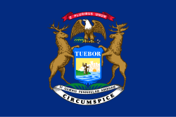
Flag of Michigan Flag of Michigan.svg
Flag of Michigan

Natural history

French colonization

British colonization

U.S. territory

As a U.S. state

See also

References and further reading

Related Research Articles

<span class="mw-page-title-main">Michigan</span> U.S. state

Michigan is a state in the Great Lakes region of the Upper Midwest region of the United States. It borders Wisconsin to the southwest in the Upper Peninsula, and Indiana and Ohio to the south in the Lower Peninsula; it is also connected by Lakes Superior, Michigan, Huron, and Erie to Minnesota and Illinois, and the Canadian province of Ontario. With a population of nearly 10.12 million and an area of 96,716 sq mi (250,490 km2), Michigan is the 10th-largest state by population, the 11th-largest by area, and the largest by area east of the Mississippi River. Its capital is Lansing, and its largest city is Detroit. Metro Detroit is among the nation's most populous and largest metropolitan economies. The name derives from a gallicized variant of the original Ojibwe word ᒥᓯᑲᒥ, meaning "large water" or "large lake".

<span class="mw-page-title-main">Upper Peninsula of Michigan</span> Northern major peninsula of the U.S. state of Michigan

The Upper Peninsulaof Michigan—also known as Upper Michigan or colloquially the U.P. or Yoop—is the northern and more elevated of the two major landmasses that make up the U.S. state of Michigan; it is separated from the Lower Peninsula by the Straits of Mackinac. It is bounded primarily by Lake Superior to the north, separated from the Canadian province of Ontario at the east end by the St. Marys River, and flanked by Lake Huron and Lake Michigan along much of its south. Although the peninsula extends as a geographic feature into the state of Wisconsin, the state boundary follows the Montreal and Menominee rivers and a line connecting them.

<span class="mw-page-title-main">St. Ignace, Michigan</span> City in Michigan, United States

St. Ignace is a city in the U.S. state of Michigan and the county seat of Mackinac County. The city had a population of 2,306 at the 2020 census. St. Ignace Township is located just to the north of the city; the two are administered separately.

<span class="mw-page-title-main">Mackinaw City, Michigan</span> Village in Michigan, United States

Mackinaw City is a village at the northernmost point of the Lower Peninsula of Michigan, United States. Divided between Cheboygan and Emmet counties, Mackinaw City is located at the southern end of the Mackinac Bridge, which carries Interstate 75 over the Straits of Mackinac to St. Ignace, in the Upper Peninsula. Mackinaw City and St. Ignace also serve as access points for ferries to and from Mackinac Island. For these reasons, Mackinaw City is considered one of Michigan's most popular tourist attractions.

<span class="mw-page-title-main">Michigan Territory</span> Territory of the US, 1805–1837

The Territory of Michigan was an organized incorporated territory of the United States that existed from June 30, 1805, until January 26, 1837, when the final extent of the territory was admitted to the Union as the State of Michigan. Detroit was the territorial capital.

Mackinac or Mackinaw may refer to:

<span class="mw-page-title-main">Straits of Mackinac</span> Strait connecting Lakes Huron and Michigan in Michigan, USA

The Straits of Mackinac are the short waterways between the U.S. state of Michigan's Upper and Lower Peninsulas, traversed by the Mackinac Bridge. The main strait is 3+12 miles wide with a maximum depth of 295 feet, and connects the Great Lakes of Lake Michigan and Lake Huron. Given the large size and configuration of the straits, hydrologically, the two connected lakes are one body of water, studied as Lake Michigan–Huron. Historically, the native Odawa people called the region around the Straits Michilimackinac.

<span class="mw-page-title-main">Fort Michilimackinac</span> Archaeological site in Michigan, United States

Fort Michilimackinac was an 18th-century French, and later British, fort and trading post at the Straits of Mackinac; it was built on the northern tip of the lower peninsula of the present-day state of Michigan in the United States. Built around 1715, and abandoned in 1783, it was located along the Straits, which connect Lake Huron and Lake Michigan of the Great Lakes of North America.

<span class="mw-page-title-main">Northern Michigan</span> Northern region of Michigans lower peninsula

Northern Michigan, also known as Northern Lower Michigan, is a region of the U.S. state of Michigan. A popular tourist destination, it is home to several small- to medium-sized cities, extensive state and national forests, lakes and rivers, and a large portion of Great Lakes shoreline. The region has a significant seasonal population much like other regions that depend on tourism as their main industry. Northern Lower Michigan is distinct from the more northerly Upper Peninsula and Isle Royale, which are also located in "northern" Michigan. In the northernmost 21 counties in the Lower Peninsula of Michigan, the total population of the region is 506,658 people.

<span class="mw-page-title-main">Fort Michilimackinac State Park</span> State park in Michigan, United States

Fort Michilimackinac State Park is a state park in the U.S. state of Michigan. It is located in Mackinaw City along the Straits of Mackinac. The park contains Fort Michilimackinac, which itself is dedicated a National Historic Landmark and Old Mackinac Point Lighthouse as well as the Old Mackinac Point Lighthouse Signal Tower which contains a foghorn.

<span class="mw-page-title-main">Fort Pontchartrain du Détroit</span> French colonial fort in present-day Detroit, Michigan, US (1701–1796)

Fort Pontchartrain du Détroit or Fort Detroit (1701–1796) was a French and later British fortification established in 1701 on the north side of the Detroit River by Antoine Laumet de Lamothe Cadillac. A settlement based on the fur trade, farming and missionary work slowly developed in the area. The fort was located in what is now downtown Detroit, northeast of the intersection of Washington Boulevard and West Jefferson Avenue.

<span class="mw-page-title-main">History of Michigan</span>

The history of human activity in Michigan, a U.S. state in the Great Lakes, began with settlement of the western Great Lakes region by Paleo-Indians perhaps as early as 11,000 B.C.E. One early technology they developed was the use of native copper, which they would fashion into tools and other implements with "hammer stones". The first Europeans to arrive in Michigan were the French. Explorer Étienne Brûlé traveled through Michigan in 1618 searching for a route to China. Soon the French laid claim to the land and began to trade with the local natives for furs. Men called "voyageurs" would travel the rivers by canoe trading various goods for furs that would bring a high price back in Europe.

<span class="mw-page-title-main">Fort de Buade</span> French colonial fort in present-day St. Ignace, Michigan, USA (1683–1701)

Fort de Buade was a French fort in the present U.S. state of Michigan's Upper Peninsula across the Straits of Mackinac from the northern tip of lower Michigan's "mitten". It was garrisoned between 1683 and 1701. The city of St. Ignace developed at the site, which also had the historic St. Ignace Mission founded by Jesuits. The fort was named after New France's governor at the time, Louis de Buade de Frontenac.

SS <i>Chief Wawatam</i> Steel ship based in Michigan

Chief Wawatam was a coal-fired steel ship that was based, for most of its working life, in St. Ignace, Michigan. The vessel was named after a distinguished Ojibwa chief of the 1760s. In initial revenue service, the Chief Wawatam served as a train ferry, passenger ferry and icebreaker that operated year-round at the Straits of Mackinac between St. Ignace and Mackinaw City, Michigan. During the winter months, it sometimes took many hours to cross the five-mile-wide Straits, and Chief Wawatam was fitted with complete passenger hospitality spaces.

<span class="mw-page-title-main">Fort St. Joseph (Ontario)</span>

Fort St. Joseph is a former British outpost on the southernmost point of St. Joseph Island in Ontario, Canada, on Lake Huron. The fort consisted of a blockhouse, powder magazine, bakery building, Indian council house and storehouse surrounded by a palisade.

<span class="mw-page-title-main">History of railroads in Michigan</span>

Railroads have been vital in the history of the population and trade of rough and finished goods in the state of Michigan. While some coastal settlements had previously existed, the population, commercial, and industrial growth of the state further bloomed with the establishment of the railroad.

<span class="mw-page-title-main">North Central State Trail</span>

The North Central State Trail is a 62-mile (100 km) recreational rail trail serving a section of the northern quarter of the Lower Peninsula of the U.S. state of Michigan. Following a route generally parallel to Interstate 75, the trail goes northward from the Michigan town of Gaylord to the top of the Lower Peninsula at Mackinaw City and connects to the North Western State Trail. It serves the towns of Vanderbilt, Indian River, and Cheboygan which connects to the North Eastern State Trail.

<span class="mw-page-title-main">Outline of Michigan</span> Overview of and topical guide to Michigan

The following outline provides an overview of and topical guide to the U.S. state of Michigan:

<span class="mw-page-title-main">Ferries in Michigan</span>

Due to its unique geography, being made of two peninsulas surrounded by the Great Lakes, Michigan has depended on many ferries for connections to transport people, vehicles and trade. The most famous modern ferries are those which carry people and goods across the Straits of Mackinac to the car-free Mackinac Island but before the Mackinac Bridge was built, large numbers of ferries carried people and cars between the two peninsulas. Other ferries continue to provide transportation to small islands and across the Detroit River to Canada. Ferries once provided transport to island parks for city dwellers. The state's only national park, Isle Royale cannot be reached by road and is normally accessed by ferry. The largest ferries in Michigan are the car ferries which cross Lake Michigan to Wisconsin. One of these, the SS Badger is one of the last remaining coal steamers on the Great Lakes and serves as a section of US Highway 10 (US 10). The Badger is also the largest ferry in Michigan, capable of carrying 600 passengers and 180 autos.

<span class="mw-page-title-main">Wawatam Lighthouse</span> Lighthouse in Michigan, United States

Wawatam Lighthouse is an automated, modern lighthouse that guards the harbor of St. Ignace, Michigan, in the Straits of Mackinac. Originally completely nonfunctional, it was erected in 1998 by the Michigan Department of Transportation (MDOT) near Monroe, Michigan as an iconic roadside attraction at a welcome center that greeted northbound drivers on Interstate 75 (I-75). After serving in this capacity for six years, the structure was threatened in 2004 when MDOT decided to rebuild the welcome center and demolish the tower.

References

  1. "The History of Otsego County". Otsego County, Michigan. Archived from the original on 2015-09-24. Retrieved 2019-09-17. In the fall of 1872, the Village of Otsego Lake was established and the railroad reached the Otsego Lake area about this same time.
  2. Friday, Matthew J. (2010). The Inland Water Route. Arcadia Publishing. p. 14. ISBN   978-1-4396-2440-1. The railroad arrived in Cheboygan in 1881... prior to this, seasonal navigation provided the only real link to places further south.
  3. "Village of Wolverine History". Village of Wolverine. Retrieved 2019-09-17. In 1881, the Michigan Central Railroad had extended their line to Mackinaw City. The Grand Rapids Railroad completed their line to Mackinaw in 1882