St. Joseph County, Michigan

Last updated

Saint Joseph County
Saint Joseph County Courthouse 8X10 II.jpg
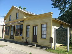
St. Joseph County Courthouse in Centreville
St. joseph logo.PNG
Map of Michigan highlighting Saint Joseph County.svg
Location within the U.S. state of Michigan
Michigan in United States.svg
Michigan's location within the U.S.
Coordinates: 41°55′N85°32′W / 41.92°N 85.53°W / 41.92; -85.53
CountryFlag of the United States.svg United States
StateFlag of Michigan.svg  Michigan
Founded1829 [1]
Named for Fort St. Joseph
Seat Centreville
Largest city Sturgis
Area
  Total521 sq mi (1,350 km2)
  Land501 sq mi (1,300 km2)
  Water20 sq mi (50 km2)  3.9%
Population
 (2020)
  Total60,939
  Density122/sq mi (47/km2)
Time zone UTC−5 (Eastern)
  Summer (DST) UTC−4 (EDT)
Congressional district 6th
Website stjosephcountymi.org

St. Joseph County is a county located in the U.S. state of Michigan, on the central southern border with Indiana. As of the 2020 United States Census, the population was 60,939. [2] The county seat is Centreville. [3]

Contents

French colonists in the late 17th century were the first Europeans to explore this territory, and they named the St. Joseph River for the patron saint of New France. [1] This area was not part of the United States until after the American Revolutionary War. After the 1821 Treaty of Chicago was signed, regional tribes of the indigenous peoples ceded much land to the United States, opening the area for American settlement. The county was set off and organized by the Michigan Territory legislature in 1829; it was named for the river. [1]

The area is home to the oldest and largest Amish community in Michigan. [4]

St. Joseph County comprises the Sturgis, MI Micropolitan Statistical Area and is included in the Kalamazoo-Battle Creek-Portage, MI Combined Statistical Area.

History

This area was settled by members of the three Algonquian-speaking tribes of the Council of Three Fires: the Potawatomi, Odawa, and Chippewa (known as Ojibwa in Canada). French explorers in a party led by Father Hennepin came upriver from Lake Michigan in 1679. A Jesuit mission was established near where the French later built Fort St. Joseph, and they named the waterway as the St. Joseph River.

After the United States and tribal representatives made the 1821 Treaty of Chicago, much of the land in this region was ceded by the tribes to Michigan Territory, so more settlers came from Detroit, Monroe and later from New England and upstate New York. The first were ethnic French. The Godfroy brothers of Detroit built a trading post south of the river, near the later Marantette House site. They appointed Frances Mouton as an agent to trade with the natives of the Nottawaseepe (sippi) settlement. They had another post nearby where Patrick Marantette, also from Detroit, first worked as an agent. He ended up settling in and marrying Mouton's daughter Francis. Theirs was the first marriage in the settlement, and their daughter the first European American born here, in 1836.

Geography

According to the U.S. Census Bureau, the county has a total area of 521 square miles (1,350 km2), of which 501 square miles (1,300 km2) is land and 20 square miles (52 km2) (3.9%) is water. [5] It is the fourth-smallest county in Michigan by total area. The entire county lies in the Saint Joseph River watershed.

Adjacent counties

Major highways

Strictly speaking, the Indiana Toll Road does not enter St. Joseph County, but it has an interchanges with US 131 barely within Indiana. Although M-66 does not quite reach the Toll Road, the toll road interchange is in clear sight from M-66 before it becomes Indiana State Road 9.

Demographics

Historical population
CensusPop.Note
1830 1,313
1840 7,068438.3%
1850 12,72580.0%
1860 21,26267.1%
1870 26,27523.6%
1880 26,6261.3%
1890 23,356−12.3%
1900 23,8892.3%
1910 25,4996.7%
1920 26,8185.2%
1930 30,61814.2%
1940 31,7493.7%
1950 35,07110.5%
1960 42,33220.7%
1970 47,39212.0%
1980 56,08318.3%
1990 58,9135.0%
2000 62,4226.0%
2010 61,295−1.8%
2020 60,939−0.6%
2023 (est.)60,878 [6] −0.1%
US Decennial Census [7]
1790-1960 [8] 1900-1990 [9]
1990-2000 [10] 2010-2018 [2]

The 2010 census indicates St. Joseph County had a 2010 population of 61,295. This decrease of -1,127 people from the 2000 United States Census represents a -1.8% population change (decrease) in that decade. In 2010 there were 23,244 households and 16,275 families in the county. The population density was 122.4 per square mile (47.3 per square kilometer). There were 27,778 housing units at an average density of 55.5 per square mile (21.4/km2). The racial and ethnic makeup of the county was 88.0% White, 2.5% Black or African American, 0.4% Native American, 0.7% Asian, 6.6% Hispanic or Latino, 0.1% from other races, and 1.8% from two or more races.

There were 23,244 households, out of which 33.0% had children under the age of 18 living with them, 52.6% were husband and wife families, 11.7% had a female householder with no husband present, 30.0% were non-families, and 24.8% were made up of individuals. The average household size was 2.60 and the average family size was 3.08.

The county population contained 25.9% under age of 18, 8.1% from 18 to 24, 23.8% from 25 to 44, 27.4% from 45 to 64, and 14.9% who were 65 years of age or older. The median age was 39 years. For every 100 females there were 97.9 males. For every 100 females age 18 and over, there were 95.9 males.

The 2010 American Community Survey 3-year estimate indicates the median income for a household in the county was $43,964 and the median income for a family was $52,600. Males had a median income of $30,517 versus $16,388 for females. The per capita income for the county was $19,737. About 1.8% of families and 16.3% of the population were below the poverty line, including 22.3% of those under the age 18 and 12.3% of those age 65 or over. [11]

Government

St. Joseph County has long been reliably Republican. Since 1884, the Republican Party nominee has carried 79% of the elections (27 of 34).

United States presidential election results for St. Joseph County, Michigan [12]
Year Republican Democratic Third party
No.%No.%No.%
2020 18,12764.78%9,26233.10%5922.12%
2016 14,88462.10%7,52631.40%1,5576.50%
2012 12,97855.36%10,11243.13%3551.51%
2008 12,88650.00%12,32247.81%5632.18%
2004 15,34060.78%9,64838.23%2510.99%
2000 12,90658.60%8,57438.93%5442.47%
1996 9,76446.96%8,52941.02%2,50112.03%
1992 9,83641.03%7,81732.61%6,31826.36%
1988 13,08464.79%7,01734.74%950.47%
1984 15,40572.34%5,79527.21%960.45%
1980 13,63163.19%6,31829.29%1,6217.52%
1976 11,78461.07%7,30637.86%2051.06%
1972 12,43869.15%5,11928.46%4312.40%
1968 10,44559.20%5,41330.68%1,78710.13%
1964 7,30743.96%9,28455.85%320.19%
1960 12,33769.13%5,44530.51%650.36%
1956 12,32874.11%4,24225.50%640.38%
1952 12,19172.19%4,50926.70%1871.11%
1948 8,16665.66%3,92831.59%3422.75%
1944 9,78569.45%4,23530.06%690.49%
1940 10,02566.32%5,04533.38%450.30%
1936 7,16051.85%6,04843.80%6014.35%
1932 5,62643.78%6,91753.82%3092.40%
1928 8,78176.05%2,69823.37%670.58%
1924 6,63365.43%2,64926.13%8558.43%
1920 6,03566.59%2,72530.07%3033.34%
1916 3,13245.01%3,56751.26%2603.74%
1912 1,22419.03%2,38837.13%2,82043.84%
1908 3,46652.93%2,77042.30%3124.76%
1904 3,64959.80%2,17635.66%2774.54%
1900 3,17848.19%3,28349.78%1342.03%
1896 3,18443.76%3,96854.54%1241.70%
1892 2,82443.93%2,44137.97%1,16318.09%
1888 3,37248.36%3,21746.14%3835.49%
1884 3,26146.89%3,55451.11%1392.00%

The county government operates the jail, operates the major local courts, records deeds, mortgages, and vital records, administers public health regulations, and participates with the state in the provision of social services. The county board of commissioners controls the and has limited authority to make laws or ordinances. In Michigan, most local government functions – police and fire, building and zoning, tax assessment, street maintenance, etc. – are the responsibility of individual cities and townships.

Elected officials

(Information verified with county website as of May 2023)

Communities

White Pigeon General Land Office White Pigeon land office.jpg
White Pigeon General Land Office

Cities

Villages

Unincorporated communities

Townships

See also

Related Research Articles

<span class="mw-page-title-main">Clinton County, Michigan</span> County in Michigan, United States

Clinton County is a county in the U.S. state of Michigan. As of the 2020 Census, the population was 79,128. The county seat is St. Johns. The county was created in 1831 and organized in 1839. It is named after early American politician DeWitt Clinton. Clinton County is included in the Lansing-East Lansing, MI Metropolitan Statistical Area.

<span class="mw-page-title-main">Lapeer County, Michigan</span> County in Michigan, United States

Lapeer County is a county located in the U.S. state of Michigan. As of the 2020 Census, the population was 88,619. The county seat is Lapeer. The county was created on September 18, 1822, and was fully organized on February 2, 1835. The name is a corruption of the French la pierre, which means "the stone". Lapeer County is located north of Detroit and east of Flint.

<span class="mw-page-title-main">Isabella County, Michigan</span> County in Michigan, United States

Isabella County is a county located in the U.S. state of Michigan. As of the 2020 Census, the population was 64,394. Its county seat is Mount Pleasant. The area was known as Ojibiway Besse, meaning "the place of the Ojibwa". Isabelle County contains the Isabella Indian Reservation, on which members of the Saginaw Chippewa Tribal Nation live.

<span class="mw-page-title-main">Ionia County, Michigan</span> County in Michigan, United States

Ionia County is a county located in the U.S. state of Michigan. As of the 2020 census, the population was 66,804. The county seat is Ionia. The Ionia County Courthouse was designed by Claire Allen, a prominent southern Michigan architect.

<span class="mw-page-title-main">Hillsdale County, Michigan</span> County in Michigan, United States

Hillsdale County is a county located in the U.S. state of Michigan. As of the 2020 Census, the population was 45,746. The county seat is Hillsdale. Hillsdale County is the only county in Michigan to border both Indiana and Ohio. Due to an angle in the state's southern border, Hillsdale County has the southernmost point in the state. Hillsdale County is conterminous with the Hillsdale, MI Micropolitan Statistical Area. The Hillsdale County Courthouse was designed by Claire Allen, a prominent southern Michigan architect.

<span class="mw-page-title-main">Branch County, Michigan</span> County in Michigan, United States

Branch County is a county in the U.S. state of Michigan. As of the 2020 Census, the population was 44,862. The county seat is Coldwater. As one of the "cabinet counties" it was named for the U.S. Secretary of the Navy John Branch under President Andrew Jackson. The county was founded in 1829, and was organized in 1833.

<span class="mw-page-title-main">Berrien County, Michigan</span> County in Michigan, United States

Berrien County is a county in the U.S. state of Michigan. It is located at the southwest corner of the state's Lower Peninsula, located on the shore of Lake Michigan and sharing a land border with Indiana. As of the 2020 Census, the population was 154,316. The county seat is St. Joseph.

<span class="mw-page-title-main">Royalton Township, Michigan</span> Civil township in Michigan, United States

Royalton Township is a civil township of Berrien County in the U.S. state of Michigan, a few miles southeast of the city of St. Joseph. The population was 5,141 at the 2020 census.

Athens Township is a civil township of southwest Calhoun County in the U.S. state of Michigan, about 15 miles (24 km) south of Battle Creek. It is part of the Battle Creek, Michigan Metropolitan Statistical Area. As of the 2020 census, the township population was 2,444. The Nottawaseppi Huron Band of Potawatomi is based in Athens Township.

<span class="mw-page-title-main">Camden Township, Michigan</span> Civil township in Michigan, United States

Camden Township is a civil township of Hillsdale County in the U.S. state of Michigan. The population was 2,093 at the 2020 census. The villages of Camden and Montgomery are within the township.

<span class="mw-page-title-main">Wakeshma Township, Michigan</span> Civil township in Michigan, United States

Wakeshma Township is a civil township of Kalamazoo County in the U.S. state of Michigan. The 2010 census recorded a population of 1,301, down from 1,414 at the 2000 census.

Mendon Township is a civil township of St. Joseph County in the U.S. state of Michigan. The population was 2,775 at the 2000 census. The Village of Mendon is located within the township.

Mottville Township is a civil township of St. Joseph County in the U.S. state of Michigan. The population was 1,499 at the 2000 census. US 12 runs through the township, and M-103 connects it with the Indiana state line.

Nottawa Township is a civil township of St. Joseph County in the U.S. state of Michigan. The population was 3,999 at the 2000 census. The township is named after the Nottawaseppi Huron Band of Potawatomi.

<span class="mw-page-title-main">Sturgis, Michigan</span> City in Michigan, United States

Sturgis is a city in St. Joseph County in the U.S. state of Michigan. The population was 10,994 at the 2010 census. The city is located at the northeast corner of Sturgis Township and at the intersection of US 12 and M-66. Sturgis is just north of the Michigan–Indiana border and the I-80/90 Indiana Toll Road.

<span class="mw-page-title-main">M-86 (Michigan highway)</span> State highway in St. Joseph and Branch counties in Michigan, United States

M-86 is an east–west state trunkline highway in the US state of Michigan in the southern portion of the Lower Peninsula. The highway starts at Business US Highway 131 and M-60 in Three Rivers and ends at US Highway 12 (US 12) near Coldwater. In between, it crosses farm country and runs along a section of the Prairie River. Following a highway originally numbered M-7, the roadway was renumbered M-86 in 1940. It has been a part of the state highway system at least since 1927. Two other roadways carried the M-86 designation in the 1920s. Two bridges along the road are eligible for inclusion on the National Register of Historic Places (NRHP).

<span class="mw-page-title-main">M-103 (Michigan highway)</span> State highway in St. Joseph County, Michigan, United States

M-103 is a state trunkline highway entirely within St. Joseph County in the southwestern region of the U.S. state of Michigan. The trunkline runs between U.S. Highway 12 (US 12) in Mottville and the Indiana state line along undivided highway near the St. Joseph River. With the connection to State Road 15 (SR 15), it provides access to the Indiana Toll Road. The current highway is the second to carry the number; the first version of M-103 has been incorporated into the routing of US 131.

<span class="mw-page-title-main">Plainfield Township, Kent County, Michigan</span> Charter township in Michigan, United States

Plainfield Charter Township is a charter township of Kent County in the U.S. state of Michigan. The population was 30,952 at the 2010 census.

Nottawa Creek is a 33.9-mile-long (54.6 km) stream in the U.S. state of Michigan that flows into the St. Joseph River at 42°00′15″N85°23′40″W, approximately three miles east of the village of Mendon.

<span class="mw-page-title-main">Marantette Bridge</span> United States historic place

The Marantette Bridge, also known as the Railroad Street Bridge, is a historic vehicle bridge, now closed to traffic, located at Railroad Street over the St. Joseph River in Mendon, Michigan. It was listed on the National Register of Historic Places in 2001.

References

  1. 1 2 3 "Bibliography on St. Joseph County". Clarke Historical Library, Central Michigan University. Retrieved January 29, 2013.
  2. 1 2 "State & County QuickFacts". US Census Bureau. Retrieved September 15, 2021.
  3. "Find a County". National Association of Counties. Retrieved June 7, 2011.
  4. "Michigan Amish". amishamerica.com. Retrieved May 8, 2022.
  5. "2010 Census Gazetteer Files". US Census Bureau. August 22, 2012. Archived from the original on November 13, 2013. Retrieved September 28, 2014.
  6. "Annual Estimates of the Resident Population for Counties: April 1, 2020 to July 1, 2023". United States Census Bureau. Retrieved April 4, 2024.
  7. "US Decennial Census". US Census Bureau. Retrieved September 28, 2014.
  8. "Historical Census Browser". University of Virginia Library. Retrieved September 28, 2014.
  9. "Population of Counties by Decennial Census: 1900 to 1990". US Census Bureau. Retrieved September 28, 2014.
  10. "Census 2000 PHC-T-4. Ranking Tables for Counties: 1990 and 2000" (PDF). US Census Bureau. Archived (PDF) from the original on March 27, 2010. Retrieved September 28, 2014.
  11. "U.S. Census website". US Census Bureau. Retrieved March 11, 2012.
  12. Leip, David. "Dave Leip's Atlas of US Presidential Elections".

41°55′N85°32′W / 41.92°N 85.53°W / 41.92; -85.53