Lockport Township, Michigan

Last updated

Lockport Township, Michigan
USA Michigan location map.svg
Red pog.svg
Lockport Township, Michigan
Location within the state of Michigan
Usa edcp location map.svg
Red pog.svg
Lockport Township, Michigan
Lockport Township, Michigan (the United States)
Coordinates: 41°56′44″N85°35′12″W / 41.94556°N 85.58667°W / 41.94556; -85.58667
Country United States
State Michigan
County St. Joseph
Area
  Total31.3 sq mi (81.0 km2)
  Land29.6 sq mi (76.7 km2)
  Water1.7 sq mi (4.3 km2)
Elevation
817 ft (249 m)
Population
 (2020)
  Total3,729
  Density120/sq mi (46/km2)
Time zone UTC-5 (Eastern (EST))
  Summer (DST) UTC-4 (EDT)
FIPS code 26-49060 [1]
GNIS feature ID1626635 [2]

Lockport Township is a civil township of St. Joseph County in the U.S. state of Michigan. The population was 3,729 at the 2020 census. [3]

Contents

History

Lockport Township was established in 1840 by the division of what is now Fabius Township. [4]

Geography

According to the United States Census Bureau, the township has a total area of 31.3 square miles (81 km2), of which 29.6 square miles (77 km2) is land and 1.7 square miles (4.4 km2) (5.31%) is water.

Demographics

At the 2000 census, [1] there were 3,814 people, 1,451 households and 1,067 families residing in the township. The population density was 128.8 people per square mile (49.7 people/km2). There were 1,618 housing units at an average density of 54.7 units per square mile (21.1 units/km2). The racial make-up of the township was 85.92% White, 10.38% African American, 0.42% Native American, 0.58% Asian, 0.89% from other races and 1.81% from two or more races. Hispanic or Latino of any race were 2.23% of the population.

There were 1,451 households, of which 36.0% had children under the age of 18 living with them, 58.0% were married couples living together, 11.3% had a female householder with no husband present and 26.4% were non-families. 21.4% of all households were made up of individuals, and 9.2% had someone living alone who was 65 years of age or older. The average household size was 2.63 and the average family size was 3.04.

28.7% of the population were under the age of 18, 7.8% from 18 to 24, 28.9% from 25 to 44, 23.3% from 45 to 64 and 11.3% who were 65 years of age or older. The median age was 35 years. For every 100 females, there were 97.5 males. For every 100 females age 18 and over, there were 93.2 males.

The median household income was $43,931 and the median family income was $52,760. Males had a median income of $38,143 and females $27,196. The per capita income was $21,184. About 8.5% of families and 9.9% of the population were below the poverty line, including 12.5% of those under age 18 and 7.6% of those age 65 or over.

Related Research Articles

Convis Township is a civil township of Calhoun County in the U.S. state of Michigan. It is part of the Battle Creek, Michigan Metropolitan Statistical Area. The population was 1,508 at the 2020 census.

<span class="mw-page-title-main">Gore Township, Michigan</span> Civil township in Michigan, United States

Gore Township is a civil township of Huron County in the U.S. state of Michigan. The population was 152 at the 2020 census.

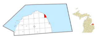
Berlin Township is a civil township of Ionia County in the U.S. state of Michigan. As of the 2020 census, the township population was 2,138.

Easton Township is a civil township of Ionia County in the U.S. state of Michigan. The population was 3,058 at the 2020 census.

<span class="mw-page-title-main">Keene Township, Michigan</span> Township in Michigan, United States

Keene Township is a civil township of Ionia County in the U.S. state of Michigan. The population was 1,730 at the 2020 census.

Orange Township is a civil township of Ionia County in the U.S. state of Michigan. The population was 1,012 at the 2020 census.

<span class="mw-page-title-main">Rollin Township, Michigan</span> Civil township in Michigan, United States

Rollin Township is a civil township of Lenawee County in the U.S. state of Michigan. The population was 3,035 at the 2020 census.

Ashland Township is a civil township of Newaygo County in the U.S. state of Michigan. As of the 2020 census, the township population was 2,764. The city of Grant is adjacent to the township. The township was established in 1854.

Big Prairie Township is a civil township of Newaygo County in the U.S. state of Michigan. As of the 2020 census, the township population was 2,436.

Bridgeton Township is a civil township of Newaygo County in the U.S. state of Michigan. As of the 2020 census, the township population was 2,224.

Greenwood Township is a civil township of Oceana County in the U.S. state of Michigan. As of the 2020 census, the township population was 1,156.

Newfield Township is a civil township of Oceana County in the U.S. state of Michigan. As of the 2020 census, the township had a population of 2,329.

Polkton Charter Township is a charter township of Ottawa County in the U.S. state of Michigan. The population was 2,565 at the 2020 census. It was organized in 1845.

Wheatland Township is a civil township of Sanilac County in the U.S. state of Michigan. The population was 416 at the 2020 census.

Florence Township is a civil township of St. Joseph County in the U.S. state of Michigan. The population was 1,153 at the 2020 census. It was organized in 1837.

Nottawa Township is a civil township of St. Joseph County in the U.S. state of Michigan. The population was 3,685 at the 2020 census. The township is named after the Nottawaseppi Huron Band of Potawatomi.

Park Township is a civil township of St. Joseph County in the U.S. state of Michigan. The population was 2,397 at the 2020 census.

Sherman Township is a civil township of St. Joseph County in the U.S. state of Michigan, located just north of Sturgis. The population was 3,444 at the 2020 census.

Arlington Township is a civil township of Van Buren County in the U.S. state of Michigan. As of the 2020 census, the township population was 1,958. Arlington Township was established in 1842.

Bangor Township is a civil township of Van Buren County in the U.S. state of Michigan. As of the 2020 census, the township population was 1,939. The City of Bangor is located in the northeast corner of the township, but is administratively autonomous. Bangor Township was organized in 1853.

References

Notes

  1. 1 2 "U.S. Census website". United States Census Bureau . Retrieved January 31, 2008.
  2. U.S. Geological Survey Geographic Names Information System: Lockport Township, Michigan
  3. "Explore Census Data". data.census.gov. Retrieved April 27, 2024.
  4. Romig 1986, p. 189.

Sources