Fruitdale is a district of San Jose, California, though some portions are still unincorporated as a census-designated place. The population of the CDP was 935 at the 2010 census.

Thawville is a village in Ridgeland Township, Iroquois County, Illinois, United States. The population was 241 at the 2010 census. The town is 100 miles (160 km) south of Chicago.
St. Dennis is a former census-designated place in western Jefferson County, Kentucky, United States. The population was 9,177 at the 2000 census. In 2003, the area was consolidated into the new Louisville Metro due to the merger of the Jefferson County and Louisville governments into one entity, thus St. Dennis remains as a unique neighborhood within Louisville.
Danforth is a town in Washington County, Maine, United States. The town was named for proprietor Thomas Danforth. The population was 587 at the 2020 census. The town contains the villages of Danforth and Eaton. East Grand High School is located in Danforth.

Three Rivers is a village and former census-designated place (CDP) in the city of Palmer in Hampden County, Massachusetts, United States. It is part of the Springfield, Massachusetts Metropolitan Statistical Area. It is named for the confluence of the Ware and Quaboag rivers, which form the Chicopee River.

Ubly is a village in Huron County in the U.S. state of Michigan. The population was 858 at the 2010 census. The village is within Bingham Township.

Iron River is a city in Iron County in the U.S. state of Michigan. As of the 2020 census, the city population was 3,007. The city is situated at the southeast corner of Iron River Township, but is administratively autonomous.

Pine Point is a census-designated place (CDP) in Becker County, Minnesota, United States. The population was 338 at the 2010 census.

Lyon Mountain is a hamlet and census-designated place located in the town of Dannemora in Clinton County, New York, United States. The population was 423 at the 2010 census.

Colley Township is a township in Sullivan County, Pennsylvania, United States. The population was 626 at the 2020 census. The village of Lopez is located in the township.

Ashaway is an unincorporated village and census-designated place (CDP) in the town of Hopkinton, Rhode Island, USA. It is a principal village of Hopkinton, along with Hope Valley, although it is the smaller of the two. The population was 1,485 at the 2010 census. The name Ashaway is derived from the American Indian name for the river that runs through the village, the Ashawague or Ashawaug, which means "land in the middle" or "land between" in the Niantic and Mohegan languages. The name "Ashawague River" appears as late as 1832 on the Findley map of Rhode Island published in Philadelphia.

West Brattleboro is a census-designated place (CDP) in the town of Brattleboro, Vermont, United States. The population was 3,222 at the 2000 census.

Clinton is a community and census-designated place (CDP) located on southern Whidbey Island in Island County, Washington, United States. The town was named after Clinton, Michigan. As of the 2010 census, the population was 928. However, the post office serves at least 2,500 people.
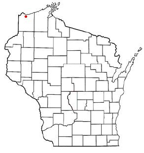
Parkland is a town in Douglas County, Wisconsin, United States. The population was 1,240 at the 2000 census. The unincorporated communities of Cutter, Parkland, Peyton, South Itasca, Sunnyside and South Range are in the town.

Knapp is a village in Dunn County, Wisconsin, United States. The population was 463 at the 2010 census.

Tichigan is a census-designated place (CDP) in Racine County, Wisconsin, United States. The population was 5,277 at the 2020 census.

Oneida is an unincorporated community and former census-designated place (CDP) in the Town of Oneida, Outagamie County, Wisconsin, United States. The population was 1,070 at the 2000 census. At the census, part of the CDP lay within the Town of Hobart, which has since incorporated as a village, in adjacent Brown County. Oneida is located on Wisconsin Highway 54.

Hingham is a census-designated place (CDP) in the town of Hingham in Plymouth County, Massachusetts, United States. The population was 5,650 at the 2010 census.

Windsor is a village and former town in Dane County, Wisconsin. The population was 8,754 at the time of the 2020 census. The communities of Lake Windsor, Morrisonville, and Token Creek are located within the village. Windsor voted to incorporate as a village on November 3, 2015; prior to its incorporation, it was a town, and a portion of the town was a census-designated place. Windsor is a part of the Census Bureau's Madison metropolitan statistical area.

The Village of Superior is a village in Douglas County, Wisconsin, United States. The population was 664 at the 2010 census. The village is located within the Town of Superior and is located immediately south of and adjacent to the City of Superior.


