St. Croix County, Wisconsin

Last updated

Saint Croix County
St. Croix County Courthouse 1.jpg
Map of Wisconsin highlighting Saint Croix County.svg
Location within the U.S. state of Wisconsin
Wisconsin in United States.svg
Wisconsin's location within the U.S.
Coordinates: 45°02′N92°27′W / 45.04°N 92.45°W / 45.04; -92.45
CountryFlag of the United States.svg United States
StateFlag of Wisconsin.svg  Wisconsin
Founded1849
Named for St. Croix River
Seat Hudson
Largest cityHudson
Area
  Total736 sq mi (1,910 km2)
  Land722 sq mi (1,870 km2)
  Water13 sq mi (30 km2)  1.8%%
Population
 (2020) [1]
  Total93,536
  Density129.5/sq mi (50.0/km2)
Time zone UTC−6 (Central)
  Summer (DST) UTC−5 (CDT)
Congressional district 7th
Website www.sccwi.gov

St. Croix County is a county in the U.S. state of Wisconsin. As of the 2020 census, the population was 93,536. [1] Its county seat is Hudson. [2] The county was created in 1840 (then in the Wisconsin Territory) and organized in 1849. [3] St. Croix County is part of the Minneapolis-St. Paul-Bloomington, MN-WI Metropolitan Statistical Area. Between 2000 and 2010, it was the fastest-growing county in Wisconsin. [4]

Contents

Soils of St. Croix County St. Croix Co WI Chart 2016 Wiki Version.pdf
Soils of St. Croix County
Soils of Willow River State Park area Willow River State Park Soils.jpg
Soils of Willow River State Park area

History

St. Croix County of 1840 and today StCroixCoWI-Hist.jpg
St. Croix County of 1840 and today

St. Croix County was created on August 3, 1840 [5] by the legislature of the Wisconsin Territory. It was named after the river on its western border. [6] Sources vary on the origin of the name; the St. Croix River may have been named after Monsieur St. Croix, an explorer who drowned at the mouth of the river late in the seventeenth century. Another account credits Father Hennepin with giving this region the French name Ste Croix (Holy Cross) because of the burial markers located at the mouth of the river. [7]

La Pointe County (now extinct, see Bayfield County) was created from the northern portions of Wisconsin Territory's St. Croix County on February 19, 1845. [8] When Wisconsin was admitted into the union as a state on May 29, 1848, the territorial St. Croix County was further divided, with the territory from the Mississippi River to the current border of Minnesota continuing as de facto Wisconsin Territory until on March 3, 1849, [9] [10] [11] it and unorganized federal territory lying north of Iowa were used in the creation of the Minnesota Territory. [12] Itasca, Washington, Ramsey and Benton Counties were created by the Minnesota Territory on October 27, 1849 [13] from the de facto Wisconsin Territory that had been separated from the Wisconsin Territory's La Pointe County.

The part of St. Croix County allocated to Wisconsin became the parental county to Pierce and Polk Counties, and formed significant portions of Dunn, Barron, Washburn and Burnett Counties.

On June 12, 1899, a deadly F5 tornado struck New Richmond. The tornado's damage path was 400 yards (370 m) wide and 46 miles (74 km) long. The tornado formed on the banks of the St. Croix River, south of Hudson. Moving to the northeast across St. Croix County, the tornado passed through the villages of Burkhardt and Boardman before striking New Richmond head on leveling the entire business district and half the town's residences. The storm continued on towards the northeast, narrowly missing the town of Deer Park before crossing into Polk County, where it again narrowly missed the towns of Clear Lake, Richardson and Clayton. Once the tornado passed into Barron County, it struck the village of Arland (No reported fatalities or serious injuries) before breaking up southwest of Barron. The tornado killed 117 people (Four at Boardman, two in Polk County and the rest at New Richmond), including at least 20 people who died from their injuries in the days after the storm. Largely in thanks to state aid and donations, most of the town was rebuilt by the following winter. Today, the tornado stands as the deadliest ever recorded in Wisconsin and the 9th deadliest tornado in U.S. history.
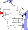
Geography

According to the U.S. Census Bureau, the county has a total area of 736 square miles (1,910 km2), of which 722 square miles (1,870 km2) is land and 13 square miles (34 km2) (1.8%) is water. [14]

Major highways

Railroads

Buses

Airport

New Richmond Regional Airport (KRNH) serves the county and surrounding communities.

National protected area

Adjacent counties

Demographics

Historical population
CensusPop.Note
1840 809
1850 624−22.9%
1860 5,392764.1%
1870 11,035104.7%
1880 18,95671.8%
1890 23,13922.1%
1900 26,83016.0%
1910 25,910−3.4%
1920 26,1060.8%
1930 25,455−2.5%
1940 24,842−2.4%
1950 25,9054.3%
1960 29,16412.6%
1970 34,35417.8%
1980 43,26225.9%
1990 50,25116.2%
2000 63,15525.7%
2010 84,34533.6%
2020 93,53610.9%
U.S. Decennial Census [15]
1790–1960 [16] 1900–1990 [17]
1990–2000 [18] 2010–2020 [19]

2020 census

As of the census of 2020, [1] the population was 93,536. The population density was 129.5 inhabitants per square mile (50.0/km2). There were 37,369 housing units at an average density of 51.7 per square mile (20.0/km2). The racial makeup of the county was 92.2% White, 1.1% Asian, 0.7% Black or African American, 0.3% Native American, 1.1% from other races, and 4.5% from two or more races. Ethnically, the population was 2.9% Hispanic or Latino of any race.

2000 Census Age Pyramid for St. Croix County. USA St. Croix County, Wisconsin age pyramid.svg
2000 Census Age Pyramid for St. Croix County.

2000 census

As of the census [20] of 2000, there were 63,155 people, 23,410 households, and 16,948 families residing in the county. The population density was 88 inhabitants per square mile (34/km2). There were 24,265 housing units at an average density of 34 per square mile (13/km2). The racial makeup of the county was 97.85% White, 0.28% Black or African American, 0.25% Native American, 0.62% Asian, 0.02% Pacific Islander, 0.22% from other races, and 0.76% from two or more races. 0.76% of the population were Hispanic or Latino of any race. 34.4% were of German, 19.3% Norwegian, 8.2% Irish and 5.4% Swedish ancestry.

There were 23,410 households, out of which 38.00% had children under the age of 18 living with them, 61.60% were married couples living together, and 27.60% were non-families. 21.20% of all households were made up of individuals, and 7.30% had someone living alone who was 65 years of age or older. The average household size was 2.66 and the average family size was 3.12.

In the county, the population was spread out, with 27.90% under the age of 18, 8.20% from 18 to 24, 32.20% from 25 to 44, 21.90% from 45 to 64, and 9.90% who were 65 years of age or older. The median age was 35 years. For every 100 females there were 100.20 males. For every 100 females age 18 and over, there were 98.50 males.

In 2017, there were 988 births, giving a general fertility rate of 59.0 births per 1000 women aged 15–44, the 25th lowest rate out of all 72 Wisconsin counties. [21] [22]

Communities

The sign for St. Croix County on US63 St. Croix County Wisconsin Sign US63.jpg
The sign for St. Croix County on US63

Cities

Villages

Towns

Census-designated places

Unincorporated communities

Politics

United States presidential election results for St. Croix County, Wisconsin [23]
Year Republican Democratic Third party
No.%No.%No.%
2020 32,19956.78%23,19040.89%1,3182.32%
2016 26,22255.19%17,48236.80%3,8048.01%
2012 25,50355.17%19,91043.07%8121.76%
2008 22,83750.95%21,17747.25%8071.80%
2004 22,67954.21%18,78444.90%3720.89%
2000 15,24050.88%13,07743.66%1,6375.47%
1996 8,25335.55%11,38449.04%3,57615.41%
1992 8,11431.60%10,28140.04%7,28128.36%
1988 9,96046.25%11,39252.90%1810.84%
1984 11,36752.54%10,12746.81%1410.65%
1980 9,26542.56%10,20346.87%2,29910.56%
1976 7,68541.16%10,60156.77%3862.07%
1972 8,55352.50%7,48845.96%2501.53%
1968 6,59546.61%6,80748.11%7465.27%
1964 4,56533.92%8,86465.86%290.22%
1960 7,11352.77%6,34147.05%240.18%
1956 6,95655.72%5,49944.05%290.23%
1952 7,60759.78%5,09440.03%250.20%
1948 4,32640.43%6,17357.69%2021.89%
1944 5,66053.01%4,93046.17%880.82%
1940 6,85757.74%4,89841.24%1211.02%
1936 4,31638.47%4,67941.71%2,22319.82%
1932 4,05937.94%6,37459.58%2652.48%
1928 6,85562.17%4,08337.03%880.80%
1924 3,60039.68%7187.91%4,75552.41%
1920 5,60173.34%1,63821.45%3985.21%
1916 2,73151.09%2,35244.00%2624.90%
1912 1,72837.18%1,80638.86%1,11423.97%
1908 3,22862.29%1,77334.21%1813.49%
1904 3,89868.33%1,56927.50%2384.17%
1900 3,36858.98%2,07636.36%2664.66%
1896 3,46256.38%2,47540.31%2033.31%
1892 2,46747.04%2,22042.33%55710.62%

See also

Related Research Articles

<span class="mw-page-title-main">Polk County, Wisconsin</span> County in Wisconsin, United States

Polk County is a county in the U.S. state of Wisconsin. As of the 2020 census, the population was 44,977. Its county seat is Balsam Lake. The county was created in 1853.

<span class="mw-page-title-main">Pierce County, Wisconsin</span> County in Wisconsin, United States

Pierce County is a county in the U.S. state of Wisconsin. As of the 2020 census, the population was 42,212. Its county seat is Ellsworth.

<span class="mw-page-title-main">Dunn County, Wisconsin</span> County in Wisconsin, United States

Dunn County is a county in the U.S. state of Wisconsin. As of the 2020 census, the population was 45,440. Its county seat is Menomonie. Dunn County comprises the Menomonie Micropolitan Statistical Area and is included in the Eau Claire-Menomonie, WI Combined Statistical Area.

<span class="mw-page-title-main">Burnett County, Wisconsin</span> County in Wisconsin, United States

Burnett County is a county located in the U.S. state of Wisconsin. As of the 2020 census, the population was 16,526. Its county seat is Siren, with the majority of county governmental services located at the Burnett County Government Center. The county was created in 1856 and organized in 1865. The St. Croix Chippewa Indians of Wisconsin have reservation lands in Burnett County and are the county's largest employer.

<span class="mw-page-title-main">Barron County, Wisconsin</span> County in Wisconsin, United States

Barron County is a county located in the U.S. state of Wisconsin. As of the 2020 census, the population was 46,711. Its county seat is Barron. The county was created in 1859 and later organized in 1874.

<span class="mw-page-title-main">Winona County, Minnesota</span> County in Minnesota, United States

Winona County is a county in the U.S. state of Minnesota. As of the 2020 census, its population was 49,671. Its county seat is Winona. Winona County comprises the Winona, MN Micropolitan Statistical Area.

<span class="mw-page-title-main">Washington County, Minnesota</span> County in Minnesota, United States

Washington County is a county in the U.S. state of Minnesota. As of the 2020 census, the population was 267,568, making it the fifth-most populous county in Minnesota. Its county seat is Stillwater. The largest city in the county is Woodbury, the eighth-largest city in Minnesota and the fourth-largest Twin Cities suburb.

<span class="mw-page-title-main">Pennington County, Minnesota</span> County in Minnesota, United States

Pennington County is a county in the northwestern part of the U.S. state of Minnesota. As of the 2020 census, the population was 13,992. Its county seat is Thief River Falls.

<span class="mw-page-title-main">Lakeland, Minnesota</span> City in Minnesota, United States

Lakeland is a city in Washington County, Minnesota, United States. The population was 1,796 at the 2010 census.

<span class="mw-page-title-main">Anderson, Burnett County, Wisconsin</span> Town in Wisconsin, United States

Anderson is a town in Burnett County in the U.S. state of Wisconsin. The population was 398 at the 2010 census. The unincorporated communities of Benson, Randall, and Trade River are located within the town.

<span class="mw-page-title-main">Prescott, Wisconsin</span> City in Wisconsin, United States

Prescott is a city in Pierce County, Wisconsin at the confluence of the St. Croix River and Mississippi River. The population was 4,258 at the 2010 census, making it the second-largest city in the county after River Falls, and the largest entirely within Pierce County.

<span class="mw-page-title-main">New Richmond, Wisconsin</span> City in Wisconsin, United States

New Richmond is a city in St. Croix County, Wisconsin, United States. Its population was 10,079 as of the 2020 census.

<span class="mw-page-title-main">Almena (town), Wisconsin</span>

The Town of Almena is in Barron County in the U.S. state of Wisconsin. The population was 858 at the 2010 census. The Village of Almena is partially located within the town.

<span class="mw-page-title-main">Turtle Lake, Wisconsin</span> Village in Wisconsin, United States

Turtle Lake is a village in Barron and Polk counties in the U.S. state of Wisconsin. Its population was 1,064 at the 2010 census. Of these, 972 were in Barron County and 93 were in Polk County. The village is located between the towns of Almena, in Barron County, and Beaver, in Polk County.

<span class="mw-page-title-main">River Falls, Wisconsin</span> City in Wisconsin, United States

River Falls is a city in Pierce and St. Croix counties in the U.S. state of Wisconsin. It is adjacent to the Town of River Falls in Pierce County and the Town of Kinnickinnic in St. Croix County. River Falls is the most populous city in Pierce County. The population was 16,182 at the 2020 census, with 11,851 residing in Pierce County and 3,149 in St. Croix County. It is part of the Minneapolis-St. Paul metropolitan area and located approximately 30 miles (48 km) east of the center of that region.

<span class="mw-page-title-main">St. Croix Falls (town), Wisconsin</span> Town in Wisconsin, United States

St. Croix Falls is a town in Polk County, Wisconsin, United States. The population was 1,119 at the 2000 census. The City of St. Croix Falls is located within the town. The unincorporated community of Lamar is located in the town.

<span class="mw-page-title-main">St. Croix Falls, Wisconsin</span> City in Wisconsin, United States

St. Croix Falls is a city in Polk County, Wisconsin, United States. The population was 2,208 at the 2020 census. The city is located within the Town of St. Croix Falls.

<span class="mw-page-title-main">Hudson, Wisconsin</span> City in Wisconsin, United States

Hudson is a city in St. Croix County, Wisconsin, United States. As of the 2020 United States census, its population was 14,755. It is part of the Minneapolis–St. Paul Metropolitan Statistical Area (MSA). The village of North Hudson is directly north of Hudson.

<span class="mw-page-title-main">1899 New Richmond tornado</span> 1899 severe windstorm in northwest Wisconsin, United States

The 1899 New Richmond tornado was an estimated F5 tornado which formed on the early evening of Monday, June 12, 1899 and tore a 45-mile path of destruction through the St. Croix, Polk and Barron counties in west-central Wisconsin. It caused 117 fatalities, twice as many injured, and hundreds homeless. The worst devastation brought by the tornado was at the city of New Richmond, Wisconsin, which took a direct hit from the storm. Over half the town was left in ruins by the tornado, which also caused minor damage to the surrounding communities in the area. More than $300,000 (USD) in damage was reported. As of 2019, it ranks as the ninth deadliest tornado in United States history, as well as the deadliest ever recorded in Wisconsin.

<span class="mw-page-title-main">St. Croix Chippewa Indians of Wisconsin</span>

The St. Croix Chippewa Indians of Wisconsin are a federally recognized tribe of Ojibwe people located in Northwest Wisconsin, along the St. Croix River valley and watershed. The band had 1,054 members as of 2010.

References

  1. 1 2 3 "2020 Decennial Census: St. Croix County, Wisconsin". data.census.gov. U.S. Census Bureau. Retrieved July 5, 2022.
  2. "Find a County". National Association of Counties. Retrieved June 7, 2011.
  3. "Wisconsin: Individual County Chronologies". Wisconsin Atlas of Historical County Boundaries. The Newberry Library. 2007. Archived from the original on April 14, 2017. Retrieved August 15, 2015.
  4. "Urban areas siphon Wisconsin's rural residents - USATODAY.com". USATODAY.COM. Retrieved August 14, 2018.
  5. Laws of the Territory of Wisconsin. Belmont and Milwaukee, 1836–1848. no. 20, sec. 1/pp. 25-6
  6. "Winnebago Took Its Name from an Indian Tribe". The Post-Crescent. December 28, 1963. p. 14. Retrieved August 25, 2014 via Newspapers.com. Open Access logo PLoS transparent.svg
  7. "Archived copy" (PDF). Archived from the original (PDF) on July 26, 2011. Retrieved August 19, 2008.{{cite web}}: CS1 maint: archived copy as title (link) History of St. Croix County
  8. Laws of the Territory of Wisconsin. Belmont and Milwaukee, 1836–1848. 1845 pp. 52-3
  9. Statutes at Large of the United States of America, 1789–1873. 17 vols. Boston: Little, Brown, 1845–1874. vol. 9, ch. 89 [1846]/pp. 56-58
  10. Statutes at Large of the United States of America, 1789–1873. 17 vols. Boston: Little, Brown, 1845–1874. vol. 9, ch. 50 [1848]/pp. 233-235
  11. Van Zandt, Franklin K. Boundaries of the United States and the Several States. Geological Survey Professional Paper 909. Washington, D.C.: Government Printing Office, 1976. pp. 128-130
  12. Statutes at Large of the United States of America, 1789–1873. 17 vols. Boston: Little, Brown, 1845–1874.vol. 9, ch. 121 [1849]/pp. 403-9
  13. Session Laws of the Territory of Minnesota. St. Paul, 1850-1857. [1849] ch. 5, secs. 2-5, 7-9, 19-20/pp. 7-9
  14. "2010 Census Gazetteer Files". United States Census Bureau. August 22, 2012. Retrieved August 9, 2015.
  15. "U.S. Decennial Census". United States Census Bureau. Retrieved August 9, 2015.
  16. "Historical Census Browser". University of Virginia Library. Retrieved August 9, 2015.
  17. Forstall, Richard L., ed. (March 27, 1995). "Population of Counties by Decennial Census: 1900 to 1990". United States Census Bureau. Retrieved August 9, 2015.
  18. "Census 2000 PHC-T-4. Ranking Tables for Counties: 1990 and 2000" (PDF). United States Census Bureau. April 2, 2001. Archived (PDF) from the original on October 9, 2022. Retrieved August 9, 2015.
  19. "State & County QuickFacts". United States Census Bureau. Retrieved January 23, 2014.
  20. "U.S. Census website". United States Census Bureau . Retrieved May 14, 2011.
  21. "Annual Wisconsin Birth and Infant Mortality Report, 2017 P-01161-19 (June 2019): Detailed Tables". Archived from the original on June 19, 2019. Retrieved June 20, 2019.
  22. Office of Health Informatics, Division of Public Health, Wisconsin Department of Health Services. Section: Trend Information, 2013–2017, Table 18, pages 17-18
  23. Leip, David. "Dave Leip's Atlas of U.S. Presidential Elections". uselectionatlas.org. Retrieved November 9, 2020.

Further reading

Coordinates: 45°02′N92°27′W / 45.04°N 92.45°W / 45.04; -92.45