Wilson, St. Croix County, Wisconsin

Last updated
Wilson
Village
St. Croix County Wisconsin Incorporated and Unincorporated areas Wilson Highlighted.svg
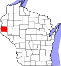
Location of Wilson in St. Croix County, Wisconsin.
USA Wisconsin location map.svg
Red pog.svg
Wilson
Location within the state of Wisconsin
Coordinates: 44°57′15″N92°10′31″W / 44.95417°N 92.17528°W / 44.95417; -92.17528 Coordinates: 44°57′15″N92°10′31″W / 44.95417°N 92.17528°W / 44.95417; -92.17528
Country Flag of the United States.svg  United States
State Flag of Wisconsin.svg  Wisconsin
County St. Croix
Area
[1]
  Total1.71 sq mi (4.42 km2)
  Land1.71 sq mi (4.42 km2)
  Water0.00 sq mi (0.00 km2)
Population
 (2010) [2]
  Total184
  Estimate 
(2019) [3]
185
  Density108.44/sq mi (41.87/km2)
Time zone UTC-6 (Central (CST))
  Summer (DST) UTC-5 (CDT)
Area code(s) 715 & 534
FIPS code 55-87475
GNIS feature ID1584447

Wilson is a village in St. Croix County, Wisconsin, United States. The population was 184 at the 2010 census.

Contents

History

Wilson was founded in 1870. [4] It was named for Captain William Wilson, a businessperson in the lumber industry. [4] A post office has been in operation in Wilson since 1873. [5]

Geography

Wilson is located at 44°57′15″N92°10′31″W / 44.95417°N 92.17528°W / 44.95417; -92.17528 (44.954167, -92.175180). [6]

According to the United States Census Bureau, the village has a total area of 1.63 square miles (4.22 km2), all of it land. [7]

Demographics

Historical population
CensusPop.
1880 442
1890 393−11.1%
1920 222
1930 200−9.9%
1940 188−6.0%
1950 174−7.4%
1960 140−19.5%
1970 130−7.1%
1980 15519.2%
1990 1635.2%
2000 1768.0%
2010 1844.5%
2019 (est.)185 [3] 0.5%
U.S. Decennial Census [8]

2010 census

As of the census [2] of 2010, there were 184 people, 72 households, and 54 families living in the village. The population density was 112.9 inhabitants per square mile (43.6/km2). There were 78 housing units at an average density of 47.9 per square mile (18.5/km2). The racial makeup of the village was 97.8% White, 0.5% Native American, and 1.6% from two or more races. Hispanic or Latino of any race were 0.5% of the population.

There were 72 households, of which 34.7% had children under the age of 18 living with them, 65.3% were married couples living together, 6.9% had a female householder with no husband present, 2.8% had a male householder with no wife present, and 25.0% were non-families. 18.1% of all households were made up of individuals, and 11.1% had someone living alone who was 65 years of age or older. The average household size was 2.56 and the average family size was 2.91.

The median age in the village was 39.5 years. 24.5% of residents were under the age of 18; 4.4% were between the ages of 18 and 24; 28.8% were from 25 to 44; 32.1% were from 45 to 64; and 10.3% were 65 years of age or older. The gender makeup of the village was 50.5% male and 49.5% female.

2000 census

As of the census [9] of 2000, there were 176 people, 66 households, and 52 families living in the village. The population density was 113.5 inhabitants per square mile (43.8/km2). There were 69 housing units at an average density of 44.5 per square mile (17.2/km2). The racial makeup of the village was 95.45% White, 3.98% Asian, and 0.57% from two or more races. Hispanic or Latino of any race were 1.14% of the population.

There were 66 households, out of which 34.8% had children under the age of 18 living with them, 71.2% were married couples living together, 3.0% had a female householder with no husband present, and 21.2% were non-families. 18.2% of all households were made up of individuals, and 10.6% had someone living alone who was 65 years of age or older. The average household size was 2.67 and the average family size was 3.02.

In the village, the population was spread out, with 25.0% under the age of 18, 6.3% from 18 to 24, 32.4% from 25 to 44, 19.3% from 45 to 64, and 17.0% who were 65 years of age or older. The median age was 36 years. For every 100 females, there were 112.0 males. For every 100 females age 18 and over, there were 91.3 males.

The median income for a household in the village was $35,893, and the median income for a family was $43,438. Males had a median income of $33,125 versus $30,417 for females. The per capita income for the village was $17,389. None of the families and 6.4% of the population were living below the poverty line, including no under eighteens and 29.0% of those over 64.

Notable people

Related Research Articles

<span class="mw-page-title-main">Franklin, Arkansas</span> Town in Arkansas, United States

Franklin is a town in Izard County, Arkansas, United States. The population was 198 at the 2010 census.

<span class="mw-page-title-main">Benham, Kentucky</span> City in Kentucky, United States

Benham is a home rule-class city in Harlan County, Kentucky, in the United States. The city was formally incorporated by the General Assembly in 1961. The population was 500 at the 2010 census and estimated in 2018 to be 434.

<span class="mw-page-title-main">Lockwood, Missouri</span> City in Missouri, United States

Lockwood is a city in Dade County, Missouri, United States. The population was 846 at the 2020 census.

<span class="mw-page-title-main">Wilson City, Missouri</span> Village in Missouri, United States

Wilson City is a village in Mississippi County, Missouri, United States. The population was 77 at the 2020 census.

<span class="mw-page-title-main">Weston, Nebraska</span> Village in Nebraska, United States

Weston is a village in Saunders County, Nebraska, United States. The population was 324 at the 2010 census.

<span class="mw-page-title-main">Ambrose, North Dakota</span> City in North Dakota, United States

Ambrose is a city in Divide County, North Dakota, United States. The population was 24 at the 2020 census. Ambrose was founded in 1906.

<span class="mw-page-title-main">Gordon, Ohio</span> Village in Ohio, United States

Gordon is a village in Darke County, Ohio, United States. The population was 212 at the 2010 census.

<span class="mw-page-title-main">New Weston, Ohio</span> Village in Ohio, United States

New Weston is a village in Darke County, Ohio, United States. The population was 136 at the 2010 census.

<span class="mw-page-title-main">Osgood, Ohio</span> Village in Ohio, United States

Osgood is a village in Darke County, Ohio, United States. The population was 302 at the 2010 census.

<span class="mw-page-title-main">Palestine, Ohio</span> Village in Ohio, United States

Palestine is a village in Darke County, Ohio, United States. The population was 200 at the 2010 census.

<span class="mw-page-title-main">Yorkshire, Ohio</span> Village in Ohio, United States

Yorkshire is a village in Darke County, Ohio, United States. The population was 99 at the 2010 census.

<span class="mw-page-title-main">Aquilla, Ohio</span> Village in Ohio, United States

Aquilla is a village in Geauga County, Ohio, United States. The population was 340 at the 2010 census. This represented a very slight change from the 386 people who were reported there by the 1950 census.

Maple Glen is a census-designated place (CDP) in Montgomery County, Pennsylvania, United States. The population was 6,742 at the 2010 census.

<span class="mw-page-title-main">Wickerham Manor-Fisher, Pennsylvania</span> Census-designated place in Pennsylvania, United States

Wickerham Manor-Fisher is a census-designated place (CDP) in Washington County, Pennsylvania, United States. The population was 1,728 at the 2010 census.

<span class="mw-page-title-main">Windsor Heights, West Virginia</span> Village in West Virginia, United States

Windsor Heights is a village in Brooke County, West Virginia, United States. It is part of the Wheeling, West Virginia Metropolitan Statistical Area. The population was 423 at the 2010 census. Grace Davis was the mayor as of June, 2017.

<span class="mw-page-title-main">Bay City, Wisconsin</span> Village in Wisconsin, United States

Bay City is a village on the Mississippi River in Pierce County, Wisconsin, United States. The population was 500 at the 2010 census.

<span class="mw-page-title-main">Wilson, Ohio</span> Village in Ohio, United States

Wilson is a village in Belmont and Monroe counties in the U.S. state of Ohio. The population was 129 at the 2020 census. It is part of the Wheeling metropolitan area.

<span class="mw-page-title-main">Burkettsville, Ohio</span> Village in Ohio, United States

Burkettsville is a village in Darke and Mercer counties in the U.S. state of Ohio. The population was 244 at the 2010 census. The current mayor is Joe Stammen.

<span class="mw-page-title-main">Wilton, Wisconsin</span> Village in Wisconsin, United States

Wilton is a village in Monroe County, Wisconsin, United States. The population was 504 at the 2010 census. The village is located partially within the Town of Wilton and partially within the Town of Wellington.

<span class="mw-page-title-main">Orange Township, Kalkaska County, Michigan</span> Civil township in Michigan, United States

Orange Township is a civil township of Kalkaska County in the U.S. state of Michigan. The population was 1,233 at the 2010 census.

References

  1. "2019 U.S. Gazetteer Files". United States Census Bureau. Retrieved August 7, 2020.
  2. 1 2 "U.S. Census website". United States Census Bureau . Retrieved 2012-11-18.
  3. 1 2 "Population and Housing Unit Estimates". United States Census Bureau. May 24, 2020. Retrieved May 27, 2020.
  4. 1 2 Chicago and North Western Railway Company (1908). A History of the Origin of the Place Names Connected with the Chicago & North Western and Chicago, St. Paul, Minneapolis & Omaha Railways. p. 196.
  5. "Saint Croix County". Jim Forte Postal History. Retrieved 5 April 2015.
  6. "US Gazetteer files: 2010, 2000, and 1990". United States Census Bureau. 2011-02-12. Retrieved 2011-04-23.
  7. "US Gazetteer files 2010". United States Census Bureau . Retrieved 2012-11-18.
  8. "Census of Population and Housing". Census.gov. Retrieved June 4, 2015.
  9. "U.S. Census website". United States Census Bureau . Retrieved 2008-01-31.
  10. Wilson's Ken Dahlberg park to be dedicated Saturday