Somerset, Wisconsin | |
---|---|
Coordinates: 45°8′30″N92°42′9″W / 45.14167°N 92.70250°W | |
Country | United States |
State | Wisconsin |
County | St. Croix |
Area | |
• Total | 3.33 sq mi (8.62 km2) |
• Land | 3.33 sq mi (8.62 km2) |
• Water | 0.00 sq mi (0.00 km2) |
Elevation | 961 ft (293 m) |
Population | |
• Total | 2,635 |
• Estimate (2019) [4] | 2,920 |
• Density | 877.93/sq mi (338.94/km2) |
Time zone | UTC-6 (Central (CST)) |
• Summer (DST) | UTC-5 (CDT) |
Area code(s) | 715 & 534 |
FIPS code | 55-74700 [5] |
GNIS feature ID | 1581724 [2] |
Website | www |
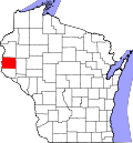
Somerset is a village in St. Croix County, Wisconsin, along the Apple River. The population was 2,635 at the 2010 census. The village is located within the Town of Somerset.
Somerset was named by General Samuel Harriman after his father's home of Somerset, England. [6] Somerset has a lengthy and colorful history. Before the turn of the century Somerset was bordered on the south by cranberry bogs. The terrain naturally lent itself to the production of cranberries as a result of the hilliness of the area, which is dotted with ponds, sloughs, swamps and bogs. These wet areas became of greater interest to the local population during Prohibition. These same low spots where water collected became ideal for collecting water for the production of moonshine (homemade alcoholic beverages). Indeed, Somerset already had a history of being a rough logging town, and it was only a natural progression to become the supplier of bootlegged alcohol to the twin cities of Saint Paul and Minneapolis. After Prohibition ended, the citizens of Somerset returned to the more humble activities of logging and farming.
Somerset is located at 45°7′30″N92°40′30″W / 45.12500°N 92.67500°W (45.125189, -92.6752). [7]
According to the United States Census Bureau, the village has a total area of 2.75 square miles (7.12 km2), all of it land. [8] The Apple River runs through Somerset.
Wisconsin Highways 35 and 64, and County Roads C, I, and VV are main routes in the community.
Census | Pop. | Note | %± |
---|---|---|---|
1880 | 77 | — | |
1920 | 406 | — | |
1930 | 480 | 18.2% | |
1940 | 476 | −0.8% | |
1950 | 531 | 11.6% | |
1960 | 729 | 37.3% | |
1970 | 778 | 6.7% | |
1980 | 860 | 10.5% | |
1990 | 1,072 | 24.7% | |
2000 | 1,556 | 45.1% | |
2010 | 2,635 | 69.3% | |
2019 (est.) | 2,920 | [4] | 10.8% |
U.S. Decennial Census [9] |
As of the census [3] of 2010, there were 2,635 people, 990 households, and 654 families living in the village. The population density was 958.2 inhabitants per square mile (370.0/km2). There were 1,102 housing units at an average density of 400.7 per square mile (154.7/km2). The racial makeup of the village was 93.1% White, 1.0% African American, 0.6% Native American, 0.8% Asian, 2.0% from other races, and 2.5% from two or more races. Hispanic or Latino of any race were 5.1% of the population.
There were 990 households, of which 44.6% had children under the age of 18 living with them, 43.8% were married couples living together, 14.8% had a female householder with no husband present, 7.4% had a male householder with no wife present, and 33.9% were non-families. 23.8% of all households were made up of individuals, and 6% had someone living alone who was 65 years of age or older. The average household size was 2.64 and the average family size was 3.15.
The median age in the village was 29.6 years. 32.1% of residents were under the age of 18; 8.7% were between the ages of 18 and 24; 36.3% were from 25 to 44; 17.4% were from 45 to 64; and 5.5% were 65 years of age or older. The gender makeup of the village was 48.9% male and 51.1% female.
As of the census [5] of 2000, there were 1,556 people, 635 households, and 391 families living in the village. The population density was 844.1 inhabitants per square mile (325.9/km2). There were 659 housing units at an average density of 357.5 per square mile (138.0/km2). The racial makeup of the village was 96.85% White, 0.77% Black or African American, 0.45% Native American, 0.06% Asian, 0.45% from other races, and 1.41% from two or more races. 1.16% of the population were Hispanic or Latino of any race.
There were 635 households, out of which 39.4% had children under the age of 18 living with them, 40.8% were married couples living together, 14.3% had a female householder with no husband present, and 38.4% were non-families. 26.8% of all households were made up of individuals, and 8.2% had someone living alone who was 65 years of age or older. The average household size was 2.45 and the average family size was 2.99.
In the village, the population was spread out, with 30.1% under the age of 18, 13.4% from 18 to 24, 36.8% from 25 to 44, 12.9% from 45 to 64, and 6.9% who were 65 years of age or older. The median age was 27 years. For every 100 females, there were 93.3 males. For every 100 females age 18 and over, there were 94.8 males.
The median income for a household in the village was $45,194, and the median income for a family was $47,426. Males had a median income of $36,827 versus $25,605 for females. The per capita income for the village was $19,170. About 6.3% of families and 7.3% of the population were below the poverty line, including 7.8% of those under age 18 and 29.0% of those age 65 or over.
Somerset's village president is Mike Kappers. [10]
Somerset High School serves students in grades nine through twelve. Somerset Middle School is the local middle school for students in grades five through eight. Somerset Elementary School is the local elementary school for students in junior kindergarten through fourth grade. All of these schools are located on the Somerset School district campus.
Somerset has several camping and tubing establishments along the Apple River. Outfitters in the area provide rentals and transportation for tubing on the river. [11] Every summer concerts are held at the Somerset Amphitheater. The Avett Brothers, Slipknot, Ozzy Osbourne, Kenny Chesney, The Lumineers, Hootie and the Blowfish, and Pretty Lights are just some of the previous headliners. Somerset also hosted the Tough Mudder and The Border Battle Beer Fest. Every June, Somerset also holds its annual Pea Soup Days. There's a carnival, parade, and late night band playing. It takes place in the Village Park.
Somerset is a village in Perry County, Ohio, United States. The population as of the 2020 census was 1,481. It is located 9.5 miles north of the county seat New Lexington and has a dedicated historical district. Saint Joseph Church, the oldest Catholic church in Ohio, is located just outside Somerset on State Route 383.
Fall River is a village in Columbia County, Wisconsin, United States, along the North Fork of the Crawfish River. The population was 1,712 at the 2010 census. It is part of the Madison Metropolitan Statistical Area.
Neosho is a village in Dodge County, Wisconsin, United States. The population was 574 at the 2010 census.
Monticello is a village in Green County, Wisconsin, United States. The population was 1,217 as of the 2010 census.
Taylor is a village in Jackson County, Wisconsin, United States, along the Trempealeau River. The population was 484 at the 2020 census.
Brokaw is a former village in Marathon County, Wisconsin, United States. It is part of the Wausau, Wisconsin Metropolitan Statistical Area. The population was 251 at the 2010 census. Brokaw merged with the village of Maine, Wisconsin on October 1, 2018.
Conrath is a village in Rusk County, Wisconsin, United States. The population was 95 at the 2010 census.
Chaseburg is a village in Vernon County, Wisconsin, United States. The population was 284 at the 2010 census.
Viola is a village in Richland (mostly) and Vernon counties in the U.S. state of Wisconsin. The population was 699 at the 2010 census. Of this, 477 were in Richland County, and 222 were in Vernon County.
Dallas is a village in Barron County in the U.S. state of Wisconsin. The population was 409 at the 2010 census. The village is located within the Town of Dallas.
Unity is a village in Clark and Marathon counties in the U.S. state of Wisconsin. It is part of the Wausau, Wisconsin Metropolitan Statistical Area. The population was 343 at the 2010 census. Of this, 204 were in Marathon County, and 139 were in Clark County. The village is located in northeastern town of Unity in Clark County and northwestern town of Brighton in Marathon County.
Eden is a village in Fond du Lac County, Wisconsin, United States. The population was 884 at the 2020 census. The village is located within the Town of Eden.
Mount Hope is a village in Grant County, Wisconsin, United States. The population was 225 at the 2010 census. The village is located within the Town of Mount Hope.
Melrose is a village in Jackson County, Wisconsin, United States. The population was 503 at the 2010 census. The village is located within the Town of Melrose.
Elderon is a village in Marathon County, Wisconsin, United States. It is part of the Wausau, Wisconsin Metropolitan Statistical Area. The population was 179 at the 2010 census.
Balsam Lake is a village in, and the county seat of Polk County, Wisconsin, United States. The population was 1,009 at the 2010 census. The village is located within the Town of Balsam Lake.
Milltown is a village in Polk County, Wisconsin, United States. The population was 917 at the 2010 census. The village is located within the Town of Milltown.
Aniwa is a village in Shawano County, Wisconsin, United States. The population was 260 at the 2010 census. The village is located within the Town of Aniwa. U.S. Route 45 runs north–south through the village.
Somerset is a town in St. Croix County, Wisconsin, United States. The population was 4,036 at the 2010 census. The Village of Somerset is adjacent to the town.
Star Prairie is a village in St. Croix County in the U.S. state of Wisconsin. The population was 561 at the 2010 census. The village is located along the Apple River on the boundary between the Town of Star Prairie and the Town of Stanton.