Erin Prairie, Wisconsin | |
---|---|
Location of Erin Prairie, Wisconsin | |
Coordinates: 45°5′12″N92°25′36″W / 45.08667°N 92.42667°W Coordinates: 45°5′12″N92°25′36″W / 45.08667°N 92.42667°W | |
Country | United States |
State | Wisconsin |
County | St. Croix |
Area | |
• Total | 35.6 sq mi (92.3 km2) |
• Land | 35.5 sq mi (91.8 km2) |
• Water | 0.2 sq mi (0.4 km2) |
Elevation | 1,083 ft (330 m) |
Population (2000) | |
• Total | 658 |
• Density | 18.6/sq mi (7.2/km2) |
Time zone | UTC-6 (Central (CST)) |
• Summer (DST) | UTC-5 (CDT) |
Area code(s) | 715 & 534 |
FIPS code | 55-24275 [2] |
GNIS feature ID | 1583172 [1] |
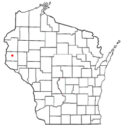
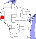
Erin Prairie is a town in St. Croix County, Wisconsin, United States. The population was 658 at the 2000 census. The unincorporated communities of Erin Corner and Jewitt are located in the town.
According to the United States Census Bureau, the town has a total area of 35.6 square miles (92.3 km2), of which, 35.5 square miles (91.8 km2) of it is land and 0.2 square miles (0.4 km2) of it (0.45%) is water.
Historical population | |||
---|---|---|---|
Census | Pop. | %± | |
2010 | 688 | — | |
2012 (est.) | 689 | 0.1% |
As of the census [2] of 2000, there were 658 people, 227 households, and 189 families residing in the town. The population density was 18.6 people per square mile (7.2/km2). There were 234 housing units at an average density of 6.6 per square mile (2.5/km2). The racial makeup of the town was 98.02% White, 0.76% African American, 0.15% Native American, 0.91% from other races, and 0.15% from two or more races. Hispanic or Latino of any race were 0.91% of the population.
There were 227 households, out of which 41.4% had children under the age of 18 living with them, 74.9% were married couples living together, 4.8% had a female householder with no husband present, and 16.7% were non-families. 12.8% of all households were made up of individuals, and 4.4% had someone living alone who was 65 years of age or older. The average household size was 2.90 and the average family size was 3.18.
In the town, the population was spread out, with 28.7% under the age of 18, 7.9% from 18 to 24, 31.8% from 25 to 44, 23.9% from 45 to 64, and 7.8% who were 65 years of age or older. The median age was 37 years. For every 100 females, there were 103.1 males. For every 100 females age 18 and over, there were 111.3 males.
The median income for a household in the town was $65,938, and the median income for a family was $72,955. Males had a median income of $45,114 versus $25,156 for females. The per capita income for the town was $23,772. About 1.1% of families and 3.0% of the population were below the poverty line, including 6.1% of those under age 18 and 8.2% of those age 65 or over.
Selmont-West Selmont is a census-designated place (CDP) in Dallas County, Alabama, United States. At the 2010 census the population was 2,671.
Quasqueton is a city in Buchanan County, Iowa, United States. The population was 554 at the 2010 census. Just northwest of the town is Cedar Rock, a home designed by Frank Lloyd Wright, which is maintained by the state as a museum.
Coggon is a city in Linn County, Iowa, United States. The population was 658 at the 2010 census. It is part of the Cedar Rapids Metropolitan Statistical Area.
Wyaconda is a city in Clark County, Missouri, United States. The population was 227 at the 2010 census. The city was organized in 1888 and is named after a Siouan name for God or the Great Spirit. The first land purchased from the Santa Fe and Land Co. was in 1888.
Belt is a town in Cascade County, Montana, United States. The population was 597 according to the 2010 census. It is part of the Great Falls, Montana metropolitan area.
Scotts Corners is a hamlet located in the town of Pound Ridge in Westchester County, New York, United States. As of the 2010 census, the CDP population was 711, making Scotts Corners Westchester County's smallest census-recognized area.
Upper Mahantongo Township is a township in Schuylkill County, Pennsylvania, United States. The population was 652 at the 2000 census.
Springdale is a town in Lexington County, South Carolina, United States. The population was 2,636 at the 2010 census. It is part of the Columbia Metropolitan Statistical Area.
East Wenatchee Bench is an unincorporated community in Douglas County, Washington, United States. Most of the area has been annexed by the city of East Wenatchee. It is part of the Wenatchee–East Wenatchee Metropolitan Statistical Area. The population was 13,658 at the 2000 census.
East Cathlamet is a census-designated place (CDP) in Wahkiakum County, Washington, on the eastern border of the town of Cathlamet. The population was 491 as of the 2010 census. The CDP includes the Indian Village Mobile Home Park community. The East Cathlamet community is part of the Wahkiakum School District, a K-12 school district of about 430 students. The name "Kathlamet" (Cathlamet) comes from the Kathlamet tribe, which in their language, means "rocky shore."
Anawalt is a town in McDowell County, West Virginia, United States. At one time it was known as Jeanette. It is named in honor of James White Anawalt, who was then manager of Union Supply Company, a subsidiary of the United States Steel Company. The population was 226 at the 2010 census. Coal mining was the town's chief industry.
Harman is a town in Randolph County, West Virginia, United States. The population was 143 at the 2010 census.
Lucas is a town in Dunn County, Wisconsin, United States. The population was 658 at the 2000 census. The unincorporated community of Hatchville is located partially in the town.
Norrie is a town in Marathon County, Wisconsin, United States. It is part of the Wausau, Wisconsin Metropolitan Statistical Area. The population was 976 at the 2010 census. The unincorporated community of Norrie is located in the town.
Lima is a town in Pepin County, Wisconsin, United States. The population was 716 at the 2000 census. The unincorporated communities of Lima and Tarrant are located in the town.
Winfield is a town in Sauk County, Wisconsin, United States. The population was 752 at the 2000 census.
Cylon is a town in St. Croix County, Wisconsin, United States. The population was 629 at the 2000 census. The unincorporated community of Cylon is located in the town.
Loveland Park is a census-designated place (CDP) located in Symmes Township, Hamilton County and Deerfield Township, Warren County, in the southwestern part of the U.S. state of Ohio. The CDP is named after the city of Loveland. The population was 1,523 at the 2010 census.
Bloomington is a town in Grant County, Wisconsin, United States. The population was 399 at the 2000 census. The Village of Bloomington is located within the town.
Reedsburg is a town in Sauk County, Wisconsin, United States. The population was 1,236 at the 2000 census. The City of Reedsburg is located within the town, though it is politically independent.