Dane County, Wisconsin

Last updated

Dane County
Madison, Wisconsin Dec04 IMG 2851.JPG
Dane County wi seal.png
Map of Wisconsin highlighting Dane County.svg
Location within the U.S. state of Wisconsin
Wisconsin in United States.svg
Wisconsin's location within the U.S.
Coordinates: 43°04′N89°25′W / 43.07°N 89.42°W / 43.07; -89.42
CountryFlag of the United States.svg United States
StateFlag of Wisconsin.svg  Wisconsin
Founded1836
Named for Nathan Dane
Seat Madison
Largest cityMadison
Government
  Executive Joe Parisi
Area
  Total1,238 sq mi (3,210 km2)
  Land1,197 sq mi (3,100 km2)
  Water41 sq mi (110 km2)  3.3%
Population
 (2020)
  Total561,504
  Density450/sq mi (180/km2)
Time zone UTC−6 (Central)
  Summer (DST) UTC−5 (CDT)
Congressional district 2nd
Website www.countyofdane.com

Dane County is a county in the U.S. state of Wisconsin. As of the 2020 census, the population was 561,504, making it the second-most populous county in Wisconsin after Milwaukee. [1] The county seat is Madison, [2] which is also the state capital.

Contents

Dane County is the central county of the Madison, Wisconsin, Metropolitan Statistical Area, as well as the Madison-Janesville-Beloit Combined Statistical Area.

History

Dane County was formed in 1836 as a territorial county and organized in 1839. [3] It was named after Nathan Dane, a Massachusetts delegate to the Congress of the Confederation who helped carve Wisconsin out of the Northwest Territory. [4] [5] Dane County was settled in the 1840s by settlers from New England. [6]

Geography

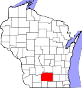
According to the U.S. Census Bureau, the county has an area of 1,238 square miles (3,210 km2), of which 1,197 square miles (3,100 km2) is land and 41 square miles (110 km2) (3.3%) is water. [7]

Soils of Dane County Dane County WI Pie Chart.pdf
Soils of Dane County

Major highways

Railroads

Freight

Buses

Public Transit

Intercity

Airports

Commercial

General Aviation

Adjacent counties

Demographics

Historical population
CensusPop.Note
1840 314
1850 16,6395,199.0%
1860 43,922164.0%
1870 53,09620.9%
1880 53,2330.3%
1890 59,57811.9%
1900 69,43516.5%
1910 77,43511.5%
1920 89,43215.5%
1930 112,73726.1%
1940 130,66015.9%
1950 169,35729.6%
1960 222,09531.1%
1970 290,27230.7%
1980 323,54511.5%
1990 367,08513.5%
2000 426,52616.2%
2010 488,07314.4%
2020 561,50415.0%
2023 (est.)575,347 [8] 2.5%
U.S. Decennial Census [9]
1790–1960 [10] 1900–1990 [11]
1990–2000 [12] 2010–2020 [13] 2020 census [14]

In 2017, there were 5,891 births, giving a general fertility rate of 51.7 births per 1000 women aged 15–44, the eighth lowest rate out of all 72 Wisconsin counties. Of these, 73 of the births occurred at home, the fifth highest number of home births for Wisconsin counties. 428 of the births were to mothers who held doctorate or professional degrees, more than any other Wisconsin county. These accounted for 7.3% of total births for the county, a higher percent than any other Wisconsin county and more than Ozaukee County which had 5.8% of births to mothers who held doctorate or professional degrees and ranked second. [15]

2020 census

As of the census of 2020, [16] the population was 561,504. The population density was 469.3 inhabitants per square mile (181.2/km2). There were 248,795 housing units at an average density of 207.9 units per square mile (80.3 units/km2). The racial makeup of the county was 77.6% White, 6.4% Asian, 5.4% Black or African American, 0.4% Native American, 3.2% from other races, and 6.9% from two or more races. Ethnically, the population was 7.5% Hispanic or Latino of any race.

2010 census

At the 2010 census there were 488,073 people, 203,750 households, and 116,752 families living in the county. The population density was 394 people per square mile (152 people/km2). There were 216,022 housing units at an average density of 174 units per square mile (67 units/km2). The racial makeup of the county was 84.7% White, 5.2% Black or African American, 0.4% Native American, 4.7% Asian, 0.003% Pacific Islander, 2.5% from other races, and 2.5% from two or more races. 5.9% of the population were Hispanic or Latino of any race. [17] Of the 203,750 households 27.0% had children under the age of 18 living with them, 45.1% were married couples living together, 8.6% had a female householder with no husband present, and 42.7% were non-families. 30.5% of households were one person and 7.7% were one person aged 65 or older. The average household size was 2.33 and the average family size was 2.95.

The age distribution was 21.7% under the age of 18, 12.8% from 18 to 24, 29.5% from 25 to 44, 25.7% from 45 to 64, and 10.3% 65 or older. The median age was 34.4 years. For every 100 females, there were 97.80 males. For every 100 females age 18 and over, there were 96.00 males.

2000 Census Age Pyramid for Dane County. USA Dane County, Wisconsin age pyramid.svg
2000 Census Age Pyramid for Dane County.

2000 census

At the 2000 census there were 426,526 people, 173,484 households, and 100,794 families living in the county. The population density was 355 people per square mile (137 people/km2). There were 180,398 housing units at an average density of 150 units per square mile (58 units/km2). The racial makeup of the county was 88.96% White, 4.00% Black or African American, 0.33% Native American, 3.45% Asian, 0.03% Pacific Islander, 1.43% from other races, and 1.79% from two or more races. 3.37% of the population were Hispanic or Latino of any race. 34.4% were of German, 11.5% Norwegian, 8.9% Irish and 6.0% English ancestry. [17] Of the 173,484 households 29.00% had children under the age of 18 living with them, 47.10% were married couples living together, 7.90% had a female householder with no husband present, and 41.90% were non-families. 29.40% of households were one person and 7.00% were one person aged 65 or older. The average household size was 2.37 and the average family size was 2.97.

The age distribution was 22.60% under the age of 18, 14.30% from 18 to 24, 32.50% from 25 to 44, 21.30% from 45 to 64, and 9.30% 65 or older. The median age was 33 years. For every 100 females, there were 97.90 males. For every 100 females age 18 and over, there were 96.00 males.

Religion

In 2010, the largest religious groups in Dane County by number of adherents were Catholic at 106,036 adherents, ELCA Lutheran at 48,620 adherents, United Methodist at 9,753 adherents, non-denominational Christian at 7,448 adherents, Evangelical Free at 6,075 adherents, United Church of Christ at 5,035 adherents, Wisconsin Synod Lutheran at 4,214 adherents, Missouri Synod Lutheran at 3,921 adherents, American Baptist at 3,755 adherents, and PC-USA Presbyterian at 3,664 adherents. [18]

Government

Dane County Courthouse Dane County Courthouse - panoramio (1).jpg
Dane County Courthouse

Dane County is governed by a county executive and a county board of supervisors. The county executive is elected in a countywide vote. The county executive is Joe Parisi. The board of supervisors consists of 37 members, each elected from single member districts. As the policy-making body of the county government, the board of supervisors enacts county ordinances, levies taxes, and appropriates money for services.

Politics

Like most other counties anchored by an urban population center and a large public university, Dane County is solidly Democratic, with a long history in the progressive movement. It has backed the Democratic presidential nominee in every election since 1932 with the exception of the two nationwide landslide victories of Dwight D. Eisenhower in 1952 and 1956, and even then, Eisenhower's margin of victory was under 3% both times. Since then, Republicans have only crossed the 35% mark six times. Only the predominantly Native American county of Menominee is more reliably Democratic.

At state level, the county is no less Democratic. The last Republicans the county supported at state level were Governor Tommy Thompson and Treasurer Jack Voight in 1994. [19] [20] The last Republican Senator to carry the county was Alexander Wiley in 1956 by less than one percent, 10 years earlier the county was the only one in the state to not vote for notorious Senator Joseph McCarthy. [21] [22] In the three-party era of 1930s-1940s, the county backed Progressive Party candidates, such as the La Follette brothers, Orland Steen Loomis and Herman Ekern. [23] [24]

Dane County is one of the only counties in the United States to have elected a member of the Green Party (Leland Pan) into county-level office.

United States presidential election results for Dane County, Wisconsin [25]
Year Republican Democratic Third party
No.%No.%No.%
2020 78,79422.86%260,12175.46%5,8131.69%
2016 71,27523.04%217,69770.37%20,3826.59%
2012 83,64427.50%216,07171.03%4,4661.47%
2008 73,06525.82%205,98472.80%3,8901.37%
2004 90,36932.95%181,05266.02%2,8281.03%
2000 75,79032.56%142,31761.15%14,6326.29%
1996 59,48730.93%109,34756.86%23,46812.20%
1992 61,95729.49%114,72454.60%33,44115.92%
1988 69,14339.30%105,41459.92%1,3770.78%
1984 74,82343.84%94,65955.46%1,2030.70%
1980 57,54534.17%85,60950.84%25,25114.99%
1976 63,46641.60%82,32153.96%6,7654.43%
1972 56,02040.88%79,56758.07%1,4391.05%
1968 39,91738.36%59,95157.61%4,1934.03%
1964 27,12428.42%68,11871.38%1840.19%
1960 43,24547.78%47,04551.98%2120.23%
1956 38,95551.11%36,89148.41%3670.48%
1952 38,72450.34%37,98749.38%2160.28%
1948 22,93437.80%35,48658.50%2,2443.70%
1944 23,02137.96%37,07661.13%5540.91%
1940 21,84534.79%40,33164.23%6110.97%
1936 15,23328.79%35,85667.77%1,8193.44%
1932 19,08339.90%26,84156.13%1,8993.97%
1928 23,68054.85%19,12644.30%3640.84%
1924 12,28031.32%2,0815.31%24,84763.37%
1920 22,84277.46%4,87916.55%1,7675.99%
1916 6,93140.13%9,85957.08%4832.80%
1912 5,24432.27%9,01755.49%1,98912.24%
1908 9,44152.42%7,81843.41%7504.16%
1904 11,04163.51%5,67932.66%6663.83%
1900 9,39658.41%6,12938.10%5623.49%
1896 9,08056.10%6,52140.29%5853.61%
1892 6,44544.93%6,83347.63%1,0687.44%

County executives

Recreation

County parks

  • Babcock County Park
  • Badger Prairie County Park
  • Blooming Grove Drumlins
  • Blue Mounds Natural Resource Area
  • Brigham County Park
  • CamRock County Park
  • Cherokee Marsh
  • Donald County Park
  • Festge County Park
  • Fish Camp County Park
  • Fish Lake County Park
  • Goodland County Park
  • Halfway Prairie School
  • Indian Lake County Park
  • Jenni & Kyle Preserve
  • La Follette County Park
  • Lake Farm County Park
  • Lake View Hill Park
  • Lussier County Park
  • McCarthy County Park
  • Mendota County Park
  • Phil's Woods County Park
  • Prairie Moraine County Park
  • Riley-Deppe County Park
  • Salmo Pond County Park
  • Scheidegger Forest
  • Schumacher Farm
  • Stewart Lake County Park
  • Token Creek County Park
  • Viking County Park
  • Walking Iron County Park
  • Yahara Heights County Park

Communities

Political map of Dane County Dane county.png
Political map of Dane County

Cities

Cities are incorporated, generally have a mayor (or a administrator/manager), an elected council, and generally provide more services than smaller administrative divisions.

Villages

Villages are incorporated, are governed by a Village President and Board of Trustees, and provide residential services.

Towns

Towns may have the same name as a city or village associated with it, but it is a separate municipality. Towns are not incorporated, are governed by a town board, and only provide limited services to residents.

Unincorporated communities

Unincorporated communities are smaller communities that are governed by the town they are located in and often exist as nomenclature in vital records.

Neighborhoods

Neighborhoods exist mostly for nomenclature purposes; some may have administrative associations with powers that are defined in the property deed covenants of the neighborhood. This is a partial list that primarily consists of former unincorporated communities that are now within the boundaries of an incorporated city or village.

Native American community

Education

School districts (all K-12) include: [26]

See also

Related Research Articles

<span class="mw-page-title-main">Vernon County, Wisconsin</span> County in Wisconsin, United States

Vernon County is a county in the U.S. state of Wisconsin. As of the 2020 census, the population was 30,714. Its county seat is Viroqua.

<span class="mw-page-title-main">Rock County, Wisconsin</span> County in Wisconsin, United States

Rock County is a county in the U.S. state of Wisconsin. As of the 2020 census, the population was 163,687. Its county seat is Janesville. Rock County comprises the Janesville-Beloit, WI Metropolitan Statistical Area and is included in the Madison-Janesville-Beloit, WI Combined Statistical Area.

<span class="mw-page-title-main">Monroe County, Wisconsin</span> County in Wisconsin, United States

Monroe County is a county in the U.S. state of Wisconsin. As of the 2020 census, the population was 46,274. Its county seat is Sparta.

<span class="mw-page-title-main">Milwaukee County, Wisconsin</span> County in Wisconsin, United States

Milwaukee County is located in the U.S. state of Wisconsin. At the 2020 census, the population was 939,489, down from 947,735 in 2010. It is both the most populous and most densely populated county in Wisconsin, and the 45th most populous county nationwide; Milwaukee, its eponymous county seat, is also the most populous city in the state. The county was created in 1834 as part of Michigan Territory and organized the following year.

<span class="mw-page-title-main">Eau Claire County, Wisconsin</span> County in Wisconsin, United States

Eau Claire County is a county located in the U.S. state of Wisconsin. As of the 2020 census, the population was 105,710. Its county seat is Eau Claire. The county took its name from the Eau Claire River.

<span class="mw-page-title-main">Columbia County, Wisconsin</span> County in Wisconsin, United States

Columbia County is a county located in the U.S. state of Wisconsin. As of the 2020 census, the population was 58,490. Its county seat and largest city is Portage. The county was created in 1846 as part of Wisconsin Territory.

<span class="mw-page-title-main">Fitchburg, Wisconsin</span> City in Wisconsin, United States

Fitchburg is a city in Dane County, Wisconsin, United States. The population was 29,609 at the 2020 census. Fitchburg is a suburb of Madison and is part of the Madison Metropolitan Statistical Area. Fitchburg consists of a mix of suburban neighborhoods closer to the border with the city of Madison, commercial and industrial properties, and more rural properties in the southern portion of the city.

<span class="mw-page-title-main">Roxbury, Wisconsin</span> Town in Wisconsin, United States

The Town of Roxbury is located in Dane County, Wisconsin, United States. The population was 1,871 at the 2020 census. The unincorporated communities of Alden Corners and Roxbury are located in the town. The unincorporated community of Lutheran Hill is also located partially in the town.

<span class="mw-page-title-main">Waunakee, Wisconsin</span> Village in Wisconsin, United States

Waunakee is a village in Dane County, Wisconsin, United States. The population was estimated at 16,165 in 2023. It is part of the Madison Metropolitan Statistical Area. Waunakee bills itself as "The Only Waunakee in the World".

<span class="mw-page-title-main">Westport, Wisconsin</span> Town in Wisconsin, United States

The Town of Westport is located in Dane County, Wisconsin, United States and a suburb of Madison. The population was 4,183 at the 2020 census. The town was named after Westport, County Mayo in Ireland because many of the early settlers were from there. The village of Waunakee was carved out of the town in 1893, leaving the remainder of the town on both sides. Other portions have been annexed by the cities of Madison and Middleton. A portion of the Town of Madison on the northern shore of Lake Mendota was transferred to the Town of Westport.

<span class="mw-page-title-main">Cambridge, Wisconsin</span> Village in Wisconsin, United States

Cambridge is a village in Dane (mostly) and Jefferson counties in the U.S. state of Wisconsin. The population was 1,638 at the 2020 census. Of this, 1,539 were in Dane County, and 99 were in Jefferson County.

<span class="mw-page-title-main">Sun Prairie, Wisconsin</span> City in Wisconsin, United States

Sun Prairie is a city in Dane County in the U.S. state of Wisconsin. A suburb of Madison, it is part of the Madison Metropolitan Statistical Area. The city's population was 35,967 at the 2020 U.S. Census. It is the second-most populous city in Dane County after Madison.

<span class="mw-page-title-main">Lodi, Wisconsin</span> City in Wisconsin, United States

Lodi is a city in Columbia County, Wisconsin, United States. The population was 3,189 at the 2020 census. Lodi is part of the Madison Metropolitan Statistical Area.

<span class="mw-page-title-main">Cross Plains, Wisconsin</span> Village in Wisconsin, United States

Cross Plains is a village in Dane County, Wisconsin, United States. The population was 4,104 at the 2020 census. The village is located partially within the Town of Cross Plains. It is part of the Madison Metropolitan Statistical Area.

<span class="mw-page-title-main">Deerfield, Wisconsin</span> City in Wisconsin, United States

Deerfield is a city in Dane County, Wisconsin. The population was 2,319 at the time of the 2010 census. The city is located within the Town of Deerfield. It is part of the Madison Metropolitan Statistical Area. Towns and villages near Deerfield include Marshall, Medina, London, Cambridge, and Cottage Grove, Wisconsin.

<span class="mw-page-title-main">Town of Madison, Wisconsin</span> Town in Wisconsin, United States

The Town of Madison was a town in Dane County, Wisconsin, United States. The population was 6,236 at the 2020 census. The remainder of the town was dissolved into the cities of Madison and Fitchburg on October 31, 2022. The majority of the town's territory was situated along the Madison Beltline Highway, comprising several neighborhoods situated between the south side of the city of Madison, and the north side of the city of Fitchburg. The town also had territory on the north side of Madison near the border with Maple Bluff, as well as a few lots on the west side of Madison near Whitney Way. The Dane County Expo Center and Alliant Energy Center was situated within the Town of Madison. Despite its status as an unincorporated community, the Town of Madison provided a variety of services to its residents which typically would only be found in incorporated cities and villages, including trash and recycling services, police, fire and emergency medical services; sewer and water utilities; and three public parks.

<span class="mw-page-title-main">Middleton, Wisconsin</span> City in Wisconsin, United States

Middleton is a city in Dane County, Wisconsin, United States, and a suburb of the state capital, Madison. Middleton's motto is "The Good Neighbor City." The population was 21,827 at the 2020 census.

<span class="mw-page-title-main">Verona, Wisconsin</span> City in Wisconsin, United States

Verona is a city in Dane County, Wisconsin, in the United States and is a suburb of Madison. The population was 14,030 at the 2020 census. The city is located ten miles southwest of downtown Madison within the Town of Verona. It is part of the Madison Metropolitan Statistical Area.

<span class="mw-page-title-main">Madison metropolitan area, Wisconsin</span> Combined Statistical Area in Wisconsin, United States

The Madison, Wisconsin, metropolitan area, also known as Greater Madison, is the metropolitan area surrounding the city of Madison, Wisconsin. Madison is the state capital of Wisconsin and is Wisconsin's second largest city, and the metropolitan area is also the state's second largest which the Madison MSA borders to its east.

<span class="mw-page-title-main">Brooklyn (village), Wisconsin</span> Place in Wisconsin, United States

Brooklyn is a village in Dane and Green counties in Wisconsin, United States. The population was 1,524 at the 2020 census, with 1,026 residents in Dane County and 498 in Green County.

References

  1. "Dane County, Wisconsin Demographics and Housing 2020 Decennial Census".
  2. "Find a County". National Association of Counties. Archived from the original on May 31, 2011. Retrieved June 7, 2011.
  3. "Wisconsin: Individual County Chronologies". Wisconsin Atlas of Historical County Boundaries. Newberry Library. 2007. Archived from the original on April 14, 2017. Retrieved August 13, 2015.
  4. "Early Wisconsin". The Milwaukee Journal, September 26, 1896.
  5. Gannett, Henry (1905). The Origin of Certain Place Names in the United States. Government Printing Office. pp.  99.
  6. Starkweather, Charles Marcus, ed. (1898). The Red Book of the Sun Prairie Methodist Episcopal Church. C. M. Starkweather.
  7. "2010 Census Gazetteer Files". United States Census Bureau. August 22, 2012. Retrieved August 4, 2015.
  8. "Annual Estimates of the Resident Population for Counties: April 1, 2020 to July 1, 2023". United States Census Bureau. Retrieved March 14, 2024.
  9. "U.S. Decennial Census". Census Bureau. Retrieved August 4, 2015.
  10. "Historical Census Browser". University of Virginia Library. Archived from the original on August 11, 2012. Retrieved August 4, 2015.
  11. Forstall, Richard L., ed. (March 27, 1995). "Population of Counties by Decennial Census: 1900 to 1990". Census Bureau. Retrieved August 4, 2015.
  12. "Census 2000 PHC-T-4. Ranking Tables for Counties: 1990 and 2000" (PDF). Census Bureau. April 2, 2001. Archived (PDF) from the original on October 9, 2022. Retrieved August 4, 2015.
  13. "Quick Facts: Dane County, Wisconsin". Census Bureau. July 1, 2018.
  14. "U.S. Census Bureau QuickFacts: Dane County, Wisconsin; United States". Archived from the original on September 24, 2020. Retrieved August 13, 2021.
  15. "Annual Wisconsin Birth and Infant Mortality Report, 2017 P-01161-19 (June 2019): Detailed Tables". Archived from the original on June 19, 2019. Retrieved June 19, 2019.
  16. "2020 Decennial Census: Dane County, Wisconsin". data.census.gov. U.S. Census Bureau. Retrieved July 2, 2022.
  17. 1 2 "U.S. Census website". Census Bureau. Retrieved May 14, 2011.
  18. thearda.com County Membership Report: Dane County (Wisconsin)
  19. "1994 Gubernatorial General Election Results - Wisconsin".
  20. "1994 State Treasurer General Election Results - Wisconsin".
  21. "1956 Senatorial General Election Results - Wisconsin".
  22. "1946 Senatorial General Election Results - Wisconsin".
  23. "Our Campaigns - WI US Senate Race - Nov 05, 1940". www.ourcampaigns.com. Retrieved May 11, 2022.
  24. "Our Campaigns - WI Governor Race - Nov 03, 1942". www.ourcampaigns.com. Retrieved May 11, 2022.
  25. Leip, David. "Dave Leip's Atlas of U.S. Presidential Elections". uselectionatlas.org. Retrieved November 11, 2020.
  26. "2020 CENSUS - SCHOOL DISTRICT REFERENCE MAP: Dane County, WI" (PDF). U.S. Census Bureau. Archived (PDF) from the original on October 9, 2022. Retrieved July 22, 2022. - Text list

Further reading

43°04′N89°25′W / 43.07°N 89.42°W / 43.07; -89.42