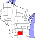
Westport, Wisconsin

Last updated

Town of Westport
Westport Town Hall.jpg
Town hall
Dane County Wisconsin incorporated and unincorporated areas Westport highlighted.svg
Location of the Town of Westport in Dane County and the state of Wisconsin.
Coordinates: 43°9′33″N89°25′33″W / 43.15917°N 89.42583°W / 43.15917; -89.42583
Country Flag of the United States.svg  United States
State Flag of Wisconsin.svg  Wisconsin
County Dane
Government
  Town Board ChairKenneth Sipsma
Area
  Total27.2 sq mi (70.5 km2)
  Land22.2 sq mi (57.6 km2)
  Water5.0 sq mi (13.0 km2)
Elevation
[1]
876 ft (267 m)
Population
 (2020)
  Total4,183
  Density161.3/sq mi (62.3/km2)
Time zone UTC-6 (Central (CST))
  Summer (DST) UTC-5 (CDT)
Area code 608
FIPS code 55-86125 [2]
GNIS feature ID1584415 [1]

The Town [3] of Westport is located in Dane County, Wisconsin, United States and a suburb of Madison. The population was 4,183 at the 2020 census. The town was named after Westport, County Mayo in Ireland because many of the early settlers were from there. [4] The village of Waunakee was carved out of the town in 1893, leaving the remainder of the town on both sides. Other portions have been annexed by the cities of Madison and Middleton. A portion of the Town of Madison on the northern shore of Lake Mendota was transferred to the Town of Westport (The remainder of the Town of Madison was later absorbed into the Cities of Madison and Fitchburg).

Contents

Geography

Westport, Wisconsin.jpg

According to the United States Census Bureau, the town has a total area of 27.2 square miles (70.6 km2), of which, 22.2 square miles (57.6 km2) of it is land and 5.0 square miles (13.0 km2) of it (18.39%) is water.

Governor Nelson State Park is located in the town.

Demographics

At the 2000 census there were 3,586 people, 1,546 households, and 1,049 families living in the town. The population density was 161.3 people per square mile (62.3/km2). There were 1,752 housing units at an average density of 78.8 per square mile (30.4/km2). The racial makeup of the town was 97.69% White, 0.61% African American, 0.17% Native American, 0.86% Asian, 0.08% Pacific Islander, 0.25% from other races, and 0.33% from two or more races. Hispanic or Latino of any race were 0.78%. [2]

Of the 1,546 households 25.3% had children under the age of 18 living with them, 62.4% were married couples living together, 3.5% had a female householder with no husband present, and 32.1% were non-families. 25.5% of households were one person and 7.6% were one person aged 65 or older. The average household size was 2.32 and the average family size was 2.80.

The age distribution was 20.8% under the age of 18, 4.7% from 18 to 24, 27.3% from 25 to 44, 32.2% from 45 to 64, and 15.0% 65 or older. The median age was 43 years. For every 100 females, there were 104.3 males. For every 100 females age 18 and over, there were 101.8 males.

The median household income was $64,750 and the median family income was $75,357. Males had a median income of $51,671 versus $34,671 for females. The per capita income for the town was $40,268. About 0.7% of families and 3.0% of the population were below the poverty line, including none of those under age 18 and 3.5% of those age 65 or over.

Notable people

Related Research Articles

<span class="mw-page-title-main">Rapids, New York</span> CDP in New York, United States

Rapids is a hamlet located in the Town of Lockport in Niagara County, New York, United States. The population was 1,636 at the 2010 census. The ZIP code for Rapids is 14094.

<span class="mw-page-title-main">Burke, Wisconsin</span> Town in Wisconsin, United States

Burke is a town in Dane County, Wisconsin, United States. The population was 3,265 at the 2020 census. The unincorporated communities of Burke and Seminary Springs are in the town.

<span class="mw-page-title-main">Waunakee, Wisconsin</span> Village in Wisconsin, United States

Waunakee is a village in Dane County, Wisconsin, United States. The population was 14,879 as of the 2020 census. A suburb of Madison, it is part of the Madison metropolitan area. Waunakee bills itself as "The Only Waunakee in the World".

<span class="mw-page-title-main">Hubbard, Dodge County, Wisconsin</span> Town in Wisconsin, United States

Hubbard is a town in Dodge County, Wisconsin, United States. The population was 1,643 at the 2000 census. The unincorporated community of Neda is located in the town. The town is named for Henry Hubbard, the governor of New Hampshire from 1842 to 1844.

<span class="mw-page-title-main">Ashford, Wisconsin</span> Town in Wisconsin, United States

Ashford is a town in Fond du Lac County, Wisconsin, United States. The population was 1,773 at the 2000 census. The unincorporated communities of Ashford and Elmore are located in the town.

<span class="mw-page-title-main">Mecan, Wisconsin</span> Town in Wisconsin, United States

Mecan is a town in Marquette County, Wisconsin, United States. The population was 726 at the 2000 census. The unincorporated community of Mecan is located in the town.

<span class="mw-page-title-main">Angelo, Wisconsin</span> Town in Wisconsin, United States

Angelo is a town in Monroe County, Wisconsin, United States. The population was 1,268 at the 2000 census. The unincorporated community of Farmers Valley is also located partially in the town.

<span class="mw-page-title-main">Doty, Wisconsin</span> Town in Wisconsin, United States

Doty is a town in Oconto County, Wisconsin, United States. The population was 309 at the 2020 census. The town was named for James Duane Doty, the first person to represent Wisconsin's third congressional district after statehood and Governor of the Utah Territory during the American Civil War. The town was platted and established in 1922. Doty was part of the town of How until 1922.

<span class="mw-page-title-main">Hubbard, Rusk County, Wisconsin</span> Town in Wisconsin, United States

Hubbard is a town in Rusk County, Wisconsin, United States. The population was 168 at the 2000 census. The town was likely named for Arthur O. Hubbard, a manufacturer based in Minnesota.

<span class="mw-page-title-main">Troy, St. Croix County, Wisconsin</span> Town in Wisconsin, United States

Troy is a town in St. Croix County, Wisconsin, United States. The population was 3,661 at the 2000 census. The unincorporated community of Glover is located in the town.

<span class="mw-page-title-main">Burnside, Wisconsin</span> Town in Wisconsin, United States

Burnside is a town in Trempealeau County, Wisconsin, in the United States. As of the 2000 census, the population was 529. The ghost town of New City was located in the town. The town was named after civil war general Ambrose Burnside.

<span class="mw-page-title-main">Dakota, Wisconsin</span> Town in Wisconsin, United States

Dakota is a town, as well as an unincorporated community in Waushara County, Wisconsin, United States. The town took its name from the community of the same name, which was platted for the community's first postmaster, Chapin M. Seeley, in 1853. It was likely named for the Dakota Territory which was in the news at the time. The unincorporated community of Bannerman is also located in the town. Bannerman was originally named Bannerman Junction in 1901 as a stop on the Chicago & Northwestern Railroad. It was named for William and John Bannerman, two Scottish men who owned the area's granite company.

<span class="mw-page-title-main">Lake Wisconsin, Wisconsin</span> CDP in Wisconsin, United States

Lake Wisconsin is a census-designated place (CDP) in Columbia and Sauk counties, in the towns of Lodi and Merrimac, in Wisconsin, United States. The population was 4,189 at the 2010 census.

Hamilton is a town in Madison County, New York, United States. The population was 6,379 at the 2020 census. The town is named after American Founding Father Alexander Hamilton, and is a college town, with Colgate University dominating the town's employment, culture and population.

<span class="mw-page-title-main">Deerfield, Wisconsin</span> Village in Wisconsin, United States

Deerfield is a village in Dane County, Wisconsin. The population was 2,319 at the time of the 2010 census. The village is located within the Town of Deerfield. It is part of the Madison Metropolitan Statistical Area. A suburb of Madison. Towns and villages near Deerfield include Stoughton, Madison, Wisconsin, Marshall, Medina, London, Lake Mills, Cambridge, and Cottage Grove, Wisconsin.

Oakfield is a town in Fond du Lac County, Wisconsin, United States. The population was 767 at the 2000 census. The Village of Oakfield is located within the town. The unincorporated community of Oak Center is also located in the town.

<span class="mw-page-title-main">Arena, Wisconsin</span> Village in Wisconsin, United States

Arena is a village in Iowa County, Wisconsin, United States. The population was 834 at the 2010 census. The village is located within the Town of Arena. It is part of the Madison Metropolitan Statistical Area.

<span class="mw-page-title-main">Waterloo, Wisconsin</span> City in Wisconsin, United States

Waterloo is a city in Jefferson County in the U.S. state of Wisconsin. As of the census of 2022, the population was 3,628. The name Waterloo was suggested by Mr. Wilt, a Frenchman living here, who was one of Napoleon's soldiers, at the battle of Waterloo. Waterloo is located in the Watertown-Fort Atkinson micropolitan area which is a sub-market of the larger Milwaukee-Racine-Waukesha CSA.

<span class="mw-page-title-main">Merton, Wisconsin</span> Town in Wisconsin, United States

Merton is a town in Waukesha County, Wisconsin, United States; before Wisconsin statehood, it was called Warren. The population was 8,277 at the 2020 census. The town surrounds the villages of Chenequa and Merton. The unincorporated communities of Camp Whitcomb, Monches, and North Lake are in the town and the unincorporated community of Stone Bank is partially in the town. The pioneer Swedish-American settlement of New Upsala was also at one time located within Merton.

<span class="mw-page-title-main">Wautoma (town), Wisconsin</span> Town in Wisconsin, United States

Wautoma is a town in Waushara County, Wisconsin, United States. The population was 1,312 at the 2000 census.

References

  1. 1 2 "US Board on Geographic Names". United States Geological Survey. October 25, 2007. Retrieved January 31, 2008.
  2. 1 2 "U.S. Census website". United States Census Bureau . Retrieved January 31, 2008.
  3. "Towns" in Wisconsin perform most of the same functions as townships in many other states. see 'Wisconsin Blue Book 2022,' Town, pp 354-355
  4. Gard, Ropbert E. (2015). The Romance of Wisconsin Place Names. Wisconsin Historical Society. pp. 733–734. ISBN   9780870207082.
  5. 'Wisconsin Blue Book 1885,' Biographical Sketch of Edward Edwin Fitz Gibbon, pg. 429
  6. 'Wisconsin Blue Book 1880,' Biographical Sketch of John H. Tierney, pg. 510

43°12′18″N90°38′28″W / 43.20500°N 90.64111°W / 43.20500; -90.64111