Muscoda, Wisconsin

Last updated

Muscoda, Wisconsin
Downtown Muscoda, WI.jpg
Downtown Muscoda
Grant County Wisconsin Incorporated and Unincorporated areas Muscoda Highlighted.svg
Location of Muscoda in Grant County, Wisconsin.
Coordinates: 43°10′29″N90°28′20″W / 43.17472°N 90.47222°W / 43.17472; -90.47222
Country Flag of the United States.svg  United States
State Flag of Wisconsin.svg  Wisconsin
Counties Grant, Iowa
Area
[1]
  Total1.55 sq mi (4.02 km2)
  Land1.55 sq mi (4.02 km2)
  Water0.00 sq mi (0.00 km2)
Elevation
[2]
725 ft (221 m)
Population
 (2010) [3]
  Total1,299
  Estimate 
(2019) [4]
1,243
  Density800.90/sq mi (309.28/km2)
Time zone UTC-6 (Central (CST))
  Summer (DST) UTC-5 (CDT)
Area code 608
FIPS code 55-55225 [5]
GNIS feature ID1583773 [2]
Website www.muscoda.com

Muscoda is a village in Grant and Iowa counties in the U.S. state of Wisconsin. The population was 1,299 at the 2010 census. Of this, 1,249 were in Grant County and 50 were in Iowa County. The Grant County part of the village is adjacent to the Town of Muscoda and the Iowa County part is adjacent to the Town of Pulaski.

Contents

History and culture

Explorer and historian William Pidgeon, who visited the area in 1840, reported that Muscoda was "the ancient location of a large Indian village, but at present occupied by a few white families. This village is situated on an extensive plain of sandy soil, on the surface of which may be seen relics of many an ancient mound, varying much in size and form; some resembling redoubts, or fortifications, others presenting the forms of gigantic men, beasts, birds, and reptiles, among which may be found the eagle, the otter, the serpent, the alligator, and others pertaining to the deer, elk, and buffalo species. The highland in the vicinity of this village abounds with monuments that bear testimony to the ancient existence of an immense population in those regions." [6]

Muscoda became known as English Prairie, named for two English fur traders, Abraham Lansing and Garrit Roseboom, who opened a post at the close of the French and Indian War. Lansing and his son were murdered in 1763 by their French assistants and the fame of the murder kept the name English Prairie alive until 1840. [7]

The word Muscoda (pronounced "MUS-co-day") may be a corruption of the Ojibwa (Chippewa) word mashkode, meaning "prairie". [8] It may also have been taken from Longfellow's Hiawatha, in which it is mentioned several times. The word's popular meaning was "Prairie of Flowers". [9]

Muscoda has billed itself as the "Wisconsin's Morel Capital" since 1982 and hosts the "Morel Mushroom Festival" every year on the weekend following Mother's Day. [10] The event includes carnival rides, tractors pulls, tournaments, merchant stands, food booths, and portable tattoo parlors.
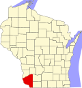
Geography

Muscoda is located at 43°11′18″N90°26′26″W / 43.18833°N 90.44056°W / 43.18833; -90.44056 (43.188457, -90.440775), [11] on the Wisconsin River. Large rolling hills board the south of the town covered in mixed hardwoods made up of mainly Maple, Red/White Oak, Aspen, Cherry, Elm, and Walnut. 2,100 acres (8.5 km2) of public land hug both the east and west sides of Muscoda. These public lands hold a great deal of wildlife for both sports and wildlife enthusiasts.

According to the United States Census Bureau, the village has a total area of 1.46 square miles (3.78 km2), all of it land. [12]

Demographics

Historical population
CensusPop.Note
1880 740
1890 605−18.2%
1900 74322.8%
1910 7987.4%
1920 90313.2%
1930 900−0.3%
1940 9020.2%
1950 1,04616.0%
1960 927−11.4%
1970 1,09918.6%
1980 1,33121.1%
1990 1,287−3.3%
2000 1,45312.9%
2010 1,299−10.6%
2019 (est.)1,243 [4] −4.3%
U.S. Decennial Census [13]

2010 census

As of the census [3] of 2010, there were 1,299 people, 569 households, and 341 families living in the village. The population density was 889.7 inhabitants per square mile (343.5/km2). There were 643 housing units at an average density of 440.4 per square mile (170.0/km2). The racial makeup of the village was 98.9% White, 0.3% African American, 0.3% Native American, 0.1% Asian, and 0.4% from two or more races. Hispanic or Latino of any race were 0.8% of the population.

There were 569 households, of which 27.9% had children under the age of 18 living with them, 42.2% were married couples living together, 10.7% had a female householder with no husband present, 7.0% had a male householder with no wife present, and 40.1% were non-families. 33.9% of all households were made up of individuals, and 13.9% had someone living alone who was 65 years of age or older. The average household size was 2.19 and the average family size was 2.74.

The median age in the village was 40.4 years. 21.6% of residents were under the age of 18; 7.7% were between the ages of 18 and 24; 26.9% were from 25 to 44; 24.3% were from 45 to 64; and 19.6% were 65 years of age or older. The gender makeup of the village was 49.8% male and 50.2% female.

2000 census

As of the census [5] of 2000, there were 1,453 people, 610 households, and 384 families living in the village. The population density was 1,069.1 people per square mile (412.5/km2). There were 661 housing units at an average density of 486.3 per square mile (187.7/km2). The racial makeup of the village was 98.42% White, 0.28% Black or African American, 0.21% Native American, 0.07% Asian, and 1.03% from two or more races. Hispanic or Latino of any race were 1.31% of the population.

There were 610 households, out of which 29.7% had children under the age of 18 living with them, 46.9% were married couples living together, 11.0% had a female householder with no husband present, and 36.9% were non-families. 32.1% of all households were made up of individuals, and 15.6% had someone living alone who was 65 years of age or older. The average household size was 2.30 and the average family size was 2.88.

In the village, the population was spread out, with 23.6% under the age of 18, 7.8% from 18 to 24, 27.3% from 25 to 44, 21.3% from 45 to 64, and 20.0% who were 65 years of age or older. The median age was 39 years. For every 100 females, there were 94.0 males. For every 100 females age 18 and over, there were 88.8 males.

The median income for a household in the village was $30,903, and the median income for a family was $38,750. Males had a median income of $29,853 versus $21,058 for females. The per capita income for the village was $15,390. About 7.9% of families and 10.2% of the population were below the poverty line, including 16.3% of those under age 18 and 9.3% of those age 65 or over.

Education

Riverdale High School, which is part of the Riverdale School District, is in Muscoda.

Related Research Articles

<span class="mw-page-title-main">Andalusia, Illinois</span> Village in Illinois, United States

Andalusia is a village in Rock Island County, Illinois, United States. The population was 1,184 at the 2020 census, up from 1,178 at the 2010 census.

<span class="mw-page-title-main">Verona, Mississippi</span> City in Mississippi, United States

Verona is a city in Lee County, Mississippi. The population was 2,792 at the 2020 census, down from 3,006 at the 2010 census.

<span class="mw-page-title-main">Fall River, Wisconsin</span> Village in Wisconsin, United States

Fall River is a village in Columbia County, Wisconsin, United States, along the North Fork of the Crawfish River. The population was 1,712 at the 2010 census. It is part of the Madison Metropolitan Statistical Area.

<span class="mw-page-title-main">Twin Lakes, Wisconsin</span> Village in Wisconsin, United States

Twin Lakes is a village in Kenosha County, Wisconsin, United States, along the Illinois-Wisconsin border east of U.S. Highway 12, incorporated in 1937. With nearly 1000 acres of surface water, the twin lakes of Mary and Elizabeth have drawn vacationers to numerous resorts as well as ice harvesters in the days of icebox refrigeration. Today, many houses there are used for recreation, and the lakes remain a popular destination. Twin Lakes is home to about 6,041 permanent residents and a third more occasional ones.

<span class="mw-page-title-main">Cashton, Wisconsin</span> Village in Wisconsin, United States

Cashton is a village in Monroe County, Wisconsin, United States. The population was 1,158 at the 2020 census.

<span class="mw-page-title-main">La Prairie, Wisconsin</span> Town in Wisconsin, United States

The Town of La Prairie is a town in Rock County, Wisconsin, United States. The population was 784 at the 2020 census. The unincorporated community of Tiffany is located partially in the town.

<span class="mw-page-title-main">Cascade, Wisconsin</span> Village in Wisconsin, United States

Cascade is a village in Sheboygan County, Wisconsin, United States. The population was 709 at the 2010 census. It is included in the Sheboygan, Wisconsin Metropolitan Statistical Area. Wisconsin Highway 28 passes through Cascade.

<span class="mw-page-title-main">Chaseburg, Wisconsin</span> Village in Wisconsin, United States

Chaseburg is a village in Vernon County, Wisconsin, United States. The population was 284 at the 2010 census.

<span class="mw-page-title-main">Stoddard, Wisconsin</span> Village in Wisconsin, United States

Stoddard is a village in Vernon County, Wisconsin, United States. The population was 840 at the 2020 census.

<span class="mw-page-title-main">De Soto, Wisconsin</span> Village in Wisconsin, United States

De Soto is a village mostly in Vernon County but also in Crawford County in Wisconsin, United States. The population was 287 at the 2010 census. Of this, 179 were in living in Vernon County, and 108 were living in Crawford County. The downtown and business area is located in Crawford County.

<span class="mw-page-title-main">Oneida, Wisconsin</span> Unincorporated community in Wisconsin, United States

Oneida is an unincorporated community and former census-designated place (CDP) in the Town of Oneida, Outagamie County, Wisconsin, United States. The population was 1,070 at the 2000 census. At the census, part of the CDP lay within the Town of Hobart, which has since incorporated as a village, in adjacent Brown County. Oneida is located on Wisconsin Highway 54.

<span class="mw-page-title-main">Prairie Farm, Wisconsin</span> Village in Wisconsin, United States

Prairie Farm is a village in Barron County in the U.S. state of Wisconsin. The population was 473 at the 2010 census. The village is located within the Town of Prairie Farm, on eastern shore of the Prairie Farm Flowage, a reservoir on the Hay River.

Prairie Farm is a town in Barron County in the U.S. state of Wisconsin. The population was 573 at the 2010 census. The village of Prairie Farm is surrounded by the town.

Nelson is a town in Buffalo County in the U.S. state of Wisconsin. The population was 571 at the 2010 census. The village of Nelson is located within the town. The unincorporated community of Misha Mokwa and railroad junction Trevino are located in the town. The unincorporated community of Urne is located partially in the town.

<span class="mw-page-title-main">Wauzeka, Wisconsin</span> Village in Wisconsin, United States

Wauzeka is a village in Crawford County, Wisconsin, United States. The population was 628 at the 2020 census. The village is located within the Town of Wauzeka near the confluence of the Kickapoo River and Wisconsin River.

<span class="mw-page-title-main">Oakdale, Wisconsin</span> Village in Wisconsin, United States

Oakdale is a village in Monroe County, Wisconsin, United States. The population was 302 at the 2020 census. The village is located within the Town of Oakdale.

The Town of Prairie du Sac is located in southwestern Sauk County, Wisconsin, United States. The population was 1,138 at the 2000 census. The Village of Prairie du Sac is located within the town. The unincorporated community of Loddes Mill is also located in the town.

<span class="mw-page-title-main">Prairie du Sac, Wisconsin</span> Village in Wisconsin, United States

Prairie du Sac is a village in Sauk County, Wisconsin, United States. The population was 4,420 at the 2020 census. The village is surrounded by the Town of Prairie du Sac, the Wisconsin River, and the village of Sauk City; together, Prairie du Sac and Sauk City are referred to as Sauk Prairie.

<span class="mw-page-title-main">Star Prairie, Wisconsin</span> Village in Wisconsin, United States

Star Prairie is a village in St. Croix County in the U.S. state of Wisconsin. The population was 561 at the 2010 census. The village is located along the Apple River on the boundary between the Town of Star Prairie and the Town of Stanton.

Star Prairie is a town in St. Croix County, Wisconsin, United States. The population was 2,944 at the 2000 census. The Village of Star Prairie is located on the eastern boundary of the town. The unincorporated communities of Huntington and Johannesburg are located in the town.

References

  1. "2019 U.S. Gazetteer Files". United States Census Bureau. Retrieved August 7, 2020.
  2. 1 2 "US Board on Geographic Names". United States Geological Survey. October 25, 2007. Retrieved January 31, 2008.
  3. 1 2 "U.S. Census website". United States Census Bureau . Retrieved November 18, 2012.
  4. 1 2 "Population and Housing Unit Estimates". United States Census Bureau. May 24, 2020. Retrieved May 27, 2020.
  5. 1 2 "U.S. Census website". United States Census Bureau . Retrieved January 31, 2008.
  6. William Pidgeon. Traditions of De-Coo-Dah and Antiquarian Researches . New York: Thayer, 1858, p. 44.
  7. English Prairie [origin of place name]
  8. Word Definition
  9. Muscoda: Origin of Muscoda, Wisconsin. Wisconsin Historical Society.
  10. Morel Mushroom Festival
  11. "US Gazetteer files: 2010, 2000, and 1990". United States Census Bureau. February 12, 2011. Retrieved April 23, 2011.
  12. "US Gazetteer files 2010". United States Census Bureau. Archived from the original on January 25, 2012. Retrieved November 18, 2012.
  13. "Census of Population and Housing". Census.gov. Retrieved June 4, 2015.

Further reading