Montfort, Wisconsin | |
---|---|
Coordinates: 42°58′17″N90°25′59″W / 42.97139°N 90.43306°W | |
Country | United States |
State | Wisconsin |
Counties | Grant, Iowa |
Incorporated | 1893 |
Area | |
• Total | 0.54 sq mi (1.39 km2) |
• Land | 0.54 sq mi (1.39 km2) |
• Water | 0.00 sq mi (0.00 km2) |
Elevation | 1,109 ft (338 m) |
Population | |
• Total | 707 |
• Estimate (2023) [4] | 715 |
• Density | 1,309.26/sq mi (508.63/km2) |
Time zone | UTC-6 (Central (CST)) |
• Summer (DST) | UTC-5 (CDT) |
Area code | 608 |
FIPS code | 55-53950 [5] |
GNIS feature ID | 1569677 [2] |
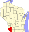
Montfort is a village in Grant and Iowa Counties in the U.S. state of Wisconsin. The population was 707 at the 2020 census.
The Iowa County portion of Montfort is part of the Madison Metropolitan Statistical Area, while the Grant County portion is part of the Platteville Micropolitan Statistical Area.
Montfort was named from an old fort situated on a nearby hill. [6] The site of the village was first platted and laid out on April 3, 1848, by Ben C. Eastman and Francis J. Dunn, who owned much of the land in this area of the town of Wingville, Wisconsin. There were about 125 residents at the time of the plat. [7] It was operated as an unincorporated settlement until it was formally incorporated as a village in 1893. The population remained quite small until the first railroad reached Montfort in 1879. It was hit by a tornado on July 28, 1885, but only one home was destroyed. [7]
The Wisconsin Farmers Union Specialty Cheese Company in Montfort produces the award-winning Montforte Blue Cheese. [8]
Montfort is located at 42°58′17″N90°25′59″W / 42.97139°N 90.43306°W (42.971399, -90.432937). [9] It is bounded on the west, north, and south, by the town of Wingville, Wisconsin, and is bounded on the east by the town of Highland, Iowa County, Wisconsin.
According to the United States Census Bureau, the village has a total area of 0.54 square miles (1.40 km2), all of it land. [10]
Census | Pop. | Note | %± |
---|---|---|---|
1880 | 64 | — | |
1890 | 407 | 535.9% | |
1900 | 627 | 54.1% | |
1910 | 558 | −11.0% | |
1920 | 598 | 7.2% | |
1930 | 554 | −7.4% | |
1940 | 615 | 11.0% | |
1950 | 576 | −6.3% | |
1960 | 538 | −6.6% | |
1970 | 518 | −3.7% | |
1980 | 616 | 18.9% | |
1990 | 676 | 9.7% | |
2000 | 663 | −1.9% | |
2010 | 718 | 8.3% | |
2020 | 707 | −1.5% | |
2023 (est.) | 715 | [4] | 1.1% |
U.S. Decennial Census [11] |
As of the census [3] of 2010, there were 718 people, 279 households, and 192 families living in the village. The population density was 1,329.6 inhabitants per square mile (513.4/km2). There were 298 housing units at an average density of 551.9 per square mile (213.1/km2). The racial makeup of the village was 98.6% White, 0.8% African American, and 0.6% from other races. Hispanic or Latino of any race were 1.3% of the population.
There were 279 households, of which 34.1% had children under the age of 18 living with them, 53.8% were married couples living together, 10.0% had a female householder with no husband present, 5.0% had a male householder with no wife present, and 31.2% were non-families. 22.2% of all households were made up of individuals, and 10% had someone living alone who was 65 years of age or older. The average household size was 2.56 and the average family size was 2.98.
The median age in the village was 35.9 years. 24.8% of residents were under the age of 18; 10.5% were between the ages of 18 and 24; 24.5% were from 25 to 44; 28.3% were from 45 to 64; and 11.8% were 65 years of age or older. The gender makeup of the village was 50.6% male and 49.4% female.
At the 2000 census, [5] there were 663 people, 252 households and 179 families living in the village. The population density was 1,252.1 per square mile (483.0/km2). There were 273 housing units at an average density of 515.6 per square mile (198.9/km2). The racial makeup of the village was 99.25% White, 0.15% African American, and 0.60% from two or more races.
There were 252 households, of which 37.7% had children under the age of 18 living with them, 55.2% were married couples living together, 11.5% had a female householder with no husband present, and 28.6% were non-families. 23.0% of all households were individuals, and 13.5% had someone living alone who was 65 years of age or older. The average household size was 2.63 and the average family size was 3.12.
In terms of age distribution, 30.3% were under the age of 18, 8.3% from 18 to 24, 26.2% from 25 to 44, 20.5% from 45 to 64, and 14.6% were 65 years of age or older. The median age was 36 years. For every 100 females, there were 95.6 males. For every 100 females age 18 and over, there were 87.0 males.
The median income for a household in the village was $37,500, and the median income for a family was $43,295. Males had a median income of $28,125 versus $21,442 for females. The per capita income for the village was $16,126. About 1.7% of families and 5.7% of the population were below the poverty line, including 4.7% of those under age 18 and 7.1% of those age 65 or over.
Harris is a city in Osceola County, Iowa, United States. The population was 151 at the time of the 2020 census.
Allouez is a village in Brown County in the U.S. state of Wisconsin. The population was 14,156 at the 2020 census. It is part of the Green Bay Metropolitan Statistical Area.
Hollandale is a village in Iowa County, Wisconsin, United States. The population was 306 at the 2020 census. It is part of the Madison Metropolitan Statistical Area.
Rewey is a village in Iowa County, Wisconsin, United States. The population was 292 at the 2010 census. It is part of the Madison Metropolitan Statistical Area.
New Diggings is a town in Lafayette County, Wisconsin, United States. The population was 502 at the 2010 census, up from 473 in 2000. The unincorporated communities of Etna, Lead Mine, and New Diggings are located in the town.
Bruce is a village in Rusk County, Wisconsin, United States. The population was 781 at the 2020 census. The village was founded in 1884 by the Sault Ste. Marie Land and Improvement Company. The land company was incorporated and led by the principal officers of the Minneapolis, Sault Ste. Marie and Atlantic Railway, which operated its ceremonial first train over its line to Bruce in November 1884. It was named for Alanson C. Bruce who operated a logging camp in the area.
Rock Springs is a village in Sauk County, Wisconsin, United States, along the Baraboo River. The population was 362 at the 2010 census.
Roberts is a village in St. Croix County, Wisconsin, United States. The population was 1,651 at the 2010 census. The village is surrounded by the town of Warren.
Butler is a village in Waukesha County, Wisconsin, United States. The population was 1,787 at the 2020 census.
Redgranite is a village in Waushara County, Wisconsin, United States. The population was 2,149 at the 2010 census.
Dorchester is a village in Clark and Marathon counties in the U.S. state of Wisconsin, along the 45th parallel. It is part of the Wausau, Wisconsin Metropolitan Statistical Area. The population was 876 at the 2010 census. Of this, 871 were in Clark County, and only 5 were in Marathon County.
De Soto is a village mostly in Vernon County but also in Crawford County in Wisconsin, United States. The population was 309 at the 2020 census, up from 287 at the 2010 census.
Birnamwood is a village in Marathon and Shawano counties in the U.S. state of Wisconsin. It is part of the Wausau, Wisconsin Metropolitan Statistical Area. The population was 818 at the 2010 census. Of this, 802 were in Shawano County, and 16 were in Marathon County. The village is located mostly within the town of Birnamwood in Shawano County; only a small portion extends into the town of Norrie in adjacent Marathon County.
Fairchild is a village in Eau Claire County, Wisconsin, United States. The population was 550 at the 2010 census. The village is located within the Town of Fairchild.
Woodman is a village in Grant County in the U.S. state of Wisconsin. The population was 132 at the 2010 census. The village is located within the Town of Woodman.
Marquette is a village in Green Lake County, Wisconsin, United States. The population was 150 at the 2010 census. The village is located within the Town of Marquette. Marquette uses the postal code 53947.
Linden is a village in Iowa County, Wisconsin, United States. The population was 549 at the 2010 census. The village is located within the Town of Linden.
Ridgeway is a town in Iowa County, Wisconsin, United States. The population was 563 at the 2020 census. The Village of Ridgeway is located within the town. The unincorporated community of Hyde is also located in the town.
Sullivan is a town in Jefferson County, Wisconsin, United States. The population was 2,208 at the 2010 census. The village of Sullivan, the census-designated place of Rome, and the unincorporated communities of Heath Mills, Oak Hill, and Slabtown are located in the town.
Oxford is a village in Marquette County, Wisconsin, United States. The population was 537 at the 2020 census. The village is located within the Town of Oxford. The Union Pacific Railroad runs through the town and over Neenah Lake to the northwest.