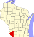
Hazel Green, Wisconsin

Last updated

Hazel Green, Wisconsin
Hazel Green Town Hall.jpg
Hazel Green Opera House
Grant County Wisconsin Incorporated and Unincorporated areas Hazel Green Highlighted.svg
Location within Grant County and Wisconsin
Coordinates: 42°33′26″N90°28′59″W / 42.55722°N 90.48306°W / 42.55722; -90.48306
Country Flag of the United States.svg  United States
State Flag of Wisconsin.svg  Wisconsin
Counties Grant, Lafayette
Founded1825
Area
[1]
  Total1.27 sq mi (3.28 km2)
  Land1.27 sq mi (3.28 km2)
  Water0.00 sq mi (0.00 km2)
Elevation
[2]
830 ft (253 m)
Population
 (2010) [3]
  Total1,256
  Estimate 
(2019) [4]
1,220
  Density963.67/sq mi (371.97/km2)
Time zone UTC-6 (Central (CST))
  Summer (DST) UTC-5 (CDT)
ZIP Code(s)
53811
Area code 608
FIPS code 55-33525 [5]
GNIS feature ID1566231 [2]
Website villageofhazelgreen.org

Hazel Green is a village in Grant and Lafayette counties in the U.S. state of Wisconsin. The population was 1,256 at the 2010 census. Of this, 1,243 were in Grant County, and only 13 were in Lafayette County. The village is located mostly within the Town of Hazel Green in Grant County; only a small portion extends into the Town of Benton in Lafayette County.

Contents

History

In 1825, the village was named from dense growth of American Hazelnut near the town site. [6]

In 1876, a tornado struck Hazel Green; nine died, many were injured, and property loss was approximately $40,000 to $50,000. [7]

Geography

Hazel Green is located at 42°31′57″N90°26′3″W / 42.53250°N 90.43417°W / 42.53250; -90.43417 (42.532741, -90.434359). [8]

According to the United States Census Bureau, the village has a total area of 1.30 square miles (3.37 km2), all of it land. [9]

Demographics

Historical population
CensusPop.Note
1870 723
1880 598−17.3%
1890 426−28.8%
1900 4423.8%
1910 62140.5%
1920 6474.2%
1930 601−7.1%
1940 582−3.2%
1950 6359.1%
1960 80727.1%
1970 98221.7%
1980 1,28230.5%
1990 1,171−8.7%
2000 1,1831.0%
2010 1,2566.2%
2019 (est.)1,220 [4] −2.9%
U.S. Decennial Census [10]

2010 census

As of the census [3] of 2010, there were 1,256 people, 531 households, and 333 families living in the village. The population density was 966.2 inhabitants per square mile (373.1/km2). There were 557 housing units at an average density of 428.5 per square mile (165.4/km2). The racial makeup of the village was 97.5% White, 0.2% African American, 0.1% Native American, 0.6% from other races, and 1.6% from two or more races. Hispanic or Latino of any race were 1.4% of the population.

There were 531 households, of which 29.4% had children under the age of 18 living with them, 49.0% were married couples living together, 9.2% had a female householder with no husband present, 4.5% had a male householder with no wife present, and 37.3% were non-families. 30.9% of all households were made up of individuals, and 11.7% had someone living alone who was 65 years of age or older. The average household size was 2.37 and the average family size was 2.99.

The median age in the village was 39.1 years. 24.9% of residents were under the age of 18; 8.8% were between the ages of 18 and 24; 24.4% were from 25 to 44; 27.5% were from 45 to 64; and 14.3% were 65 years of age or older. The gender makeup of the village was 49.1% male and 50.9% female.

2000 census

As of the census [5] of 2000, there were 1,183 people, 472 households, and 328 families living in the village. The population density was 941.8 people per square mile (362.5/km2). There were 497 housing units at an average density of 395.7 per square mile (152.3/km2). The racial makeup of the village was 99.58% White, 0.17% Black or African American, 0.08% Asian, and 0.17% from two or more races. Hispanic or Latino of any race were 0.34% of the population.

There were 472 households, out of which 31.8% had children under the age of 18 living with them, 55.7% were married couples living together, 10.2% had a female householder with no husband present, and 30.3% were non-families. 26.7% of all households were made up of individuals, and 12.1% had someone living alone who was 65 years of age or older. The average household size was 2.48 and the average family size was 2.98.

In the village, the population was spread out, with 25.8% under the age of 18, 7.7% from 18 to 24, 29.1% from 25 to 44, 23.4% from 45 to 64, and 14.0% who were 65 years of age or older. The median age was 37 years. For every 100 females, there were 89.9 males. For every 100 females age 18 and over, there were 90.0 males.

The median income for a household in the village was $39,643, and the median income for a family was $45,905. Males had a median income of $28,828 versus $19,706 for females. The per capita income for the village was $18,052. About 6.5% of families and 10.7% of the population were below the poverty line, including 19.6% of those under age 18 and 8.4% of those age 65 or over.

Notable people

Related Research Articles

<span class="mw-page-title-main">Margaret, Alabama</span> City in Alabama, United States

Margaret is a city in St. Clair County, Alabama, United States. At the 2020 census, the population was 5,106. As of the 2010 census, the population is 4,428, an increase of 278.8%. Margaret incorporated in 1960 and became a city in October 2011.

<span class="mw-page-title-main">Rodney Village, Delaware</span> CDP in Delaware, United States

Rodney Village is a census-designated place (CDP) in Kent County, Delaware, United States. It is part of the Dover, Delaware Metropolitan Statistical Area. The population was 1,487 at the 2010 census.

<span class="mw-page-title-main">Oliver, Georgia</span> City in Georgia, United States

Oliver is a city in Screven County, Georgia, United States. The population as of the 2000 census was 253.

<span class="mw-page-title-main">Hersey, Maine</span> Town in the state of Maine, United States

Hersey is a town in Aroostook County, Maine, United States. The population was 73 at the 2020 census.

Damariscotta-Newcastle was a census-designated place (CDP) in Lincoln County, Maine, United States. It designated a concentration of population around where the most developed portions of the towns of Damariscotta and Newcastle meet, generally corresponding to the "Twin Villages" area. As of the 2000 census, the CDP population was 1,751. For the 2010 census, the area was delineated as two separate CDPs, Damariscotta and Newcastle.

<span class="mw-page-title-main">Middle River, Minnesota</span> City in Minnesota, United States

Middle River is a city in Marshall County, Minnesota, United States, along the Middle River, from which the city took its name. The population was 304 at the 2020 census.

<span class="mw-page-title-main">Rives, Missouri</span> Village in Missouri, United States

Rives is a town in Dunklin County, Missouri, United States. The population was 63 at the 2010 census.

<span class="mw-page-title-main">Cuyahoga Heights, Ohio</span> Village in Ohio, United States

Cuyahoga Heights is a village in Cuyahoga County, Ohio, United States. The population was 573 at the 2020 census. A suburb of Cleveland, it is a part of the Cleveland metropolitan area.

<span class="mw-page-title-main">Millersport, Ohio</span> Village in Ohio, United States

Millersport is a village in Fairfield County, Ohio, United States. The population was 978 at the 2020 census. Millersport is most notable as the home of the Sweet Corn Festival, which is held in Millersport annually during the first week of September.

<span class="mw-page-title-main">Boston Heights, Ohio</span> Village in Ohio, United States

Boston Heights is a village in northern Summit County, Ohio, United States. The population was 1,402 at the 2020 census. It is part of the Akron metropolitan area. Boston Heights is home to the headquarters of Arhaus, a major home furnishings retailer.

<span class="mw-page-title-main">West Unity, Ohio</span> Village in Ohio, United States

West Unity is a village in Williams County, Ohio, United States. The population was 1,763 at the 2020 census.

<span class="mw-page-title-main">Fairwater, Wisconsin</span> Village in Wisconsin, United States

Fairwater is a village in Fond du Lac County, Wisconsin, United States. The population was 371 at the 2010 census. The town of Metomen surrounds the village.

<span class="mw-page-title-main">Avoca, Wisconsin</span> Village in Wisconsin, United States

Avoca is a village in Iowa County, Wisconsin, United States. The population was 637 at the 2010 census. It is part of the Madison Metropolitan Statistical Area. It is named after Avoca in Ireland.

<span class="mw-page-title-main">South Wayne, Wisconsin</span> Village in Wisconsin, United States

South Wayne is a village in Lafayette County, Wisconsin, United States. The population was 489 at the 2010 census.

<span class="mw-page-title-main">Warrens, Wisconsin</span> Village in Wisconsin, United States

Warrens is a village in Monroe County, Wisconsin, United States off I-94. The population was 363 at the 2010 census.

<span class="mw-page-title-main">La Farge, Wisconsin</span> Village in Wisconsin, United States

La Farge is a village along the Kickapoo River in Vernon County, Wisconsin, United States. Its population was 730 at the 2020 census.

<span class="mw-page-title-main">Buckeye Lake, Ohio</span> Village in Ohio, United States

Buckeye Lake is a village in Fairfield and Licking counties in the U.S. state of Ohio. The population was 2,520 at the 2020 census. It is named for Buckeye Lake, a large lake along which the village is built.

<span class="mw-page-title-main">Cazenovia, Wisconsin</span> Village in Wisconsin, United States

Cazenovia is a village in Richland and Sauk Counties in the U.S. state of Wisconsin. The population was 318 at the 2010 census. Of this, 314 were in Richland County, and only 4 were in Sauk County.

<span class="mw-page-title-main">Patch Grove, Wisconsin</span> Village in Wisconsin, United States

Patch Grove is a village in Grant County, Wisconsin, United States. The population was 198 at the 2010 census. The village is located within the Town of Patch Grove.

<span class="mw-page-title-main">Hawkins, Wisconsin</span> Village in Wisconsin, United States

Hawkins is a village in Rusk County, Wisconsin, United States. The population was 305 at the 2010 census. The village is located within the Town of Hawkins.

References

  1. "2019 U.S. Gazetteer Files". United States Census Bureau. Retrieved August 7, 2020.
  2. 1 2 "US Board on Geographic Names". United States Geological Survey. October 25, 2007. Retrieved January 31, 2008.
  3. 1 2 "U.S. Census website". United States Census Bureau . Retrieved November 18, 2012.
  4. 1 2 "Population and Housing Unit Estimates". United States Census Bureau. May 24, 2020. Retrieved May 27, 2020.
  5. 1 2 "U.S. Census website". United States Census Bureau . Retrieved January 31, 2008.
  6. Chicago and North Western Railway Company (1908). A History of the Origin of the Place Names Connected with the Chicago & North Western and Chicago, St. Paul, Minneapolis & Omaha Railways. p. 82.
  7. "The Wisconsin Tornado". The Peabody Gazette . March 24, 1876. p. 1. Retrieved May 15, 2018.
  8. "US Gazetteer files: 2010, 2000, and 1990". United States Census Bureau. February 12, 2011. Retrieved April 23, 2011.
  9. "US Gazetteer files 2010". United States Census Bureau . Retrieved November 18, 2012.
  10. "Census of Population and Housing". Census.gov. Retrieved June 4, 2015.