Potosi (town), Wisconsin

Last updated

Potosi Town Hall 02 Potosi Town Hall 02.jpg
Potosi Town Hall 02

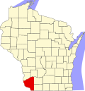
The Town [1] of Potosi is located in Grant County, Wisconsin, United States. The population was 831 at the 2000 census. The Village of Potosi and the unincorporated communities of British Hollow, Buena Vista, Rockville, and Van Buren are located in the town.

Contents

Geography

According to the United States Census Bureau, the town has a total area of 57.7 square miles (149.4 km2), of which, 46.5 square miles (120.3 km2) of it is land and 11.2 square miles (29.1 km2) of it (19.45%) is water.

Demographics

At the 2000 census there were 831 people, 299 households, and 232 families living in the town. The population density was 17.9 people per square mile (6.9/km2). There were 337 housing units at an average density of 7.3 per square mile (2.8/km2). The racial makeup of the town was 99.40% White, and 0.60% from two or more races. 0.00% of the population were Hispanic or Latino of any race. [2] Of the 299 households 36.1% had children under the age of 18 living with them, 67.9% were married couples living together, 5.0% had a female householder with no husband present, and 22.4% were non-families. 17.4% of households were one person and 4.3% were one person aged 65 or older. The average household size was 2.78 and the average family size was 3.16.

The age distribution was 28.5% under the age of 18, 7.0% from 18 to 24, 28.9% from 25 to 44, 26.6% from 45 to 64, and 9.0% 65 or older. The median age was 37 years. For every 100 females, there were 114.2 males. For every 100 females age 18 and over, there were 116.0 males.

The median household income was $42,697 and the median family income was $44,141. Males had a median income of $28,056 versus $18,929 for females. The per capita income for the town was $16,379. About 1.7% of families and 3.9% of the population were below the poverty line, including 5.9% of those under age 18 and 1.4% of those age 65 or over.

Related Research Articles

<span class="mw-page-title-main">Fairbanks Township, Michigan</span> Civil township in Michigan, United States

Fairbanks Township is a civil township of Delta County in the U.S. state of Michigan. As of the 2020 census, the township population was 297, up from 281 at the 2010 census.

<span class="mw-page-title-main">Sherman, Clark County, Wisconsin</span> Town in Wisconsin, United States

Sherman is a town in Clark County, Wisconsin, United States. The population was 831 at the 2000 census. The unincorporated community of Veefkind is located in the town. The unincorporated community of Spokeville is also located partially in the town.

<span class="mw-page-title-main">Fountain Prairie, Wisconsin</span> Town in Wisconsin, United States

Fountain Prairie is a town in Columbia County, Wisconsin, United States. The population was 810 at the 2000 census. The unincorporated community of Englewood is located in the town. The town is about 35 miles (56 km) northeast of Madison.

<span class="mw-page-title-main">Haney, Wisconsin</span> Town in Wisconsin, United States

Haney is a town in Crawford County, Wisconsin, United States. The population was 309 at the 2010 census. The unincorporated communities of Barnum and Petersburg are located within the town.

<span class="mw-page-title-main">Berry, Wisconsin</span> Town in Wisconsin, United States

Berry is a town in Dane County, Wisconsin, United States. The population was 1,168 at the 2020 census. The unincorporated community of Marxville is in the Town of Berry.

<span class="mw-page-title-main">Long Lake, Florence County, Wisconsin</span> Town in Wisconsin, United States

Long Lake is a town in Florence County, Wisconsin, United States. The population was 197 at the 2000 census. The census-designated place of Long Lake is located in the town.

<span class="mw-page-title-main">Tennyson, Wisconsin</span> Village in Wisconsin, United States

Tennyson is a village in Grant County, Wisconsin, United States, originally called Dutch Hollow. The population was 355 at the 2010 census.

<span class="mw-page-title-main">Clyde, Wisconsin</span> Town in Wisconsin, United States

Clyde is a town in Iowa County, Wisconsin, United States. The population was 322 at the 2000 census. The unincorporated community of Clyde is located in the town. The town was named by Seth Champion, a director of the Kewaunee, Green Bay & Western railroad in the 1890s, for his son Clyde.

<span class="mw-page-title-main">Cutler, Wisconsin</span> Town in Wisconsin, United States

Cutler is a town in Juneau County, Wisconsin, United States. The population was 282 at the 2000 census. The town was named in honor of Charles "Fred" Cutler, who had been the Juneau County clerk for thirty years.

<span class="mw-page-title-main">Johnson, Wisconsin</span> Town in Wisconsin, United States

The Town of Johnson is located in Marathon County, Wisconsin, United States. It is part of the Wausau, Wisconsin Metropolitan Statistical Area. The population was 985 at the 2010 census. The unincorporated communities of Corinth, Milan, and Wuertsburg are located in the town.

<span class="mw-page-title-main">Village of Maine, Wisconsin</span> Village in Wisconsin, United States

Maine is an incorporated village in Marathon County, Wisconsin, United States. It is part of the Wausau, Wisconsin Metropolitan Statistical Area. The population was 2,337 at the 2010 census. The unincorporated communities of Mount View and Taegesville are located partially in the town.

<span class="mw-page-title-main">Town of Maine, Wisconsin</span> Town in Wisconsin, United States

Maine is a town in Outagamie County, Wisconsin, United States. The population was 831 at the 2000 census. The unincorporated community of Leeman is located in the town.

<span class="mw-page-title-main">Georgetown, Polk County, Wisconsin</span> Town in Wisconsin, United States

Georgetown is a town in Polk County, Wisconsin, United States. The population was 977 at the 2010 census. The unincorporated communities of Bunyan and Fox Creek are located in the town.

<span class="mw-page-title-main">Bradford, Wisconsin</span> Town in Wisconsin, United States

The Town of Bradford is located in Rock County, Wisconsin, United States. The population was 1,013 at the 2020 census. The unincorporated communities of Avalon and Emerald Grove are located within the town. The unincorporated community of Fairfield is also located partially in the town. The town was named by William C. Chase, one of the original settlers, for his birthplace in Orange County, Vermont.

<span class="mw-page-title-main">Willard, Rusk County, Wisconsin</span> Town in Wisconsin, United States

Willard is a town in Rusk County, Wisconsin, United States. The population was 539 at the 2000 census.

<span class="mw-page-title-main">La Grange, Walworth County, Wisconsin</span> Town in Wisconsin, United States

La Grange is a town in Walworth County, Wisconsin, United States. The population was 2,472 at the 2020 census. The unincorporated communities of Heart Prairie, La Grange, Lauderdale, Lauderdale Lakes, and Lauderdale Shores are located in the town.

<span class="mw-page-title-main">Whitewater (town), Wisconsin</span>

Whitewater is a town in Walworth County, Wisconsin, United States. The population was 1,433 at the 2020 census.

Lake No. 2 is an unorganized territory in Lake County, Minnesota, United States. The population was 1,955 at the 2000 census.

Hawkins is a town in Rusk County, Wisconsin, United States. The population was 170 at the 2000 census. The Village of Hawkins is located within the town.

<span class="mw-page-title-main">Pepperell (CDP), Massachusetts</span> Census-designated place in Massachusetts, United States

Pepperell is a census-designated place (CDP) comprising the main village in the town of Pepperell in Middlesex County, Massachusetts, United States. The population was 2,390 at the 2020 census, out of 11,604 in the entire town of Pepperell.

References

  1. "Towns" in Wisconsin perform most of the same functions as townships in many other states. see 'Wisconsin Blue Book 2022,' Town, pp 354-355
  2. "U.S. Census website". United States Census Bureau . Retrieved January 31, 2008.

42°40′04″N90°42′57″W / 42.66778°N 90.71583°W / 42.66778; -90.71583