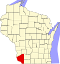
Watterstown, Wisconsin | |
---|---|
Coordinates: 43°9′49″N90°35′40″W / 43.16361°N 90.59444°W | |
Country | United States |
State | Wisconsin |
County | Grant |
Area | |
• Total | 28.8 sq mi (74.5 km2) |
• Land | 27.7 sq mi (71.8 km2) |
• Water | 1.0 sq mi (2.7 km2) |
Elevation | 735 ft (224 m) |
Population (2000) | |
• Total | 362 |
• Density | 13.1/sq mi (5.0/km2) |
Time zone | UTC-6 (Central (CST)) |
• Summer (DST) | UTC-5 (CDT) |
Area code | 608 |
FIPS code | 55-84075 [2] |
GNIS feature ID | 1584368 [1] |
Watterstown is a town in Grant County, Wisconsin, United States. The population was 362 at the 2000 census.
According to the United States Census Bureau, the town has a total area of 28.8 square miles (74.5 km2), of which, 27.7 square miles (71.8 km2) of it is land and 1.0 square miles (2.7 km2) of it (3.61%) is water.
At the 2000 census there were 362 people, 134 households, and 99 families living in the town. The population density was 13.1 people per square mile (5.0/km2). There were 171 housing units at an average density of 6.2 per square mile (2.4/km2). The racial makeup of the town was 96.13% White, 0.28% Native American, 3.31% Asian, and 0.28% from two or more races. [2] Of the 134 households 35.8% had children under the age of 18 living with them, 61.9% were married couples living together, 4.5% had a female householder with no husband present, and 25.4% were non-families. 21.6% of households were one person and 9.7% were one person aged 65 or older. The average household size was 2.70 and the average family size was 3.07.
The age distribution was 28.2% under the age of 18, 8.8% from 18 to 24, 24.9% from 25 to 44, 25.1% from 45 to 64, and 13.0% 65 or older. The median age was 40 years. For every 100 females, there were 114.2 males. For every 100 females age 18 and over, there were 109.7 males.
The median household income was $41,806 and the median family income was $44,107. Males had a median income of $27,500 versus $21,771 for females. The per capita income for the town was $15,726. About 11.5% of families and 14.3% of the population were below the poverty line, including 15.7% of those under age 18 and 23.1% of those age 65 or over.
Elmore is a town in Elmore County, Alabama, United States. Although initially incorporated in 1906, it lapsed and was not reincorporated again until 1997. At the 2010 census the population was 1,262, up from 199 in 2000. It is part of the Montgomery Metropolitan Statistical Area.
Treynor is a city in Pottawattamie County, Iowa, United States. The population was 1,032 as of the 2020 census.
Caswell is a town in Aroostook County, Maine, United States. The population was 293 at the 2020 census.
Crystal is a town in Aroostook County, Maine, United States. The population was 248 at the 2020 census.
Greenwood is a town in Oxford County, Maine, United States. The population was 774 at the 2020 census. The town was named for surveyor Alexander Greenwood. The village of Locke Mills, on State Route 26 in the northern part of Greenwood, is the town's urban center and largest settlement.
Detroit is a town in Somerset County, Maine, United States. The population was 885 at the 2020 census.
Charlotte is a town in Washington County, Maine, United States. The town was named for the wife of legislator William Vance. The population was 337 at the 2020 census.
Perry is a town in Washington County, Maine, United States, on the Canada–United States border. At the 2020 census, the town had a population of 802.
Everton is a city in southeast Dade County, Missouri, United States. The population was 273 at the 2020 census.
Barry Township is a township in Schuylkill County, Pennsylvania. Formed in 1822, it is named for American Revolutionary War Commander John Barry and was formed from parts of Norwegian and Schuylkill Townships.
Franklin Township is a township in Susquehanna County, Pennsylvania, United States. The population was 833 at the 2020 census. Salt Springs State Park, a Pennsylvania state park, is in Franklin Township.
Henderson is an unincorporated community and former town in Mason County, West Virginia, United States, at the confluence of the Ohio and Kanawha Rivers. The population was 231 at the 2020 census. It is part of the Point Pleasant, WV–OH Micropolitan Statistical Area. The town was incorporated in 1893 and named for Samuel Bruce Henderson, who owned the townsite at the time. The town was unincorporated following a public hearing on August 11, 2022.
Granville is a town in Monongalia County, West Virginia, United States. The population was 1,355 at the 2020 census. It is included in the Morgantown metropolitan area.
Newburg is a town in western Preston County, West Virginia, United States. The population was 275 at the 2020 census. It is part of the Morgantown metropolitan area.
Pullman is a town in Ritchie County, West Virginia, United States. The population was 134 at the 2020 census.
Marcellon is a town in Columbia County, Wisconsin, United States. The population was 1,024 at the 2000 census. The unincorporated community of Belle Fountain is located in the town.
Medina is a town in Dane County, Wisconsin, United States. The population was 1,235 at the 2000 census. The unincorporated community of Deansville is located in the town.
Hortonia is a town in Outagamie County, Wisconsin, United States. The population was 1,097 at the 2010 census.
Richland is a town in Richland County, Wisconsin, United States. The population was 1,364 at the 2000 census.
Helvetia is a town in Waupaca County, Wisconsin, in the United States. As of the 2000 census, the town population was 649.