Kieler, Wisconsin | |
|---|---|
 | |
 Kieler  Kieler | |
| Coordinates: 42°34′59″N90°36′20″W / 42.58306°N 90.60556°W | |
| Country | United States |
| State | Wisconsin |
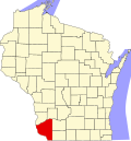
| County | Grant |
| Town | Jamestown |
| Area | |
• Total | 0.840 sq mi (2.18 km2) |
| • Land | 0.840 sq mi (2.18 km2) |
| • Water | 0 sq mi (0 km2) |
| Population | |
• Total | 557 |
| • Density | 663/sq mi (256/km2) |
| Time zone | UTC-6 (Central (CST)) |
| • Summer (DST) | UTC-5 (CDT) |
| Area code | 608 |
Kieler is an unincorporated census-designated place in the Town of Jamestown in Grant County, Wisconsin. [2] It is located about seven miles northeast of the Iowa-Wisconsin border and the city of Dubuque, Iowa, and about four miles southwest of Dickeyville, Wisconsin, along U.S. routes 61 and 151. As of the 2020 census, its population was 557, up from 497 at the 2010 census. [3]