Little Grant, Wisconsin

Last updated
Little Grant, Wisconsin
WIMap-doton-Little Grant.png
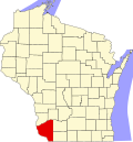
Location of Little Grant, Wisconsin
Coordinates: 42°54′14″N90°50′21″W / 42.90389°N 90.83917°W / 42.90389; -90.83917 Coordinates: 42°54′14″N90°50′21″W / 42.90389°N 90.83917°W / 42.90389; -90.83917
Country Flag of the United States.svg  United States
State Flag of Wisconsin.svg  Wisconsin
County Grant
Area
  Total36.0 sq mi (93.3 km2)
  Land36.0 sq mi (93.3 km2)
  Water0.0 sq mi (0.0 km2)
Elevation
[1]
932 ft (284 m)
Population
 (2000)
  Total257
  Density7.1/sq mi (2.8/km2)
Time zone UTC-6 (Central (CST))
  Summer (DST) UTC-5 (CDT)
Area code 608
FIPS code 55-45025 [2]
GNIS feature ID1583583 [1]
Town of Little Grant, Grant County, Wisconsin MapHighlightingTownOfLittleGrantGrantCtWI.png
Town of Little Grant, Grant County, Wisconsin

Little Grant is a town in Grant County, Wisconsin, United States. The population was 257 at the 2000 census.

Contents

Geography

According to the United States Census Bureau, the town has a total area of 36.0 square miles (93.3 km2), all of it land.

Demographics

At the 2000 census there were 257 people, 93 households, and 70 families living in the town. The population density was 7.1 people per square mile (2.8/km2). There were 99 housing units at an average density of 2.7 per square mile (1.1/km2). The racial makeup of the town was 99.22% White, 0.39% Native American, and 0.39% from two or more races. [2] Of the 93 households 39.8% had children under the age of 18 living with them, 69.9% were married couples living together, 3.2% had a female householder with no husband present, and 23.7% were non-families. 16.1% of households were one person and 5.4% were one person aged 65 or older. The average household size was 2.76 and the average family size was 3.15.

The age distribution was 27.2% under the age of 18, 10.1% from 18 to 24, 30.0% from 25 to 44, 23.3% from 45 to 64, and 9.3% 65 or older. The median age was 36 years. For every 100 females, there were 105.6 males. For every 100 females age 18 and over, there were 105.5 males.

The median household income was $35,833 and the median family income was $40,417. Males had a median income of $24,375 versus $21,806 for females. The per capita income for the town was $16,239. About 9.1% of families and 12.9% of the population were below the poverty line, including 21.2% of those under the age of 18 and none of those 65 or over.

Related Research Articles

<span class="mw-page-title-main">Woodburn, Iowa</span> City in Iowa, United States

Woodburn is a city in Clarke County, Iowa, United States. The population was 146 at the time of the 2020 census.

Newburgh is a town in Penobscot County, Maine, United States. The population was 1,595 at the time of the 2020 census.

Big Bend Township is a township in Chippewa County, Minnesota, United States. The population was 257 at the 2000 census.

<span class="mw-page-title-main">De Kalb, Missouri</span> City in Missouri, United States

De Kalb is a city in southwest Buchanan County, Missouri, United States. The population was 233 at the 2020 census. It is part of the St. Joseph, MO–KS Metropolitan Statistical Area.

<span class="mw-page-title-main">Lewis and Clark Village, Missouri</span> Village in Missouri, United States

Lewis and Clark Village is a village in Buchanan County, Missouri, United States. The population was 132 at the 2010 census. It is part of the St. Joseph, MO–KS Metropolitan Statistical Area.

<span class="mw-page-title-main">Weaubleau, Missouri</span> City in Missouri, United States

Weaubleau is a city in Hickory County, Missouri, United States, founded in 1867. The population was 378 at the 2020 census.

<span class="mw-page-title-main">Linneus, Missouri</span> City in Missouri, United States

Linneus is a small city in Linn County, Missouri, United States. The population was 281 at the 2020 census. It is the county seat of Linn County.

<span class="mw-page-title-main">Barnard, Missouri</span> City in Missouri, United States

Barnard is a city in Nodaway County, Missouri, United States. As of the 2010 census, the city population was 221.

<span class="mw-page-title-main">Wood Heights, Missouri</span> City in Missouri, United States

Wood Heights is a city in western Ray County, Missouri, and part of the Kansas City metropolitan area within the United States. The population was 757 at the 2020 census.

<span class="mw-page-title-main">Mount Leonard, Missouri</span> Village in Missouri, United States

Mount Leonard is a village in Saline County, Missouri, United States. The population was 87 at the 2010 census.

<span class="mw-page-title-main">Fairburn, South Dakota</span> Town in South Dakota, United States

Fairburn is a town in Custer County, South Dakota, United States. The population was 60 at the 2020 census.

<span class="mw-page-title-main">Kenbridge, Virginia</span> Town in Virginia, United States

Kenbridge is a town in Lunenburg County, Virginia, United States. The population was 1,257 at the 2010 census. It is in a tobacco farming area. The area is home to noted folk artist Eldridge Bagley.

<span class="mw-page-title-main">White Hall, West Virginia</span> Town in West Virginia, United States

White Hall is a town in Marion County, West Virginia, United States. The population was 706 at the 2020 census. Incorporated in 1989, White Hall is adjacent to the county seat, Fairmont, and is part of the Fairmont, West Virginia, Micropolitan Statistical Area. White Hall has many different stores and restaurants.

<span class="mw-page-title-main">Worthington, West Virginia</span> Town in West Virginia, United States

Worthington is a town in Marion County, West Virginia, United States. The population was 158 at the 2010 census. Worthington was incorporated in 1893 and named for Colonel George Worthington, an early settler. U.S. Route 19 passes through the town.

<span class="mw-page-title-main">Hartford City, West Virginia</span> Town in West Virginia, United States

Hartford City, also known as Hartford, is a town in Mason County, West Virginia, United States. The population was 509 at the 2020 census. It is part of the Point Pleasant, WV–OH Micropolitan Statistical Area.

<span class="mw-page-title-main">Vance Creek, Wisconsin</span> Town in Wisconsin, United States

Vance Creek is a town in Barron County in the U.S. state of Wisconsin. The population was 669 at the 2010 census. The unincorporated community of Reeve is located in the town. The unincorporated community of Graytown is located partially in the town.

<span class="mw-page-title-main">York, Dane County, Wisconsin</span> Town in Wisconsin, United States

h Town of York is located in Dane County, Wisconsin, United States. The population was 697 at the 2020 census. The unincorporated community of York Center is located in the town.

<span class="mw-page-title-main">North Lancaster, Wisconsin</span> Town in Wisconsin, United States

North Lancaster is a town in Grant County, Wisconsin, United States. The population was 515 at the 2000 census.

<span class="mw-page-title-main">Akan, Wisconsin</span> Town in Wisconsin, United States

Akan is a town in Richland County, Wisconsin, United States. The population was 444 at the 2000 Census. The unincorporated communities of Five Points and Jimtown are located in the town.

<span class="mw-page-title-main">Spider Lake, Wisconsin</span> Town in Wisconsin, United States

Spider Lake is a town in Sawyer County, Wisconsin, United States. The population was 391 at the 2000 census.

References

  1. 1 2 "US Board on Geographic Names". United States Geological Survey. 2007-10-25. Retrieved 2008-01-31.
  2. 1 2 "U.S. Census website". United States Census Bureau . Retrieved 2008-01-31.