Fennimore, Wisconsin

Last updated
Fennimore, Wisconsin
FennimoreWisconsinDowntown1US18US61.jpg
Downtown Fennimore on US 18/US 61
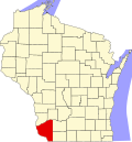
Grant County Wisconsin Incorporated and Unincorporated areas Fennimore Highlighted.svg
Location of Fennimore in Grant County, Wisconsin.
Coordinates: 42°58′56″N90°39′11″W / 42.98222°N 90.65306°W / 42.98222; -90.65306 Coordinates: 42°58′56″N90°39′11″W / 42.98222°N 90.65306°W / 42.98222; -90.65306
Country Flag of the United States.svg  United States
State Flag of Wisconsin.svg  Wisconsin
County Grant
Area
[1]
  Total1.73 sq mi (4.47 km2)
  Land1.73 sq mi (4.47 km2)
  Water0.00 sq mi (0.00 km2)
Elevation
[2]
1,194 ft (364 m)
Population
 (2010) [3]
  Total2,497
  Estimate 
(2019) [4]
2,456
  Density1,423.77/sq mi (549.62/km2)
Time zone UTC-6 (Central (CST))
  Summer (DST) UTC-5 (CDT)
Area code(s) 608
FIPS code 55-25600 [5]
GNIS feature ID1564906 [2]
Website www.fennimore.com

Fennimore is a city in Grant County, Wisconsin, United States. The population was 2,497 at the 2010 census. The city's area was separated from the Town of Fennimore, which remains as an adjacent rural area.

Contents

History

Fennimore was named for a settler who disappeared during the Black Hawk War. [6] It was previously also known as Fennimore Center. [7] Fennimore incorporated as a village in 1889 and changed to a city in 1919. [8]

Geography

According to the United States Census Bureau, the city has a total area of 1.62 square miles (4.20 km2), all of it land. [9]

Demographics

Historical population
CensusPop.
1880 295
1890 616108.8%
1900 1,03568.0%
1910 1,15912.0%
1920 1,38319.3%
1930 1,341−3.0%
1940 1,59218.7%
1950 1,6966.5%
1960 1,7473.0%
1970 1,8616.5%
1980 2,21218.9%
1990 2,3787.5%
2000 2,3870.4%
2010 2,4974.6%
Est. 20192,456 [4] −1.6%
U.S. Decennial Census [10]

2010 census

As of the census [3] of 2010, there were 2,497 people, 1,053 households, and 647 families living in the city. The population density was 1,541.4 inhabitants per square mile (595.1/km2). There were 1,145 housing units at an average density of 706.8 per square mile (272.9/km2). The racial makeup of the city was 98.2% White, 0.1% African American, 0.4% Native American, 0.5% Asian, 0.3% from other races, and 0.4% from two or more races. Hispanic or Latino of any race were 1.2% of the population.

There were 1,053 households, of which 31.0% had children under the age of 18 living with them, 45.4% were married couples living together, 11.0% had a female householder with no husband present, 5.0% had a male householder with no wife present, and 38.6% were non-families. 32.0% of all households were made up of individuals, and 13.9% had someone living alone who was 65 years of age or older. The average household size was 2.31 and the average family size was 2.89.

The median age in the city was 36.7 years. 25% of residents were under the age of 18; 9.8% were between the ages of 18 and 24; 24.2% were from 25 to 44; 23.4% were from 45 to 64; and 17.7% were 65 years of age or older. The gender makeup of the city was 48.8% male and 51.2% female.

2000 census

As of the census of 2000, there were 2,387 people, 1,021 households, and 622 families living in the city. The population density was 1,610.5 people per square mile (622.7/km2). There were 1,068 housing units at an average density of 278.6 persons/km2 (720.6 persons/sq mi). The racial makeup of the city was 99.12% White, 0.08% African American, 0.08% Native American, 0.21% Asian, 0.00% Pacific Islander, 0.34% from other races, and 0.17% from two or more races. 0.75% of the population were Hispanic or Latino of any race.

There were 1,021 households, out of which 28.0% had children under the age of 18 living with them, 48.8% were married couples living together, 9.7% have a woman whose husband does not live with her, and 39.0% were non-families. 32.0% of all households were made up of individuals, and 16.8% had someone living alone who was 65 years of age or older. The average household size was 2.27 and the average family size was 2.88.

In the city, the population was spread out, with 23.2% under the age of 18, 9.4% from 18 to 24, 25.8% from 25 to 44, 20.1% from 45 to 64, and 21.6% who were 65 years of age or older. The median age was 40 years. For every 100 females, there were 91.1 males. For every 100 females age 18 and over, there were 83.2 males.

The median income for a household in the city was $34,453, and the median income for a family was $42,287. Males had a median income of $33,095 versus $20,274 for females. The per capita income for the city was $18,701. 7.9% of the population and 4.1% of families were below the poverty line. Out of the total people living in poverty, 8.4% are under the age of 18 and 7.8% are 65 or older.

Notable people

Education

Related Research Articles

Hallock, Minnesota City in Minnesota, United States

Hallock is a city in and the county seat of Kittson County, Minnesota, United States. The population was 981 at the 2010 census.

Monticello, Green County, Wisconsin Village in Wisconsin, United States

Monticello is a village in Green County, Wisconsin, United States. The population was 1,217 as of the 2010 census.

Markesan, Wisconsin City in Wisconsin, United States

Markesan is a city in Green Lake County, Wisconsin, United States. The population was 1,476 at the 2010 census. The center of population of Wisconsin is located in Markesan.

Schleswig, Wisconsin Town in Wisconsin, United States

Schleswig is a town in Manitowoc County, Wisconsin, United States. The population was 1,900 at the 2000 census. The unincorporated communities of Louis Corners, Millhome, and Rockville are located in the town. The unincorporated community of Meggers is also located partially in the town.

Brighton, Marathon County, Wisconsin Town in Wisconsin, United States

Brighton is a town in Marathon County, Wisconsin, United States. It is part of the Wausau, Wisconsin Metropolitan Statistical Area. The population was 612 at the 2010 census.

Cudahy, Wisconsin City in Wisconsin, United States

Cudahy is a city in Milwaukee County, Wisconsin, United States, North America. The population was 18,267 at the 2010 census.

Dover, Racine County, Wisconsin Town in Wisconsin, United States

Dover is a town in Racine County, Wisconsin, United States. The population was 3,908 at the 2000 census. The unincorporated communities of Beaumont, Eagle Lake Manor, Eagle Lake Terrace, Kansasville, and Rosewood are located in the town. The census-designated place of Eagle lake is also located in the town.

Richland, Richland County, Wisconsin Town in Wisconsin, United States

Richland is a town in Richland County, Wisconsin, United States. The population was 1,364 at the 2000 census.

La Prairie, Wisconsin Town in Wisconsin, United States

La Prairie is a town in Rock County, Wisconsin, United States. The population was 929 at the 2000 census.

Lake Geneva, Wisconsin City in Wisconsin, United States

Lake Geneva is a city in Walworth County, Wisconsin, USA. The population was 7,651 at the 2010 census. A resort city located on Geneva Lake, it is popular with vacationers from the Chicago, Milwaukee, Rockford and Madison.

Whitewater is a town in Walworth County, Wisconsin, United States. The population was 1,399 at the 2000 census.

Wayne, Washington County, Wisconsin Town in Wisconsin, United States

Wayne is a town in Washington County, Wisconsin, United States. The population was 1,727 at the 2000 census. The unincorporated communities of Kohlsville and Wayne are located in the town.

Genesee, Wisconsin Town in Wisconsin, United States

Genesee is a town in Waukesha County, Wisconsin, United States. The population was 7,284 at the 2000 census. The unincorporated communities of Bethesda, Genesee Depot, and Saylesville are in the town.

Menasha, Wisconsin City in Wisconsin, United States

Menasha is a city in Calumet and Winnebago counties in the U.S. state of Wisconsin. The population was 17,353 at the 2010 census. Of this, 15,144 were in Winnebago County, and 2,209 were in Calumet County. The city is located mostly in Winnebago County; only a small portion is in the Town of Harrison in Calumet County. Doty Island is located partially in Menasha. The city's name comes from the Winnebago word meaning "thorn" or "island". In the Menominee language, it is known as Menāēhsaeh, meaning "little island". Menasha is home to the Barlow Planetarium and Weis Earth Science Museum, both housed at the University of Wisconsin-Fox Valley.

Whitewater, Wisconsin City in Wisconsin, United States

Whitewater is a city in Walworth (mostly) and Jefferson counties in the U.S. state of Wisconsin. Located near the southern portion of the Kettle Moraine State Forest, Whitewater is the home of the University of Wisconsin–Whitewater. As of the 2010 census, the city's population was 14,390. Of this, 11,150 were in Walworth County, and 3,240 were in Jefferson County.

Alma, Wisconsin City in Wisconsin, United States

Alma is a city in and the county seat of Buffalo County in the U.S. state of Wisconsin. The population was 781 at the 2010 census. The city borders the Town of Alma and the Town of Nelson, the Town of Belvidere, and Greenfield Township, Wabasha County, Minnesota. The motto for the city of Alma is: "Step into Living History."

Fennimore is a town in Grant County, Wisconsin, United States. The population was 599 at the 2000 census. The size of the town was reduced when Mount Ida was split off, and when the City of Fennimore was incorporated from a part of the town. The unincorporated community of Lancaster Junction, Wisconsin is located in the town. The unincorporated community of Preston is also located partially in the town.

Wausaukee, Wisconsin Village in Wisconsin, United States

Wausaukee is a village in Marinette County, Wisconsin, in the United States. The population was 575 at the 2010 census. The village is part of the Marinette, WI–MI Micropolitan Statistical Area.

Durand, Wisconsin City in Wisconsin, United States

Durand is the county seat of Pepin County, Wisconsin, United States. Situated on the banks of the Chippewa River approximately 15 miles (24 km) from its confluence with the Mississippi River, the city borders the Town of Durand. The population was 1,931 at the 2010 census.

Sheboygan Falls (town), Wisconsin Town in Wisconsin, United States

Sheboygan Falls is a town located in Sheboygan County, Wisconsin. As of the 2000 census, the town had a total population of 1,706. It is included in the Sheboygan, Wisconsin Metropolitan Statistical Area. The unincorporated community of Johnsonville is located in the town.

References

  1. "2019 U.S. Gazetteer Files". United States Census Bureau. Retrieved August 7, 2020.
  2. 1 2 "US Board on Geographic Names". United States Geological Survey. 2007-10-25. Retrieved 2008-01-31.
  3. 1 2 "U.S. Census website". United States Census Bureau . Retrieved 2012-11-18.
  4. 1 2 "Population and Housing Unit Estimates". United States Census Bureau. May 24, 2020. Retrieved May 27, 2020.
  5. "U.S. Census website". United States Census Bureau . Retrieved 2008-01-31.
  6. Gannett, Henry (1905). The Origin of Certain Place Names in the United States. Govt. Print. Off. pp.  125.
  7. Chicago and North Western Railway Company (1908). A History of the Origin of the Place Names Connected with the Chicago & North Western and Chicago, St. Paul, Minneapolis & Omaha Railways. p. 70.
  8. "City of Fennimore celebrates 100 years". SWNew4u.com for Fennimore Times. Retrieved December 28, 2019.
  9. "US Gazetteer files 2010". United States Census Bureau. Archived from the original on 2012-01-25. Retrieved 2012-11-18.
  10. "Census of Population and Housing". Census.gov. Retrieved June 4, 2015.
  11. 'Wisconsin Blue Book 1954,' Biographical Sketch of William A. Loy, pg. 44