Woodman, Wisconsin

Last updated
Woodman, Wisconsin
Grant County Wisconsin Incorporated and Unincorporated areas Woodman Highlighted.svg
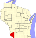
Location of Woodman in Grant County, Wisconsin.
Coordinates: 43°3′49″N90°49′23″W / 43.06361°N 90.82306°W / 43.06361; -90.82306 Coordinates: 43°3′49″N90°49′23″W / 43.06361°N 90.82306°W / 43.06361; -90.82306
Country Flag of the United States.svg  United States
State Flag of Wisconsin.svg  Wisconsin
County Grant
Area
[1]
  Total0.25 sq mi (0.64 km2)
  Land0.25 sq mi (0.64 km2)
  Water0.00 sq mi (0.00 km2)
Elevation
[2]
659 ft (201 m)
Population
 (2010) [3]
  Total132
  Estimate 
(2019) [4]
129
  Density518.07/sq mi (200.19/km2)
Time zone UTC-6 (Central (CST))
  Summer (DST) UTC-5 (CDT)
Area code(s) 608
FIPS code 55-88850 [5]
GNIS feature ID1584476 [2]

Woodman is a village in Grant County in the U.S. state of Wisconsin. The population was 132 at the 2010 census. The village is located within the Town of Woodman.

Contents

History

A post office called Woodman was established in 1863, and remained in operation until it was discontinued in 1995. [6] The village was named for Captain E. E. Woodman, a railroad official. [7]

Geography

Woodman is located at 43°5′31″N90°48′3″W / 43.09194°N 90.80083°W / 43.09194; -90.80083 (43.092098, -90.801077). [8]

According to the United States Census Bureau, the village has a total area of 0.24 square miles (0.62 km2), all of it land. [9]

Demographics

Historical population
CensusPop.
1880 111
1920 138
1930 101−26.8%
1940 1086.9%
1950 14938.0%
1960 112−24.8%
1970 102−8.9%
1980 11613.7%
1990 1203.4%
2000 96−20.0%
2010 13237.5%
Est. 2019129 [4] −2.3%
U.S. Decennial Census [10]

2010 census

As of the census [3] of 2010, there were 132 people, 49 households, and 33 families living in the village. The population density was 550.0 inhabitants per square mile (212.4/km2). There were 58 housing units at an average density of 241.7 per square mile (93.3/km2). The racial makeup of the village was 93.2% White, 1.5% African American, 1.5% Native American, and 3.8% from two or more races. Hispanic or Latino of any race were 3.0% of the population.

There were 49 households, of which 34.7% had children under the age of 18 living with them, 49.0% were married couples living together, 6.1% had a female householder with no husband present, 12.2% had a male householder with no wife present, and 32.7% were non-families. 26.5% of all households were made up of individuals, and 6.1% had someone living alone who was 65 years of age or older. The average household size was 2.69 and the average family size was 3.30.

The median age in the village was 34.7 years. 28% of residents were under the age of 18; 6% were between the ages of 18 and 24; 25.7% were from 25 to 44; 28.8% were from 45 to 64; and 11.4% were 65 years of age or older. The gender makeup of the village was 55.3% male and 44.7% female.

2000 census

As of the census [5] of 2000, there were 96 people, 45 households, and 25 families living in the village. The population density was 407.6 people per square mile (154.4/km2). There were 52 housing units at an average density of 220.8 per square mile (83.7/km2). The racial makeup of the village was 100.00% White. 0.00% of the population were Hispanic or Latino of any race.

There were 45 households, out of which 24.4% had children under the age of 18 living with them, 48.9% were married couples living together, 4.4% had a female householder with no husband present, and 44.4% were non-families. 42.2% of all households were made up of individuals, and 26.7% had someone living alone who was 65 years of age or older. The average household size was 2.13 and the average family size was 3.00.

In the village, the population was spread out, with 17.7% under the age of 18, 7.3% from 18 to 24, 24.0% from 25 to 44, 27.1% from 45 to 64, and 24.0% who were 65 years of age or older. The median age was 46 years. For every 100 females, there were 95.9 males. For every 100 females age 18 and over, there were 102.6 males.

The median income for a household in the village was $27,500, and the median income for a family was $41,875. Males had a median income of $28,750 versus $21,875 for females. The per capita income for the village was $16,363. There were no families and 8.8% of the population living below the poverty line, including no under eighteens and 21.7% of those over 64.

Related Research Articles

Woodville, California census-designated place in California, United States

Woodville is a census-designated place (CDP) in Tulare County, California, United States. The population was 1,740 at the 2010 census, up from 1,678 at the 2000 census.

St. Francis, Kansas City and County seat in Kansas, United States

St. Francis is a city in and the county seat of Cheyenne County, Kansas, United States. As of the 2010 census, the city population was 1,329.

Winton, Minnesota City in Minnesota, United States

Winton is a city in Saint Louis County, Minnesota, United States. The population was 172 at the 2010 census. The city is home to a small hydroelectric dam on the edge of Garden Lake, one of 11 stations owned by Minnesota Power.

West Union, Minnesota City in Minnesota, United States

West Union is a city in Todd County, Minnesota, United States. The population was 111 when looking at the 2010 census.

Evergreen, Missouri Village in Missouri, United States

Evergreen is a village in Laclede County, Missouri, United States. The population was 28 at the 2010 census. It was named Twin Bridges at the 2000 census.

Whiteside, Missouri Village in Missouri, United States

Whiteside is a village in union township in Lincoln County, Missouri, United States. The population was 75 at the 2010 census.

Cliff Village, Missouri Village in Missouri, United States

Cliff Village is a village in Newton County, Missouri, United States. The population was 40 at the 2010 census. It is part of the Joplin, Missouri Metropolitan Statistical Area.

Penermon, Missouri Village in Missouri, United States

Penermon is a village in Stoddard County, Missouri, United States. The population was 64 at the 2010 census.

Paradise, Montana CDP in Montana, United States

Paradise is a census-designated place (CDP) in Sanders County, Montana, United States. The population was 184 at the 2000 census.

Odell, Nebraska Village in Nebraska, United States

Odell is a village in Gage County, Nebraska, United States. The population was 307 at the 2010 census.

Clark Mills, New York CDP in New York, United States

Clark Mills is a hamlet in Oneida County, New York, United States. The population was 1,905 at the 2010 census.

Forest, Ohio Village in Ohio, United States

Forest is a village in Hardin and Wyandot counties in the U.S. state of Ohio. The population was 1,461 at the 2010 census.

Hills and Dales, Ohio Village in Ohio, United States

Hills and Dales is a village in Stark County, Ohio, United States. It is an affluent suburban enclave near Canton. Hills and Dales is part of the Canton–Massillon Metropolitan Statistical Area. The population was 221 at the 2010 census.

Bowmanstown, Pennsylvania Borough in Pennsylvania, United States

Bowmanstown is a borough in Carbon County, Pennsylvania, United States. The population was 937 at the 2010 census. Bowmanstown is at an elevation of 437 feet (133 m) and is located 3 miles (5 km) west of Palmerton and 4 miles (6 km) south of Lehighton off Route 248.

Riceville, Pennsylvania Census-designated place in Pennsylvania, United States

Riceville is a census-designated place in Crawford County, Pennsylvania, United States. The population was 68 at the 2010 census.

Melvina, Wisconsin Village in Wisconsin, United States

Melvina is a village in Monroe County, Wisconsin, United States. The population was 104 at the 2010 census.

Raymond, Wisconsin Village in Wisconsin, United States

Raymond is a village in Racine County, Wisconsin, United States. The population was 3,516 at the 2000 census. The unincorporated communities of Kneeland and Raymond are located in the town, as was the ghost town of Raymond Center. The unincorporated communities of North Cape and Union Church are also located partially in the town.

Chaseburg, Wisconsin Village in Wisconsin, United States

Chaseburg is a village in Vernon County, Wisconsin, United States. The population was 284 at the 2010 census.

Thorp, Wisconsin City in Wisconsin, United States

Thorp is a city in Clark County in the U.S. state of Wisconsin. The population was 1,621 at the 2010 census. The city is located partially within the Town of Thorp and partially within the Town of Withee.

Woodman is a town in Grant County in the U.S. state of Wisconsin. The population was 195 at the 2000 census. The Village of Woodman is located within the town.

References

  1. "2019 U.S. Gazetteer Files". United States Census Bureau. Retrieved August 7, 2020.
  2. 1 2 "US Board on Geographic Names". United States Geological Survey. 2007-10-25. Retrieved 2008-01-31.
  3. 1 2 "U.S. Census website". United States Census Bureau . Retrieved 2012-11-18.
  4. 1 2 "Population and Housing Unit Estimates". United States Census Bureau. May 24, 2020. Retrieved May 27, 2020.
  5. 1 2 "U.S. Census website". United States Census Bureau . Retrieved 2008-01-31.
  6. "Grant County". Jim Forte Postal History. Retrieved 1 April 2015.
  7. Chicago and North Western Railway Company (1908). A History of the Origin of the Place Names Connected with the Chicago & North Western and Chicago, St. Paul, Minneapolis & Omaha Railways. p. 140.
  8. "US Gazetteer files: 2010, 2000, and 1990". United States Census Bureau. 2011-02-12. Retrieved 2011-04-23.
  9. "US Gazetteer files 2010". United States Census Bureau . Retrieved 2012-11-18.
  10. "Census of Population and Housing". Census.gov. Retrieved June 4, 2015.