Cuba City, Wisconsin

Last updated

Cuba City, Wisconsin
Cuba City Depot.jpg
Former Cuba City State Bank and Post Office [2]
Motto: 
"The City of Presidents"
Grant County Wisconsin Incorporated and Unincorporated areas Cuba City Highlighted.svg
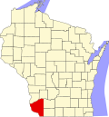
Location of Cuba City in Grant County, Wisconsin.
Coordinates: 42°36′21″N90°25′49″W / 42.60583°N 90.43028°W / 42.60583; -90.43028
Country Flag of the United States.svg  United States
State Flag of Wisconsin.svg  Wisconsin
Counties Grant, Lafayette
Area
[3]
  Total1.16 sq mi (3.00 km2)
  Land1.16 sq mi (3.00 km2)
  Water0.00 sq mi (0.00 km2)
Elevation
[4]
1,010 ft (308 m)
Population
 (2010) [5]
  Total2,086
  Estimate 
(2019) [6]
2,029
  Density1,749.14/sq mi (675.33/km2)
Time zone UTC-6 (Central (CST))
  Summer (DST) UTC-5 (CDT)
Zip Code
53807
Area code 608
FIPS code 55-17950 [7]
GNIS feature ID1563606 [4]
Website cubacity.org

Cuba City is a city partially in both Grant County and Lafayette County in the U.S. state of Wisconsin. The population was 2,086 at the 2010 census. Of this, 1,877 were in Grant County, and 209 were in Lafayette County. The city is nicknamed "The City of Presidents" because of the presidential banners displayed along the city's Main Street.

Contents

History

The history of the city began in 1836, when John Amie Merle and Mathais Comstock purchased 160 acres of land from the American Government in Grant County. The first structure in the community was erected in 1846 by Jack Deboard. Deboard is considered the first settler in Cuba City. [8]

The name "Yuba City" was finally picked after a dispute about the name of the new village, but after discovering another location had already been given that name, a new name, "Cuba City," was selected. [9] [10]

The community incorporated as a village in Grant County only in 1894. [11] The village incorporated as a city in 1925 [12] and annexed into Lafayette County between 1960 and 1970.

Geography

Cuba City is located at 42°36′21″N90°25′49″W / 42.60583°N 90.43028°W / 42.60583; -90.43028 (42.605874, -90.430274). [13]

According to the United States Census Bureau, the city has a total area of 1.08 square miles (2.80 km2), all of it land. [14] Most of the city lies in Grant County, with only a small portion in Lafayette County.

The community is located on State Highway 80.

Education

Cuba City is notable in terms of education because of its high school, Cuba City High School. Though the school is small in terms of attendance (250-300 students), it stands out in its academic and athletic performance. In 2007, it won a National Blue Ribbon Award from the National Blue Ribbon Schools Program. [15] The Cuba City Varsity Women's Basketball team has qualified for and won the Wisconsin Interscholastic Athletic Association's state basketball tournament more times than any other team since the tournament began in 1976. [16] Though its Women's Basketball team is its most successful, its Wrestling team and Track & Field team has also been somewhat successful at the state level.

Students that attend Cuba City High School matriculate from Cuba City Middle School, St. Rose of Lima Catholic School in Cuba City (serving grades K-8), and Immaculate Conception in Kieler, Wisconsin (serving grades 4-8).

Cuba City Elementary School (serving grades K-5) and Cuba City Middle School (serving grades 6-8) are located in the same building just north of the High School. As the building housing the schools is a circle, it is often affectionately called "The Round School".

Demographics

Historical population
CensusPop.Note
1880 48
1900 636
1910 96752.0%
1920 1,17521.5%
1930 1,157−1.5%
1940 1,2598.8%
1950 1,3335.9%
1960 1,67325.5%
1970 1,99319.1%
1980 2,1296.8%
1990 2,024−4.9%
2000 2,1566.5%
2010 2,086−3.2%
2019 (est.)2,029 [6] −2.7%
U.S. Decennial Census [17]

2010 census

As of the census [5] of 2010, there were 2,086 people, 847 households, and 537 families living in the city. The population density was 1,931.5 inhabitants per square mile (745.8/km2). There were 899 housing units at an average density of 832.4 per square mile (321.4/km2). The racial makeup of the city was 99.1% White, 0.2% African American, 0.1% Native American, 0.1% Asian, and 0.5% from two or more races. Hispanic or Latino of any race were 0.5% of the population.

There were 847 households, of which 29.0% had children under the age of 18 living with them, 51.0% were married couples living together, 7.8% had a female householder with no husband present, 4.6% had a male householder with no wife present, and 36.6% were non-families. 29.4% of all households were made up of individuals, and 15.4% had someone living alone who was 65 years of age or older. The average household size was 2.36 and the average family size was 2.95.

The median age in the city was 40.9 years. 23.1% of residents were under the age of 18; 8.4% were between the ages of 18 and 24; 23.4% were from 25 to 44; 23.1% were from 45 to 64; and 21.9% were 65 years of age or older. The gender makeup of the city was 48.6% male and 51.4% female.

2000 census

As of the census [7] of 2000, there were 2,156 people, 861 households, and 569 families living in the city. The population density was 1,997.1 people per square mile (770.8/km2). There were 900 housing units at an average density of 833.7 per square mile (321.8/km2). The racial makeup of the city was 99.49% White, 0.05% Native American, 0.23% Asian, and 0.23% from two or more races. Hispanic or Latino of any race were 0.09% of the population.

There were 861 households, out of which 30.7% had children under the age of 18 living with them, 56.1% were married couples living together, 6.7% had a female householder with no husband present, and 33.9% were non-families. 29.7% of all households were made up of individuals, and 15.4% had someone living alone who was 65 years of age or older. The average household size was 2.39 and the average family size was 2.98.

In the city, the population was spread out, with 24.1% under the age of 18, 7.7% from 18 to 24, 25.6% from 25 to 44, 21.0% from 45 to 64, and 21.7% who were 65 years of age or older. The median age was 40 years. For every 100 females, there were 94.4 males. For every 100 females age 18 and over, there were 88.7 males.

The median income for a household in the city was $38,750, and the median income for a family was $46,550. Males had a median income of $30,884 versus $21,359 for females. The per capita income for the city was $19,375. About 5.9% of families and 8.8% of the population were below the poverty line, including 17.8% of those under age 18 and 4.3% of those age 65 or over.

Notable people

Related Research Articles

<span class="mw-page-title-main">Lafayette County, Wisconsin</span> County in Wisconsin, United States

Lafayette County, sometimes spelled La Fayette County, is a county located in the U.S. state of Wisconsin. It was part of the Wisconsin Territory at the time of its founding. As of the 2020 census, the population was 16,611. Its county seat is Darlington. The county was named in honor of the Marquis de Lafayette, the French general who rendered assistance to the Continental Army in the American Revolutionary War. The courthouse scenes from the 2009 film Public Enemies were filmed at the Lafayette County Courthouse in Darlington.

<span class="mw-page-title-main">Grant County, Wisconsin</span> County in Wisconsin, United States

Grant County is the most Southwestern county, in the U.S. state of Wisconsin. As of the 2020 census, the population was 51,938. Due to its central location, its county seat is Lancaster. While the largest and only city with more than 10,000 people, is Platteville. The county is named after the Grant River, in turn named after a fur trader who lived in the area when Wisconsin was a territory. Grant County comprises the Platteville, WI Micropolitan Statistical Area. It is in the tri-state area of Illinois, Iowa, and Wisconsin, and is crossed by travelers commuting to Madison from a number of eastern Iowan cities, and by residents of northern Illinois traveling to the Twin Cities or La Crosse, Wisconsin.

<span class="mw-page-title-main">Lafayette County, Mississippi</span> County in Mississippi, United States

Lafayette County is a county in the U.S. state of Mississippi. At the 2020 census, the population was 55,813. Its county seat is Oxford. The local pronunciation of the name is "la-FAY-et." The county's name honors Marquis de Lafayette, a French military hero and American general who fought during the American Revolutionary War.

<span class="mw-page-title-main">East Dubuque, Illinois</span> City in Illinois, United States

East Dubuque is a city in Jo Daviess County, Illinois, United States. The population was 1,505 at the 2020 census, down from 1,704 in 2010. East Dubuque is located alongside the Mississippi River. Across the river is the city of Dubuque, Iowa. The city limits extend along the river to the Illinois – Wisconsin border.

<span class="mw-page-title-main">Fountain City, Wisconsin</span> City in Wisconsin, United States

Fountain City is a small city bordering the Mississippi River in Buffalo County, Wisconsin, United States.

<span class="mw-page-title-main">Granton, Wisconsin</span> Village in Wisconsin, United States

Granton is a village in Clark County in the U.S. state of Wisconsin. The population was 355 at the 2010 census.

<span class="mw-page-title-main">Lancaster, Wisconsin</span> City in Wisconsin, United States

Lancaster is a city in and the county seat of Grant County, Wisconsin, United States. The population was 3,907 at the 2020 census.

<span class="mw-page-title-main">Cobb, Wisconsin</span> Village in Wisconsin, United States

Cobb is a village in Iowa County, Wisconsin, United States. The population was 458 at the 2010 census. It is part of the Madison Metropolitan Statistical Area.

<span class="mw-page-title-main">Fayette, Wisconsin</span> Town in Wisconsin, United States

Fayette is a town in Lafayette County, Wisconsin, United States. The population was 376 at the 2010 census. The unincorporated communities of Fayette and Yellowstone are located in the town.

<span class="mw-page-title-main">Lamont, Wisconsin</span> Town in Wisconsin, United States

Lamont is a town in Lafayette County, Wisconsin, United States. The population was 314 at the 2010 census, up from 267 at the 2000 census. The unincorporated community of Lamont is located in the town.

<span class="mw-page-title-main">Willow Springs, Wisconsin</span> Town in Wisconsin, United States

Willow Springs is a town in Lafayette County, Wisconsin, United States. The population was 758 at the 2010 census, up from 632 at the 2000 census. The unincorporated community of Calamine is located in the town.

<span class="mw-page-title-main">Stratford, Wisconsin</span> Village in Wisconsin, United States

Stratford is a village in Marathon County, Wisconsin, United States. It is part of the Wausau, Wisconsin Metropolitan Statistical Area. The population was 1,578 at the 2010 census.

<span class="mw-page-title-main">Cashton, Wisconsin</span> Village in Wisconsin, United States

Cashton is a village in Monroe County, Wisconsin, United States. The population was 1,158 at the 2020 census.

<span class="mw-page-title-main">Park Falls, Wisconsin</span> City in Wisconsin, United States

Park Falls is a city in Price County, Wisconsin, United States. The population was 2,462 at the 2010 census. Located in the woods of north central Wisconsin, primarily the Chequamegon National Forest, Park Falls is a small community divided by the North Fork of the Flambeau River, a popular destination for fishing, canoeing and whitewater rafting.

<span class="mw-page-title-main">Union Grove, Wisconsin</span> Village in Wisconsin, United States

Union Grove is a village in Racine County, Wisconsin, United States. The population was 4,806 at the 2020 census.

<span class="mw-page-title-main">Livingston, Wisconsin</span> Village in Wisconsin, United States

Livingston is a village in Grant and Iowa Counties in the U.S. state of Wisconsin. The population was 664 at the 2010 census. Of this, 657 were in Grant County, and only 7 were in Iowa County.

<span class="mw-page-title-main">Washburn, Wisconsin</span> City in Wisconsin, United States

Washburn is a city in Bayfield County, in the U.S. state of Wisconsin. The population was 2,051 at the 2020 census. The city is just east of and adjacent to the Town of Washburn. It is in northern Wisconsin, on the shore of Lake Superior's Chequamegon Bay.

<span class="mw-page-title-main">Hazel Green, Wisconsin</span> Village in Wisconsin, United States

Hazel Green is a village in Grant and Lafayette counties in the U.S. state of Wisconsin. The population was 1,256 at the 2010 census. Of this, 1,243 were in Grant County, and only 13 were in Lafayette County. The village is located mostly within the Town of Hazel Green in Grant County; only a small portion extends into the Town of Benton in Lafayette County.

<span class="mw-page-title-main">Monroe (town), Green County, Wisconsin</span> Town in Wisconsin, United States

Monroe is a town in Green County, Wisconsin, United States. The population was 10,142 at the 2000 census. The City of Monroe is located partially within the town. The unincorporated community of Stearns is also located in the town.

<span class="mw-page-title-main">Benton, Wisconsin</span> Village in Wisconsin, United States

Benton is a village in Lafayette County, Wisconsin, United States. The population was 973 at the 2010 census. The village is located within the Town of Benton.

References

  1. "201-203 S Main St". Wisconsin Architecture and History Inventory. Wisconsin State Historical Society. January 2012. Retrieved August 21, 2017.
  2. "201-203 S Main St". Wisconsin Architecture and History Inventory. Wisconsin State Historical Society. January 2012. Retrieved August 21, 2017.
  3. "2019 U.S. Gazetteer Files". United States Census Bureau. Retrieved August 7, 2020.
  4. 1 2 "US Board on Geographic Names". United States Geological Survey. October 25, 2007. Retrieved January 31, 2008.
  5. 1 2 "U.S. Census website". United States Census Bureau . Retrieved November 18, 2012.
  6. 1 2 "Population and Housing Unit Estimates". United States Census Bureau. May 24, 2020. Retrieved May 27, 2020.
  7. 1 2 "U.S. Census website". United States Census Bureau . Retrieved January 31, 2008.
  8. "City History". Cuba City, Wisconsin. Archived from the original on August 15, 2012. Retrieved July 25, 2012.
  9. History of Cuba City Archived August 15, 2012, at the Wayback Machine
  10. Company, Chicago and North Western Railway (1908). A History of the Origin of the Place Names Connected with the Chicago & North Western and Chicago, St. Paul, Minneapolis & Omaha Railways. p. 61.
  11. Holford, Castello N. (1900). History of Grant County, Wisconsin: Including Its Civil, Political, Geological, Mineralogical, Archaeological and Military History, and a History of the Several Towns. p. 741.
  12. "Cuba City, Wisconsin". City-Data.com. Retrieved July 25, 2012.
  13. "US Gazetteer files: 2010, 2000, and 1990". United States Census Bureau. February 12, 2011. Retrieved April 23, 2011.
  14. "US Gazetteer files 2010". United States Census Bureau. Archived from the original on January 25, 2012. Retrieved November 18, 2012.
  15. "2006-2007 No Child Left Behind - Blue Ribbon Schools Program" (PDF). National Blue Ribbon Schools. Retrieved March 12, 2021.
  16. "Girls Basketball - Records & Results | Girls Basketball | Sports | Wisconsin Interscholastic Athletic Association". www.wiaawi.org. Retrieved March 12, 2021.
  17. "Census of Population and Housing". Census.gov. Retrieved June 4, 2015.

42°36′21″N90°25′49″W / 42.605874°N 90.430274°W / 42.605874; -90.430274