Liberty, Grant County, Wisconsin

Last updated

Liberty, Wisconsin
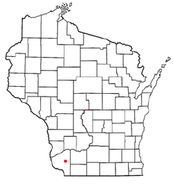
WIMap-doton-Liberty.png
Location of Liberty, Wisconsin
Coordinates: 42°53′38″N90°36′32″W / 42.89389°N 90.60889°W / 42.89389; -90.60889
Country Flag of the United States.svg  United States
State Flag of Wisconsin.svg  Wisconsin
County Grant
Area
  Total36.5 sq mi (94.5 km2)
  Land36.5 sq mi (94.5 km2)
  Water0.0 sq mi (0.0 km2)
Elevation
[1]
945 ft (288 m)
Population
 (2000)
  Total552
  Density15.1/sq mi (5.8/km2)
Time zone UTC-6 (Central (CST))
  Summer (DST) UTC-5 (CDT)
Area code 608
FIPS code 55-43825 [2]
GNIS feature ID1583550 [1]

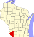
Liberty is a town in Grant County, Wisconsin, United States. The population was 552 at the 2000 census. The unincorporated community of Stitzer, Wisconsin is in the town. The town was named from the American ideal of liberty. [3]

Contents

Geography

According to the United States Census Bureau, the town has a total area of 36.5 square miles (94.5 km2), all of it land.

Demographics

As of the census [2] of 2000, there were 552 people, 189 households, and 147 families living in the town. The population density was 15.1 people per square mile (5.8/km2). There were 204 housing units at an average density of 5.6 per square mile (2.2/km2). The racial makeup of the town was 99.28% White, 0.54% African American, 0.18% from other races. Hispanic or Latino of any race were 1.09% of the population.

There were 189 households, out of which 41.3% had children under the age of 18 living with them, 69.8% were married couples living together, 4.2% had a female householder with no husband present, and 22.2% were non-families. 19.6% of all households were made up of individuals, and 7.9% had someone living alone who was 65 years of age or older. The average household size was 2.92 and the average family size was 3.37.

In the town, the population was spread out, with 32.8% under the age of 18, 6.5% from 18 to 24, 28.3% from 25 to 44, 22.6% from 45 to 64, and 9.8% who were 65 years of age or older. The median age was 34 years. For every 100 females, there were 111.5 males. For every 100 females age 18 and over, there were 105.0 males.

The median income for a household in the town was $37,000, and the median income for a family was $44,688. Males had a median income of $23,068 versus $23,750 for females. The per capita income for the town was $15,560. About 12.1% of families and 16.3% of the population were below the poverty line, including 20.2% of those under age 18 and 13.7% of those age 65 or over.

Related Research Articles

<span class="mw-page-title-main">Chapman, Maine</span> Town in the state of Maine, United States

Chapman is a town in Aroostook County, Maine, United States. The population was 491 at the 2020 census.

Palmyra is a town in Somerset County, Maine, United States. The population was 1,924 at the 2020 census.

<span class="mw-page-title-main">Waterloo, Nebraska</span> Village in Douglas County, Nebraska, United States

Waterloo is a village in Douglas County, Nebraska, United States. The population was 935 at the 2020 census.

<span class="mw-page-title-main">Winside, Nebraska</span> Village in Wayne County, Nebraska, United States

Winside is a village in Wayne County, Nebraska, United States. The population was 381 at the 2020 census.

<span class="mw-page-title-main">Wingate, North Carolina</span> Town in North Carolina, United States

Wingate is a town in Union County, North Carolina, United States. The population was 3,491 at the 2010 census.

<span class="mw-page-title-main">Larimore, North Dakota</span> City in North Dakota, United States

Larimore is a city in Grand Forks County, North Dakota, United States. It is located three miles south of the junction of U.S. Route 2 and North Dakota Highway 18. Larimore is part of the "Grand Forks, ND-MN Metropolitan Statistical Area" or "Greater Grand Forks". The population was 1,260 at the 2020 census.

<span class="mw-page-title-main">Huntsville, Ohio</span> Village in Ohio, United States

Huntsville is a village in Logan County, Ohio, United States. The population was 408 at the 2020 census.

<span class="mw-page-title-main">Wolsey, South Dakota</span> Town in South Dakota, United States

Wolsey is a town in Beadle County, South Dakota, United States. The population was 459 at the 2020 census.

<span class="mw-page-title-main">Clark, South Dakota</span> City in South Dakota, United States

Clark is a city in and county seat of Clark County, South Dakota, United States. The population was 1,148 at the 2020 census.

<span class="mw-page-title-main">West Liberty, West Virginia</span> Town in West Virginia, United States

West Liberty is a town in Ohio County, West Virginia, United States. The population was 1,557 at the 2020 census. It is part of the Wheeling metropolitan area.

<span class="mw-page-title-main">Pine Grove, West Virginia</span> Town in West Virginia, United States

Pine Grove is a town in Wetzel County, West Virginia, United States. The population was 363 at the 2020 census. The community was named for a grove of pine trees near the original town site.

<span class="mw-page-title-main">Liberty Grove, Wisconsin</span> Town in Wisconsin, United States

Liberty Grove is a town in Door County, Wisconsin, United States. The population was 2,096 at the 2020 census. The unincorporated communities of Ellison Bay, Gills Rock, North Bay, Northport, and Rowleys Bay are in the town.

<span class="mw-page-title-main">Cobb, Wisconsin</span> Village in Wisconsin, United States

Cobb is a village in Iowa County, Wisconsin, United States. The population was 458 at the 2010 census. It is part of the Madison Metropolitan Statistical Area.

<span class="mw-page-title-main">Grover, Marinette County, Wisconsin</span> Town in Wisconsin, United States

Grover is a town in Marinette County, Wisconsin, United States. The population was 1,768 at the 2010 census.

<span class="mw-page-title-main">Liberty, Outagamie County, Wisconsin</span> Town in Wisconsin, United States

There are three other towns called 'Liberty' in Wisconsin. See Liberty, Wisconsin

<span class="mw-page-title-main">Erin Prairie, Wisconsin</span> Town in Wisconsin, United States

Erin Prairie is a town in St. Croix County, Wisconsin, United States. The population was 658 at the 2000 census. The unincorporated communities of Erin Corner and Jewitt are located in the town.

Whitewater is a town in Walworth County, Wisconsin, United States. The population was 1,433 at the 2020 census.

<span class="mw-page-title-main">Albany, Pepin County, Wisconsin</span> Town in Wisconsin, United States

Albany is a town in Pepin County, Wisconsin, United States. The population was 716 at the 2020 census.

<span class="mw-page-title-main">Fairchild, Wisconsin</span> Village in Wisconsin, United States

Fairchild is a village in Eau Claire County, Wisconsin, United States. The population was 550 at the 2010 census. The village is located within the Town of Fairchild.

<span class="mw-page-title-main">Elderon, Wisconsin</span> Village in Wisconsin, United States

Elderon is a village in Marathon County, Wisconsin, United States. It is part of the Wausau, Wisconsin Metropolitan Statistical Area. The population was 179 at the 2010 census.

References

  1. 1 2 "US Board on Geographic Names". United States Geological Survey. October 25, 2007. Retrieved January 31, 2008.
  2. 1 2 "U.S. Census website". United States Census Bureau . Retrieved January 31, 2008.
  3. Chicago and North Western Railway Company (1908). A History of the Origin of the Place Names Connected with the Chicago & North Western and Chicago, St. Paul, Minneapolis & Omaha Railways. p. 94.