Werley, Wisconsin | |
|---|---|
 Werley  Werley | |
| Coordinates: 43°01′10″N90°45′55″W / 43.01944°N 90.76528°W | |
| Country | |
| State | |
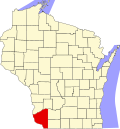
| County | Grant |
| Town | Mount Ida |
| Elevation | 235 m (771 ft) |
| Time zone | UTC-6 (Central (CST)) |
| • Summer (DST) | UTC-5 (CDT) |
| Area code | 608 |
| GNIS feature ID | 1577875 [1] |
Werley is an unincorporated community in the town of Mount Ida, Grant County, Wisconsin, United States, at latitude 43.019 and longitude -90.765, where Star Lane feeds into County Road K, roughly five miles west-northwest of Fennimore. [1] [2]
There used to be a narrow gauge railway run by the Chicago and Northwestern Railway which ran nearby. [3]
Werley was named after local settler and legislator Gottlieb Wehrle, whose name was pronounced "Werley" by the local residents. [4] The community used to be called Climbing Rock. [5]