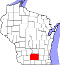
Cambridge, Wisconsin

Last updated

Cambridge, Wisconsin
Downtown Cambridge - panoramio.jpg
Downtown Cambridge in March 2014, looking west on Highway 12
Jefferson County Wisconsin Incorporated and Unincorporated areas Cambridge Highlighted.svg
Location of Cambridge in Jefferson County, Wisconsin.
Coordinates: 43°0′15″N89°1′2″W / 43.00417°N 89.01722°W / 43.00417; -89.01722
Country Flag of the United States.svg  United States
State Flag of Wisconsin.svg  Wisconsin
Counties Dane, Jefferson
Government
  TypeVillage Board of Trustees
  PresidentMark McNally
Area
[1]
  Total
1.48 sq mi (3.83 km2)
  Land1.47 sq mi (3.81 km2)
  Water0.01 sq mi (0.02 km2)
Elevation
[2]
850 ft (260 m)
Population
 (2020) [3]
  Total
1,638
  Density1,042.80/sq mi (402.54/km2)
Time zone UTC-6 (Central (CST))
  Summer (DST) UTC-5 (CDT)
Area code 608
FIPS code 55-12225 [4]
GNIS feature ID1562561 [2]
Website ci.cambridge.wi.us
Looking east while entering Cambridge on Highway 12/18 CambridgeWisconsinWIS134SouthTerminus.jpg
Looking east while entering Cambridge on Highway 12/18

Cambridge is a village in Dane (mostly) and Jefferson counties in the U.S. state of Wisconsin. The population was 1,638 at the 2020 census. Of this, 1,539 were in Dane County, and 99 were in Jefferson County.

Contents

The Dane County portion of Cambridge is part of the Madison Metropolitan Statistical Area, while the Jefferson County portion is part of the Watertown Fort Atkinson Micropolitan Statistical Area which is included in the Milwaukee-Racine-Waukesha CSA.

History

Settlement–1890

The settlement of Cambridge dates back to October 15, 1847, when the farmer Joseph Keyes filed plans with the Register of Deeds of Dane County. The first structure in the area was a dam on the northern part of Koshkonong Creek. By the late 1880s, Cambridge had grown into a community of about 700 people with shops, hotels, and a post office. Future inventor Ole Evinrude lived there. In 1890 a devastating fire broke out, destroying most of the businesses and parts of Main Street. [5]

Oldest Scandinavian Methodist Church Oldest Scandanavian Methodist Church.jpg
Oldest Scandinavian Methodist Church
Lake Ripley in Cambridge, WI Lake Ripley in Cambridge, WI.jpg
Lake Ripley in Cambridge, WI

1900s–2000s

The town was rebuilt by 1910, following the fire, and the invention of the automobile ignited tourism. Nearby Lake Ripley became a destination for many Chicago travelers.

Rowe Pottery, a staple of downtown Cambridge, Wisconsin Rowe Pottery.jpg
Rowe Pottery, a staple of downtown Cambridge, Wisconsin

During the 1980s and 1990s, Cambridge was touted as the "salt glaze pottery capital of the world" because of the potteries located there. [6]

2000s–present

After Cambridge lost much of its pottery draw,[ clarification needed ] the village began to draw mountain bikers from southeastern Wisconsin. CamRock County Park offers trails for hiking and cross-country skiing, and a 16-mile mountain bike track. [7]

Geography

Cambridge is located at 43°0′15″N89°1′2″W / 43.00417°N 89.01722°W / 43.00417; -89.01722 (43.004089, -89.017201). [8]

According to the United States Census Bureau, the village has a total area of 1.44 square miles (3.73 km2), of which 1.43 square miles (3.70 km2) is land and 0.01 square miles (0.03 km2) is water. [9] Koshkonong Creek runs through the center of the village, flowing south to Lake Koshkonong.

Demographics

Historical population
CensusPop.Note
1880 303
1890 45249.2%
1910 507
1920 490−3.4%
1930 5002.0%
1940 57715.4%
1950 552−4.3%
1960 6059.6%
1970 68913.9%
1980 84422.5%
1990 96314.1%
2000 1,10114.3%
2010 1,45732.3%
2020 1,63812.4%
U.S. Decennial Census [10]

2010 census

As of the census [3] of 2010, there were 1,457 people, 615 households, and 397 families living in the village. The population density was 1,018.9 inhabitants per square mile (393.4/km2). There were 654 housing units at an average density of 457.3 units per square mile (176.6 units/km2). The racial makeup of the village was 96.8% White, 0.9% African American, 0.3% Native American, 0.5% Asian, 0.5% from other races, and 1.1% from two or more races. Hispanic or Latino of any race were 1.7% of the population.

There were 615 households, of which 32.0% had children under the age of 18 living with them, 52.4% were married couples living together, 8.5% had a female householder with no husband present, 3.7% had a male householder with no wife present, and 35.4% were non-families. 28.3% of all households were made up of individuals, and 14.6% had someone living alone who was 65 years of age or older. The average household size was 2.37 and the average family size was 2.93.

The median age in the village was 41.3 years. 24.4% of residents were under the age of 18; 6.1% were between the ages of 18 and 24; 25.1% were from 25 to 44; 30.2% were from 45 to 64; and 14.1% were 65 years of age or older. The gender makeup of the village was 48.2% male and 51.8% female.

2000 census

As of the census [4] of 2000, there were 1,101 people, 470 households, and 303 families living in the village. The population density was 1,238.5 people per square mile (478.2 people/km2). There were 483 housing units at an average density of 543.3 units per square mile (209.8 units/km2). The racial makeup of the village was 98.55% White, 0.09% African American, 0.18% Native American, 0.27% Asian, 0.45% from other races, and 0.45% from two or more races. Hispanic or Latino of any race were 1.00% of the population.

There were 470 households, out of which 32.6% had children under the age of 18 living with them, 53.8% were married couples living together, 7.7% had a female householder with no husband present, and 35.5% were non-families. 29.8% of all households were made up of individuals, and 17.0% had someone living alone who was 65 years of age or older. The average household size was 2.32 and the average family size was 2.89.

In the village, the population was spread out, with 24.3% under the age of 18, 5.5% from 18 to 24, 29.5% from 25 to 44, 21.1% from 45 to 64, and 19.5% who were 65 years of age or older. The median age was 40 years. For every 100 females, there were 91.5 males. For every 100 females age 18 and over, there were 85.1 males.

The median income for a household in the village was $52,039, and the median income for a family was $57,895. Males had a median income of $37,986 versus $29,018 for females. The per capita income for the village was $22,599. About 0.6% of families and 4.4% of the population were below the poverty line, including 1.4% of those under age 18 and 7.1% of those age 65 or over.

Media

Cambridge is home to a weekly newspaper, The Cambridge News and Deerfield Independent, covering as its name suggests both communities.

Cambridge is a part of the Madison radio and television market, stations from the Milwaukee market are also available over the air and via cable, satellite and OTT services in the Jefferson County portion of the village.

Notable people

Images

Related Research Articles

<span class="mw-page-title-main">Jefferson County, Wisconsin</span> County in Wisconsin, United States

Jefferson County is a county in the U.S. state of Wisconsin. As of the 2020 census, the population was 84,900. Its county seat is Jefferson. Jefferson County comprises the Watertown-Fort Atkinson, WI Micropolitan Statistical Area, which is also included in the Milwaukee-Racine-Waukesha, WI Combined Statistical Area.

<span class="mw-page-title-main">Koshkonong, Missouri</span> City in Missouri, United States

Koshkonong is a city in Oregon County, Missouri, United States. The population was 196 at the 2020 census.

<span class="mw-page-title-main">Albion, Dane County, Wisconsin</span> Town in Wisconsin, United States

The Town of Albion is located in Dane County, Wisconsin, United States. The population was 2,069 at the 2020 Census. The unincorporated communities of Albion, Highwood, Hillside, and Indian Heights are located in the town.

<span class="mw-page-title-main">Christiana, Dane County, Wisconsin</span> Town in Wisconsin, United States

The Town of Christiana is located in Dane County, Wisconsin, United States. The population was 1,235 at the 2020 census. It is named after Oslo, Norway and has one of the highest percentages of Norwegian ancestry in the United States. The unincorporated community of Utica and the village of Rockdale are located within the town. The village of Cambridge is located partly within the Town.

<span class="mw-page-title-main">Rockdale, Wisconsin</span> Village in Wisconsin, United States

Rockdale is a village in Dane County, Wisconsin, United States. The population was 207 at the 2020 census, making it the smallest incorporated municipality in Dane County. The village is split in half by the Koshkonong Creek. It is part of the Madison Metropolitan Statistical Area.

<span class="mw-page-title-main">Shorewood Hills, Wisconsin</span> Village in Wisconsin, United States

Shorewood Hills is a village in Dane County, Wisconsin, United States. It was established in 1927. The population was 2,169 at the 2020 census. Entirely surrounded by the city of Madison and Lake Mendota, it is part of the Madison Metropolitan Statistical Area.

<span class="mw-page-title-main">Koshkonong, Wisconsin</span> Town in Wisconsin, United States

Koshkonong is a town in Jefferson County, Wisconsin, United States. The population was 3,763 at the 2020 census. The town entirely surrounds the city of Fort Atkinson. The unincorporated communities of Koshkonong Mounds and Vinnie Ha Ha are located in the town. The unincorporated communities of Blackhawk Island and Koshkonong, as well as the census-designated place of Lake Koshkonong are also located partially in the town.

<span class="mw-page-title-main">Lake Koshkonong, Wisconsin</span> Census-designated place in Wisconsin, United States

Lake Koshkonong is a census-designated place (CDP) in the towns of Koshkonong and Sumner, Jefferson County, Wisconsin, United States. The population was 1,239 at the 2020 census. Lake Koshkonong is in the area.

<span class="mw-page-title-main">Sumner, Jefferson County, Wisconsin</span> Town in Wisconsin, United States

Sumner is a town in Jefferson County, Wisconsin, United States. The population was 832 at the 2010 census. The census-designated place of Lake Koshkonong and the unincorporated communities of Busseyville, Carcajou, Glenn Oaks Beach, Koshkonong Manor, and North Shore are located within the town. The community of Blackhawk Island is located partially in the town.

<span class="mw-page-title-main">Edgar, Wisconsin</span> Village in Wisconsin, United States

Edgar is a village in Marathon County, Wisconsin, United States. It is part of the Wausau, Wisconsin Metropolitan Statistical Area. The population was 1,479 at the 2010 census. Edgar has maintained Tree City USA standing since 1995.

<span class="mw-page-title-main">Nelsonville, Wisconsin</span> Village in Wisconsin, United States

Nelsonville is a village in Portage County, Wisconsin, United States. The population was 155 at the 2010 census.

<span class="mw-page-title-main">Boaz, Wisconsin</span> Village in Wisconsin, United States

Boaz is a village in Richland County, Wisconsin, United States. According to the 2010 census, the population of the village was 156.

<span class="mw-page-title-main">West Baraboo, Wisconsin</span> Village in Wisconsin, United States

West Baraboo is a village along the Baraboo River in Sauk County, Wisconsin, United States. The population was 1,627 at the 2020 census. It is part of the Baraboo micropolitan statistical area.

<span class="mw-page-title-main">Ogdensburg, Wisconsin</span> Village in Wisconsin, United States

Ogdensburg is a village in Waupaca County, Wisconsin, United States. The population was 185 at the 2010 census.

<span class="mw-page-title-main">Belleville, Wisconsin</span> Village in Wisconsin, United States

Belleville is a village in Dane and Green counties in the U.S. state of Wisconsin. The population was 2,491 at the 2020 census. Of this, 1,909 were in Dane County, and 582 were in Green County.

<span class="mw-page-title-main">Cross Plains (town), Wisconsin</span> Town in Dane County, Wisconsin

Cross Plains is a town in Dane County, Wisconsin, United States. The population was 1,419 at the 2000 census. The Village of Cross Plains is located partially within the town. The unincorporated community of Pine Bluff is located in the town.

<span class="mw-page-title-main">Dane, Wisconsin</span> Village in Wisconsin, United States

Dane is a village in Dane County, Wisconsin, United States. The population was 1,117 at the 2020 census. Located in the Town of Dane, the village is part of the Madison Metropolitan Statistical Area.

<span class="mw-page-title-main">Deerfield (town), Dane County, Wisconsin</span> Town in Wisconsin, USA

Deerfield is a town in Dane County, Wisconsin, United States. The population was 1,470 at the 2000 census. The City of Deerfield is located within the town. The unincorporated communities of London and Old Deerfield are located in the town.

<span class="mw-page-title-main">Deerfield, Wisconsin</span> Village in Wisconsin, United States

Deerfield is a village in Dane County, Wisconsin. The population was 2,319 at the time of the 2010 census. The village is located within the Town of Deerfield. It is part of the Madison Metropolitan Statistical Area. A suburb of Madison. Towns and villages near Deerfield include Stoughton, Madison, Wisconsin, Marshall, Medina, London, Lake Mills, Cambridge, and Cottage Grove, Wisconsin.

<span class="mw-page-title-main">Brooklyn (village), Wisconsin</span> Place in Wisconsin, United States

Brooklyn is a village in Dane and Green counties in Wisconsin, United States. The population was 1,524 at the 2020 census, with 1,026 residents in Dane County and 498 in Green County.

References

  1. "2019 U.S. Gazetteer Files". United States Census Bureau. Retrieved August 7, 2020.
  2. 1 2 U.S. Geological Survey Geographic Names Information System: Cambridge, Wisconsin
  3. 1 2 "U.S. Census website". United States Census Bureau . Retrieved November 18, 2012.
  4. 1 2 "U.S. Census website". United States Census Bureau . Retrieved January 31, 2008.
  5. "The History of Cambridge - Cambridge House B & B". Archived from the original on July 21, 2013. Retrieved August 8, 2013.
  6. "Our history". Village of Cambridge. Retrieved April 18, 2018.
  7. "CamRock County Park". Dane County Land & Water Resources Department. Retrieved April 18, 2018.
  8. "US Gazetteer files: 2010, 2000, and 1990". United States Census Bureau. February 12, 2011. Retrieved April 23, 2011.
  9. "US Gazetteer files 2010". United States Census Bureau. Archived from the original on July 2, 2012. Retrieved November 18, 2012.
  10. "Census of Population and Housing". Census.gov. Retrieved June 4, 2015.
  11. "Allen, Carolyn Blanchard 1921". Wisconsin Historical Society. Retrieved November 26, 2019.
  12. "Cambridge: From Farms to Tourism". Wisconsin State Journal. April 19, 1993. p. 24. Retrieved November 26, 2019 via Newspapers.com. Open Access logo PLoS transparent.svg
  13. "Inventor of Outboard Motor, Ole Evinrude, Dies Suddenly". The Journal Times. July 13, 1934. p. 7. Retrieved November 26, 2019 via Newspapers.com. Open Access logo PLoS transparent.svg
  14. "Halfway Home". The La Crosse Tribune. July 4, 2003. p. 11. Retrieved November 26, 2019 via Newspapers.com. Open Access logo PLoS transparent.svg
  15. "Legreid, Blacksmith, Dies in Cambridge". Wisconsin State Journal. April 18, 1944. p. 7. Retrieved November 26, 2019 via Newspapers.com. Open Access logo PLoS transparent.svg
  16. "Ex-Assemblyman Porter Dies". Wisconsin State Journal. January 7, 1941. p. 7. Retrieved November 27, 2019 via Newspapers.com. Open Access logo PLoS transparent.svg
  17. "Schuler's Team Surviving without Big Budget". The Capital Times. June 28, 2003. p. 19. Retrieved November 27, 2019 via Newspapers.com. Open Access logo PLoS transparent.svg