Ixonia, Wisconsin

Last updated

Town of Ixonia, Wisconsin
Ixonia Wisconsin town hall and water tower.jpg
WIMap-doton-Ixonia.png
Location of the Town of Ixonia, Wisconsin
Coordinates: 43°9′0″N88°35′24″W / 43.15000°N 88.59000°W / 43.15000; -88.59000
Country Flag of the United States.svg  United States
State Flag of Wisconsin.svg  Wisconsin
County Jefferson
OrganizedJanuary 21, 1846
Area
  Total36.3 sq mi (93.9 km2)
  Land35.8 sq mi (92.7 km2)
  Water0.5 sq mi (1.3 km2)
Elevation
[1]
889 ft (271 m)
Population
 (2010)
  Total4,385
  Density120/sq mi (47/km2)
Time zone UTC-6 (Central (CST))
  Summer (DST) UTC-5 (CDT)
ZIP Code
53036
Area code 920
FIPS code 55-37600 [2]
GNIS feature ID1583440 [1]
Website townofixonia.com

Ixonia is a town in Jefferson County, Wisconsin. The population was 4,385 at the time of the 2010 census. [3] The unincorporated communities of Ixonia and Pipersville are located within the town.

Contents

History

The town of Union was separated from the town of Watertown on February 12, 1841. Five years later, Union was further divided into two new towns. The first town became known as Concord, and as the residents could not otherwise agree on a name for the second town, the name was chosen by drawing letters at random until a name could be formed from the letters. As a result, "Ixonia" was the name given to the town on January 21, 1846, and still remains the only town with this name in the United States. [4] [5]

Geography

According to the United States Census Bureau, the town has a total area of 36.3 square miles (93.9 km2), of which 35.8 square miles (92.7 km2) is land and 0.50 square miles (1.3 km2), or 1.35%, is water. [6]

Demographics

Historical population
CensusPop.Note
1980 2,905
1990 2,789−4.0%
2000 2,9024.1%
2010 4,37550.8%

As of the census of 2000, there were 2,902 people, 1,047 households, and 864 families residing in the town. The population density was 80.7 people per square mile (31.2 people/km2). There were 1,082 housing units at an average density of 11.6 persons per square kilometre (30 persons/sq mi). The racial makeup of the town was 98.55% White, 0.07% African American, 0.21% Native American, 0.31% Asian, 0.03% Pacific Islander, 0.28% from other races, and 0.55% from two or more races. 0.90% of the population were Hispanic or Latino of any race.

There were 1,047 households, out of which 35.1% had children under the age of 18 living with them, 72.6% were married couples living together, 5.9% have a woman whose husband does not live with her, and 17.4% were non-families. 13.9% of all households were made up of individuals, and 5.0% had someone living alone who was 65 years of age or older. The average household size was 2.77 and the average family size was 3.05.

In the town, the population was spread out, with 25.4% under the age of 18, 7.5% from 18 to 24, 28.4% from 25 to 44, 28.8% from 45 to 64, and 9.8% who were 65 years of age or older. The median age was 38 years. For every 100 females, there were 105.8 males. For every 100 females age 18 and over, there were 106.3 males.

The median income for a household in the town was $58,629, and the median income for a family was $60,184. Males had a median income of $41,190 versus $28,125 for females. The per capita income for the town was $23,979. 1.5% of the population and 1.2% of families were below the poverty line. Out of the total people living in poverty, 2.8% are under the age of 18 and 2.5% are 65 or older.

Education

Ixonia is within the Oconomowoc Area School District. [7] The district includes Ixonia Elementary School and Oconomowoc High School.

Notable people

Related Research Articles

<span class="mw-page-title-main">Jefferson County, Wisconsin</span> County in Wisconsin, United States

Jefferson County is a county in the U.S. state of Wisconsin. As of the 2020 census, the population was 84,900. Its county seat is Jefferson. Jefferson County comprises the Watertown-Fort Atkinson, WI Micropolitan Statistical Area, which is also included in the Milwaukee-Racine-Waukesha, WI Combined Statistical Area.

<span class="mw-page-title-main">Ashippun, Wisconsin</span> Town in Wisconsin, United States

Ashippun is a town in Dodge County, Wisconsin, United States. The unincorporated communities of Alderley, Ashippun, and Old Ashippun are located in the town. The population was 2,308 at the 2000 census.

<span class="mw-page-title-main">Aztalan, Wisconsin</span> Town in Wisconsin, United States

Aztalan is a town in Jefferson County, Wisconsin, United States. The population was 1,457 at the 2010 census. The unincorporated communities of Aztalan and Jefferson Junction are located in the town.

<span class="mw-page-title-main">Cold Spring, Wisconsin</span> Town in Wisconsin, United States

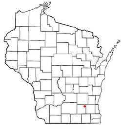
Cold Spring is a town in Jefferson County, Wisconsin, United States. The population was 727 in the recent 2010 census.

<span class="mw-page-title-main">Concord, Wisconsin</span> Town in Wisconsin, United States

Concord is a town in Jefferson County, Wisconsin, United States. The population was 2,072 at the 2010 census.

<span class="mw-page-title-main">Farmington, Jefferson County, Wisconsin</span> Town in Wisconsin, United States

Farmington is a town in Jefferson County, Wisconsin, United States. The population as of the 2010 census was 1,380.

<span class="mw-page-title-main">Milford, Wisconsin</span> Town in Wisconsin, United States

Milford is a town in Jefferson County, Wisconsin, United States. The population was 1,099 at the 2010 census. The unincorporated communities of Grellton, Hoopers Mill, Hubbleton, and Milford are located in the town.

<span class="mw-page-title-main">Oakland, Jefferson County, Wisconsin</span> Town in Wisconsin, United States

Oakland is a town in Jefferson County, Wisconsin, United States. The population was 3,100 at the 2010 census. The unincorporated communities of Breezy Knoll, Oakland, and Sylvan Mounds, as well as the census-designated place of Lake Ripley, are located in the town.

<span class="mw-page-title-main">Sumner, Jefferson County, Wisconsin</span> Town in Wisconsin, United States

Sumner is a town in Jefferson County, Wisconsin, United States. The population was 832 at the 2010 census. The census-designated place of Lake Koshkonong and the unincorporated communities of Busseyville, Carcajou, Glenn Oaks Beach, Koshkonong Manor, and North Shore are located within the town. The community of Blackhawk Island is located partially in the town.

<span class="mw-page-title-main">Troy, St. Croix County, Wisconsin</span> Town in Wisconsin, United States

Troy is a town in St. Croix County, Wisconsin, United States. The population was 3,661 at the 2000 census. The unincorporated community of Glover is located in the town.

<span class="mw-page-title-main">Jefferson, Vernon County, Wisconsin</span> Town in Wisconsin, United States

Jefferson is a town in Vernon County, Wisconsin, United States. The population was 974 at the 2000 census. The unincorporated communities of Bud, Esofea, and Springville are located with the town.

<span class="mw-page-title-main">Lac La Belle, Wisconsin</span> Village in Wisconsin, United States

Lac La Belle is a village located mostly in Waukesha County in the U.S. state of Wisconsin. The population was 281 at the 2020 census. The village is located mostly within the town of Oconomowoc in Waukesha County. On March 28, 2002, the village annexed a portion of land in the town of Ixonia in Jefferson County.

<span class="mw-page-title-main">Oconomowoc Lake, Wisconsin</span> Village in Wisconsin, United States

Oconomowoc Lake is a village in Waukesha County, Wisconsin, United States. Located just outside the City of Oconomowoc, the village includes the residential area encircling Oconomowoc Lake.

<span class="mw-page-title-main">Okauchee Lake, Wisconsin</span> CDP in Wisconsin, United States

Okauchee Lake is a census-designated place (CDP) in Waukesha County, Wisconsin, United States. The population was 5,094 at the 2020 census. Okauchee Lake is located in the town of Oconomowoc.

<span class="mw-page-title-main">Summit, Waukesha County, Wisconsin</span> Village in Wisconsin, United States

Summit is a village in Waukesha County, Wisconsin, United States. The population was 4,784 at the 2020 census. The former unincorporated communities of Summit Center, Summit Corners, and Waterville are located in the village.

Watertown is a town in Jefferson County, Wisconsin, United States. The population was 1,975 at the 2010 census. The unincorporated community of Ebenezer is located in the town.

<span class="mw-page-title-main">Ixonia (CDP), Wisconsin</span> Census-designated place in Wisconsin, United States

Ixonia is a census-designated place (CDP) in the town of Ixonia, Jefferson County, Wisconsin, United States. The population was 2,367 at the 2020 census.

Jefferson is a town in Jefferson County, Wisconsin, United States. The population was 2,178 at the 2010 census. The city of Jefferson is located partially within the town. The census-designated place of Helenville is also located in the town.

<span class="mw-page-title-main">Oconomowoc (town), Wisconsin</span> Town in Wisconsin, United States

Oconomowoc is a town in Waukesha County, Wisconsin, United States. The population was 8,836 at the 2020 census. The City of Oconomowoc and the Villages of Chenequa and Lac La Belle are located partially in the town. The unincorporated communities of Mapleton, Monterey, and Okauchee Lake, are located in the town. The unincorporated community of Stone Bank is located partially in the town.

<span class="mw-page-title-main">Oconomowoc, Wisconsin</span> City in Wisconsin, United States

Oconomowoc is a city in Waukesha County, Wisconsin, United States. The name was derived from Coo-no-mo-wauk, the Potawatomi term for "waterfall." The population was 18,203 at the 2020 census. The city is partially adjacent to the Town of Oconomowoc and near the village of Oconomowoc Lake, Wisconsin.

References

  1. 1 2 U.S. Geological Survey Geographic Names Information System: Ixonia, Wisconsin
  2. "U.S. Census website". United States Census Bureau . Retrieved January 31, 2008.
  3. "Profile of General Population and Housing Characteristics: 2010 Demographic Profile Data (DP-1): Ixonia town, Jefferson County, Wisconsin". United States Census Bureau . Retrieved October 9, 2012.
  4. History of the Town of Ixonia
  5. "Ixonia Heritage Book Index" Dodge/Jefferson Counties Genealogical Society
  6. "Geographic Identifiers: 2010 Demographic Profile Data (G001): Ixonia town, Jefferson County, Wisconsin". United States Census Bureau . Retrieved October 9, 2012.
  7. "2020 CENSUS – SCHOOL DISTRICT REFERENCE MAP: Jefferson County, WI" (PDF). U.S. Census Bureau . Retrieved August 29, 2021.
  8. 'Wisconsin Blue Book 1887,' Biographical Sketch of Edwin Coe, pg. 512